October 24 Frosty Start And The Big Warm Up Begins Lasting To The Weekend
October 24, 2023
Tuesday Morning Update
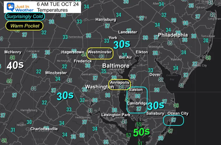
Here we go! Ideal conditions with a clear sky and light winds allowed temps to drop into the 30s in many areas. This is the first frost and the end of the growing season for many areas.
It is common after we get a cold morning like this, the jet stream bounces back with a warm-up flipping temps to the other side of ‘average’. We will get the boost to the 70s and even one or two days in the 80s this week.
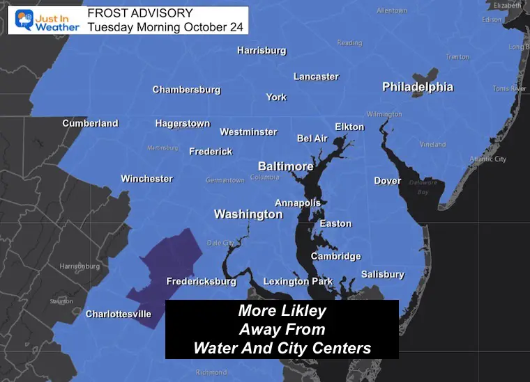
Frost Advisory In Place
I had to revise this map three times as more counties were added. YES, even just inland from the beaches on Delmarva.
Morning Temperatures
Pockets of 30s are scattered across the board. The official thermometers may be at airports or city locations that tend to be warmer. Outside of these areas, temps can drop 5 degrees or more.
At this time of year, temperatures in urban areas and by the water remain warmer.
ALSO SEE:
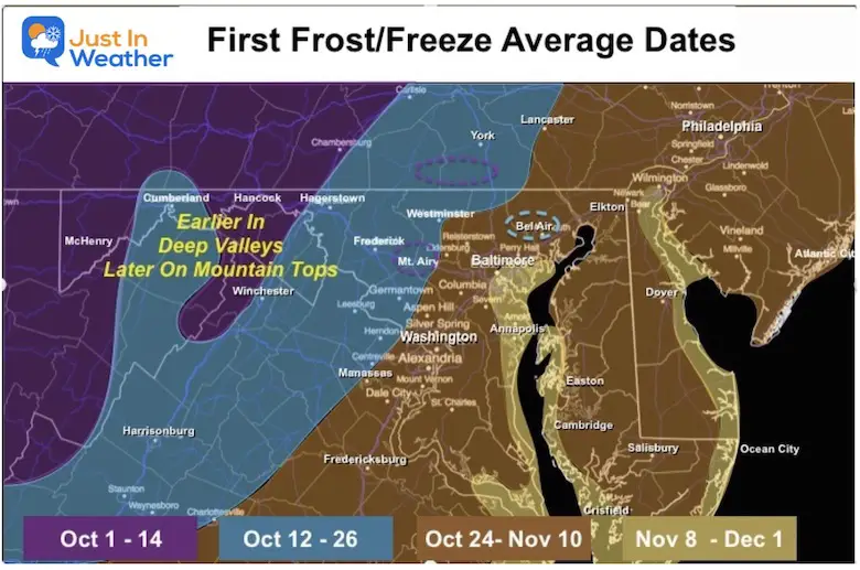
Explore The Average First Frost For MD and PA
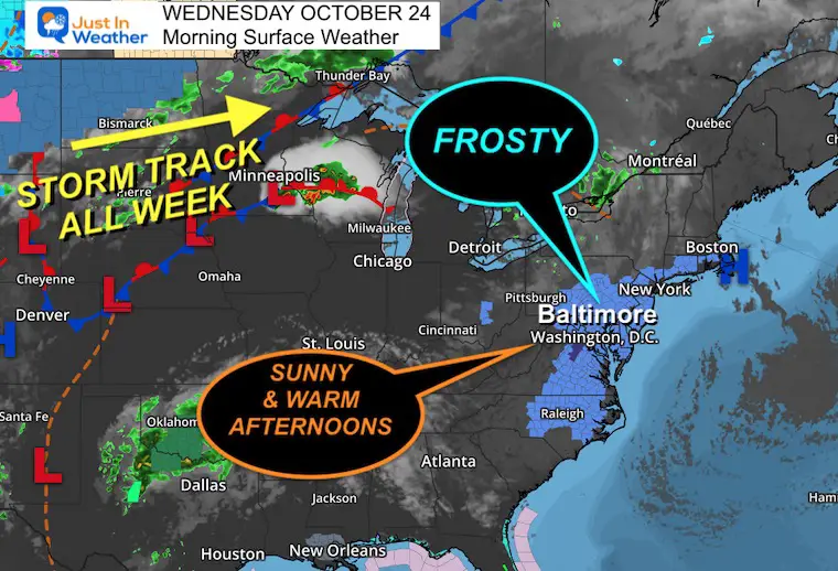
Morning Surface Weather
High and Dry! High-pressure overhead will result in light winds and little to no cloud cover for the next few days.
This will lock in for the week and gradually pump in warmer air.
CLIMATE DATA: Baltimore
TODAY October 24
Sunrise at 7:25 AM
Sunset at 6:16 PM
Normal Low in Baltimore: 43ºF
Record 25ºF in 1969
Normal High in Baltimore: 65ºF
Record 82ºF 2001
New Reports:
NEW: NOAA’s Winter Outlook 2024
Other Reports:
Winter Weather: Can Woolley Bear Caterpillar Stripes Really Foretell Snow?
El Niño Advisory: First Look At NOAA’s Winter Outlook Expectations
Winter Outlook 2024 From Two Farmers AlmanacsReturn to Cold and Snow
Subscribe for eMail Alerts
Weather posts straight to your inbox
Sign up and be the first to know!
Temperatures
Morning
Afternoon
It is common at this time of year for wide temperature spreads from chilly mornings to mild afternoons.
Looking Ahead:
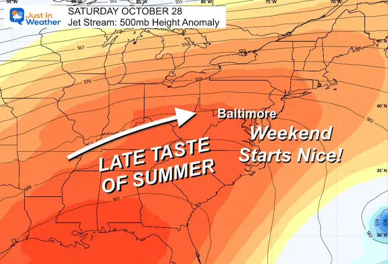
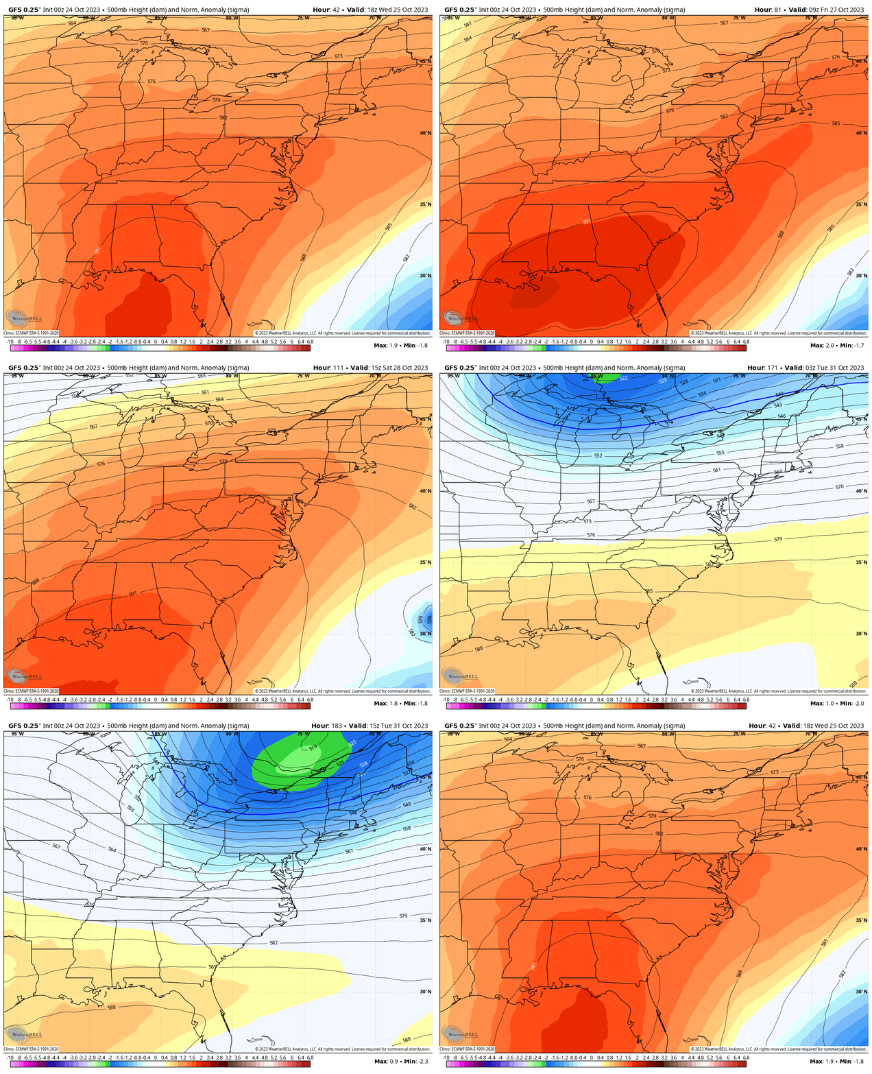
Jet Stream Wednesday to Next Tuesday
Notice the ridge of High Pressure pumping in the warmer air. This will only be for this week. Colder air will reestablish a chillier pattern next week.
Snapshot Saturday:
It may feel like summer and fellow Generation X’ers call this an Indian Summer, or Second Summer. When we hit the 80s AFTER the first frost.
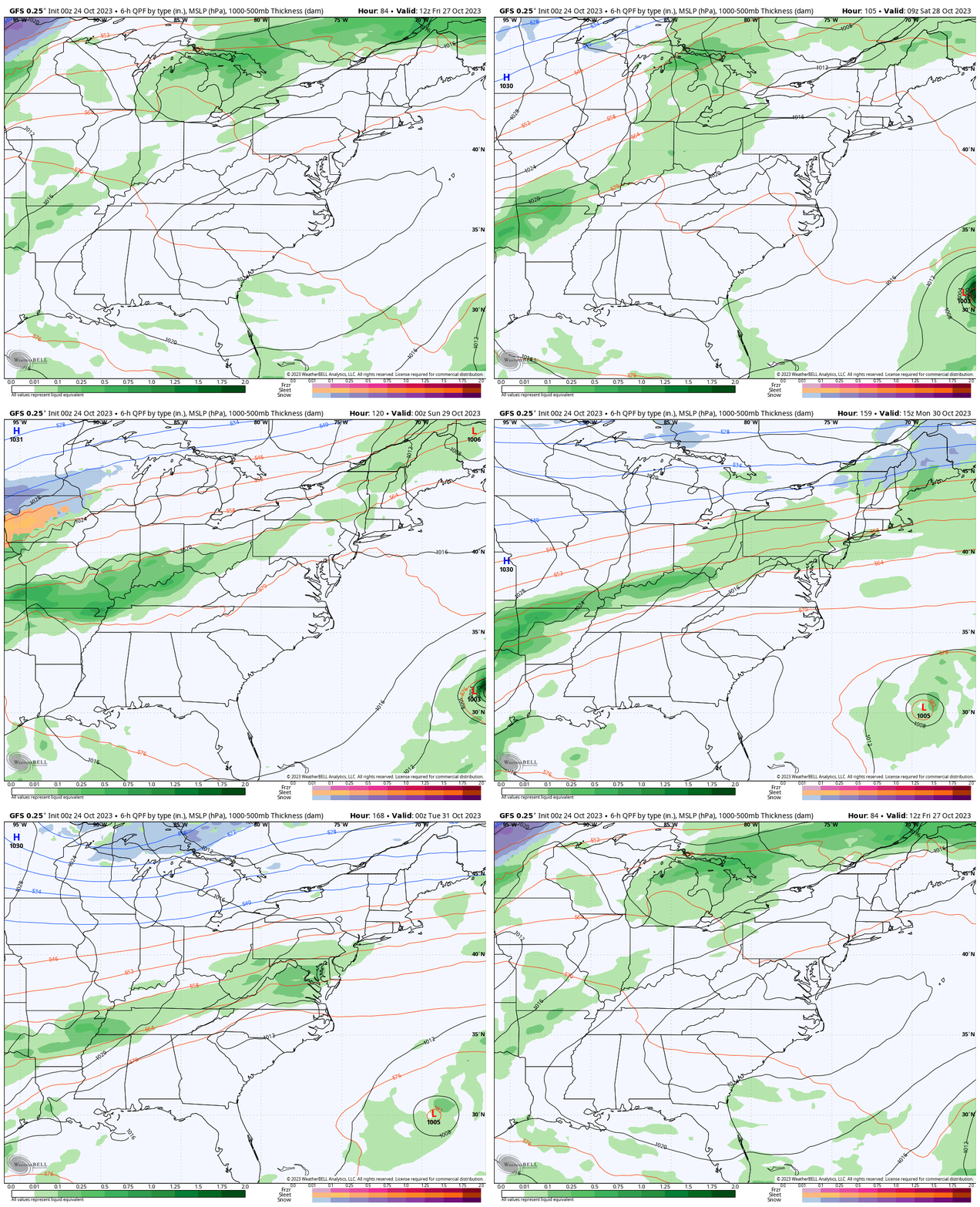
Storm Forecast Friday to Monday
The transition between the late summer heat and the cool down will be rain showers later Sunday and into Monday.
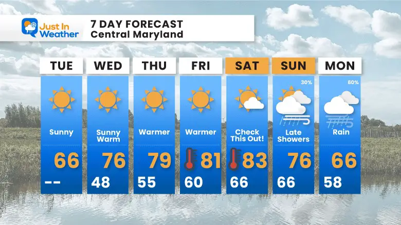
7 Day Forecast
CHECK THIS OUT! While we begin with widespread frost, the afternoon will be back to near normal/average.
THEN: Sunshine and a warming trend pushing us to the 80s Friday and YES… Saturday. A nice weekend day for a change.
The change will begin Monday followed by much cooler air next week.
Subscribe for eMail Alerts
Weather posts straight to your inbox
Sign up and be the first to know!
Faith in the Flakes Gear
STEM Assemblies/In School Fields Trips Are Back
Click to see more and ‘Book’ a visit to your school
Please share your thoughts and best weather pics/videos, or just keep in touch via social media
-
Facebook: Justin Berk, Meteorologist
-
Twitter
-
Instagram
RESTATING MY MESSAGE ABOUT DYSLEXIA
I am aware there are some spelling and grammar typos and occasional other glitches. I take responsibility for my mistakes and even the computer glitches I may miss. I have made a few public statements over the years, but if you are new here, you may have missed it: I have dyslexia and found out during my second year at Cornell University. It didn’t stop me from getting my meteorology degree and being the first to get the AMS CBM in the Baltimore/Washington region. One of my professors told me that I had made it that far without knowing and to not let it be a crutch going forward. That was Mark Wysocki, and he was absolutely correct! I do miss my mistakes in my own proofreading. The autocorrect spell check on my computer sometimes does an injustice to make it worse. I also can make mistakes in forecasting. No one is perfect at predicting the future. All of the maps and information are accurate. The ‘wordy’ stuff can get sticky. There has been no editor who can check my work when I need it and have it ready to send out in a newsworthy timeline. Barbara Werner is a member of the web team that helps me maintain this site. She has taken it upon herself to edit typos when she is available. That could be AFTER you read this. I accept this and perhaps proves what you read is really from me… It’s part of my charm.
#FITF


