Weekend Weather Brings Rain Again But NOT a Washout
October 18, 2023
Wednesday Night Update
Does it seem like it has rained every weekend lately? I get it! This seems like a weekly occurrence as I prepare an outlook for the weekend rain and try to navigate the timing to fit your plans.
For starters, I did my homework on soggy Saturdays. It has not rained EVERY weekend, but going back through September, here are what the observations were at Baltimore’s BWI: I found 4 out of the last 7. If this weekend verifies as well, that will make 50% of the last two months’ worth. Still not a majority, but more than most of us would like.
- September 2: No Rain; High 87ºF
- September 9: 1.60” Rain; High 88ºF
- September 16: No Rain; High 82ºF
- September 23: 1.29” Rain; High 64ºF
- September 30: No Rain; High 75ºF
- October 7: 0.10” Rain; High 70ºF
- October 14: 0.73” Rain; High 60ºF
- October 21 ???
Wednesday Night Surface Weather
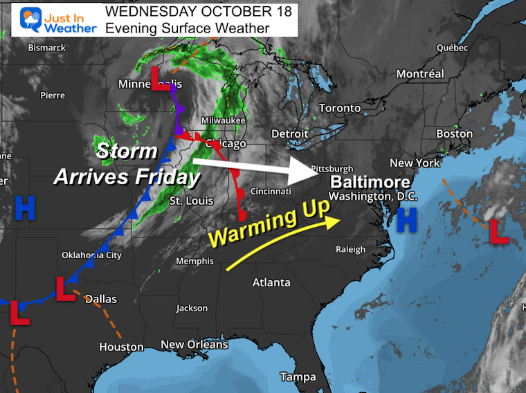
I am noticing a pattern. In addition to the wet (partial) weekends, there have been warm-ups at the end of the work week. We will get another warming wind ahead of the next storm.
The main area of Low Pressure in the Northern Plains has a trailing cold front that is heading our way. This is similar to the last two weekends, but it is expected to arrive a little sooner.
Another area of Low Pressure that is not seen on the map tonight, will be developing along the coast to spread rain ahead of the main system.
Computer Model Simulation
GFS Model Thursday Night to Monday Morning
I am playing this longer loop to show how the Southern Storm will track off the coast, and we can watch the next system pushing our way and developing overhead Friday evening into Saturday morning.
(Confession) I have a template saved from my report last Wednesday night just to see the similarities. The last paragraph was almost identical. Last week there was a dominant storm from the Gulf of Mexico. This time the main feature is the northern Low Pressure.
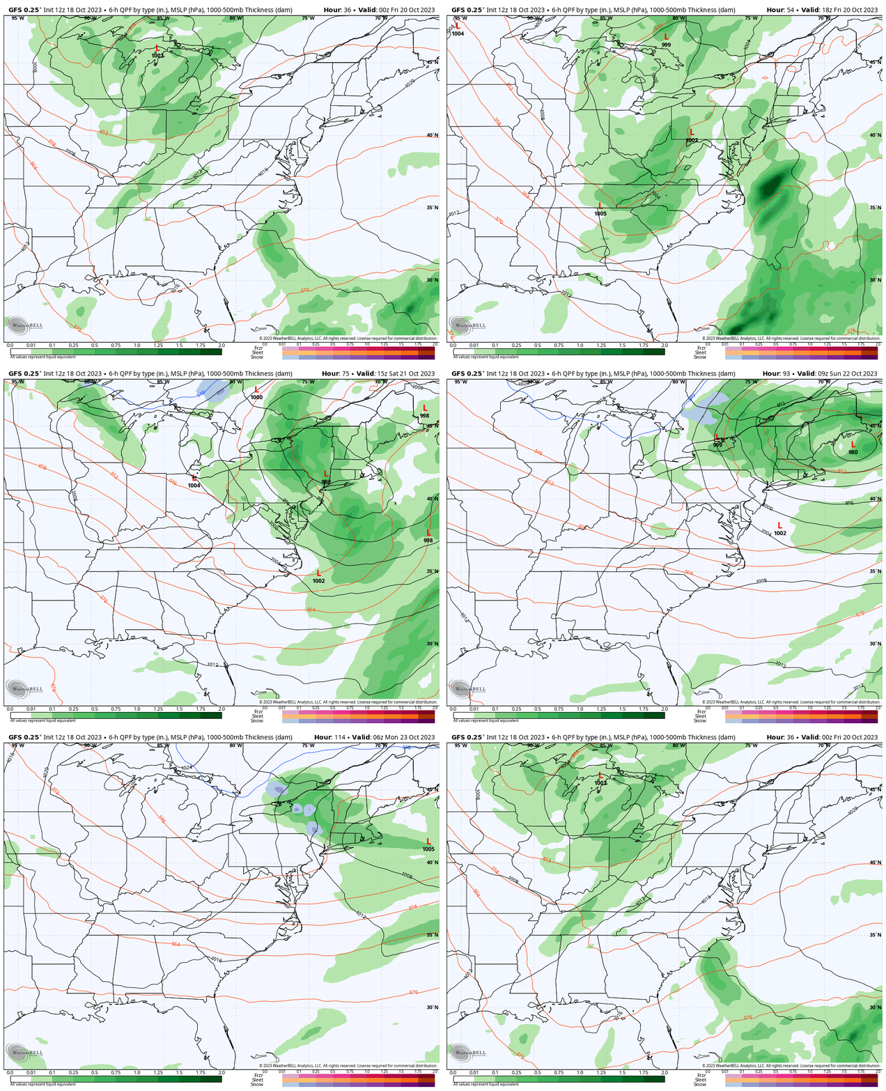
Snapshots
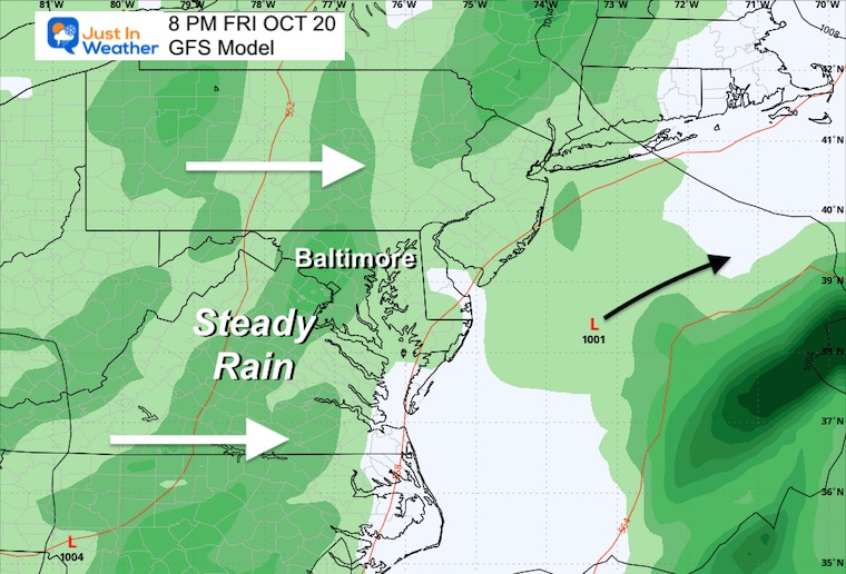
Friday Night
While showers will develop during the day (more details below), I want to focus on the evening plans. It looks like rain will become more widespread and steady.
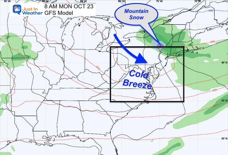
Monday Morning
I am showing this frame mainly for my own interest. Actually, the snow that shows up in the Catskill Mountains of New York (blue) is a fun feature. It also signals the colder air flowing in. We will be dependent on the wind speed to drop and allow colder air to develop inland frost. The winds may be too brisk this time, however, there is a second run at frost the following morning.
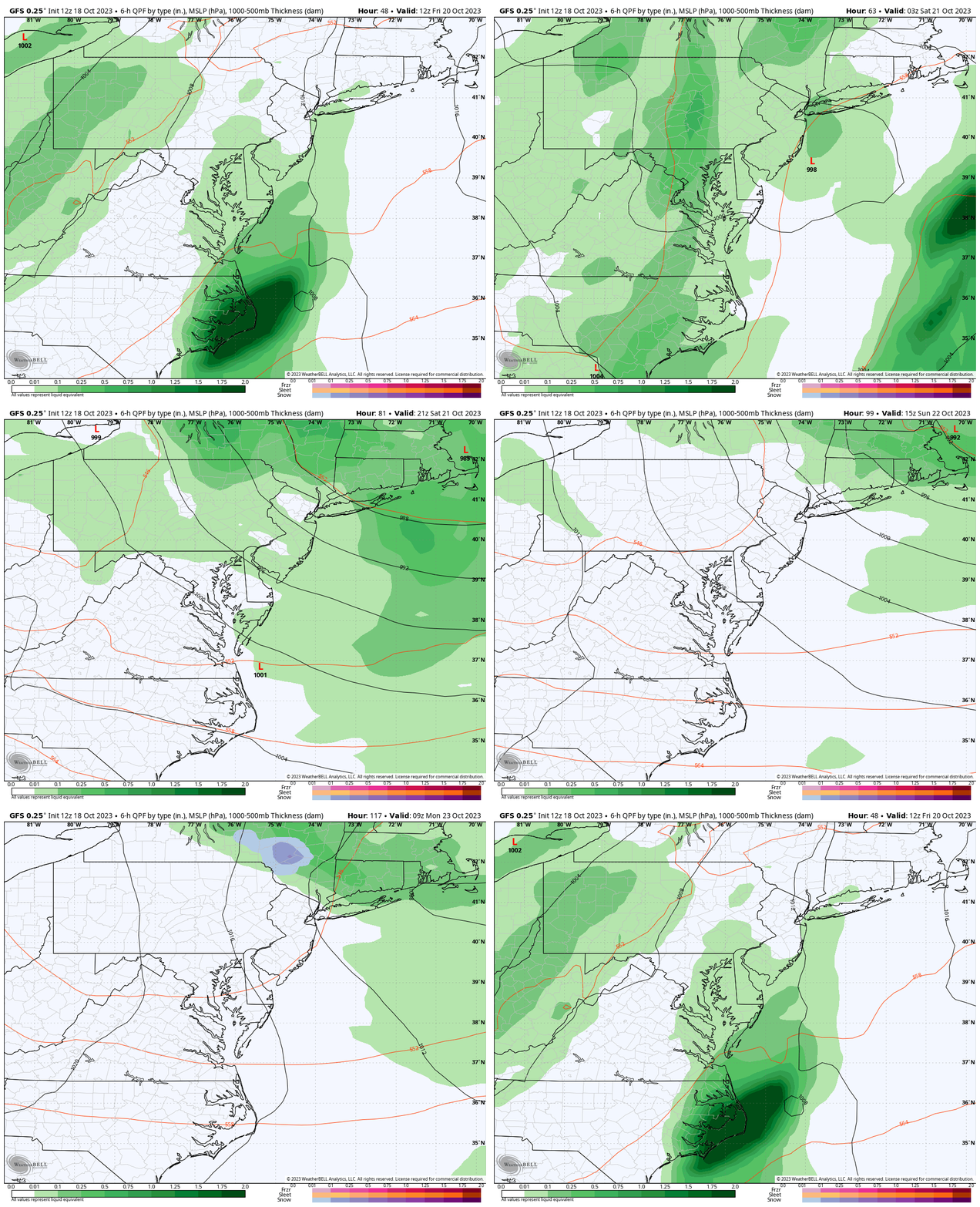
Closer Look:
Friday Morning to Monday Morning
Key Timeframes Below
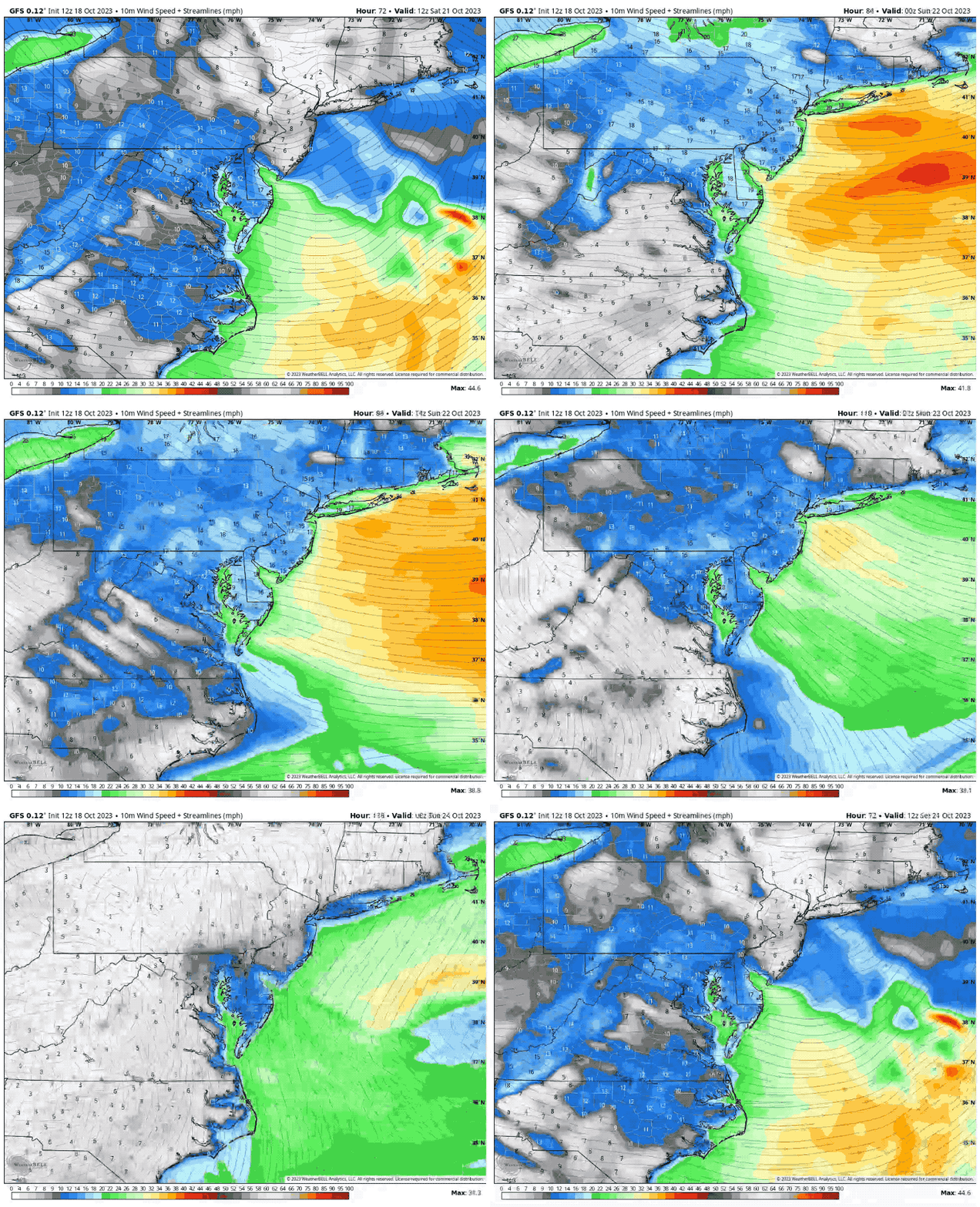
Wind Forecast
Saturday Morning to Tuesday Morning
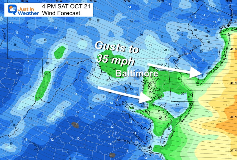
The winds will be brisk with and after the rain. As the cold air settles in, the true test for frost may hold until the winds subside on Tuesday morning.
Snapshots
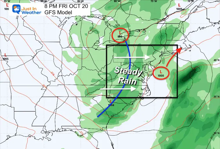
8 PM Friday
Steady rain will be expanding during the afternoon and evening. I’ve noticed that the recent systems have arrived earlier than the model plots, so I made this broad-brushed.
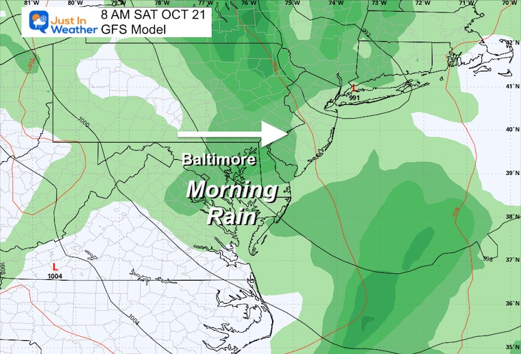
8 AM Saturday
This looks like a soggy start… However, if we follow the trend of it arriving earlier, the rain may depart earlier as well.
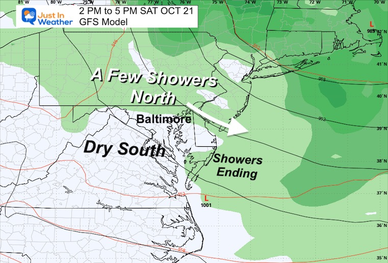
Saturday Afternoon
The primary rain should be gone. But with strong winds and unstable air… there may be bands of showers still scattered… especially to the North.
Wind Forecast
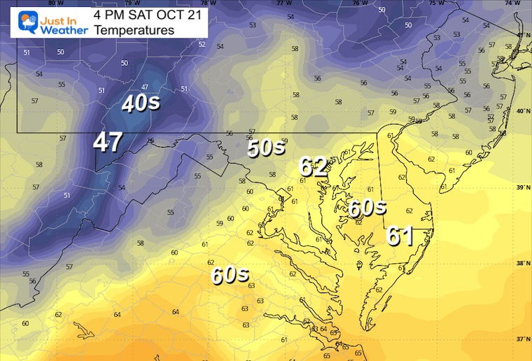
Temperatures
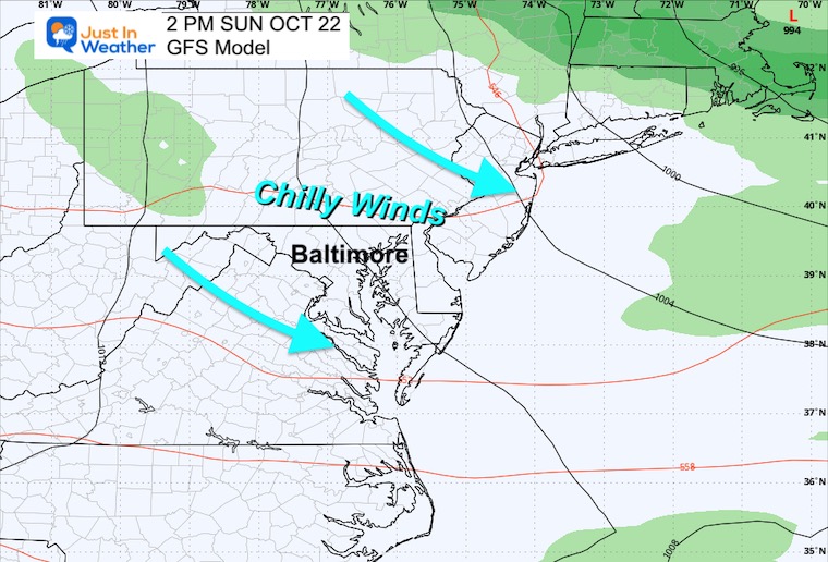
Sunday Afternoon
If you are heading to the Ravens Game, it will be dry! However, it will also be chilly with gusty winds. I have Justin Tucker on my Fantasy Team and gladly offer to be his personal meteorologist to help analyze the wind vortices in the stadium.
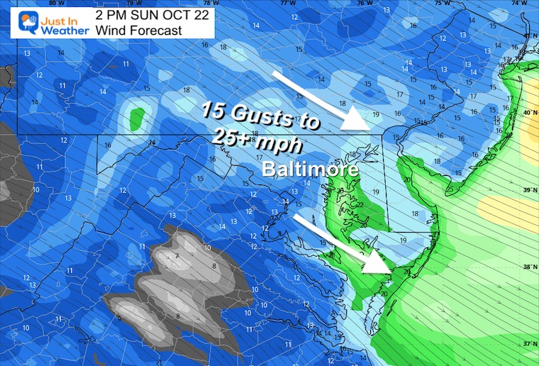
Wind Forecast
From the Northwest at 15 mph gusting to 25 mph or higher at times.
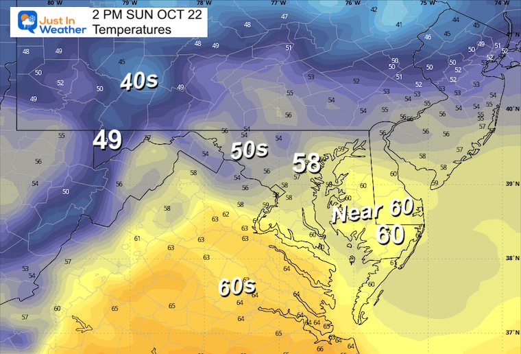
Temperatures
A chilly day in the upper 50s around Baltimore. Near 60ºF around the Bay and cooler 40s to lower 50s inland.
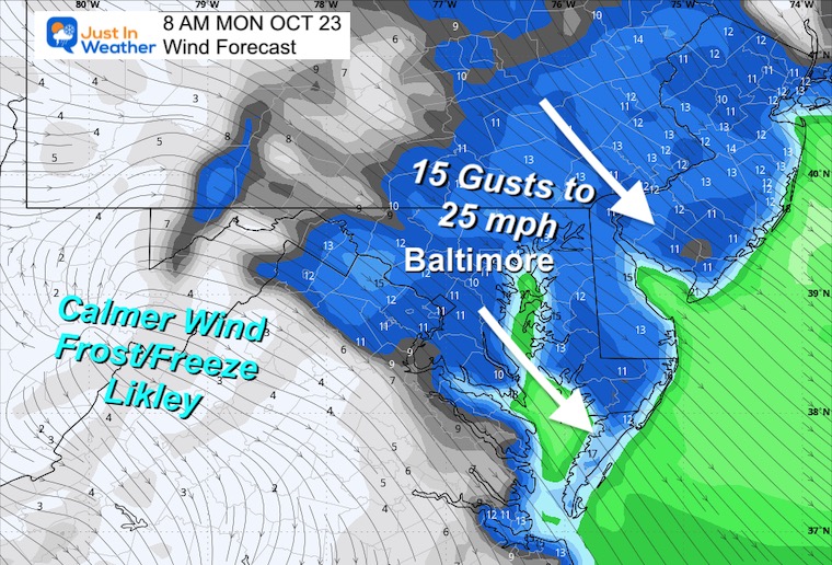
Monday Morning
At the same time when snow may be falling in the Catskill Mountains of New York, colder air will be settling into our region. The reason I pushed back my expectations for local frost is due to winds still gusting to 25 mph. Frost likes a light wind.
Temperatures
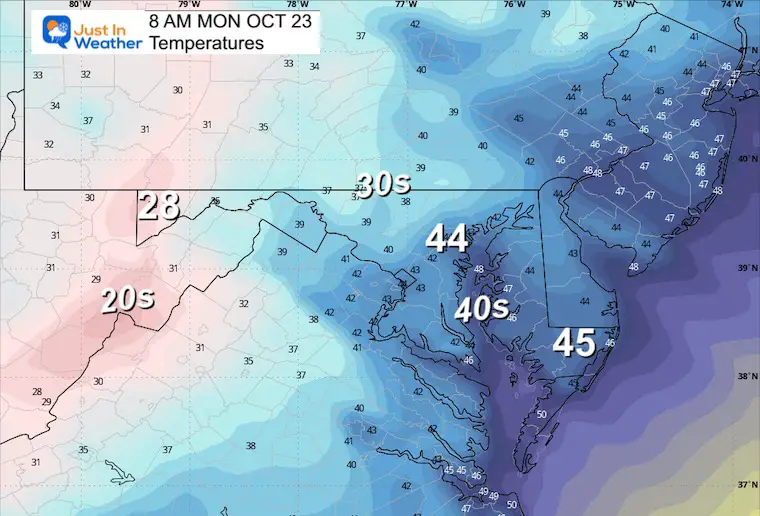
Looking Ahead: Tuesday Morning
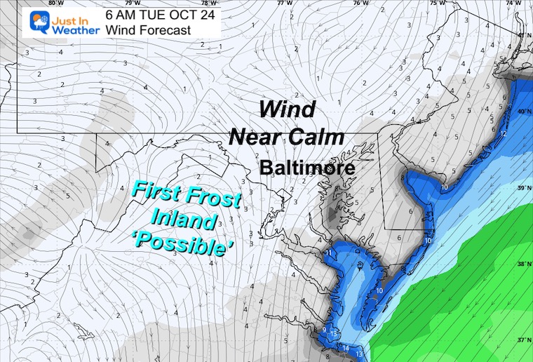
Winds
The airflow should settle to near calm. This may allow for maximum cooling.
A light wind can allow for exceptional cooling, which is why I think patchy frost is ‘possible’.
More Seasonal Reports:
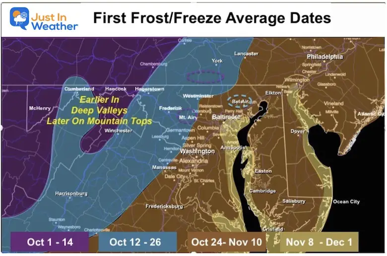
Explore The Average First Frost For MD and PA
Winter Weather: Can Woolley Bear Caterpillar Stripes Really Foretell Snow?
New Reports:
El Niño Advisory: First Look At NOAA’s Winter Outlook Expectations
Winter Outlook 2024 From Two Farmers Almanacs Return to Cold and Snow
Subscribe for eMail Alerts
Weather posts straight to your inbox
Sign up and be the first to know!


