Tropical Storm Franklin Crossing The Dominican Republic, Growth To Hurricane Before Getting Close To Bermuda
Wednesday Afternoon, August 23, 2023
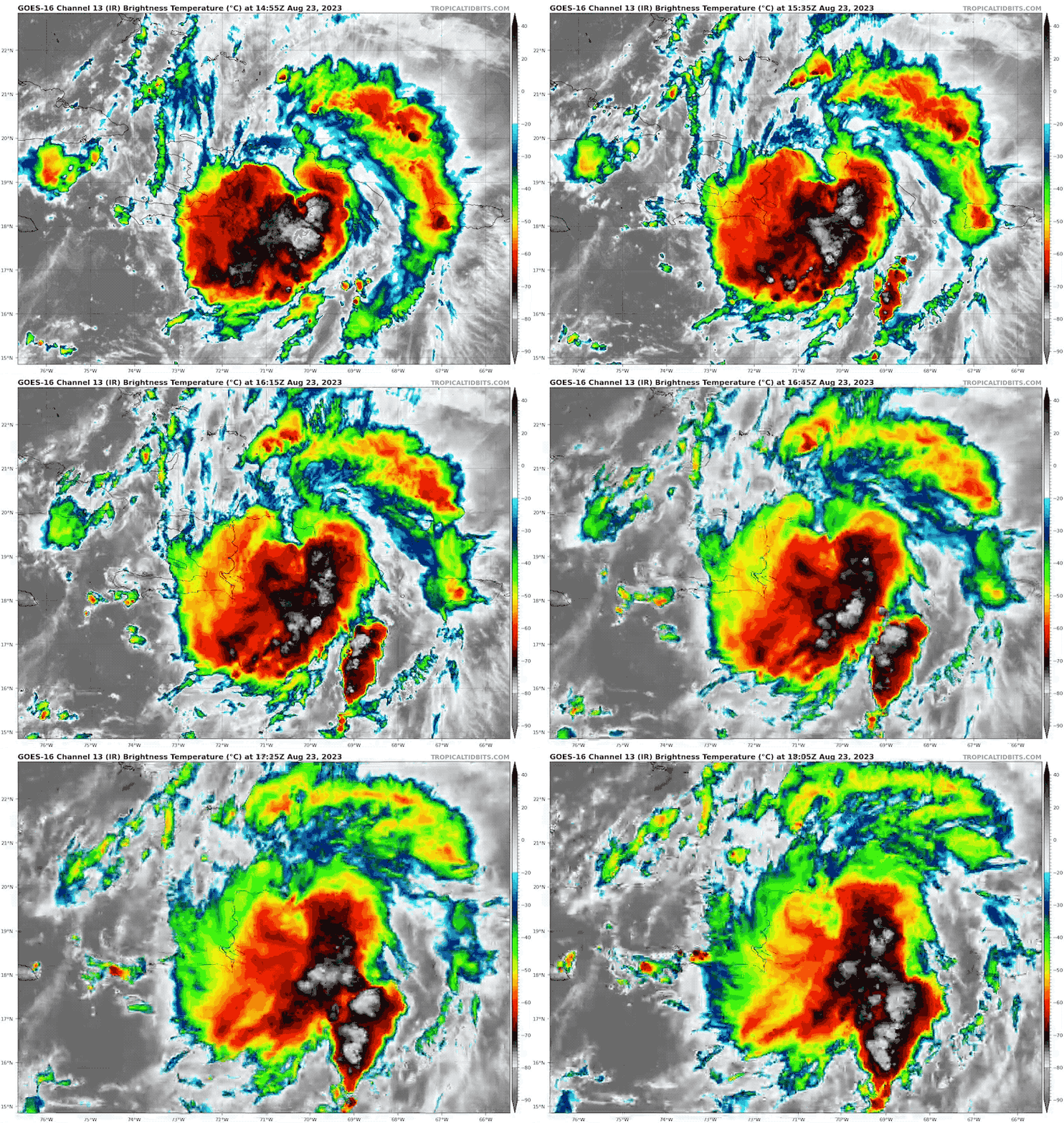
This is the third landfalling tropical system we have discussed this week. On Sunday, it was Hilary in California, yesterday it was Harold in South Texas. Today, we have Tropical Storm Franklin passing through The Dominican Republic. Hispaniola is a mountainous island that enhances the rainfall and destructive flooding. There is a lesser impact on the west side of the island in Haiti.
Tropical Storm force winds will reach The Turks and Caicos Islands later today.
Before this heads out to the Atlantic and near Bermuda, the risk is for:
- High winds
- Tornadoes
- Heavy rain
- Flash flooding
- Mudslides
National Hurricane Center Update: 2 PM EDT
- LOCATION…19.2N 70.7W
- ABOUT 40 MI…65 KM S OF PUERTO PLATA DOMINICAN REPUBLIC
- ABOUT 160 MI…255 KM S OF GRAND TURK ISLAND
- MAXIMUM SUSTAINED WINDS…40 MPH…65 KM/H
- PRESENT MOVEMENT…NNE OR 15 DEGREES AT 13 MPH…20 KM/H
- MINIMUM CENTRAL PRESSURE…1004 MB…29.65 INCHES
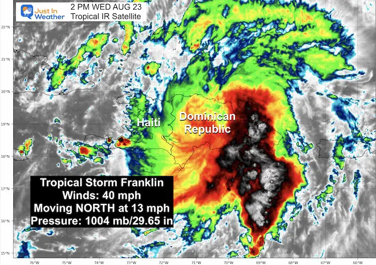
IR Satellite Loop
SUMMARY OF WATCHES AND WARNINGS IN EFFECT:
A Tropical Storm Warning is in effect for…
* Dominican Republic entire south coast from Haiti border eastward to Cabo Engano
* Dominican Republic entire north coast from Haiti border eastward to Cabo Engano
* Turks and Caicos Islands
A Tropical Storm Warning means that tropical storm conditions are expected somewhere within the warning area, in this case, within the next 12 to 24 hours.
Discussion From The National Hurricane Center
RAINFALL
Dominican Republic: 6 to 12 inches, with locally higher amounts around 16 inches, mainly across western and central portions.
Haiti: 2 to 4 inches, with locally higher amounts near 8 inches, mainly across eastern portions.
Turks and Caicos: 1 to 3 inches, mainly across the eastern islands.
Puerto Rico: Up to an inch, mainly across western portions.
WIND:
Tropical storm conditions are occurring over portions of:
Hispaniola and are expected to spread northward to the Turks and Caicos Islands later today.
Live Windy Widget
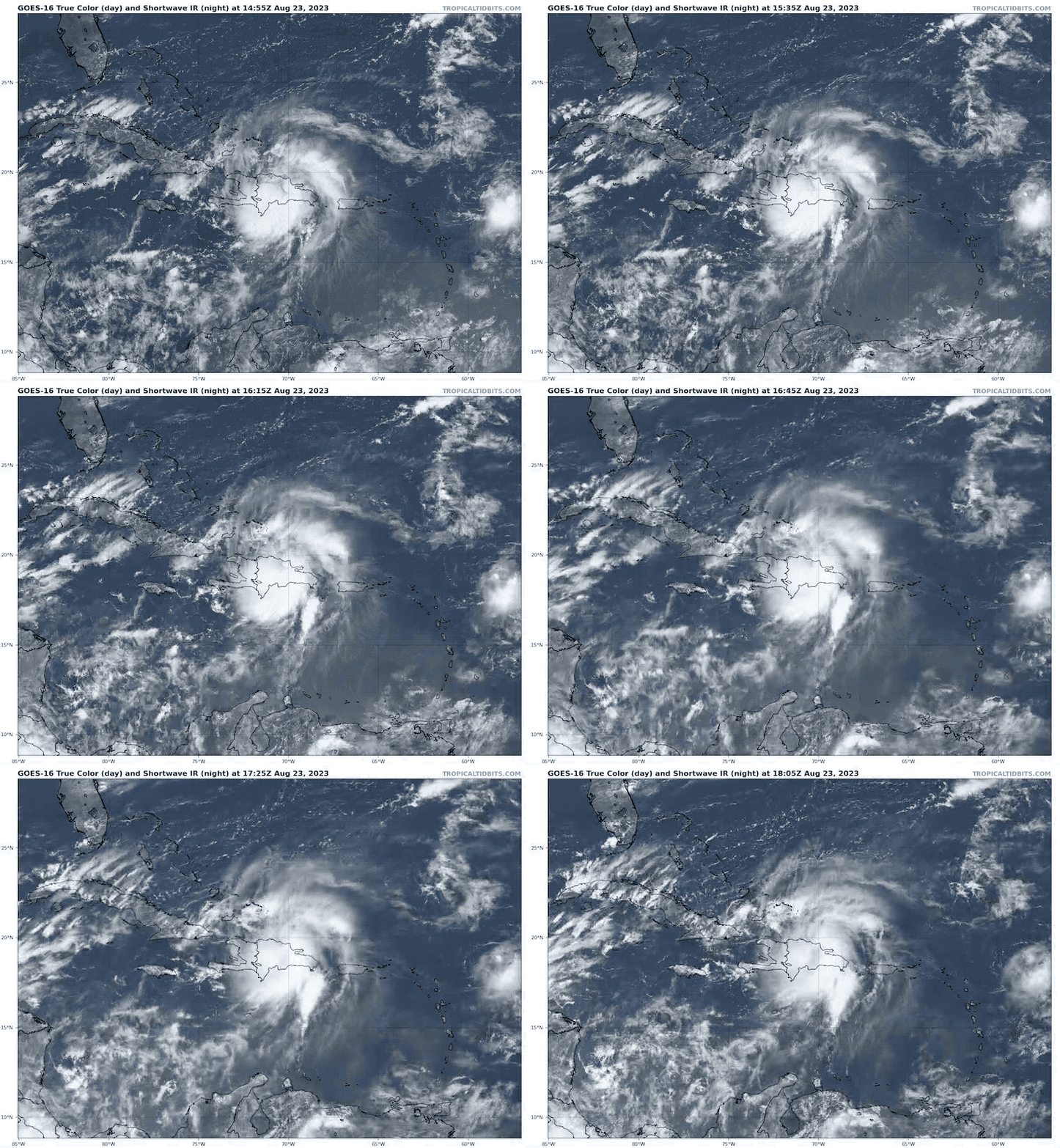
Wide True Color Satellite
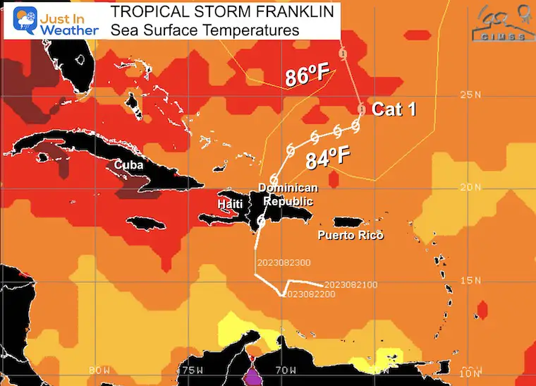
Restrengthening Over Warm Water
The Sea Surface Temperatures show support for this to restrengthen as it heads north.
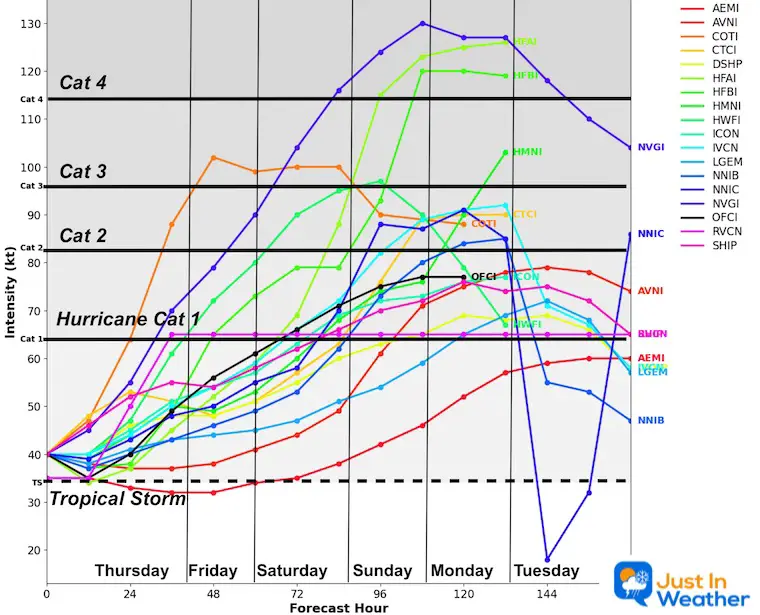
Water temperatures will allow this to reach Hurricane intensity over the weekend.
Forecast Intensity
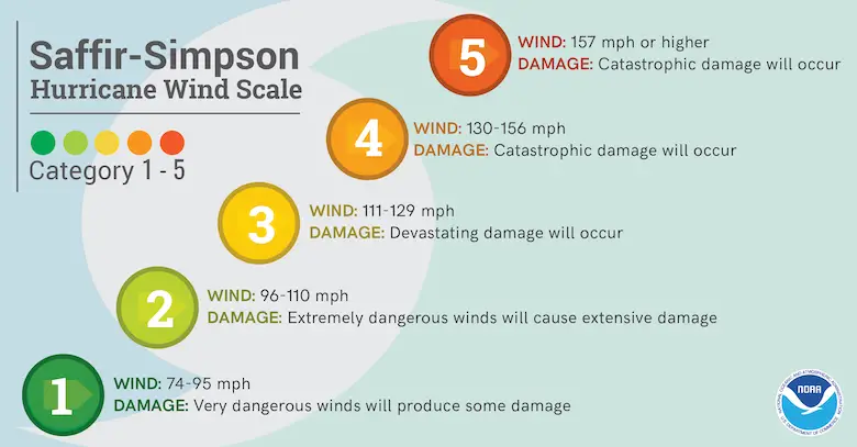
Saffir Simpson Scale
Ranking of Categories Based On Wind Speed
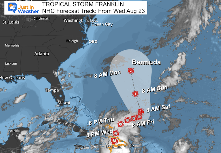
Forecast Track From The National Hurricane Center
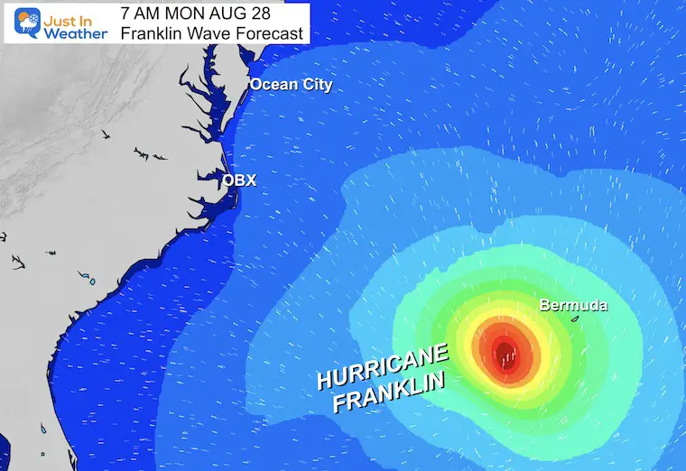
Wave Forecast
The impact on the US (at this time) looks minimal. There may be swells along the Mid Atlantic coast, but this is mostly a Bermuda and cruise ship impact.
EARLIER THIS MONTH: Maryland Trek 10 For These Kids
I will have a follow-up and recap on our amazing week shortly.
Subscribe for eMail Alerts
Weather posts straight to your inbox
Sign up and be the first to know!
EXPLORE MORE
2023 Hurricane Season Forecast With An El Niño Watch
La Niña Has Ended. El Niño May Return By Fall
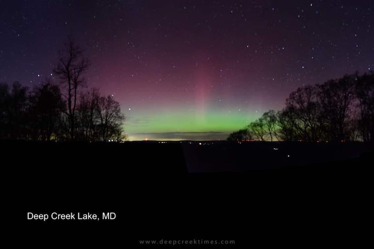
Aurora Photos From Maryland, Delaware, and Virginia
Please share your thoughts, and best weather pics/videos, or just keep in touch via social media
-
Facebook: Justin Berk, Meteorologist
-
Twitter
-
Instagram
RESTATING MY MESSAGE ABOUT DYSLEXIA
I am aware there are some spelling and grammar typos and occasional other glitches. I take responsibility for my mistakes and even the computer glitches I may miss. I have made a few public statements over the years, but if you are new here, you may have missed it: I have dyslexia and found out during my second year at Cornell University. It didn’t stop me from getting my meteorology degree and being the first to get the AMS CBM in the Baltimore/Washington region. One of my professors told me that I had made it that far without knowing and to not let it be a crutch going forward. That was Mark Wysocki, and he was absolutely correct! I do miss mistakes in my own proofreading. The autocorrect spell check on my computer sometimes does an injustice to make it worse. I also can make mistakes in forecasting. No one is perfect at predicting the future. All of the maps and information are accurate. The ‘wordy’ stuff can get sticky. There has been no editor who can check my work when I need it and have it ready to send out in a newsworthy timeline. Barbara Werner is a member of the web team that helps me maintain this site. She has taken it upon herself to edit typos when she is available. That could be AFTER you read this. I accept this and perhaps proves what you read is really from me… It’s part of my charm.
#FITF


