August 20 Hilary To Hit California Today And Local Weather Forecast
August 20, 2023
Sunday Morning Update
I have spent the last few days with my attention on Hurricane Hilary. This will be an historic event for California and the Desert Southwest. It will hit today as a tropical storm with extensive flooding and possible tornadoes in areas not able to handle it.
Below is the latest information and tracking tools. I am also getting back to our local forecast which will have some results from that system midweek. Also, just in case you were wondering… The quiet Atlantic Basin is about to get more active for the next few weeks.
Hurricane Hilary Update
Category 1
- Winds 85 mph
- Moving NNW at 21 mph
- Hurricane Force Winds Extends 45 miles from the center
- Tropical Storm Force Winds Extend 230 miles from the center
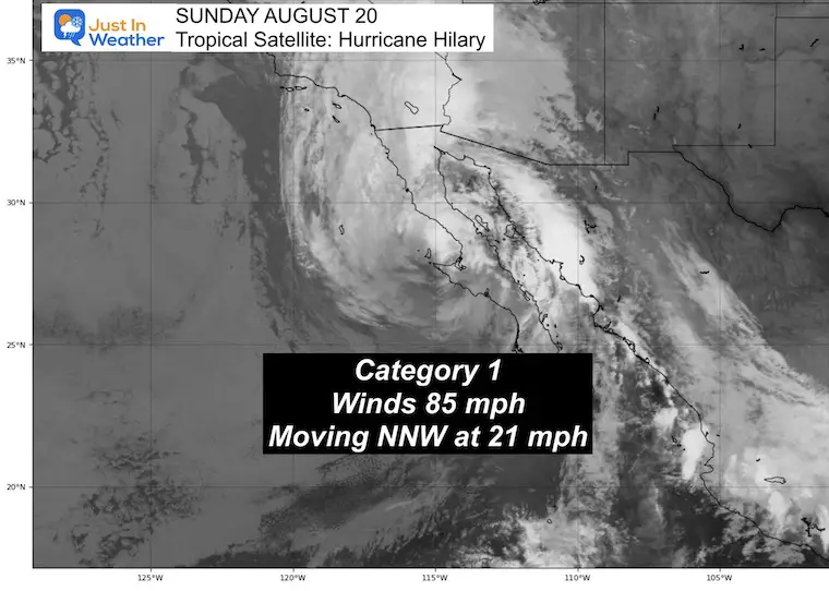
Satellite Loop
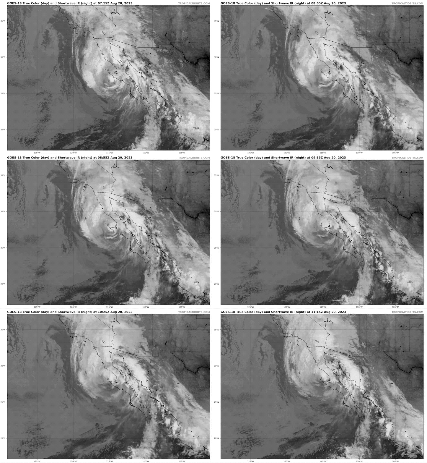
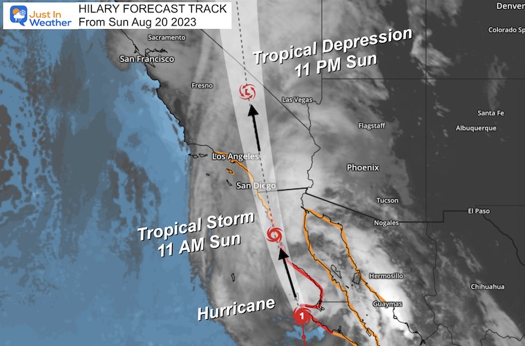
Forecast Track
Tropical Storm Warnings are still in place for the Southern California coast.
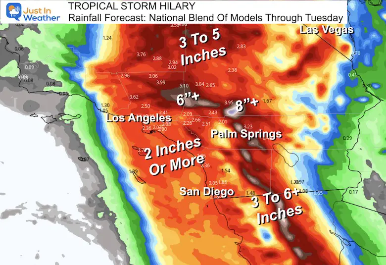
Inland Excessive Rainfall and Flooding are likely.
Hurricane Hilary will weaken to a Tropical Storm today and then a Tropical Depression tonight as it races north into the mountains and away from water.
In addition to flooding, mudslides and even tornadoes are possible.
Live Radar Widget
Latest Rainfall Forecast
National Blend Of Models
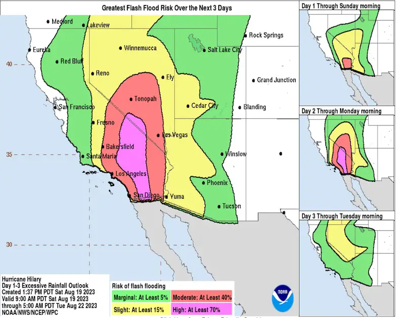
Flood Guidance
From the NOAA National Center For Environmental Prediction
From NWS Phoenix
The worst flooding will be in Southern California. The chance does exist for the deserts of Arizona, but lower.
309pm: Flooding potential increases Sunday as a weakened form of Hurricane Hilary moves through (focused over CA). The map shows the potential for excessive rain from 5am Sunday through 5am Monday. Note, localized heavy rain can occur even in the green areas (2) #cawx #azwx pic.twitter.com/qmS1vZVsd9
— NWS Phoenix (@NWSPhoenix) August 19, 2023
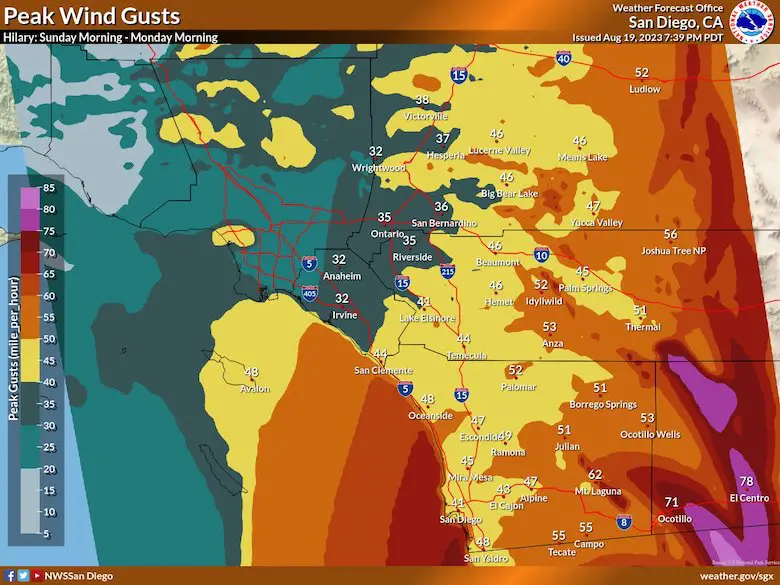
Wind Gust Forecast From NWS
Large Pattern
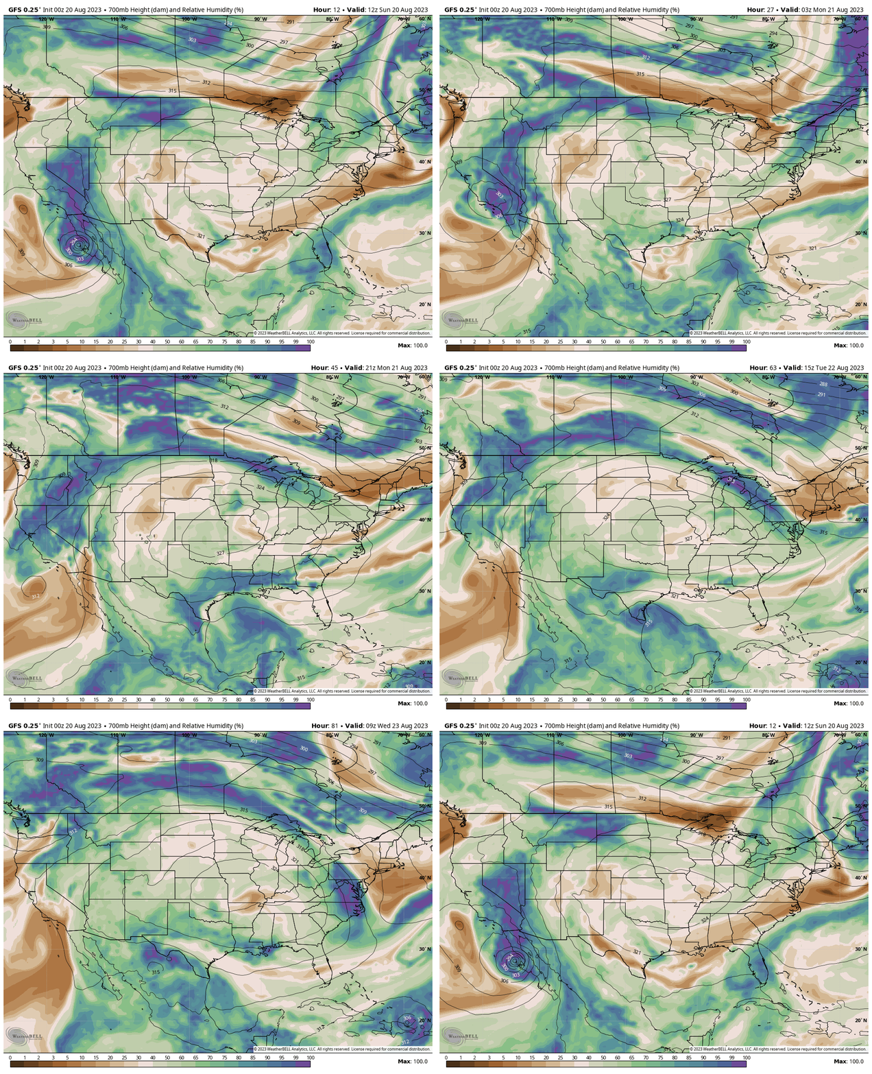
The United States weather has been governed by a Large Dome of High Pressure in the middle of the country. This is helping to steer Hilary AND keep the Eastern US cool and pleasant.
The moisture seen here is expected to move up and around the ridge. It will lose some along the way, but could wrap around and reach the Eastern US mid week.
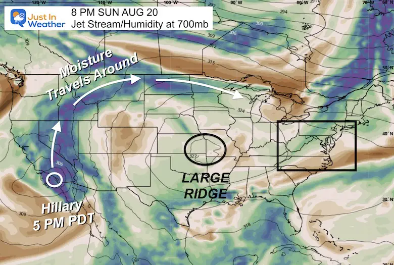
Jet Stream Animation
Sunday Morning To Wednesday Morning
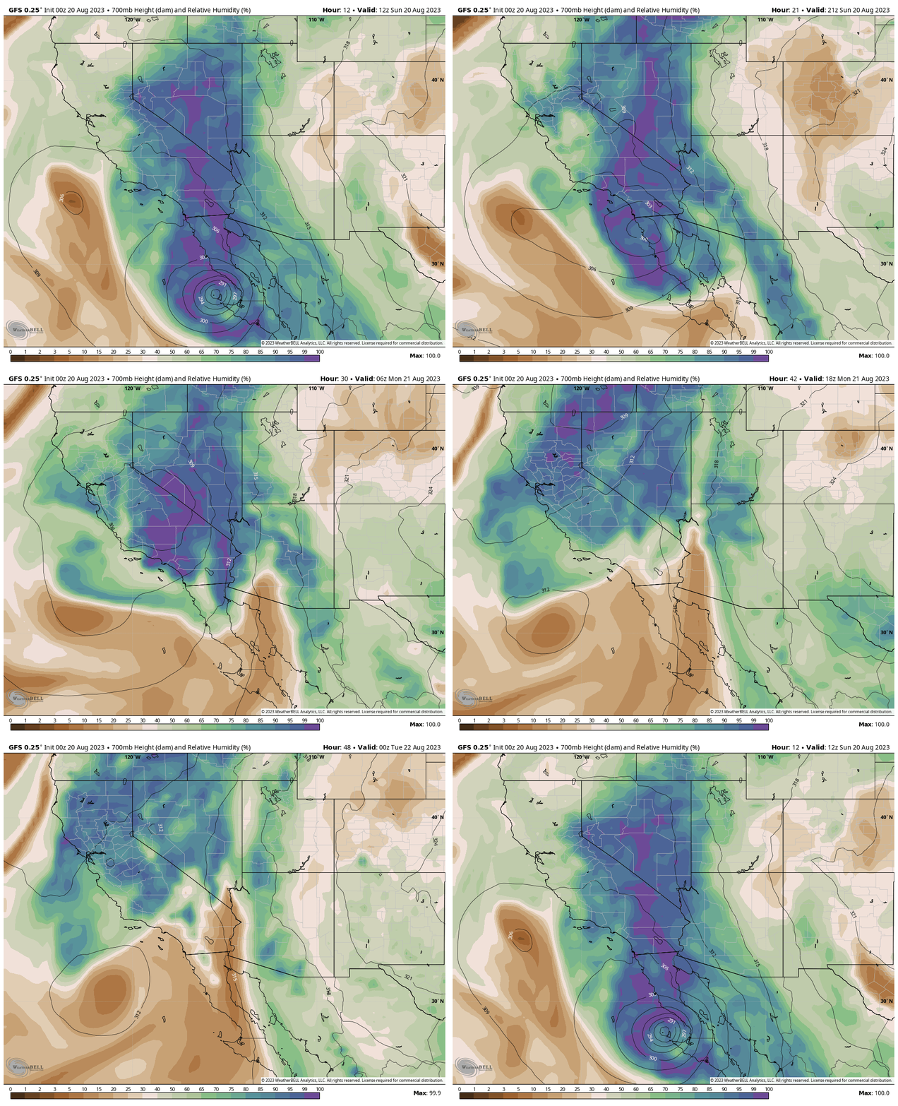
Follow the plume of ‘green’ from Southern California around the ridge to the Eastern US.
Jet Stream Animation
West Coast: Sunday Morning To Monday Night
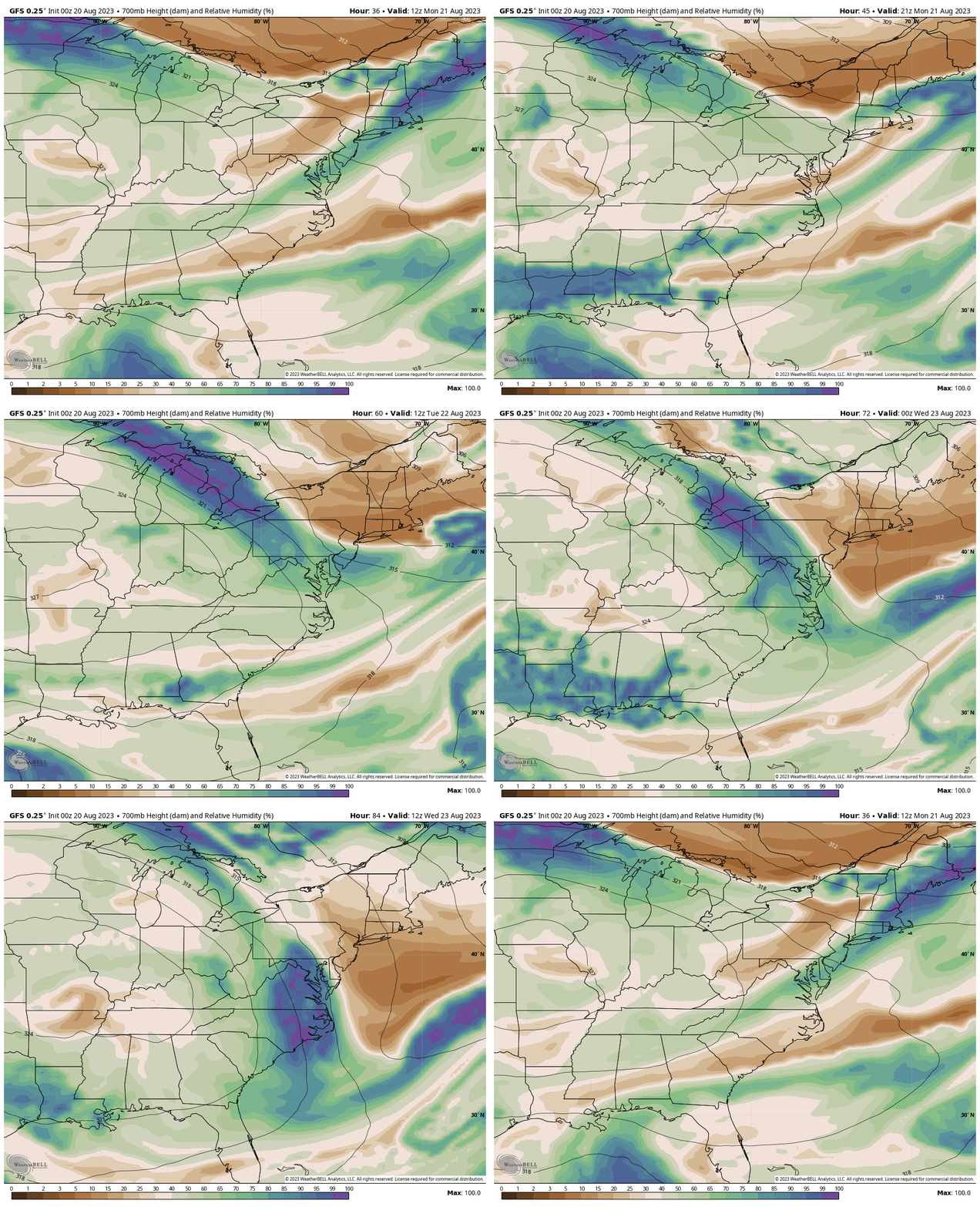
Jet Stream Animation
East Coast: Monday Morning To Wednesday
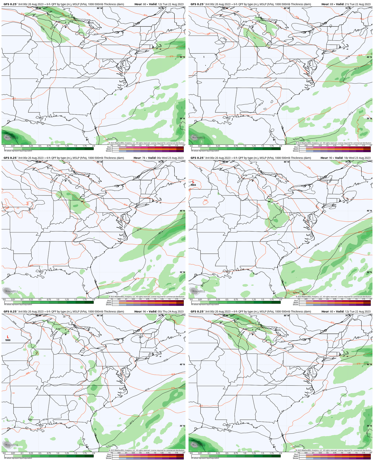
This may look impressive, but it may end up just being more clouds than anything else for us… while cooling our temps down.
Rainfall Forecast
Tuesday Morning to Wednesday Night
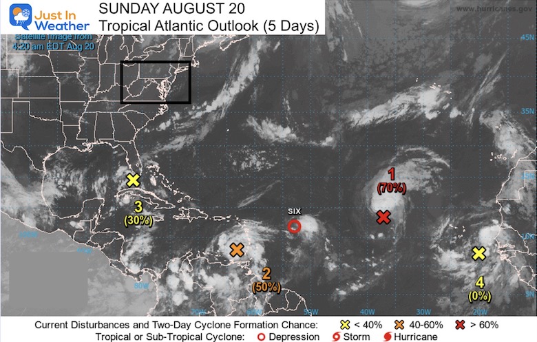
Tropical Atlantic
It has been a quiet summer, which was expected in this El Niño year. However, we are entering prime time for activity that peaks Mid September. The next week or two looks like it will be getting busy.
Subscribe for eMail Alerts
Weather posts straight to your inbox
Sign up and be the first to know!
Weather posts straight to your inbox
Sign up and be the first to know!
EXPLORE MORE
2023 Hurricane Season Forecast With An El Niño Watch
LOCAL WEATHER
CLIMATE DATA: Baltimore
TODAY August 20
Sunrise at 6:23 AM
Sunset at 7:55 PM
Normal Low in Baltimore: 65F
Record 49ºF in 1998
Normal High in Baltimore: 86ºF
Record 105ºF 1983
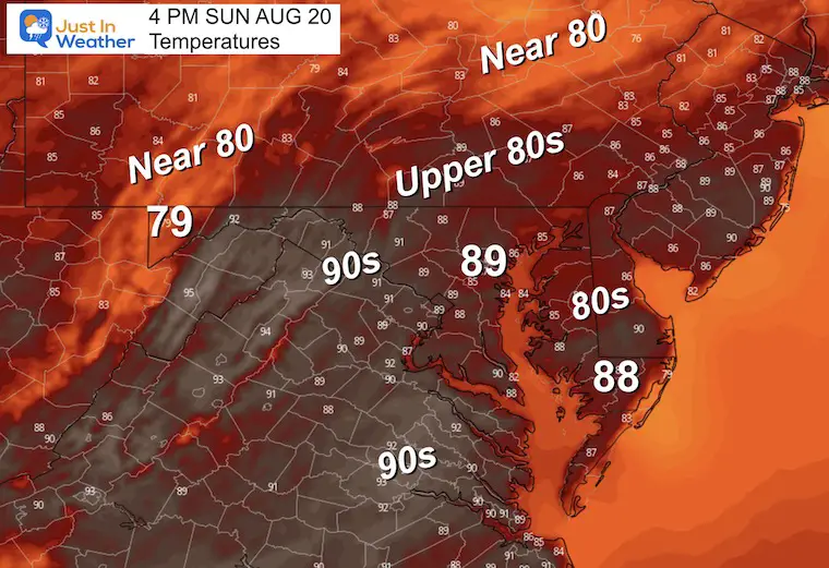
Afternoon Temperatures
It will be a little warmer but still comfortable.
Monday
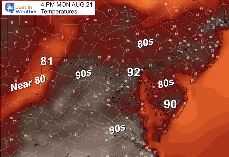
Heating Up! Not Excessive and records may not be challenged. The humidity does not look to be excessive either. This should be a brief and tolerable warm-up.
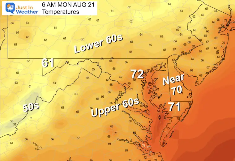
Morning Temperatures
Back to that summer feel again.
Afternoon Temperatures
Definitely lower than prior expectations. This is thanks in part to the large High Pressure dome position keeping our wind flow from bringing in the full fury of the heat.
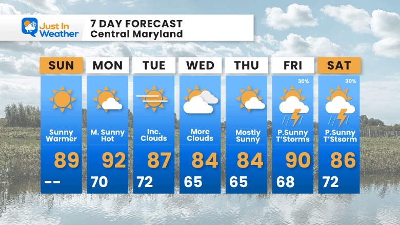
7 Day Forecast
The heat looks less impressive but only for a day or two. More clouds from Hilary and wind flow will keep us cooler midweek.
The next chance for rain or thunderstorms may return by next weekend.
LAST WEEK: Maryland Trek 10 For These Kids
I will have a follow-up and recap on our amazing week shortly.
Subscribe for eMail Alerts
Weather posts straight to your inbox
Sign up and be the first to know!
EXPLORE MORE
2023 Hurricane Season Forecast With An El Niño Watch
La Niña Has Ended. El Niño May Return By Fall
Aurora Photos From Maryland, Delaware, and Virginia
Please share your thoughts, and best weather pics/videos, or just keep in touch via social media
-
Facebook: Justin Berk, Meteorologist
-
Twitter
-
Instagram
RESTATING MY MESSAGE ABOUT DYSLEXIA
I am aware there are some spelling and grammar typos and occasional other glitches. I take responsibility for my mistakes, and even the computer glitches I may miss. I have made a few public statements over the years, but if you are new here you may have missed it: I have dyslexia, and found out during my second year at Cornell University. It didn’t stop me from getting my meteorology degree and being the first to get the AMS CBM in the Baltimore/Washington region. One of my professors told me that I had made it that far without knowing, and to not let it be a crutch going forward. That was Mark Wysocki and he was absolutely correct! I do miss my mistakes in my own proofreading. The autocorrect spell check on my computer sometimes does an injustice to make it worse. I also can make mistakes in forecasting. No one is perfect at predicting the future. All of the maps and information are accurate. The ‘wordy’ stuff can get sticky. There has been no editor that can check my work when I needed it and have it ready to send out in a newsworthy timeline. Barbara Werner is a member of the web team that helps me maintain this site. She has taken it upon herself to edit typos when she is available. That could be AFTER you read this. I accept this and perhaps proves what you read is really from me… It’s part of my charm.
#FITF


