August 6 Weather: Showers And Severe Storms Plus Starting Maryland Trek 10
August 6, 2023
Sunday Morning Update
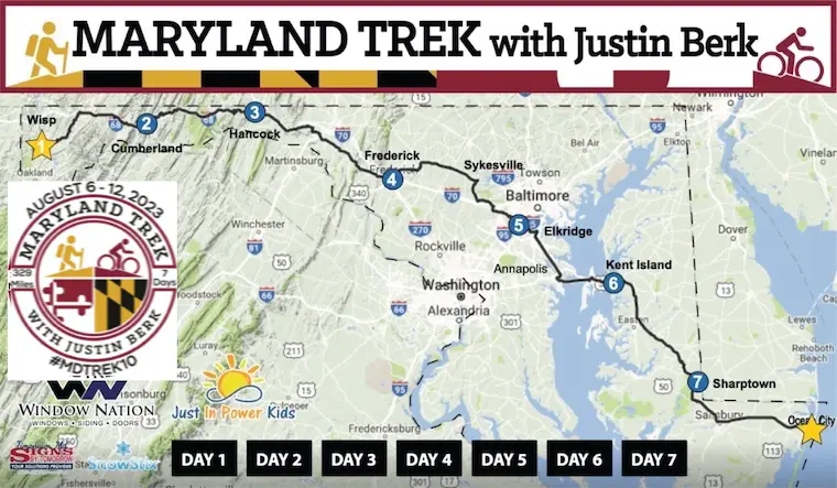
Thank you for visiting here for my weather report. Local weather is below and I plan to continue all week, but please note my attention is on Maryland Trek 10. My team begins today from the summit of Wisp Ski Resort for our week-long journey to Ocean City. This is my 10th year in a row and it never gets old! My favorite week of the year!
Yesterday we visited the Wisp 3,000 Ft summit, and this morning we will meet with our Power Kid Tyler and his family. We are honoring a kid in cancer treatment each day and raising money for our free programs at Just In Power Kids. As of this morning, we have already raised over $61,000 towards our goal of $140,000+.

Maryland Trek 10 Starts TODAY
Today’s Route will be 41 miles from Wisp to Cumberland, Maryland. We will do 27 miles on foot, then bike the rest of the day. Our total will be 329 miles by the time we reach Ocean City and the water next Saturday.
Today our challenge will be rain (in the mountains). Here is the weather for today’s day event.
Today’s Power Kid is Tyler. Please see his story here and consider donating. We will be live with his family beginning between 8 AM and 8:30 AM on my Facebook Page.
Weather for our route today:
Weather Briefing
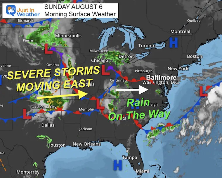
Morning Surface Weather
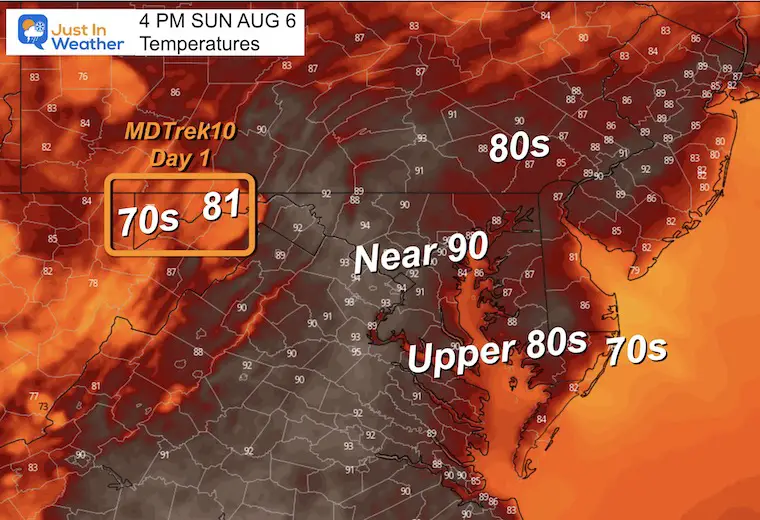
A muggy start for some and turning unstable. A weather system will be approaching from the west and reach the mountains with rain. So our day may end wet, but the rain should hold off for metro areas until later today and tonight.
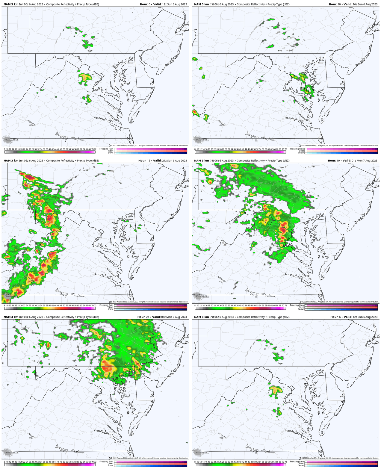
Radar Simulation Forecast
8 AM to Midnight
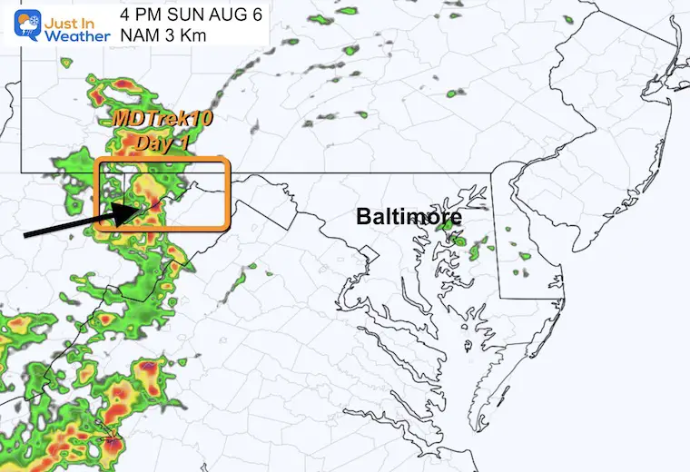
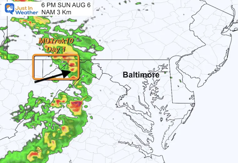
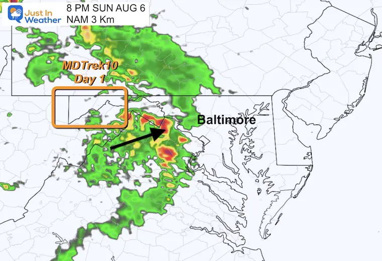
This is a rough guide but not perfect. My suggestion is for rain later… starting in the mountains after 2 PM, then reaching central Maryland tonight.
4 PM Snapshot
6 PM Snapshot
8 PM Snapshot
Afternoon Temperatures
Subscribe for eMail Alerts
Weather posts straight to your inbox
Sign up and be the first to know!
EXPLORE MORE
2023 Hurricane Season Forecast With An El Niño Watch
Drought Report
CLIMATE DATA
TODAY August 6
Normal Low in Baltimore: 67ºF
Record 51ºF in 1951
Normal High in Baltimore: 88ºF
Record 105ºF 1918
Monday Weather
SEVERE STORM RISK
NOAA has an ENHANCED RISK west of the cities. This is a Level 3 of 5 chance for storms to turn severe with more intensity.
The challenge here is the timing. Modeling does vary and the earlier they develop and arrive, the stronger and more intense they can be tapping into the daytime heating. However, we may have severe storms lasting overnight.
This includes the potential for:
- Winds over 70 mph
- Hail over 1.5”
- A few tornadoes
- Flash Flooding
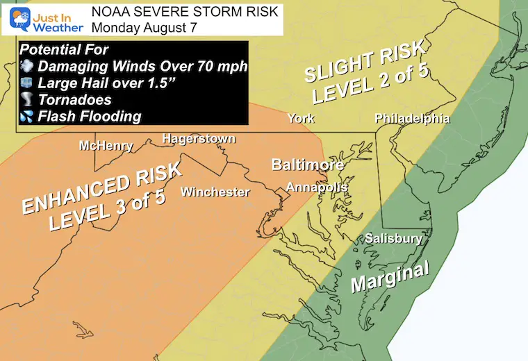
I do not trust the modeling, but we use them as guides. It is likely there will be more activity than shown here.
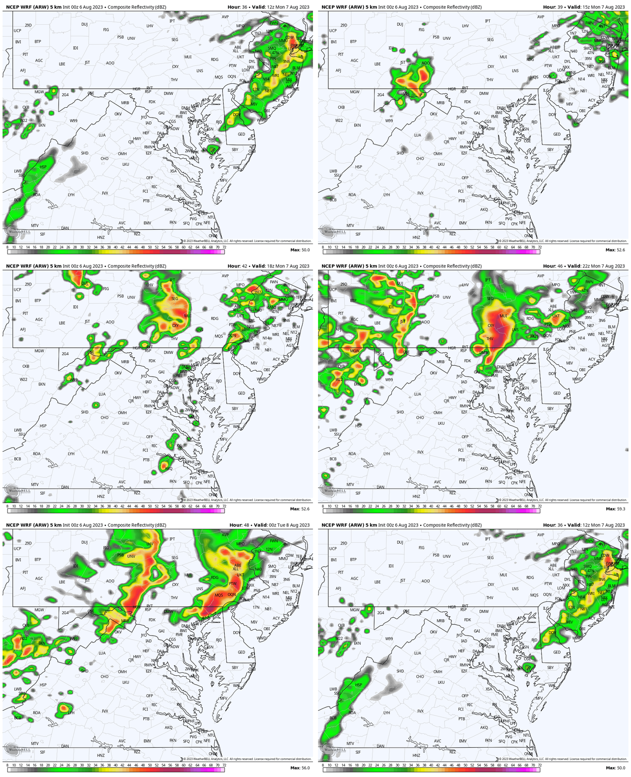
Radar Simulation: WRF Model
This model shows showers are more likely any time after 2 PM. This product only goes out to 8 PM… Where we see multiple lines of storms.
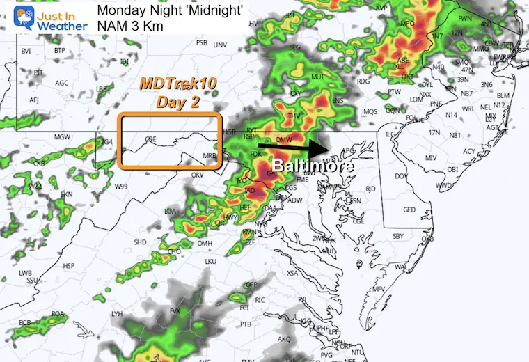
Midnight: NAM 3 Km
This model has the storm line arriving later…. But I believe we still will be watching all afternoon and evening as well.
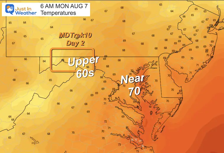
Morning Temperatures
The day will start off more muggy.
Afternoon Temperatures
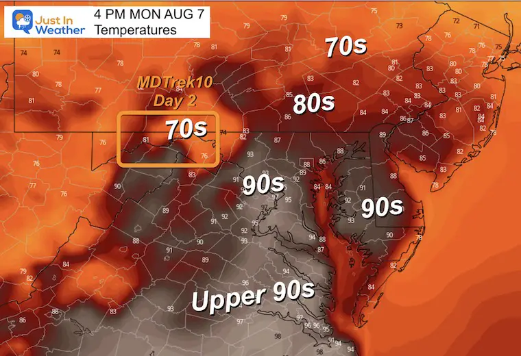
The numbers are subject to where the showers reach. Where it rains it will cool into the 70s, but before that arrives there will be widespread 90s. This is fuel for the approaching storm system.
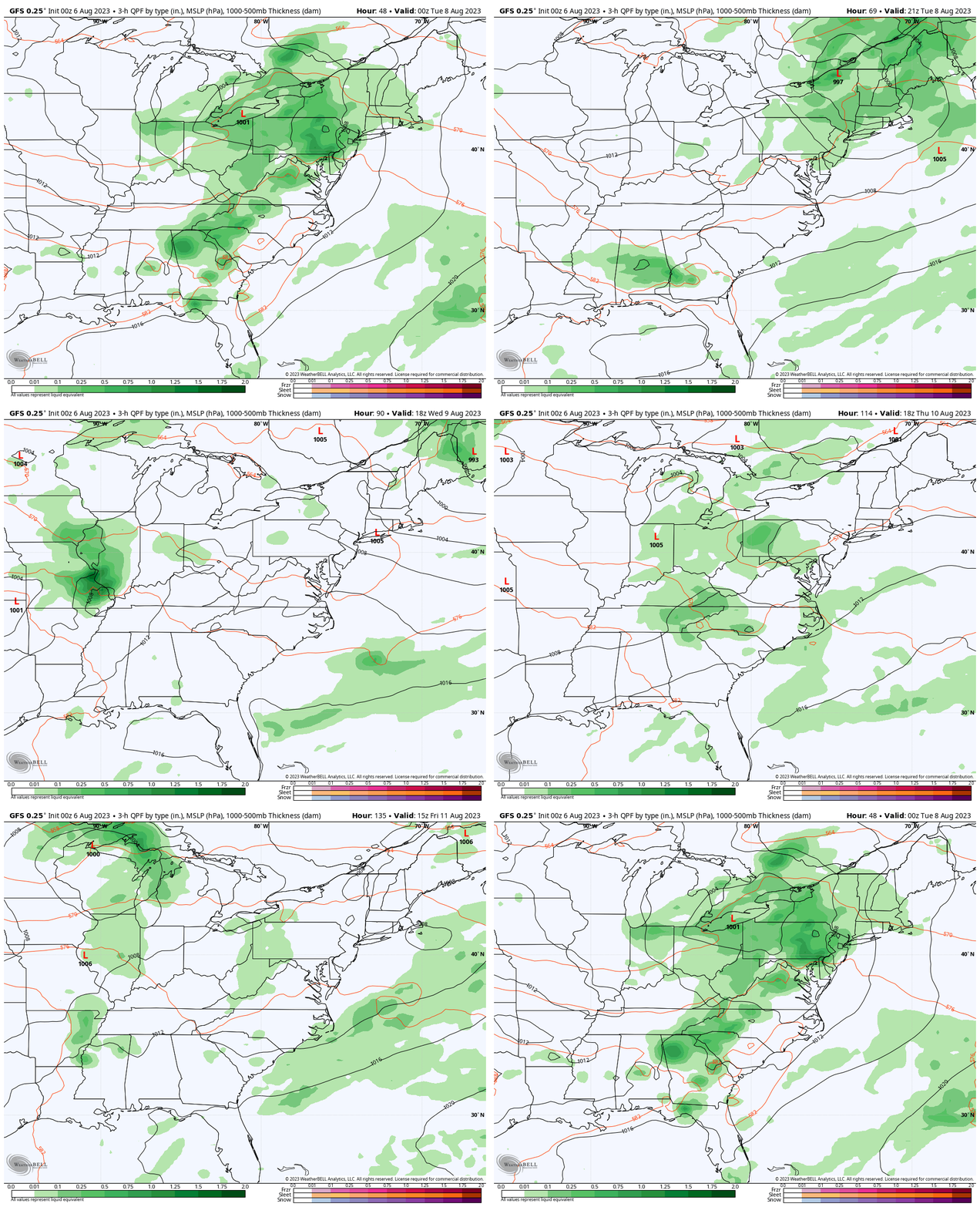
Rain Forecast Monday Evening To Friday Evening
After a stormy Monday, the middle of the week looks great. This is when our Maryland Trek Team will cross central Maryland.
More seasonal afternoon showers or thunderstorms will return Thursday, but I would not change any plans.
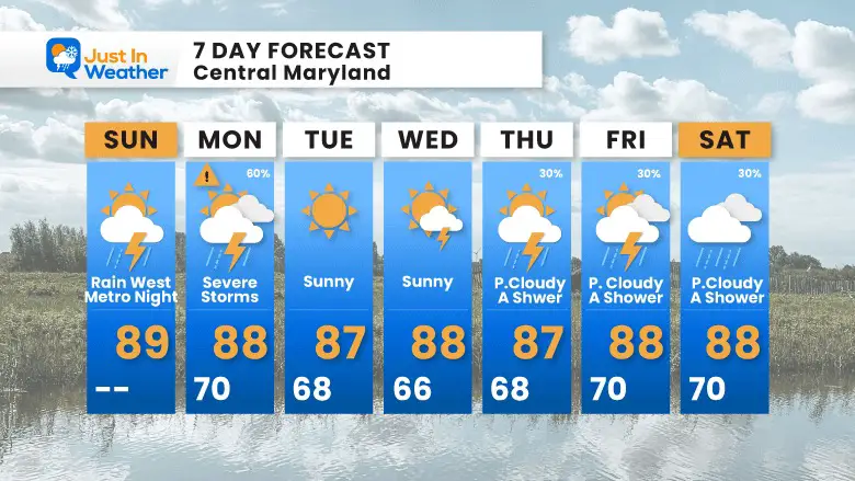
7 Day Forecast
After we get through the storms Monday the middle of the week looks good.
Typical summer afternoon showers or thunderstorms will return Thursday into next weekend.
All Week For These Kids
Subscribe for eMail Alerts
Weather posts straight to your inbox
Sign up and be the first to know!
EXPLORE MORE
2023 Hurricane Season Forecast With An El Niño Watch
La Niña Has Ended. El Niño May Return By Fall
Aurora Photos From Maryland, Delaware, and Virginia
Please share your thoughts, and best weather pics/videos, or just keep in touch via social media
-
Facebook: Justin Berk, Meteorologist
-
Twitter
-
Instagram
RESTATING MY MESSAGE ABOUT DYSLEXIA
I am aware there are some spelling and grammar typos and occasional other glitches. I take responsibility for my mistakes, and even the computer glitches I may miss. I have made a few public statements over the years, but if you are new here you may have missed it: I have dyslexia, and found out during my second year at Cornell University. It didn’t stop me from getting my meteorology degree and being the first to get the AMS CBM in the Baltimore/Washington region. One of my professors told me that I had made it that far without knowing, and to not let it be a crutch going forward. That was Mark Wysocki and he was absolutely correct! I do miss my mistakes in my own proofreading. The autocorrect spell check on my computer sometimes does an injustice to make it worse. I also can make mistakes in forecasting. No one is perfect at predicting the future. All of the maps and information are accurate. The ‘wordy’ stuff can get sticky. There has been no editor that can check my work when I needed it and have it ready to send out in a newsworthy timeline. Barbara Werner is a member of the web team that helps me maintain this site. She has taken it upon herself to edit typos when she is available. That could be AFTER you read this. I accept this and perhaps proves what you read is really from me… It’s part of my charm.
#FITF


