July 27 Heat Advisory and NOAA Severe Storm Risk
July 27, 2023
Thursday Morning Update
This is the day we will all feel it. High humidity is noticeable this morning and is the main factor for making it feel hotter this afternoon. It will also work with a disturbance to ignite thunderstorms mid-day and early afternoon. Some of these storms may turn severe.
Tomorrow will also be very hot, but less stormy. Then more clouds and storms on Saturday will lead to a cooler air mass on Sunday and next week.
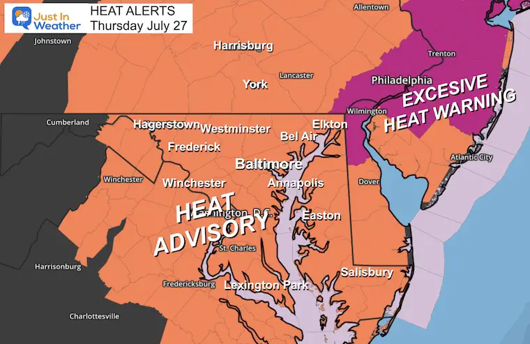
Weather Alerts
Heat Advisory
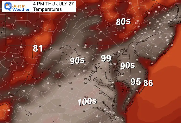
Temperatures will be in the 90s to 100ºF, but the Heat Index could reach 110ºF.
Heat Advisory around Philadelphia where the heat index may be even higher.
NOAA Severe Storm Risk
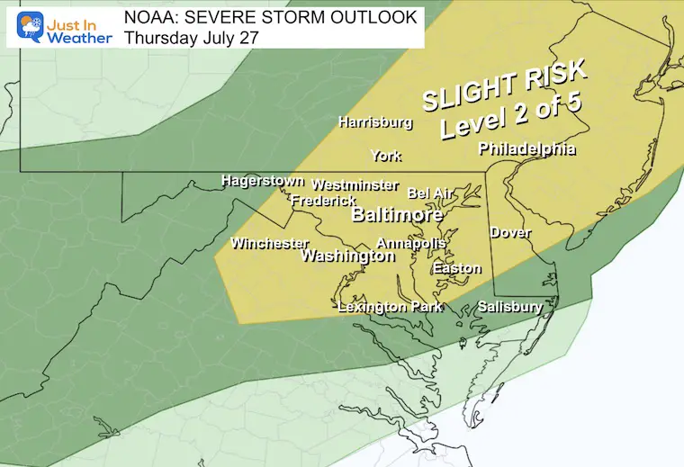
The Slight Risk is Level 2 of 5. It means of the storms that develop, there will be scattered cells that turn severe.
Risk is for:
- Damaging Winds
- Large Hail over 1” Diameter
- Flash Flooding
- Isolated Tornadoes
Next Round of Alerts: If Issued
Watch: This may be posted first. It will mark the Potential NOT a Promise for storms to turn severe.
Warning: This is when a severe cell is spotted. It will include a timeline and path with specific towns.
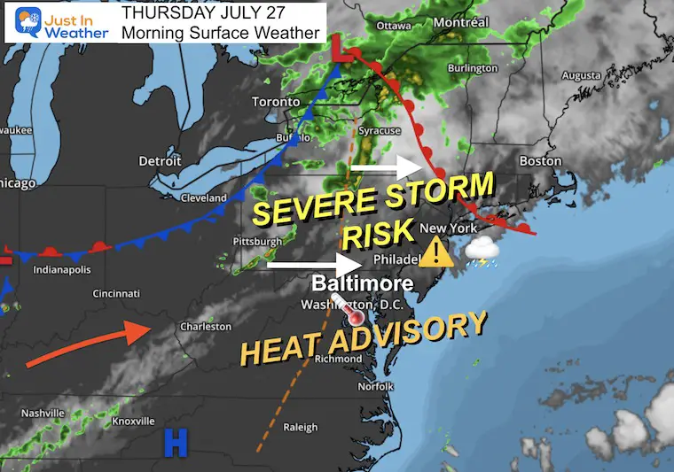
Morning Surface Weather
Warm and muggy this morning… The high heat and a trough will act to ignite showers and thunderstorms that may turn severe.
The humidity will make the high temps feel like over 100ºF to 110ºF.
Live Radar And Lightning Widget
We may see activity mid-day… sooner than the forecast model below.
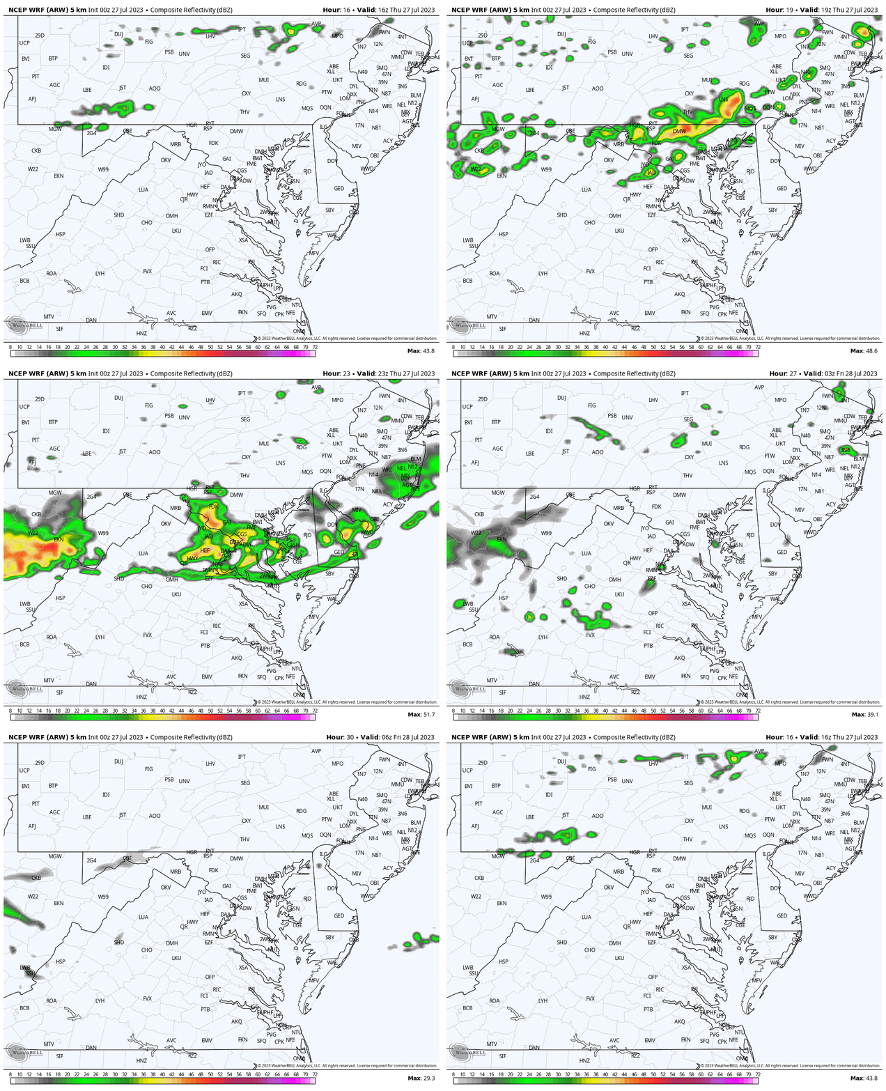
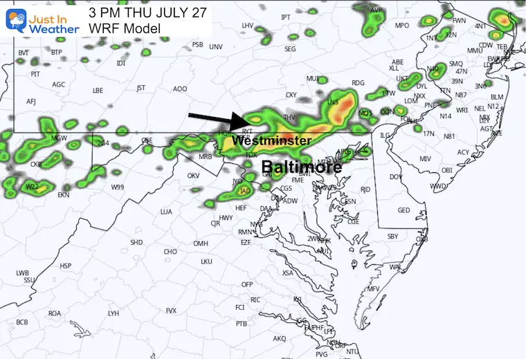
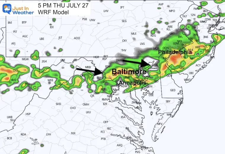
Radar Simulation 12 PM to 10 PM
I still have low confidence in this product, but we will use it as a suggestion.
The trend I have seen is that storm activity has developed earlier and has been more numerous or widespread. So compare this to the live radar above if you check in later.
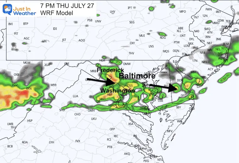
The idea is for storms to begin showing up around noon… and then pass through central Maryland any time after 2 PM.
3 PM Snapshot
5 PM Snapshot
7 PM Snapshot
Afternoon Temperatures
EXPLORE MORE
2023 Hurricane Season Forecast With An El Niño Watch
Drought Report
https://justinweather.com/2023/07/20/severe-drought-remains-in-parts-of-maryland-july-20-2023/
Subscribe for eMail Alerts
Weather posts straight to your inbox
Sign up and be the first to know!
CLIMATE DATA
TODAY July 27
Normal Low in Baltimore: 68ºF
Record 52ºF in 1962
Normal High in Baltimore: 89ºF
Record 101ºF 1940 (Record Heat Wave That Year)
Friday Weather
Another very hot day with higher humidity and Heat Index values over 100ºF.
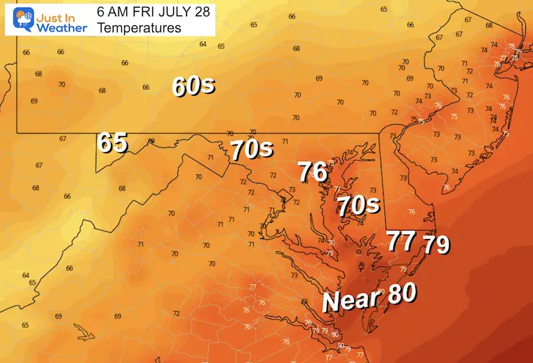
Morning Temperatures
Warm and muggy! It is possible some metro areas could remain near 80ºF.
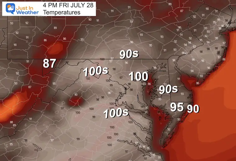
Afternoon Temperatures
Temps up near 100ºF with the heat index between 100ºF and 110ºF.
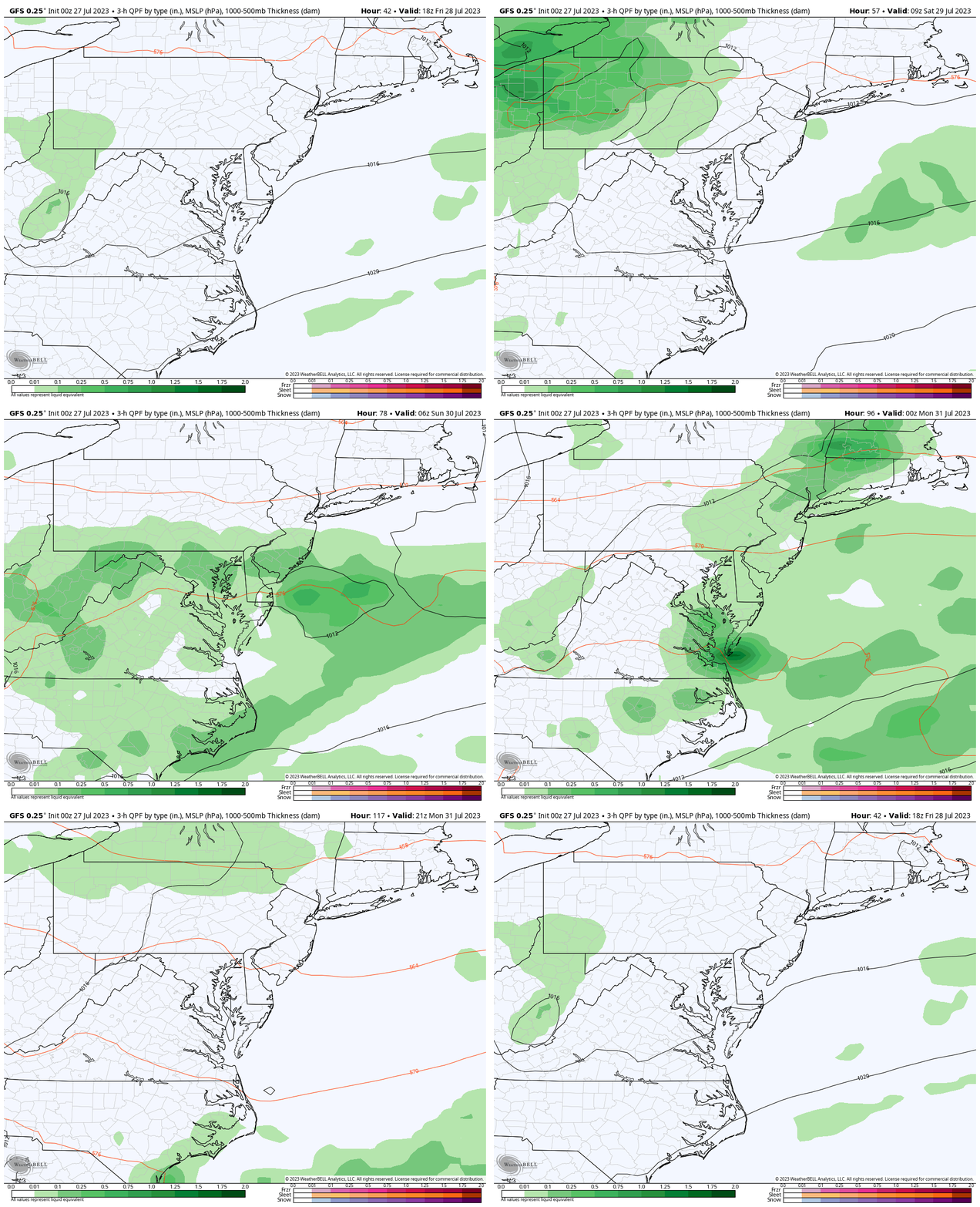
Rain Forecast: GFS Model
The heat will eventually give way to the next air mass. This cold front will approach with increasing showers and storms.
- Friday: Another very HOT day with more evening showers and storms.
- Saturday: There will be more clouds and showers.
- Sunday: The delay in the air mass movement may keep some showers around but it will be cooler.
- Monday: Dry and cooler.
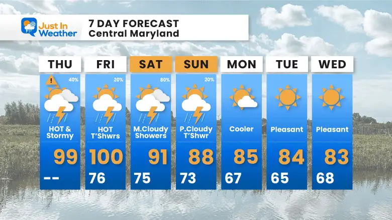
7 Day Forecast
High heat today with strong to severe storms. Tomorrow may have fewer storms but the heat will remain. Then more storms on Saturday will mark the cooling trend.
Subscribe for eMail Alerts
Weather posts straight to your inbox
Sign up and be the first to know!
EXPLORE MORE
2023 Hurricane Season Forecast With An El Niño Watch
La Niña Has Ended. El Niño May Return By Fall
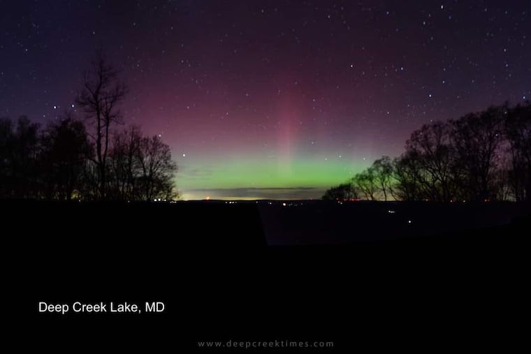
Aurora Photos From Maryland, Delaware, and Virginia
Please share your thoughts, and best weather pics/videos, or just keep in touch via social media
-
Facebook: Justin Berk, Meteorologist
-
Twitter
-
Instagram
RESTATING MY MESSAGE ABOUT DYSLEXIA
I am aware there are some spelling and grammar typos and occasional other glitches. I take responsibility for my mistakes, and even the computer glitches I may miss. I have made a few public statements over the years, but if you are new here you may have missed it: I have dyslexia, and found out during my second year at Cornell University. It didn’t stop me from getting my meteorology degree, and being the first to get the AMS CBM in the Baltimore/Washington region. One of my professors told me that I had made it that far without knowing, and to not let it be a crutch going forward. That was Mark Wysocki and he was absolutely correct! I do miss my mistakes in my own proofreading. The autocorrect spell check on my computer sometimes does an injustice to make it worse. I also can make mistakes in forecasting. No one is perfect predicting the future. All of the maps and information are accurate. The ‘wordy’ stuff can get sticky. There has been no editor that can check my work when I needed it and have it ready to send out in a newsworthy timeline. Barbara Werner is a member of the web team that helps me maintain this site. She has taken it upon herself to edit typos, when she is able. That could be AFTER you read this. I accept this and perhaps proves what you read is really from me… It’s part of my charm.
#FITF


