July 23 Still Comfortable Then Storms Mark The Developing Heat Wave
July 23, 2023
Sunday Morning Update
Anytime we get lower humidity in late July, it is a treat. Temperatures have dropped to cooler levels inland. Even if you are feeling warm by the water in the morning, and we have had hot afternoons, this has been a pleasant air mass.
The shift to a new air mass will be tonight and Monday as showers and thunderstorms return. This is the mark of the wind shift and heat wave we expect during the work week.
We will have many days pushing into the upper 90s or even close to 100ºF. This is within the spectrum of expectation and the upper limit on some long-standing recorded highs. I want to remind you again that May and June concluded with below-average temperatures in Baltimore and the Mid-Atlantic. So this may be balancing out the equation.
Our heat wave is expected to peak and come crashing to an end with strong or severe storms Friday.
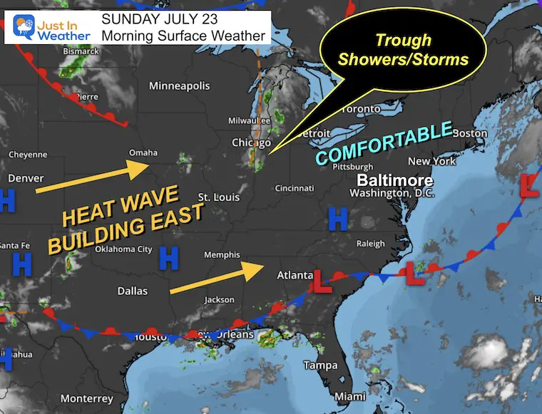
Morning Surface Weather
The broader view looks quiet. But a closer inspection shows that we are still comfortable with High Pressure keeping winds light and the original Canadian Air Mass with lower humidity.
A trough in the Midwest will be the focus for developing thunderstorms, and a signal of the transition to the next air mass: The Heat Wave that will dominate most of next week.
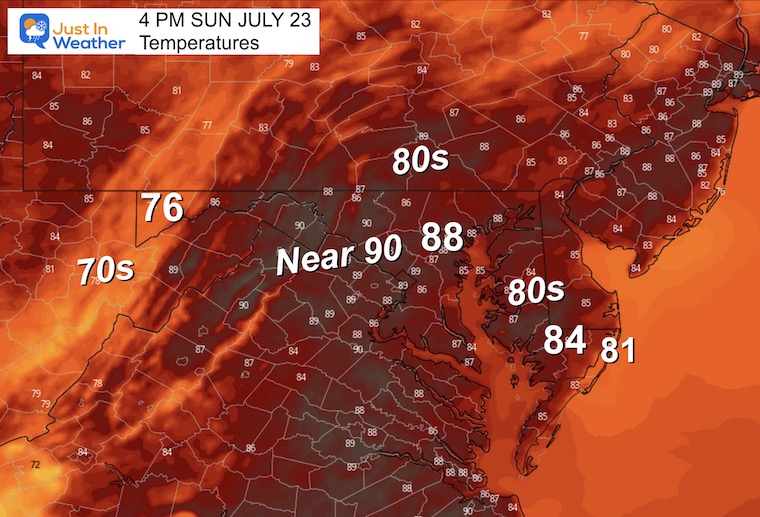
Afternoon Temperatures
EXPLORE MORE
2023 Hurricane Season Forecast With An El Niño Watch
Drought Report
https://justinweather.com/2023/07/20/severe-drought-remains-in-parts-of-maryland-july-20-2023/
Subscribe for eMail Alerts
Weather posts straight to your inbox
Sign up and be the first to know!
CLIMATE DATA
TODAY July 23
Normal Low in Baltimore: 68ºF
Record 57ºF in 1977
Normal High in Baltimore: 89ºF
Record 102ºF 2011
Monday Weather
This is the transition between the recent air mass and the heat wave on the way. In between a disturbance is expected to bring a wave of showers and thunderstorms.
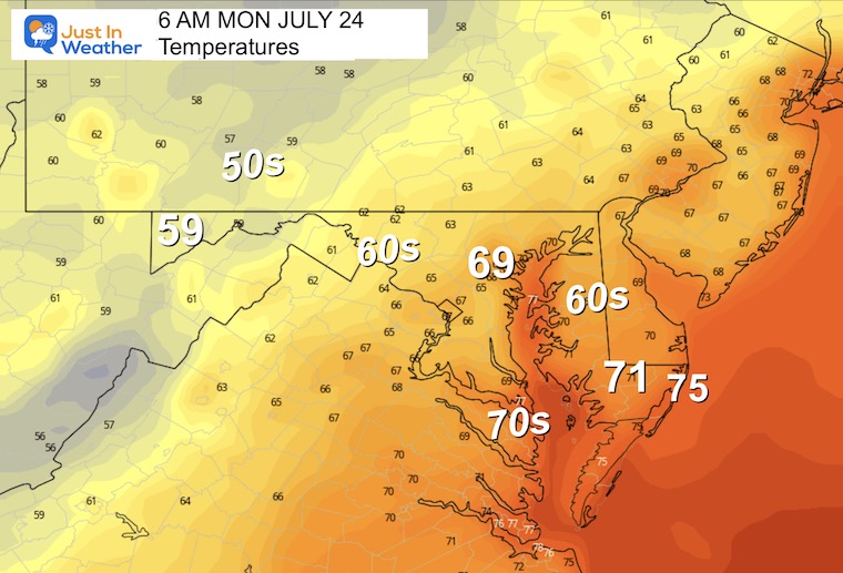
Morning Temperatures
Radar Simulation 8 AM to 10 PM
The suggestion here is that a wave or cluster of showers and thunderstorms will move north during the day. This is the transition from our pleasant weather to the heat wave on the way.
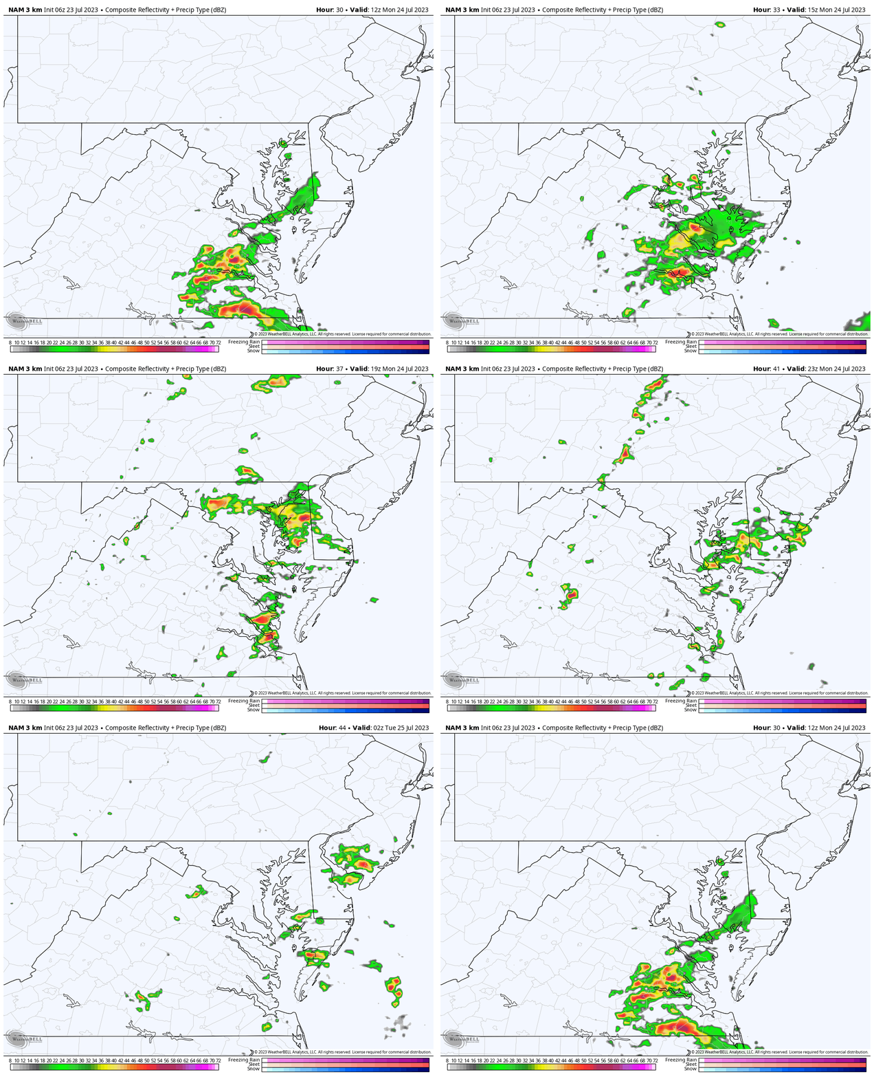
Snapshot at 1 PM
If this timing works out, then the bulk of showers will be mid-day and the afternoon. That would hold temperatures back one more day.
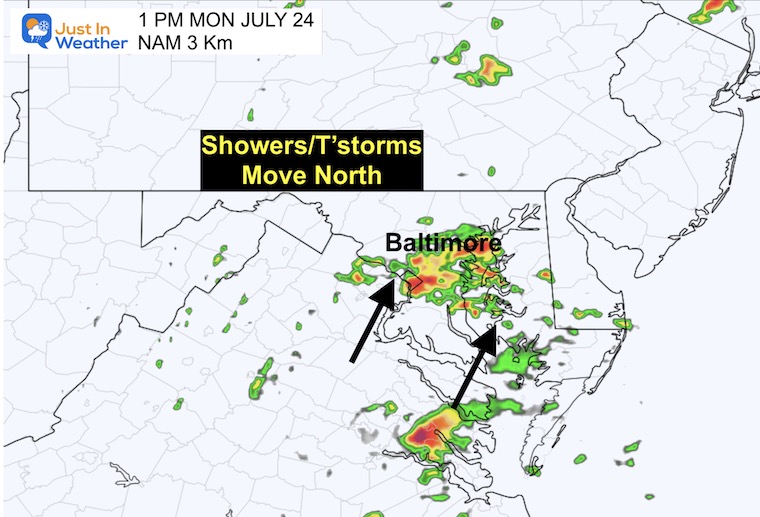
Afternoon Temperatures
These cooler numbers reflect the influence of more clouds and showers.
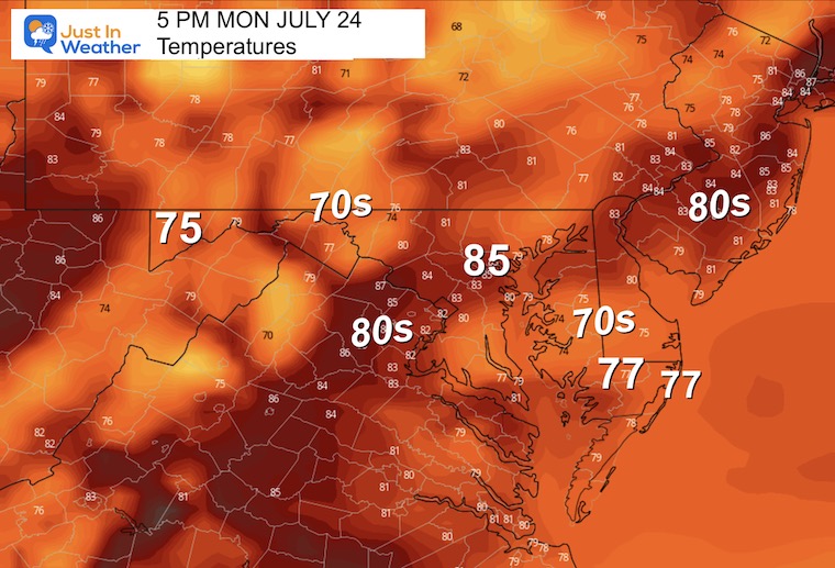
Looking Ahead: Building Heat Wave
Jet Stream Monday Through Friday
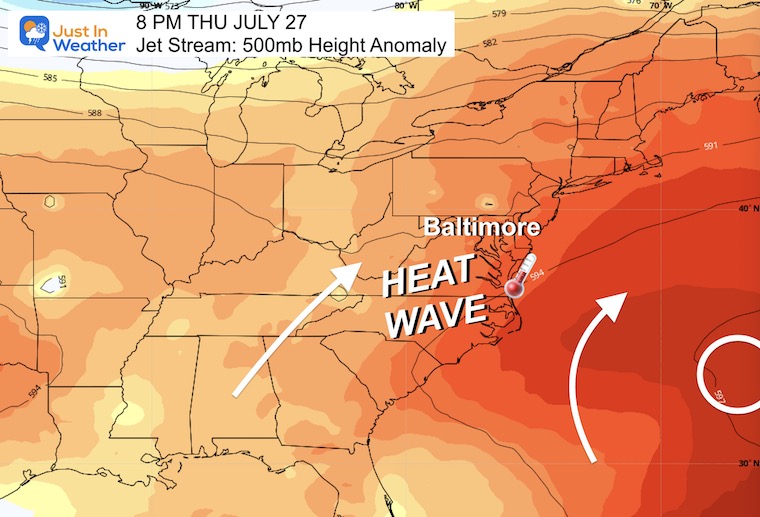
The Ridge of High Pressure setting up off the East Coast will allow for the warmest air of the season to expand for a few days.
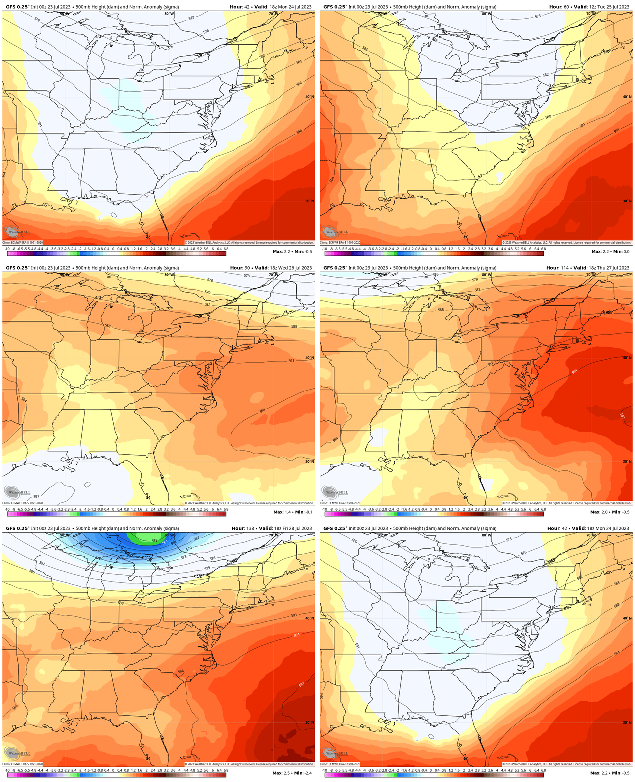
Jet Stream Snapshot Thursday Evening
A Ridge of High Pressure will set up off the coast. This ‘Bermuda High’ setup is a common summer source that pumps in high heat and humidity up the east coast.
In this case, there is a force of extreme heat that will traverse the continent and reach the Mid-Atlantic. Many areas could approach 100ºF on both Thursday and Friday.
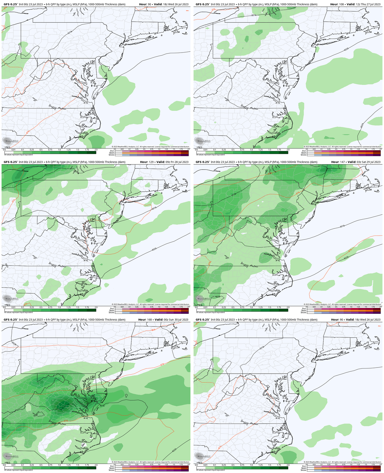
Rain Forecast:
The heat will eventually give way to the next air mass. This cold front will approach with increasing showers and storms.
Wednesday: Mainly in the mountains.
Thursday: A very hot day with strong thunderstorms (that this model is likely to not pick up on).
Friday: Another very HOT day with more showers and possibly severe storms.
Saturday: The cold front is forecast to slow down and take a day to cross the region with clouds and leftover rain, then it will be much cooler.
7 Day Forecast
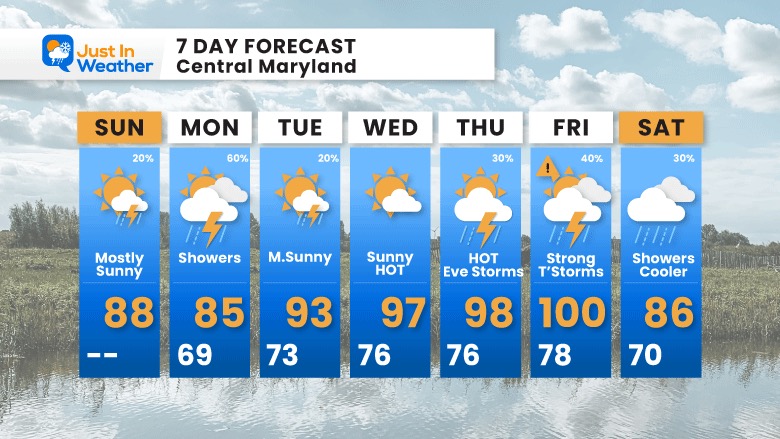
Monday will be our transition day… The wind will shift after the showers pass, then bring on the Heat Wave.
The HOT trend still brings the peak between Thursday and Friday!
With high heat, storms may be strong to severe at the end of the week.
I would apply some wiggle room to the end of the week, but at this time it looks like the cold front will take an extra day (Saturday) to cross the region. So clouds and rain may linger with cooler temps.
Subscribe for eMail Alerts
Weather posts straight to your inbox
Sign up and be the first to know!
EXPLORE MORE
2023 Hurricane Season Forecast With An El Niño Watch
La Niña Has Ended. El Niño May Return By Fall
Aurora Photos From Maryland, Delaware, and Virginia
Please share your thoughts, and best weather pics/videos, or just keep in touch via social media
-
Facebook: Justin Berk, Meteorologist
-
Twitter
-
Instagram
RESTATING MY MESSAGE ABOUT DYSLEXIA
I am aware there are some spelling and grammar typos and occasional other glitches. I take responsibility for my mistakes, and even the computer glitches I may miss. I have made a few public statements over the years, but if you are new here you may have missed it: I have dyslexia, and found out during my second year at Cornell University. It didn’t stop me from getting my meteorology degree, and being the first to get the AMS CBM in the Baltimore/Washington region. One of my professors told me that I had made it that far without knowing, and to not let it be a crutch going forward. That was Mark Wysocki and he was absolutely correct! I do miss my mistakes in my own proofreading. The autocorrect spell check on my computer sometimes does an injustice to make it worse. I also can make mistakes in forecasting. No one is perfect predicting the future. All of the maps and information are accurate. The ‘wordy’ stuff can get sticky. There has been no editor that can check my work when I needed it and have it ready to send out in a newsworthy timeline. Barbara Werner is a member of the web team that helps me maintain this site. She has taken it upon herself to edit typos, when she is able. That could be AFTER you read this. I accept this and perhaps proves what you read is really from me… It’s part of my charm.
#FITF


