July 13 Very Hot Day With Code Orange AQ and Slight Risk For Severe Storms
July 13, 2023
Thursday Update
Today may feel like the hottest day of the year. Baltimore did reach 97ºF on June 2, with low humidity. So it was a dry heat. Today the humidity will be higher so with temperatures into the upper 90s, it might feel like 100ºF.
That humidity and a cold front will combine with the risk for storms to develop and some cells could turn severe.
One other factor to consider is that pollution levels remain high, which has promoted a Code Orange Air Quality Alert this afternoon for some urban areas.
NOAA Severe Storm Risk
The slight risk is level 2 of 5 on the expectation scale. This includes our mountains region and clips Frederick, Carroll, and York, Counties.
There may be some strong thunderstorms that include damaging wind, large hail, and even an isolated tornado.
Air Quality Forecast
This is a common function of high heat, high sun angle, and light wind. This allows daily pollution to build and react to form ground-level ozone. It is NOT from the Canadian Wildfires this time.
More of Central Maryland will reach Code Orange Air Quality. This is unhealthy for sensitive groups. Counties included: Anne Arundel, Baltimore, Harford, and Cecil in Maryland. Plus much of Southern Pennsylvania.
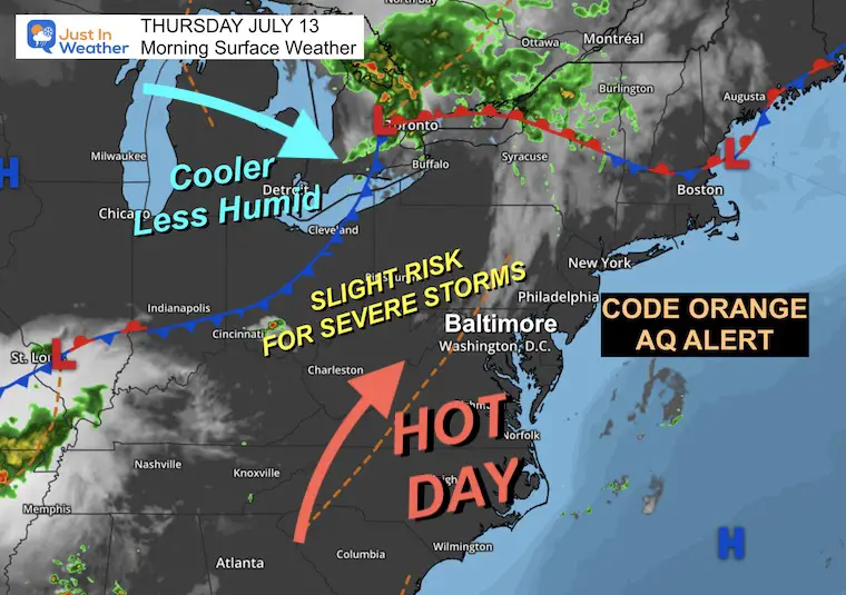
Morning Surface Weather
The winds around High Pressure today will be pumping in both the heat and increased humidity.
A cold front is what is expected to ignite strong to severe storms. This front will cross central Maryland tonight and may stall nearby for a few days. So, temps will cool, but more rain may linger.
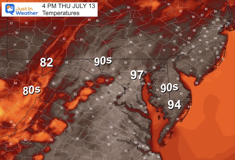
Afternoon Temperatures
The Heat Index may approach 100ºF in urban areas.
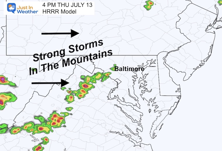
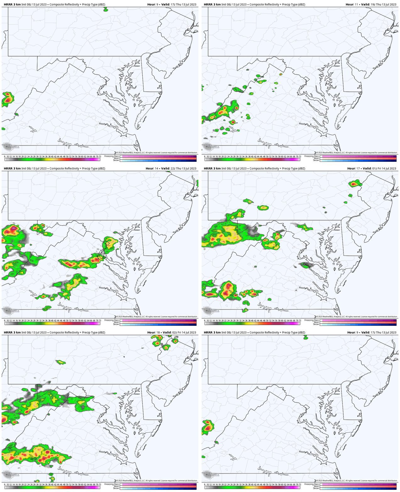
Radar Simulation
HRRR Model 1 PM to 10 PM
THIS IS A SUGGESTION: I DO NOT TRUST short-range modeling.
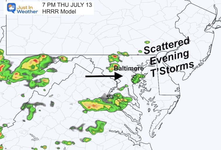
Recently I have seen them miss a lot of storm cells. This product is showing the first line in the mountains, heading towards Washington, then scattered showers in the suburbs this evening.
Snapshots
3 PM
7 PM
EXPLORE MORE
2023 Hurricane Season Forecast With An El Niño Watch
Subscribe for eMail Alerts
Weather posts straight to your inbox
Sign up and be the first to know!
CLIMATE DATA
TODAY July 13
Normal Low in Baltimore: 68ºF
Record 55ºF in 1978
Normal High in Baltimore: 89ºF
Record 99ºF 1966
Friday Weather
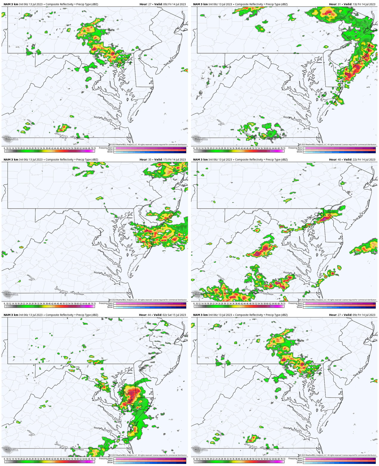
Radar Simulation
5 AM to 10 PM
We may have some showers or even a morning storm to start the day. Then more showers and storms develop.
Again: This is a suggestion. I would not promise the specific locations, just an idea that we will have an expectation for showers throughout the day.
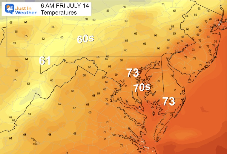
Morning Temperatures
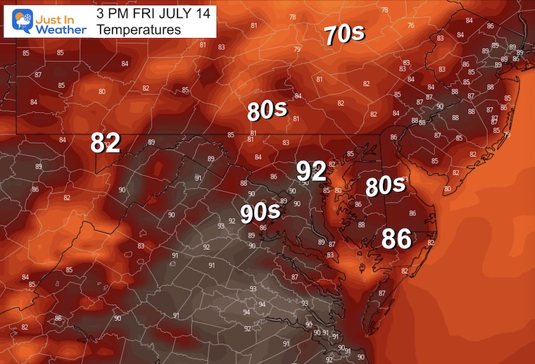
Afternoon Temperatures
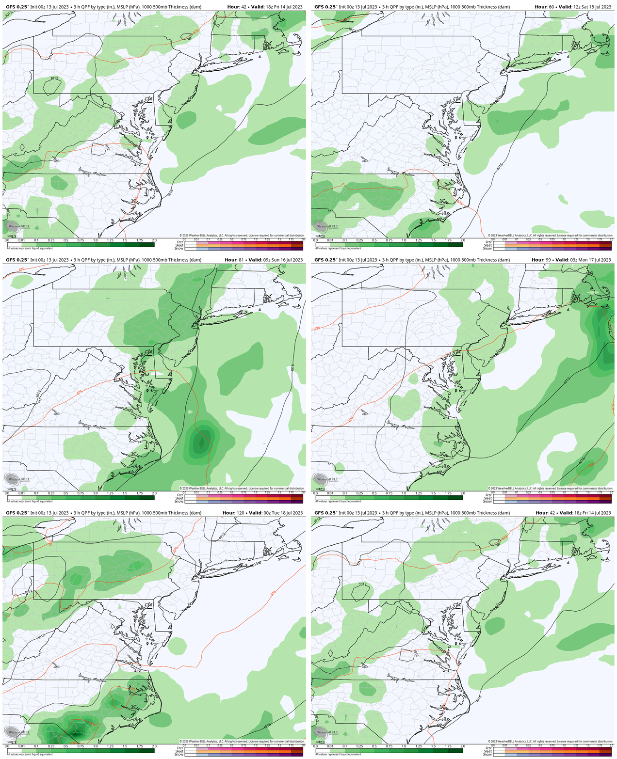
Storm Forecast Friday to Monday
Daily pulsing of thunderstorms mainly in the afternoon heating and fading overnight. We may get a break from the activity on Sunday.
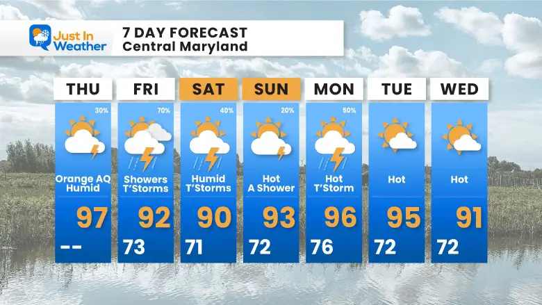
7 Day Forecast
The cold front may stall and keep the risk for showers more numerous tomorrow, then still around Saturday, but less widespread.
The heat stays with us and rebuilds next week.
Subscribe for eMail Alerts
Weather posts straight to your inbox
Sign up and be the first to know!
EXPLORE MORE
2023 Hurricane Season Forecast With An El Niño Watch
La Niña Has Ended. El Niño May Return By Fall
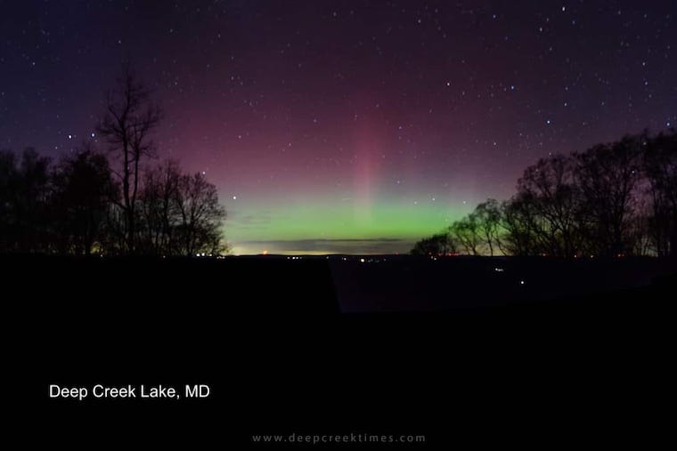
Aurora Photos From Maryland, Delaware, and Virginia
Please share your thoughts, and best weather pics/videos, or just keep in touch via social media
-
Facebook: Justin Berk, Meteorologist
-
Twitter
-
Instagram
RESTATING MY MESSAGE ABOUT DYSLEXIA
I am aware there are some spelling and grammar typos and occasional other glitches. I take responsibility for my mistakes, and even the computer glitches I may miss. I have made a few public statements over the years, but if you are new here you may have missed it: I have dyslexia, and found out during my second year at Cornell University. It didn’t stop me from getting my meteorology degree, and being the first to get the AMS CBM in the Baltimore/Washington region. One of my professors told me that I had made it that far without knowing, and to not let it be a crutch going forward. That was Mark Wysocki and he was absolutely correct! I do miss my mistakes in my own proofreading. The autocorrect spell check on my computer sometimes does an injustice to make it worse. I also can make mistakes in forecasting. No one is perfect predicting the future. All of the maps and information are accurate. The ‘wordy’ stuff can get sticky. There has been no editor that can check my work when I needed it and have it ready to send out in a newsworthy timeline. Barbara Werner is a member of the web team that helps me maintain this site. She has taken it upon herself to edit typos, when she is able. That could be AFTER you read this. I accept this and perhaps proves what you read is really from me… It’s part of my charm.
#FITF


