July 10 Weather Brief Break Then Another Heat Wave
July 10, 2023
Monday Morning Update
It is summer and it is supposed to be hot. In fact, today is the anniversary of the hottest day in Baltimore’s history. On this date in 1936, the temperature reached 107ºF. We have seen a few days get close, but not breach that mark.
With that in mind, we will have a little heat wave return this week as we push into the mid to upper 90s. However, before we get there, today gives us a reprieve. More on that below.
First, let’s recap the rain from yesterday’s storms.
We had a Flood Watch in place, and there were areas that saw excessive rainfall in the 1 to 3+ inch range.
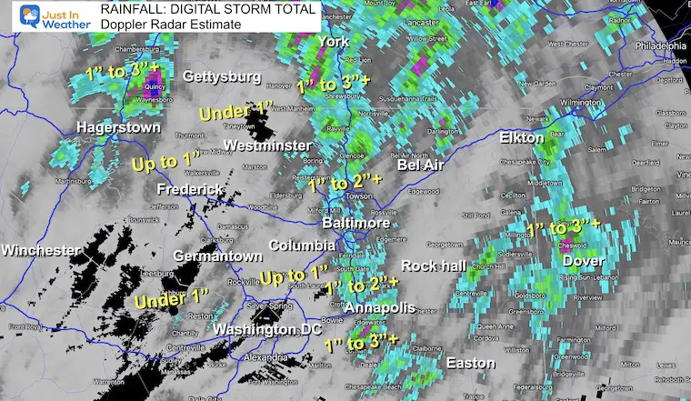
Rainfall Storm Estimates From Doppler Radar
Wide View
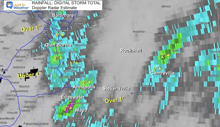
The ‘pulsing’ of storm bursts shows up here with pockets or bands of 1 to 2 or 3+ inches. However, there are still some places missing out.
Baltimore recorded 2.78″ at BWI which is more than suggested by Doppler Radar here. The yearly total still has a deficit of -5.28 inches.
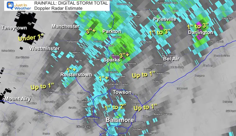
Baltimore/North Central Maryland
The top rain spots were along I-83 and into Harford Couty.
Missing out: North central Carroll County north of Westminster is parched.
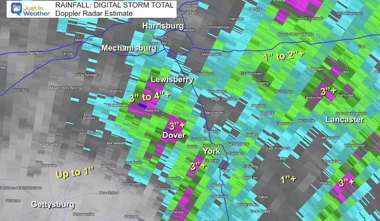
Southern Pennsylvania
The heaviest rain was in York County where a wide region experienced over 2 inches with pockets over 3 inches.
Another pocket of heavy rain surrounded Lancaster, while there was much less in and around Gettysburg.
Annapolis/Central Bay Region
An extension of the I-83 rain burst extended south along I-97 in Anne Arundel Couty and included shore areas between Annapolis, Edgewater, and Mayo. Some of these areas received 2 to over 3 inches.
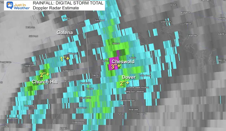
Delaware
The heaviest rain near the coast was between Dover and Cheswold in Delaware. Here they saw 2 to over 3 inches of rain.
Morning Surface Weather
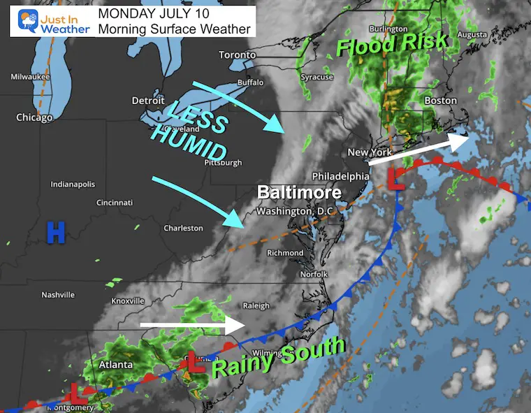
The change today is a combination of the old storm departing and High Pressure moving in. That storm continues to drop moderate to heavy rain in New England where the flood risk is high in Vermont.
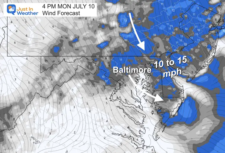
High Pressure from The Ohio Valley will move in. As it clears the sky it will bring in lower humidity with a refreshing breeze.
Wind Animation
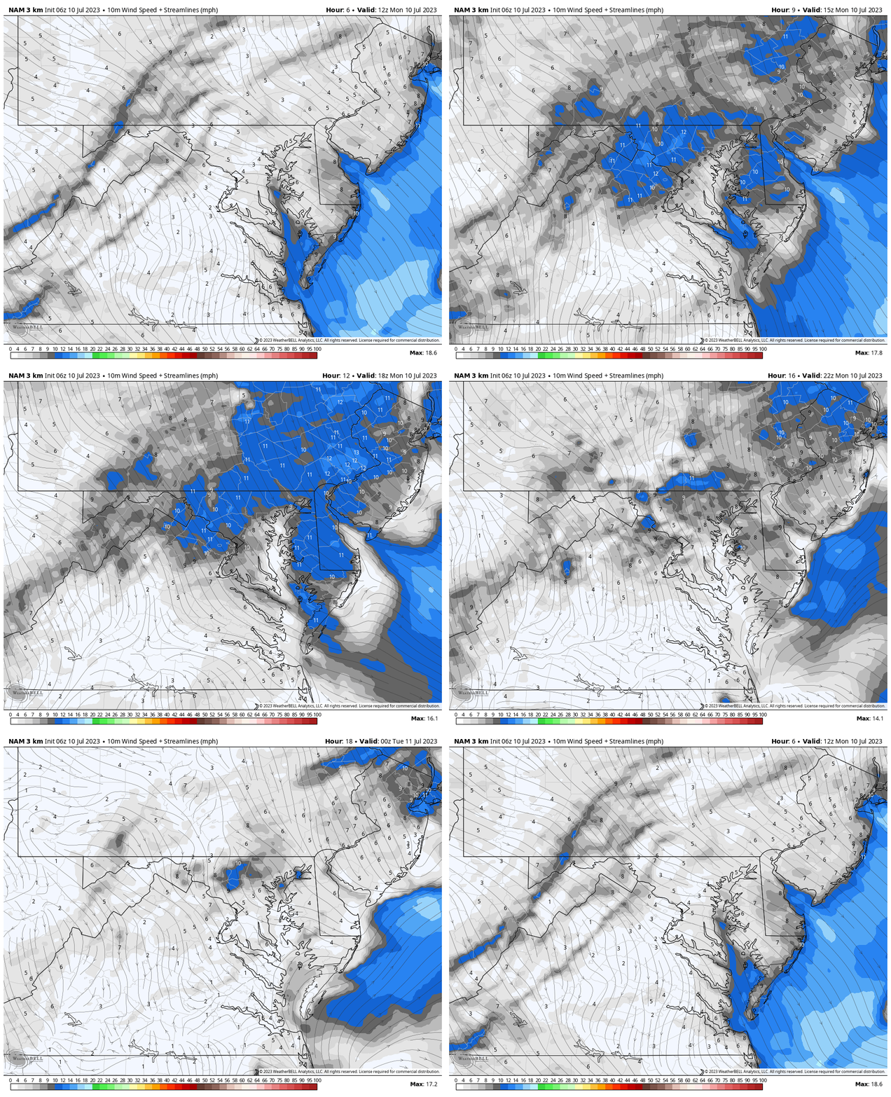
NAM 3 Km 8 AM to 8 PM
4 PM Snapshot
Wind will average 10 to 15 mph helping to bring in lower humidity.
Afternoon Temperatures
A break from the heat and humidity AND it looks like no smoke from Canada as well.

EXPLORE MORE
2023 Hurricane Season Forecast With An El Niño Watch
Subscribe for eMail Alerts
Weather posts straight to your inbox
Sign up and be the first to know!
CLIMATE DATA
TODAY July 10
Normal Low in Baltimore: 68ºF
Record 55ºF in 1961
Normal High in Baltimore: 89ºF
Record 107ºF 1936
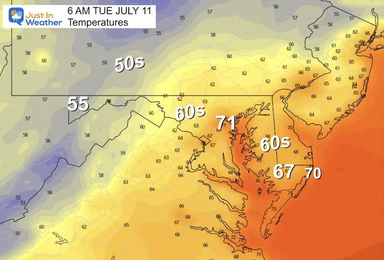
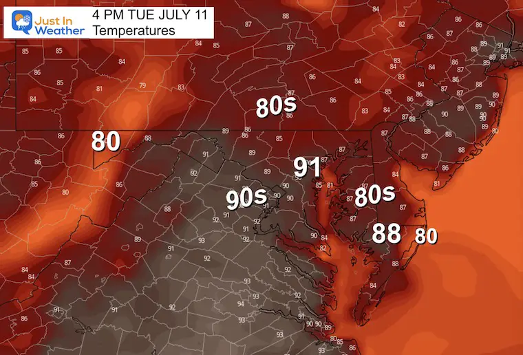
Tuesday Weather
Morning Temperatures
Afternoon Temperatures
Looking Ahead
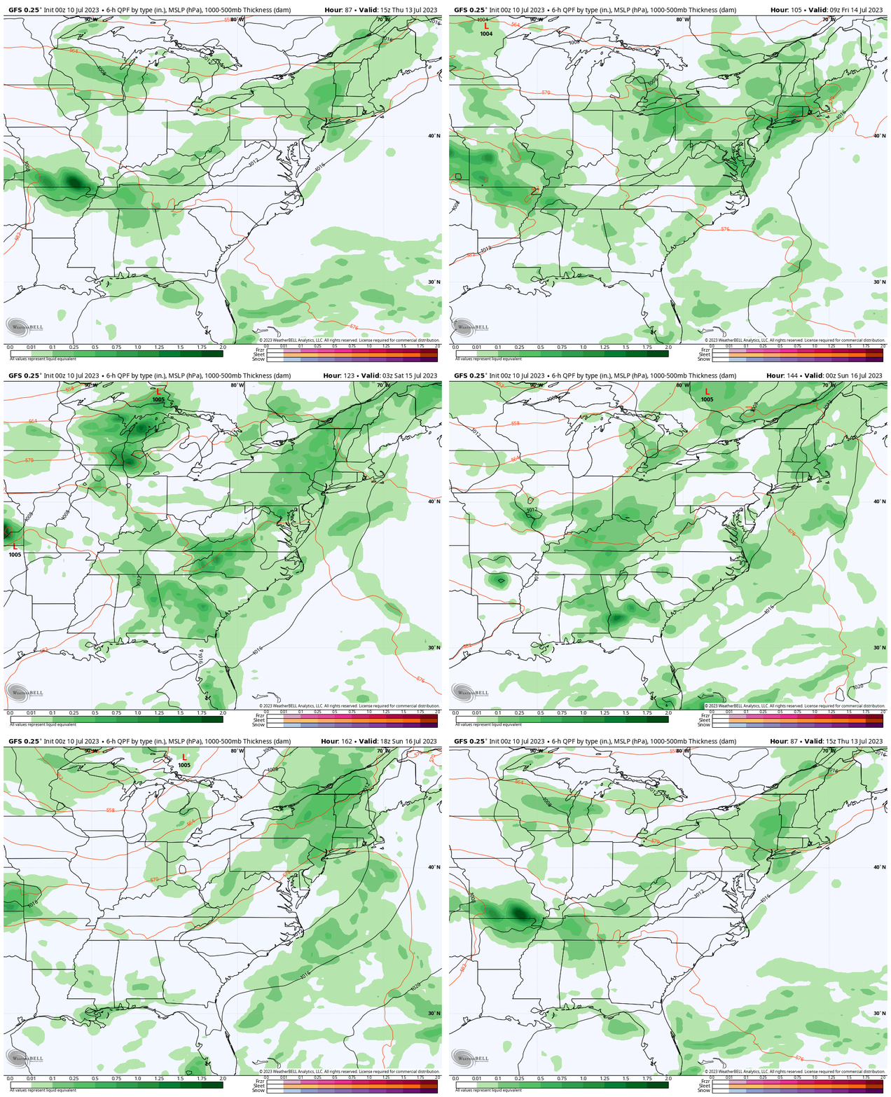
Storm Forecast Thursday to Sunday
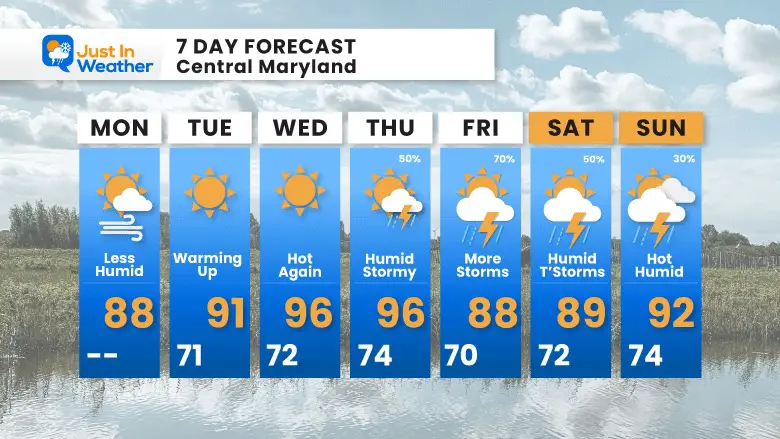
We build a little heat wave with dry days… Until Thursday. That is when the next round of afternoon thunderstorms are expected.
7 Day Forecast
Temperatures will build to the upper 90s mid-week, joined by increasing humidity. The next expected round of storms will build in Thursday into the weekend.
Subscribe for eMail Alerts
Weather posts straight to your inbox
Sign up and be the first to know!
EXPLORE MORE
2023 Hurricane Season Forecast With An El Niño Watch
La Niña Has Ended. El Niño May Return By Fall
Aurora Photos From Maryland, Delaware, and Virginia
Please share your thoughts, and best weather pics/videos, or just keep in touch via social media
-
Facebook: Justin Berk, Meteorologist
-
Twitter
-
Instagram
RESTATING MY MESSAGE ABOUT DYSLEXIA
I am aware there are some spelling and grammar typos and occasional other glitches. I take responsibility for my mistakes, and even the computer glitches I may miss. I have made a few public statements over the years, but if you are new here you may have missed it: I have dyslexia, and found out during my second year at Cornell University. It didn’t stop me from getting my meteorology degree, and being the first to get the AMS CBM in the Baltimore/Washington region. One of my professors told me that I had made it that far without knowing, and to not let it be a crutch going forward. That was Mark Wysocki and he was absolutely correct! I do miss my mistakes in my own proofreading. The autocorrect spell check on my computer sometimes does an injustice to make it worse. I also can make mistakes in forecasting. No one is perfect predicting the future. All of the maps and information are accurate. The ‘wordy’ stuff can get sticky. There has been no editor that can check my work when I needed it and have it ready to send out in a newsworthy timeline. Barbara Werner is a member of the web team that helps me maintain this site. She has taken it upon herself to edit typos, when she is able. That could be AFTER you read this. I accept this and perhaps proves what you read is really from me… It’s part of my charm.
#FITF


