Air Quality Forecast: Smoke Filled Air Forecast To Improve This Weekend
June 29, 2023
I am sick of this smoke too. The novelty of deep red sunrises faded long ago. If you are active and outdoors like me, this may have also hindered your plans. I train long miles every summer to hike and bike and have lasted in excessive heat. But this smokey air has irritated my eyes and smells pretty bad. I’ve talked to too many healthy people with headaches, so I kept my workouts indoors.
How about we change that this weekend? It’s got to get better because it can’t get worse. Right? Whatever your plans are, they will improve, as we trade off for warmer, humid winds with afternoon thunderstorms.
I am only covering through Saturday afternoon in this report, but that gets us through the important stuff for now.
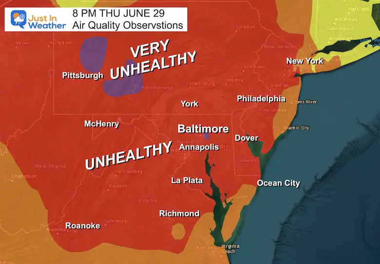
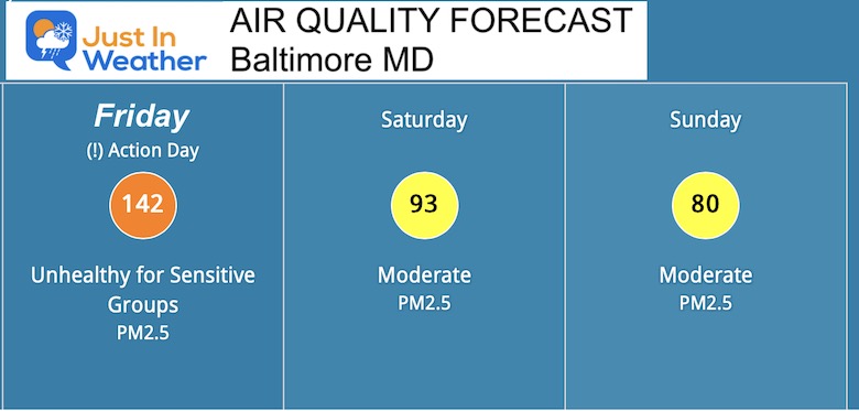
Air Quality Thursday Evening
Most of our region has been in the Code Red or Unhealthy Range. There have been pockets of ‘Purple’ which represents Very Unhealthy.
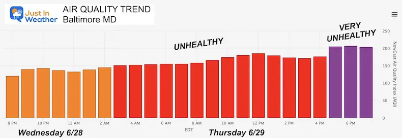
Baltimore Air Quality Trend
Notice how the pollution has been measuring on an upward trend since yesterday. We peaked with the worst pollution this afternoon.
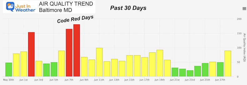
Past 30 Days
If you were wondering, the last stretch of Code Red Days were earlier this month.
Images Posted On Social Media Earlier
Morning Sunrise
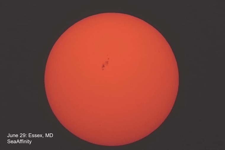
This photo from Essex, MD just east of Baltimore was taken by SeaAffinity. The filter of smoke enhanced the orange color AND allowed for sunspots to be seen.
Satellite Loop
This morning we could see the brown haze from space. If not for the fires, this would have been a clear blue sky day for us.
Source Region
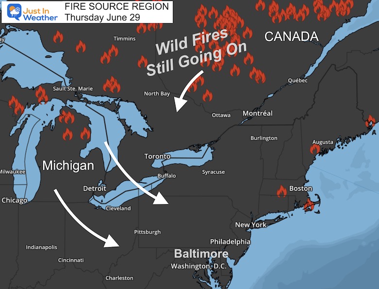
The Wild Fires are most prominent in very rural northern Ontario in Canada. There is also a cluster in Northern Michigan.
Weather Set Up
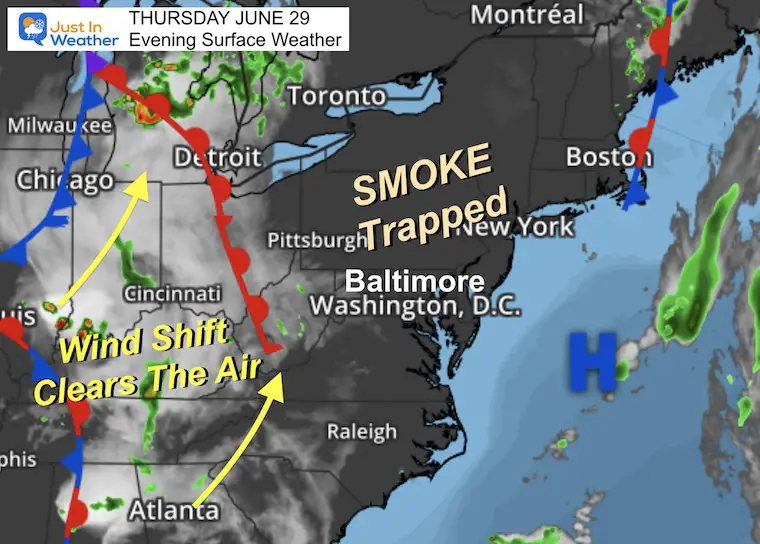
High Pressure is moving off the coast. But as it passed overhead, the sinking air and light wind trapped the smoke particulates and kept them in place. That is why we got this pollution and it was worse than originally forecast.
The winds will shift tomorrow ahead of the next front. Even if we do not get storms (see the radar forecast below) the air will improve into the weekend.
Wind Forecast Friday
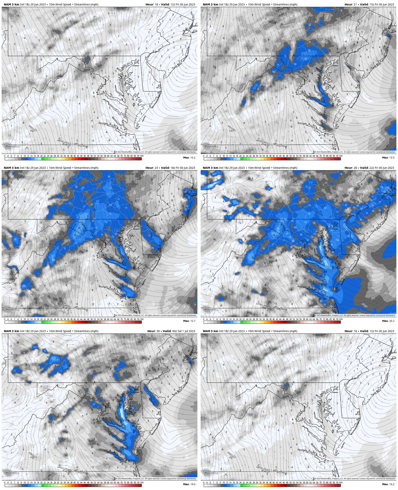
8 AM to 8 PM
Notice the wind FROM THE SOUTH increase 10 to 15 mph. That will help to stir up the pollution.
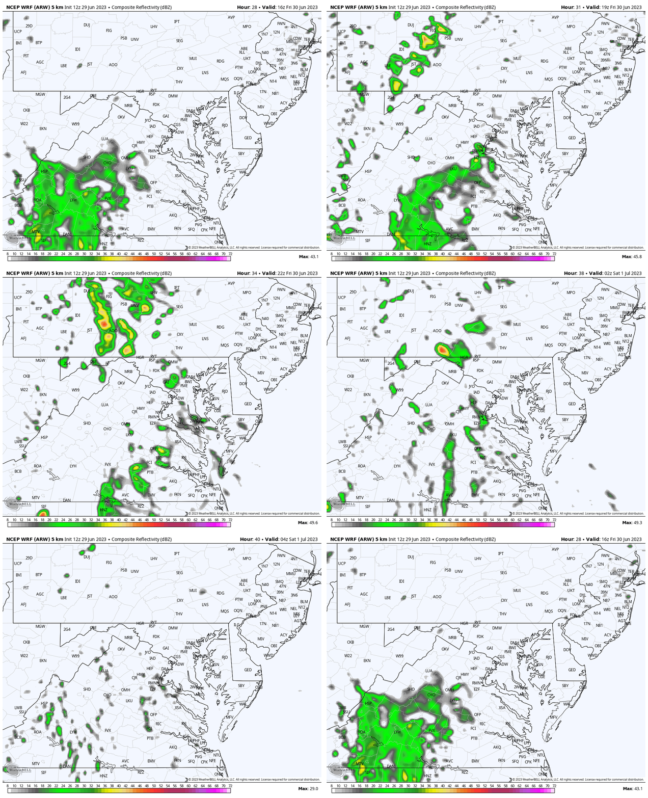
Radar Simulation
Noon to Midnight
There is a 30% chance for storms, however, that is more likely farther west and may break up as it approaches central Maryland.
Even if you do not get rain. The winds will help to move the smoke…
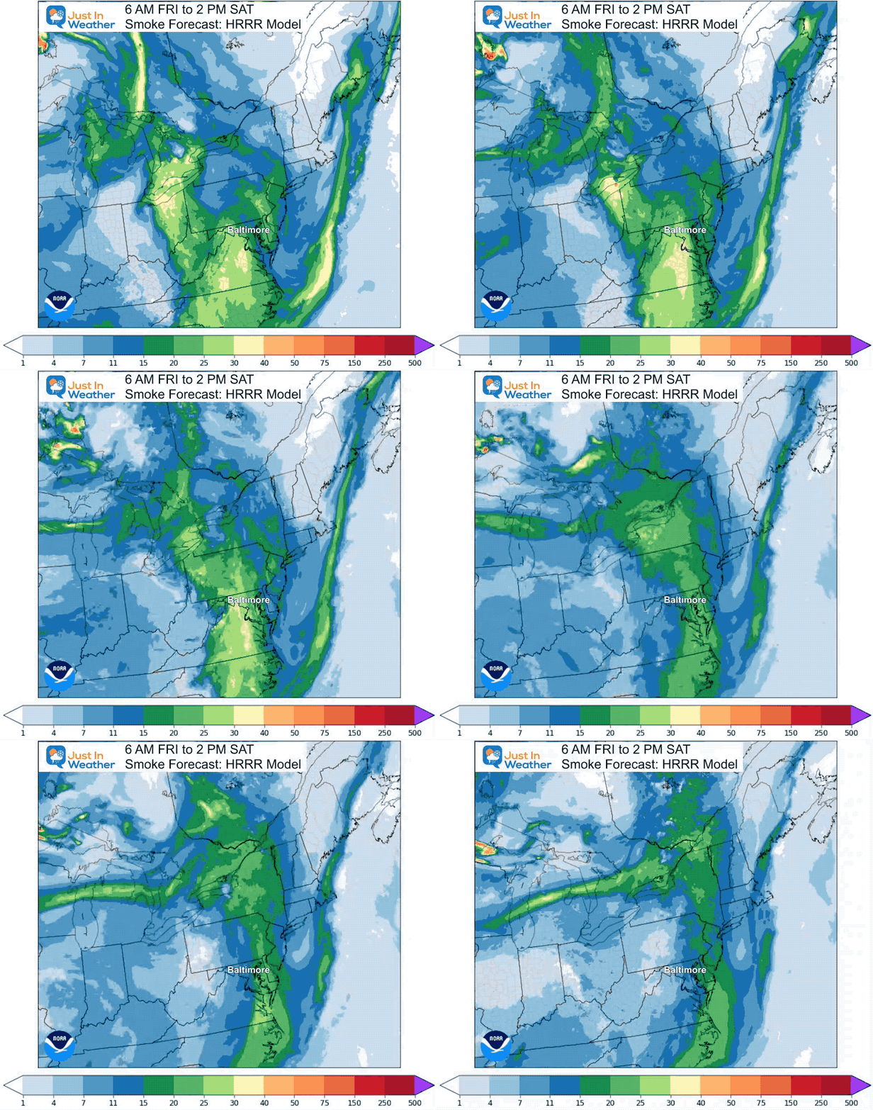
Smoke Forecast
Animation 6 AM Friday to 2 PM Sunday
We will wake up with smoke, but the pollution levels will gradually lower during the day. The really clear air will come in with a west wind Saturday morning.
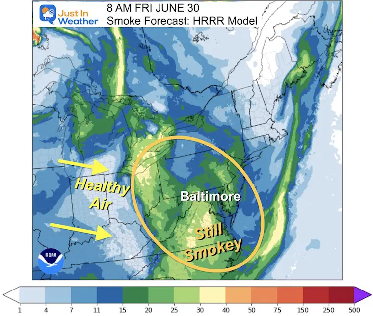
Snapshot Friday 8 AM
Still pretty thick to start the day.
Snapshot Friday Noon
Smoke will still be around, but not as thick. However, there may be more in southern Maryland to Virginia and North Carolina.
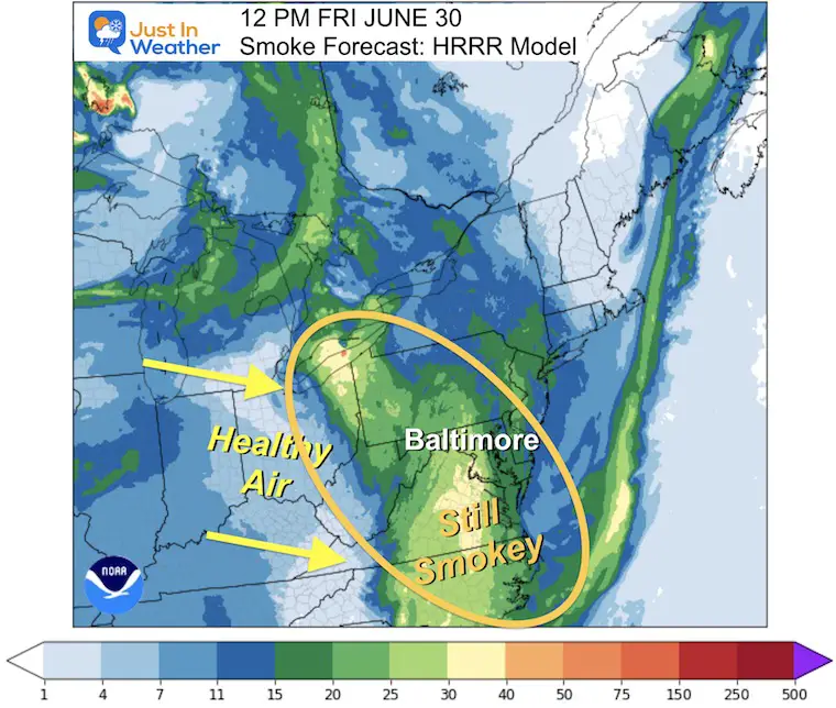
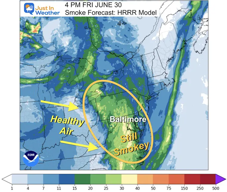
Snapshot Friday 4 PM
Smoke will still be around and stirring with the winds FROM the south. So it could resurge in some areas, but still some improvement.
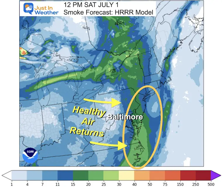
Snapshot Saturday 12 PM
This is the winning shot and when we really should notice the improvement. It may turn humid, but the pollution will move out. It may take a few more hours to clear east of the beaches. It will definitely be better than it was today (Thursday).
Subscribe for eMail Alerts
Weather posts straight to your inbox
Sign up and be the first to know!
EXPLORE MORE
2023 Hurricane Season Forecast With An El Niño Watch
La Niña Has Ended. El Niño May Return By Fall
Aurora Photos From Maryland, Delaware, and Virginia
Please share your thoughts, and best weather pics/videos, or just keep in touch via social media
-
Facebook: Justin Berk, Meteorologist
-
Twitter
-
Instagram
RESTATING MY MESSAGE ABOUT DYSLEXIA
I am aware there are some spelling and grammar typos and occasional other glitches. I take responsibility for my mistakes, and even the computer glitches I may miss. I have made a few public statements over the years, but if you are new here you may have missed it: I have dyslexia and found out during my second year at Cornell University. It didn’t stop me from getting my meteorology degree and being the first to get the AMS CBM in the Baltimore/Washington region. One of my professors told me that I had made it that far without knowing, and to not let it be a crutch going forward. That was Mark Wysocki and he was absolutely correct! I do miss my mistakes in my own proofreading. The autocorrect spell check on my computer sometimes does an injustice to make it worse. I also can make mistakes in forecasting. No one is perfect at predicting the future. All of the maps and information are accurate. The ‘wordy’ stuff can get sticky. There has been no editor that can check my work when I needed it and have it ready to send out in a newsworthy timeline. Barbara Werner is a member of the web team that helps me maintain this site. She has taken it upon herself to edit typos, when she is able. That could be AFTER you read this. I accept this and perhaps proves what you read is really from me… It’s part of my charm.
#FITF


