June 8 Thursday Smoke Today The Worst For Mid Atlantic
June 8, 2023
Thursday Morning Update
The smoke has gotten worse this morning! We have been tracking the build-up of pollution in our air for days, while the thickest has been to our north. The irony is that the cooler north winds that are keeping our temps below average are pushing the smoke our way.
Air travel has been affected. Yesterday, over 5,000 flights were canceled, and a few hundred already this morning.
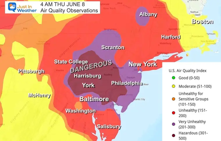
Thursday Morning Smoke
This has reached Dangerous Levels from central Maryland to Northeast Maryland and Delaware. If you stay outside, this measurement is equivalent to smoking a full cigarette every 10 minutes.
Air Quality Trends
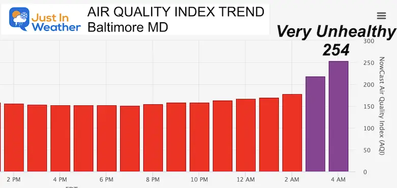
Baltimore, MD
This has reached the Very Unhealthy range.
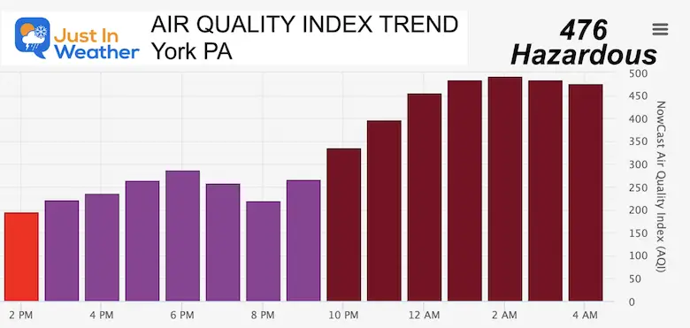
York, PA
The highest measurement is 500. This is near the top of the list and close to what was measured in New York City yesterday!
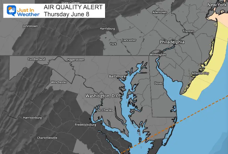
Air Quality Alert
Today is one of those days that even the most healthy people should stay indoors.
Yesterday:
Let’s look back at what happened yesterday to get an idea of what is building our way.
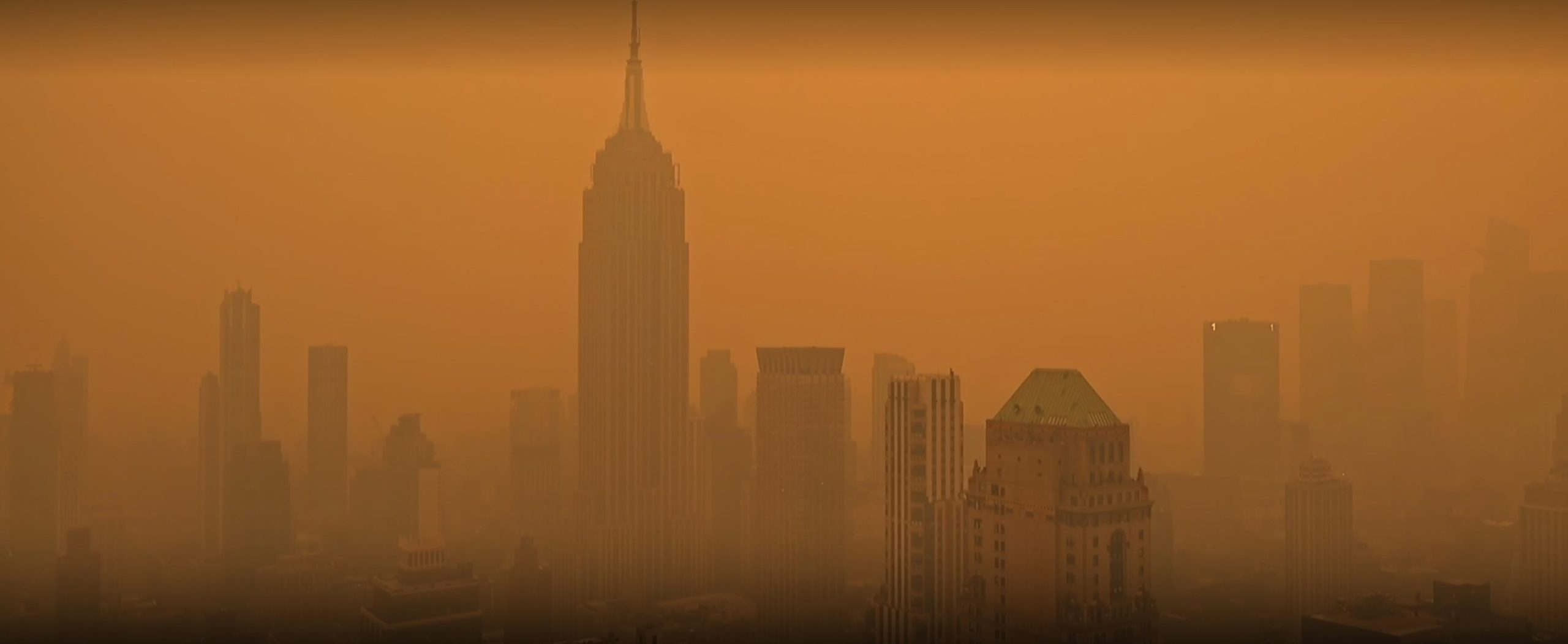
New York City
This was from Earthcam at 2 PM. That orange haze also led to delayed flights due to poor visibility.
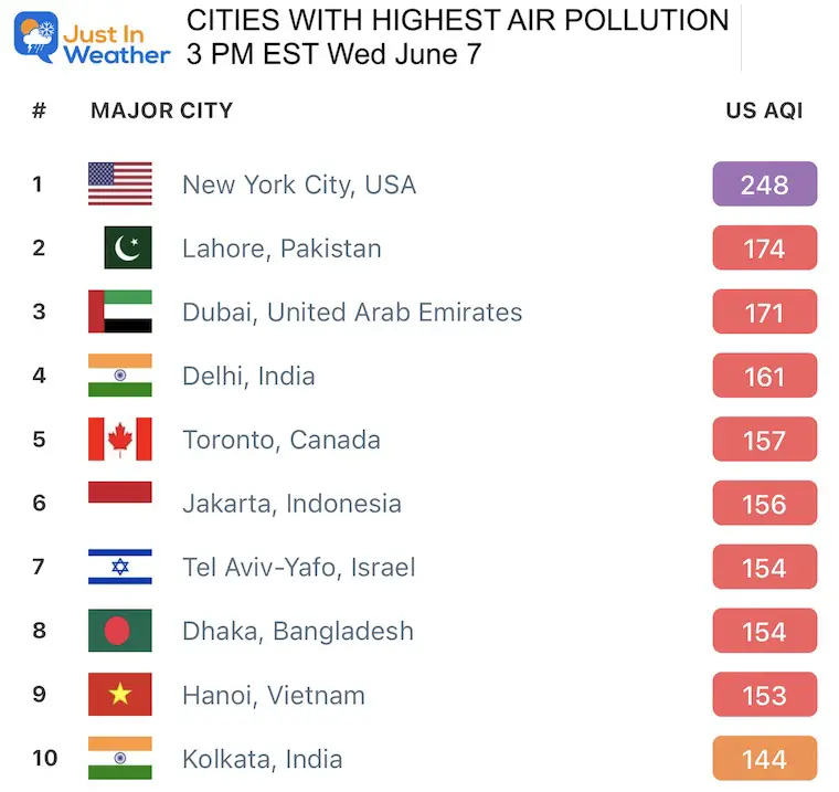
Worst Cities
New York and Detroit topped the list around the globe, and that is the stuff moving this way this morning.
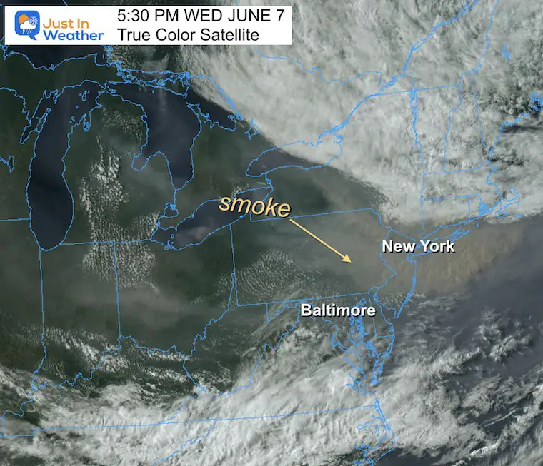
Satellite Wednesday Afternoon
Here we can see that smoke as a brown glaze on the true color satellite.
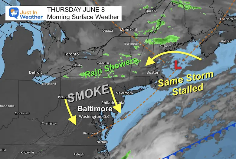
Morning Surface Weather
The same storm off the coast of Maine continues to push the smoke southward our way. That is why we have a cooler air mass, which would normally be pleasant. However, it keeps bringing in thick smoke.
Smoke Forecast
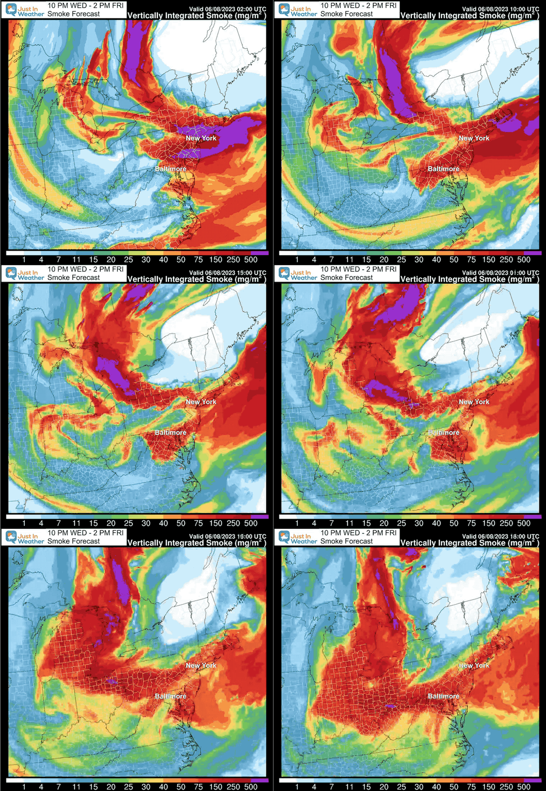
Forecast Maps Comparing yesterday through Friday
Today is worse than yesterday, with some improvement in the afternoon. The smoke will linger for a few more days. Then we hope to shake things up for the weekend.
4 PM Afternoon Temperatures
It will be comfortably cool for the season, but the very deceiving haze will make it look hazy and humid.
Reminder: That code red is a suggestion for all to limit outdoor activities and workouts.
There is a 20% chance of an isolated rain shower.

EXPLORE MORE
Building Drought As We Begin June
2023 Hurricane Season Forecast With An El Niño Watch
Subscribe for eMail Alerts
Weather posts straight to your inbox
Sign up and be the first to know!
CLIMATE DATA
TODAY June 8
Normal Low in Baltimore: 60ºF
Record 43ºF in 1977
Normal High in Baltimore: 82ºF
Record 99ºF 2011
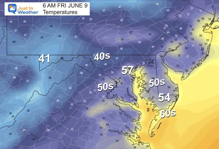
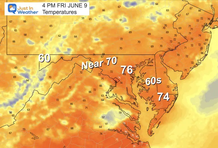
Friday Weather
Morning Temperatures
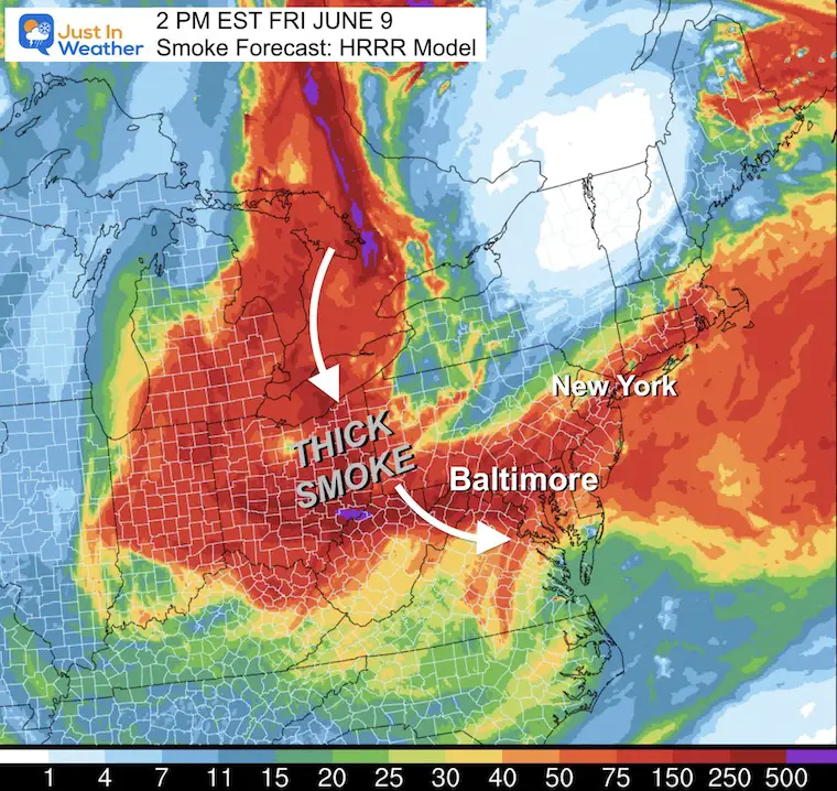
Afternoon Smoke
Afternoon Temperatures
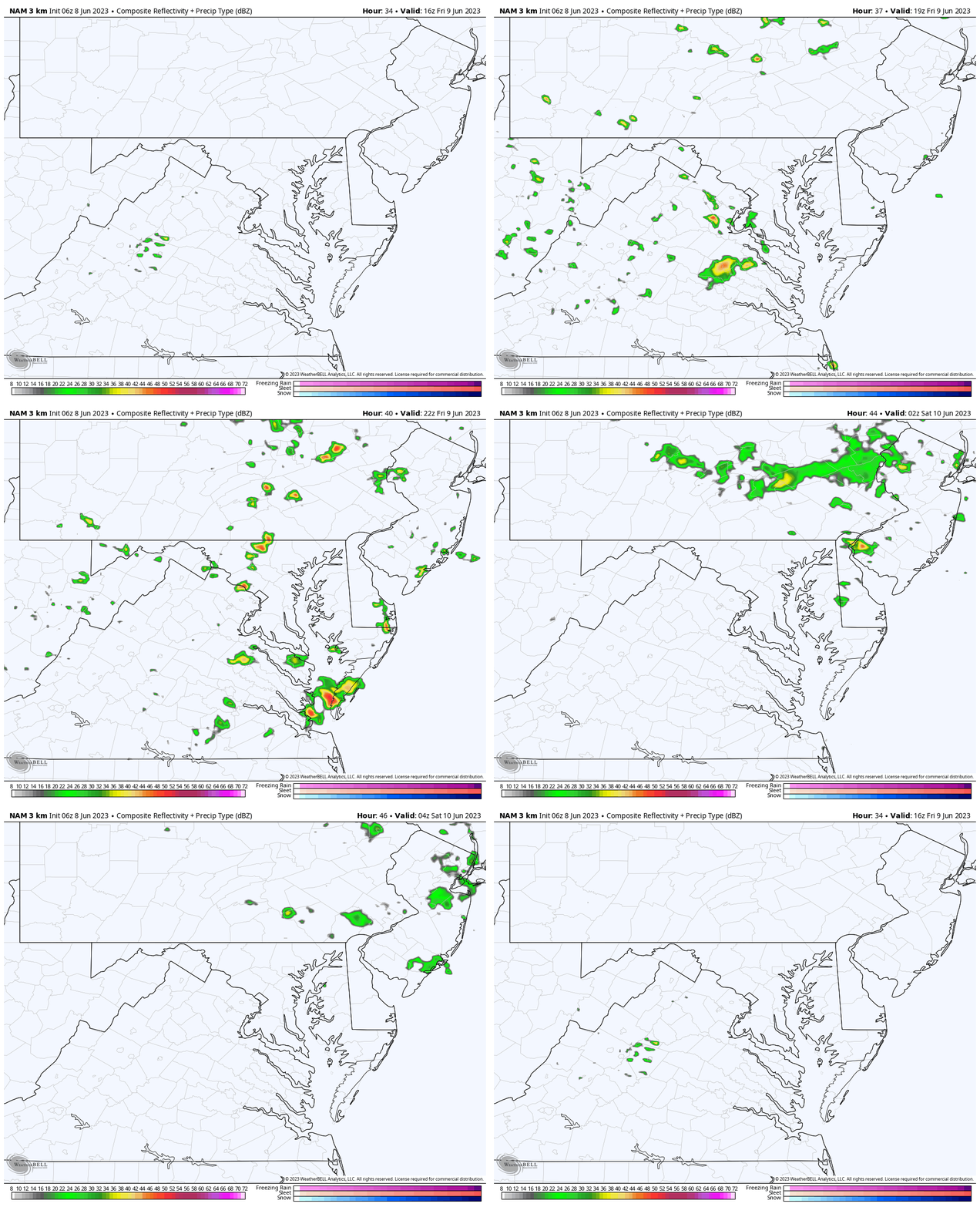
Radar Simulation:
Rain Forecast Noon to Midnight
Scattered showers will develop during the afternoon. The chances you get wet are about 30%.
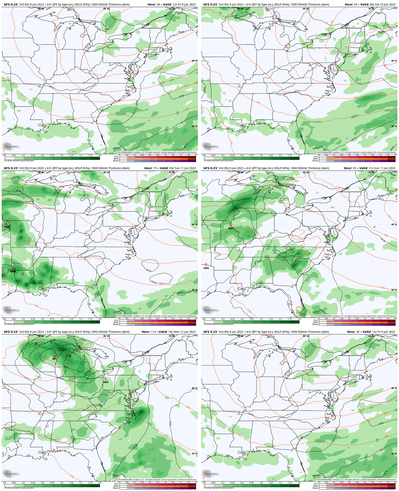
Rain Outlook
Friday to Monday Night
The best chance for a widespread rain event will be arriving on Monday.
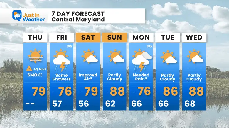
7 Day Forecast
The air quality should improve this weekend as the winds shift. Then we look for a chance for needed rain on Monday.
Subscribe for eMail Alerts
Weather posts straight to your inbox
Sign up and be the first to know!
Also See:
La Niña Has Ended. El Niño May Return By Fall
Aurora Photos From Maryland, Delaware, and Virginia
Please share your thoughts, and best weather pics/videos, or just keep in touch via social media
-
Facebook: Justin Berk, Meteorologist
-
Twitter
-
Instagram
RESTATING MY MESSAGE ABOUT DYSLEXIA
I am aware there are some spelling and grammar typos, and occasional other glitches. I take responsibility for my mistakes, and even the computer glitches I may miss. I have made a few public statements over the years, but if you are new here you may have missed it: I have dyslexia, and found out during my second year at Cornell University. It didn’t stop me from getting my meteorology degree, and being first to get the AMS CBM in the Baltimore/Washington region. One of my professors told me that I had made it that far without knowing, and to not let it be a crutch going forward. That was Mark Wysocki and he was absolutely correct! I do miss my mistakes in my own proofreading. The autocorrect spell check on my computer sometimes does an injustice to make it worse. I also can make mistakes in forecasting. No one is perfect predicting the future. All of the maps and information are accurate. The ‘wordy’ stuff can get sticky. There has been no editor that can check my work when I needed it and have it ready to send out in a newsworthy timeline. Barbara Werner is a member of the web team that helps me maintain this site. She has taken it upon herself to edit typos, when she is able. That could be AFTER you read this. I accept this and perhaps proves what you read is really from me… It’s part of my charm.
#FITF


