May 29 Memorial Day Monday Has Rain Inland Already
May 29, 2023
Memorial Day Monday Update
I have not had many complaints, but I want to point out how I realize my forecast did not work out for all. This has been a very challenging holiday weekend for the weather. Temperatures have ended up warmer across central Maryland as the rain has been suppressed to the south.
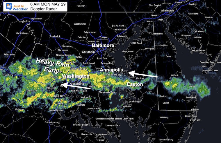
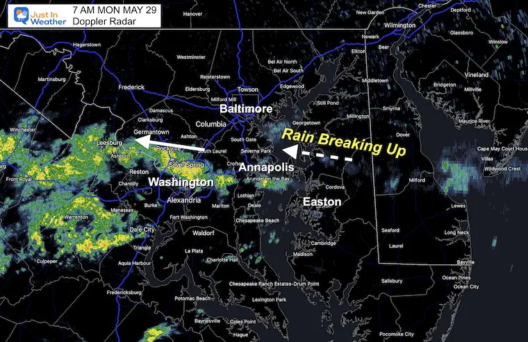
Today that may change for some as rain has already moved into central Maryland. Here we see the Doppler radar snapshots showing the advancement between 6 AM and 7 AM… The band of rain has pushed inland and is breaking up to the east… but the lingering unsettled weather remains.
Doppler Radar Snapshots
6 AM
A solid line of rain pushing inland and advancing north.
7 AM
That line of rain reached Annapolis and broke up to the east, while the steadier rain moved inland across Northern Virginia.
Morning Surface Weather
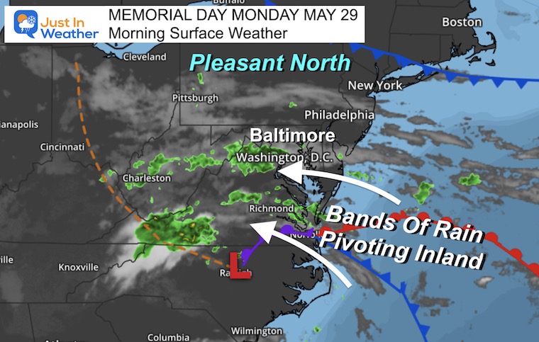
The coastal storm has moved inland and is now centered over Raleigh, NC. Bands of rain continue to generate off the ocean and push inland. The entire system has slowly been shifting north and has reached parts of Maryland and Virginia.
This is not at all organized, so there are pockets of nice weather in between the rain bands. However, the unsettled environment will allow for more showers and storms to form during the afternoon.
Farther north, High Pressure has kept much of Pennsylvania nicer. The clouds break up to the north, but a few renegade showers can still penetrate today.
Live Radar Widget
The morning showers will break up as they move inland. More will generate during the day.
Radar Simulation Forecast
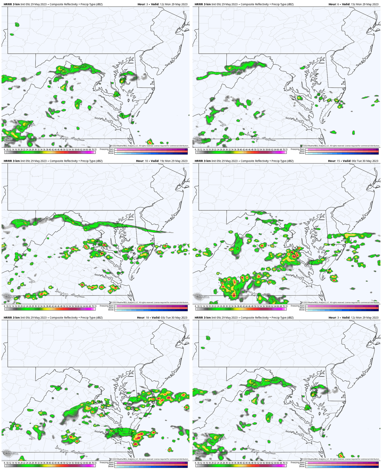
8 AM to 11 PM
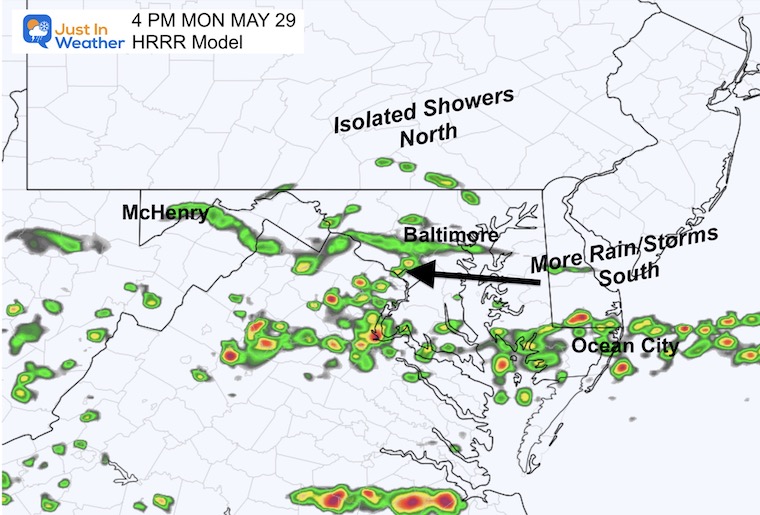
It has taken a few days, but the rain has finally reached central Maryland. The modeling is still guidance and less than perfect. The band of rain may reach Baltimore between Noon and 4 PM, then pockets of showers and thunderstorms can pop up at anytime.
4 PM Snapshot
Some spotty showers may reach into York County PA, but less rain north.
More rain and storms are likely farther south through tonight.
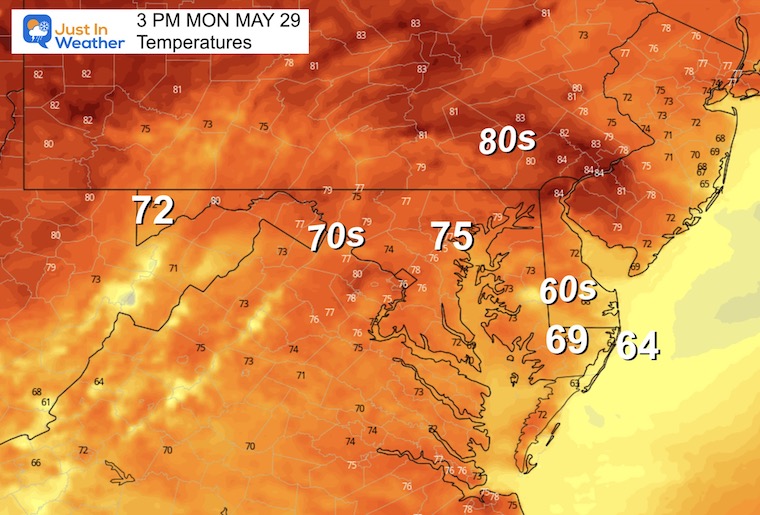
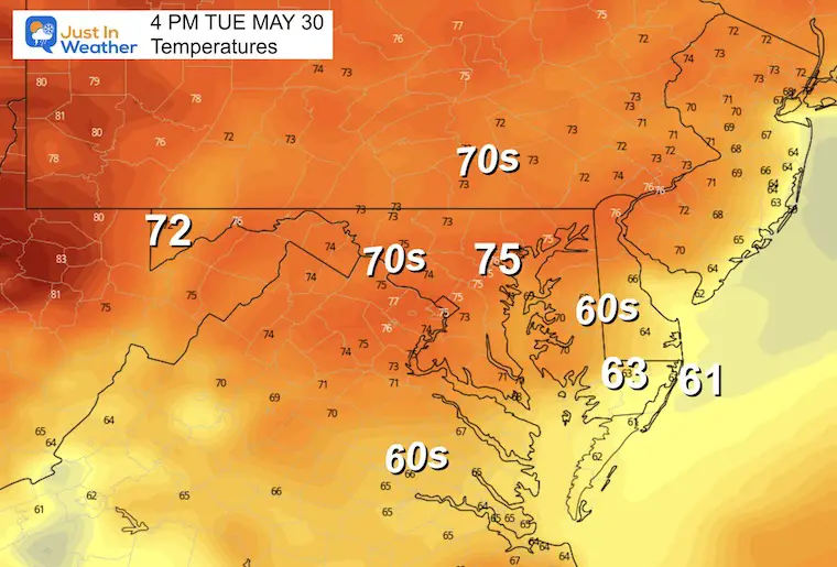
Afternoon Temperatures
These numbers have ended up warmer than the chill we expected. Reaching the mid-70s may depend on how much rain your area gets.
Notice that warmer temps are expected with more sun farther north.
Subscribe for eMail Alerts
Weather posts straight to your inbox
Sign up and be the first to know!
CLIMATE DATA
TODAY May 29
Normal Low in Baltimore: 57ºF
Record 41ºF in 1997
Normal High in Baltimore: 78ºF
Record 97ºF 1969
Tuesday Temperatures
Morning
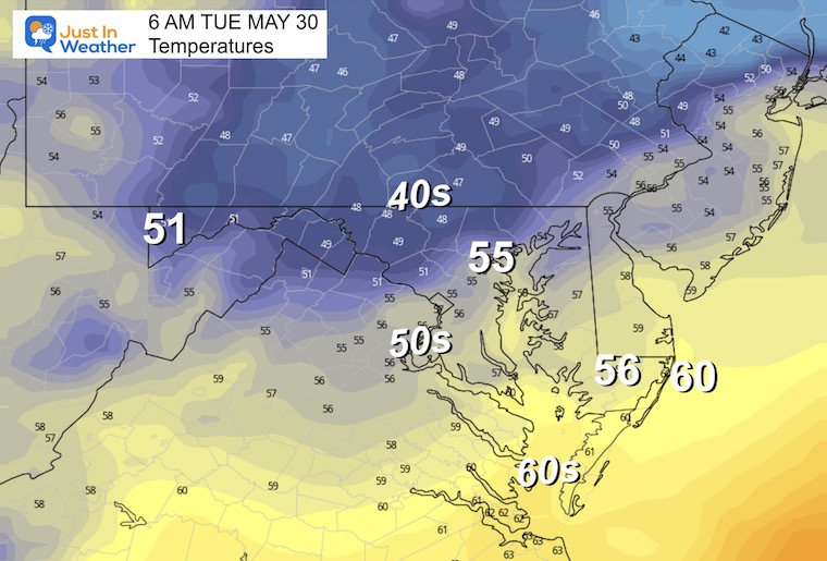
Afternoon
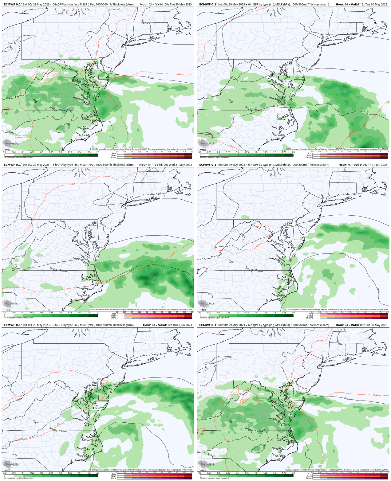
Rain Forecast: Monday Morning To Thursday
The latest model guidance supports the rain pushing south but it may return late Wednesday or Thursday with occasional showers. This is all under the influence of a broad upper Low off the coast.
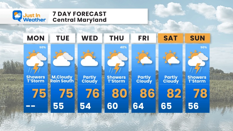
7 Day Forecast
I have low confidence in the specifics this week as we have this broad but weak system on the eastern seaboard.
The warmer temps at the end of the week will be more like summer, but maybe not as hot as earlier thought. We may still be watching the influence of unsettled weather off the coast.
OTHER REPORTS:
NEW:
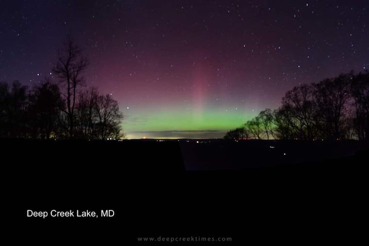
Aurora Photos From Maryland, Delaware, and Virginia
April Heat Wave History
Winter 2023 Recap: My BUSTED Snow Outlook
La Niña Has Ended. El Niño May Return By Fall
STEM Assemblies/In School Fields Trips Are Back
Click to see more and ‘Book’ a visit to your school
Please share your thoughts, best weather pics/videos, or just keep in touch via social media
-
Facebook: Justin Berk, Meteorologist
-
Twitter
-
Instagram
RESTATING MY MESSAGE ABOUT DYSLEXIA
I am aware there are some spelling and grammar typos, and occasional other glitches. I take responsibility for my mistakes, and even the computer glitches I may miss. I have made a few public statements over the years, but if you are new here you may have missed it: I have dyslexia, and found out during my second year at Cornell University. It didn’t stop me from getting my meteorology degree, and being first to get the AMS CBM in the Baltimore/Washington region. One of my professors told me that I had made it that far without knowing, and to not let it be a crutch going forward. That was Mark Wysocki and he was absolutely correct! I do miss my mistakes in my own proofreading. The autocorrect spell check on my computer sometimes does an injustice to make it worse. I also can make mistakes in forecasting. No one is perfect predicting the future. All of the maps and information are accurate. The ‘wordy’ stuff can get sticky. There has been no editor that can check my work when I needed it and have it ready to send out in a newsworthy timeline. Barbara Werner is a member of the web team that helps me maintain this site. She has taken it upon herself to edit typos, when she is able. That could be AFTER you read this. I accept this and perhaps proves what you read is really from me… It’s part of my charm.
#FITF
Subscribe for eMail Alerts
Weather posts straight to your inbox
Sign up and be the first to know!


