A Tornado In Maryland Among Numerous Storm Reports On April 22
Update Sunday April 23, 2023
The eruption of severe weather on Saturday lived up to expectations across The Mid Atlantic. This included a tornado in Maryland, wind damage, and much needed rainfall over 1 inch in many (but not all) areas.
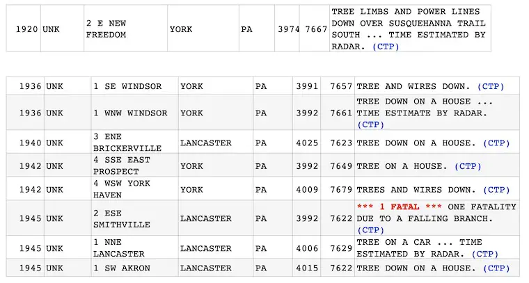
Below is a look at the Tornado Report, Doppler Radar Recap, Storm Report Map, and Wind Damage Reports Across Maryland and Pennsylvania, with one fatality.
Storm Clouds
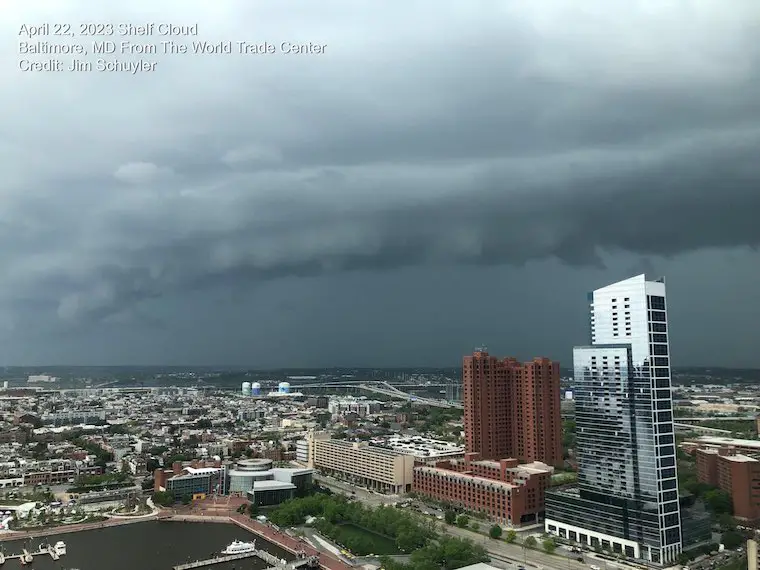
This shelf cloud was seen from The World Trade Center at Baltimore’s Inner Harbor. It was captured by Jim Schuyler and highlighted the leading edge of the severe storm line.
EF-0 Tornado In Poolesville, MD
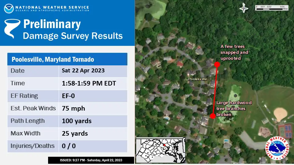
The National Weather Service confirmed a tornado was briefly on the ground in western Montgomery County, MD.
- Location: Dowden Circle near Stevens Park
- Time: ONE MINUTE From 1:58 PM to 1:59 PM
- Rating: EF-0
- Wind Speed: 75 mph
- Multiple backyards with Trees Down
- Length: 100 Yards
- Width: 25 yards
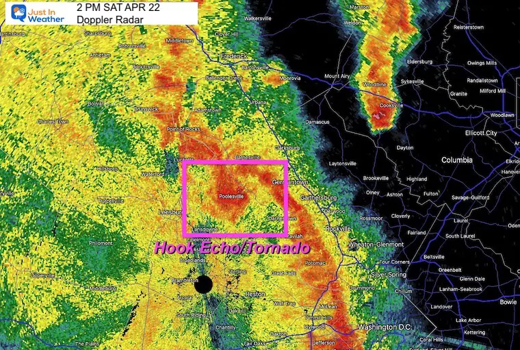
Doppler Radar Recap
At 2 PM Doppler Radar identified this hook echo in Montgomery County, MD.
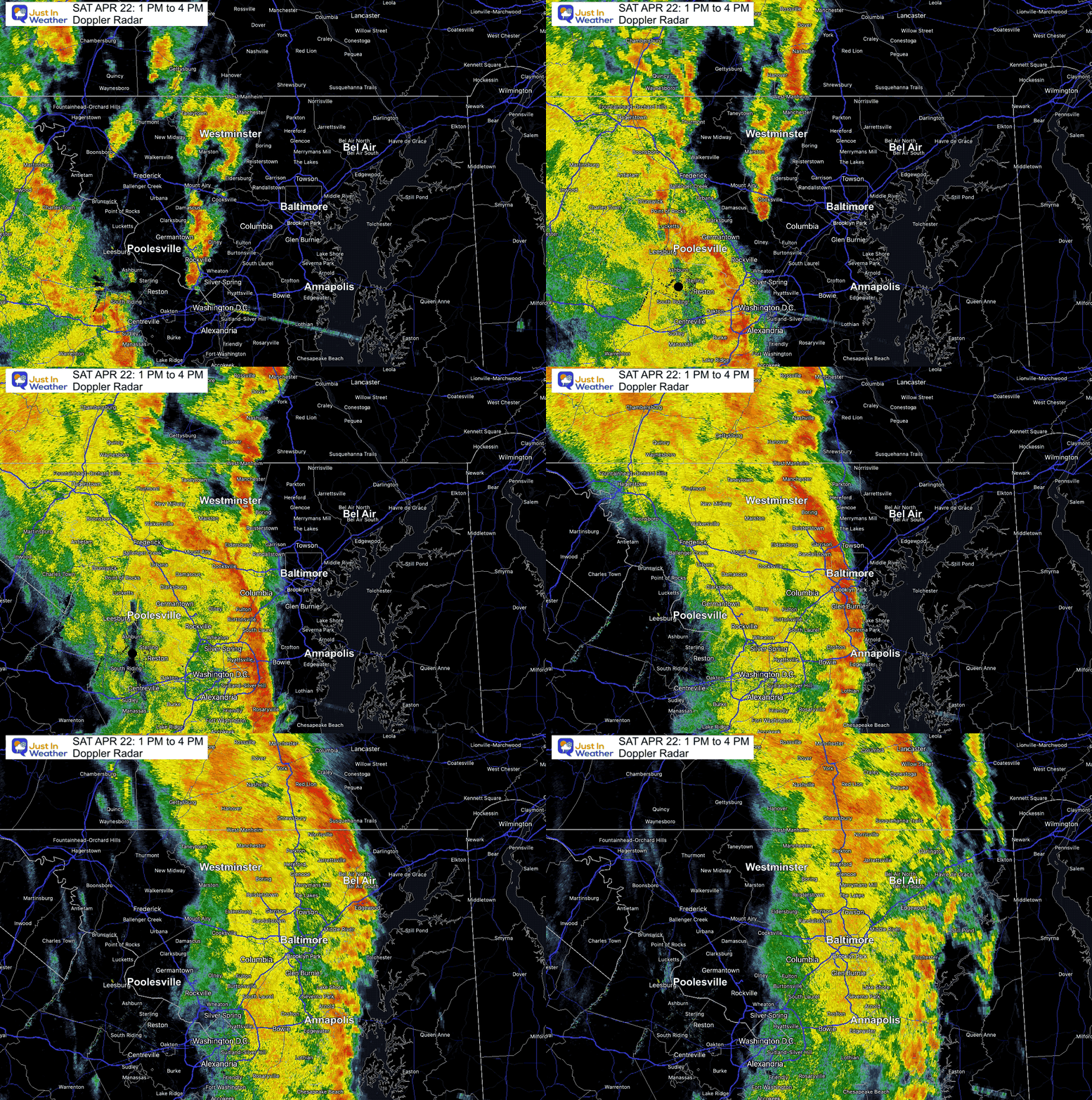
Doppler Radar Loop
1 PM to 4 PM
The line of storms slowed down and lasted a few hours over metro Baltimore.
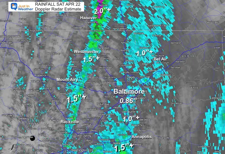
Doppler Radar Rainfall Estimate
This helps display the banding of heavier rain along the patch of individual cells moving north along the front.
One band dropped between 1 and 1.5+ inches from Rockville, through Westminster, MD. Over 2 inches in parts of York County, PA.
Another band of 1 inch or more lined up around I-95, Baltimore and east to near Bel Air, MD.
Storm Reports Mostly Wind
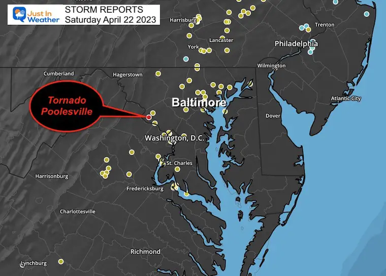
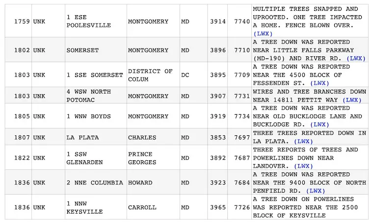
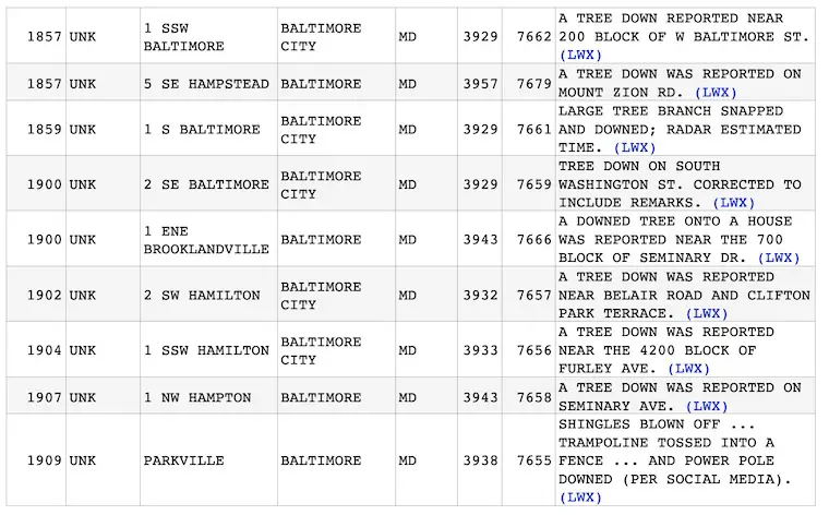
Maryland Wind Reports
Pennsylvania Wind Reports
Sadly this turned deadly in Lancaster County where a tree fell on a person.
REPORTS:
NEW: April Heat Wave History
Winter 2023 Recap: My BUSTED Snow Outlook
La Niña Has Ended. El Niño May Return By Fall
Subscribe for eMail Alerts
Weather posts straight to your inbox
Sign up and be the first to know!
STEM Assemblies/In School Fields Trips Are Back
Click to see more and ‘Book’ a visit to your school
Please share your thoughts, best weather pics/videos, or just keep in touch via social media
-
Facebook: Justin Berk, Meteorologist
-
Twitter
-
Instagram
RESTATING MY MESSAGE ABOUT DYSLEXIA
I am aware there are some spelling and grammar typos, and occasional other glitches. I take responsibility for my mistakes, and even the computer glitches I may miss. I have made a few public statements over the years, but if you are new here you may have missed it: I have dyslexia, and found out during my second year at Cornell University. It didn’t stop me from getting my meteorology degree, and being first to get the AMS CBM in the Baltimore/Washington region. One of my professors told me that I had made it that far without knowing, and to not let it be a crutch going forward. That was Mark Wysocki and he was absolutely correct! I do miss my mistakes in my own proofreading. The autocorrect spell check on my computer sometimes does an injustice to make it worse. I also can make mistakes in forecasting. No one is perfect predicting the future. All of the maps and information are accurate. The ‘wordy’ stuff can get sticky. There has been no editor that can check my work when I needed it and have it ready to send out in a newsworthy timeline. Barbara Werner is a member of the web team that helps me maintain this site. She has taken it upon herself to edit typos, when she is able. That could be AFTER you read this. I accept this and perhaps proves what you read is really from me… It’s part of my charm.
#FITF


