April 21 Our Last Hot Day Then Severe Storms Saturday And Cooler Next Week
April 21, 2023
Friday Morning Update
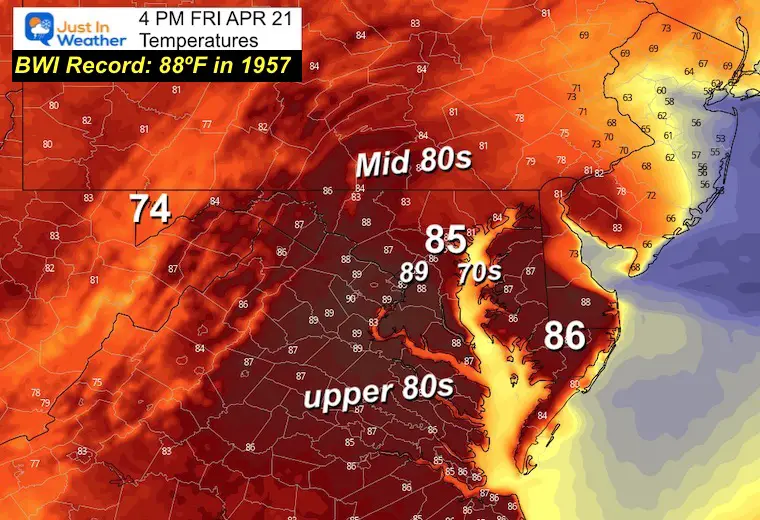
We are in for a major change, but have one more summer-like day first. This Friday was expected to perhaps bring the 3rd record high to BWI this month, but a wind from the water may mitigate that heat, however, inland could approach 90ºF.
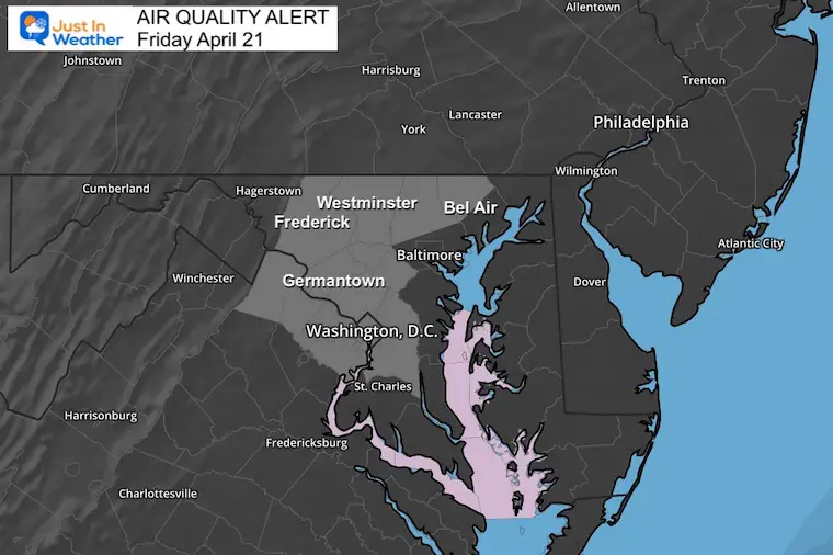
Those inland areas will have both poor air quality AND a fire risk today.
A strong cold front will arrive Saturday with a risk for storms to turn severe later in the day. The air mass that follows will overcorrect to a below-average pattern to end the month.
Morning Temperatures
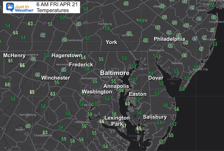
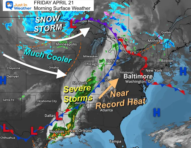
Morning Surface Weather
A snow storm is raging across the Northern Plains, while an eruption of severe storms is along the southern end of the trailing Cold Front.
Today we get our last full day of summer heat. It will be warmer inland with cooler winds off the water.
That cold front will reach us Saturday.
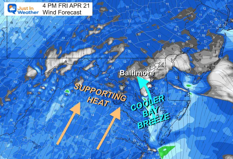
Wind Forecast
Most of the region will have a wind FROM the Southwest. However, a SOUTHEAST wind off the water will bring in a cooling result nearby, which is why I have lowered the expectations for BWI to remain below the record.
Afternoon Temperatures
There may be some areas approaching 90ºF, but that wind from the Chesapeake Bay is expected to influence BWI and keep them just below the record mark.
Air Quality Alert
Area brush fires and stagnant air/pollution has lowered the air quality inland west of the cities.
Subscribe for eMail Alerts
Weather posts straight to your inbox
Sign up and be the first to know!
CLIMATE DATA
TODAY April 21
Normal Low in Baltimore: 46ºF
Record 29ºF in 1956
Normal High in Baltimore: 69ºF
Record 88ºF in 1957
REPORTS:
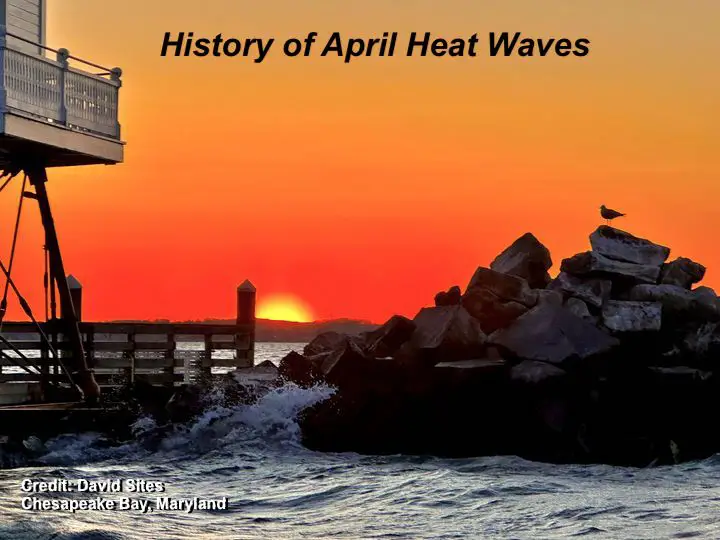
NEW: April Heat Wave History
Winter 2023 Recap: My BUSTED Snow Outlook
La Niña Has Ended. El Niño May Return By Fall
Saturday Weather
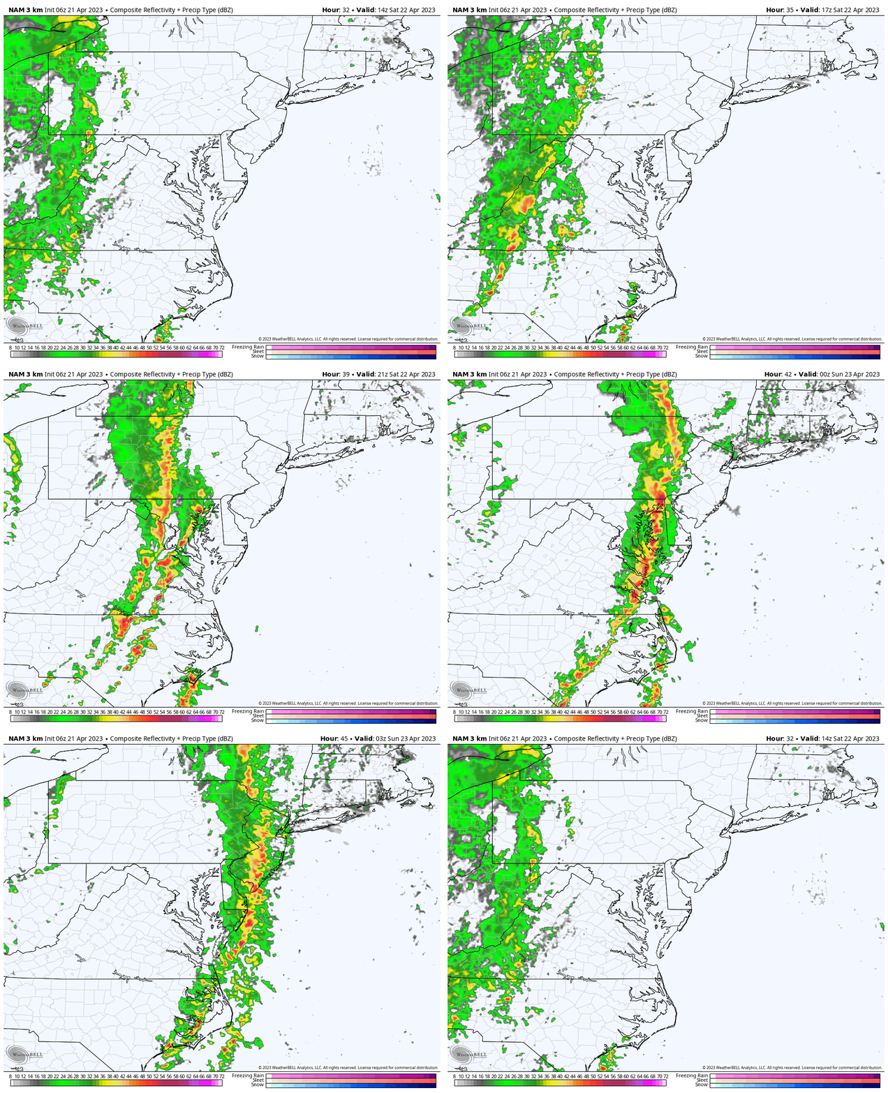
Storm Animation: 10 AM to 11 PM
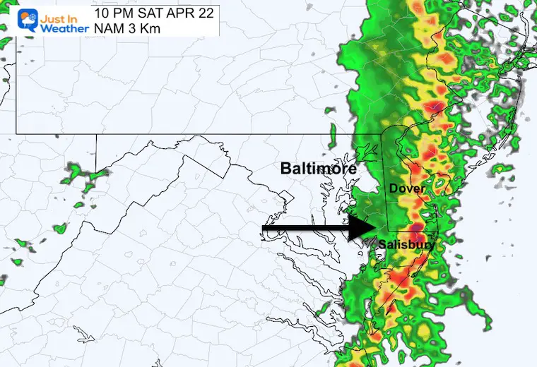
The storm line may appear to slow up in the Ohio Valley on Friday. This will get a push east on Saturday, arriving in metro areas later in the day. Then sweep through and be off the coast on Sunday, and get replaced by cooler winds.
Temperatures
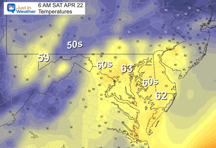
Morning
A warm start and consider that these temps may match or be higher than some afternoons next week.
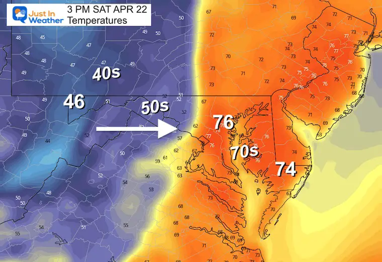
Afternoon
Here we can see the sharp contrast with this strong cold front. Temps in the 70s will be replaced by 50s and 40s.
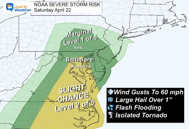
Severe Storm Risk
From Baltimore southward there is an increased chance for storms to contain damaging winds, large hail, and even an isolated tornado.
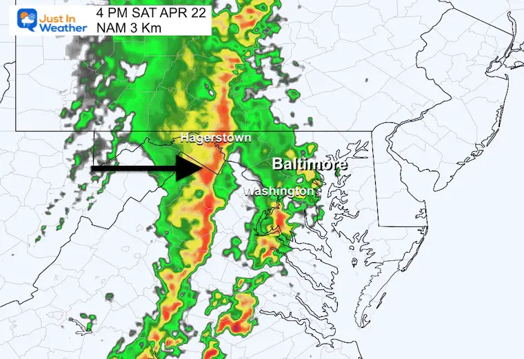
Storm Snapshots Late Saturday
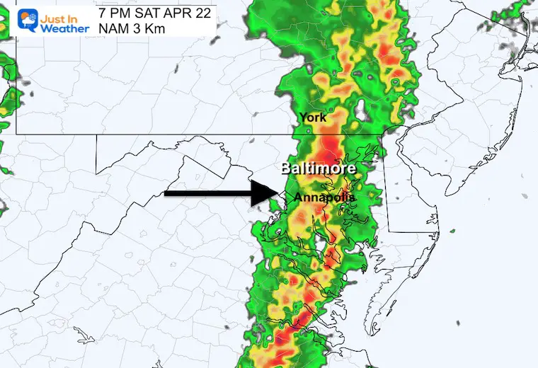
This is still NOT PERFECT. It is our first look to narrow down the time frame for the arrival of the rain and storms.
At this point: Western Maryland = Saturday afternoon.
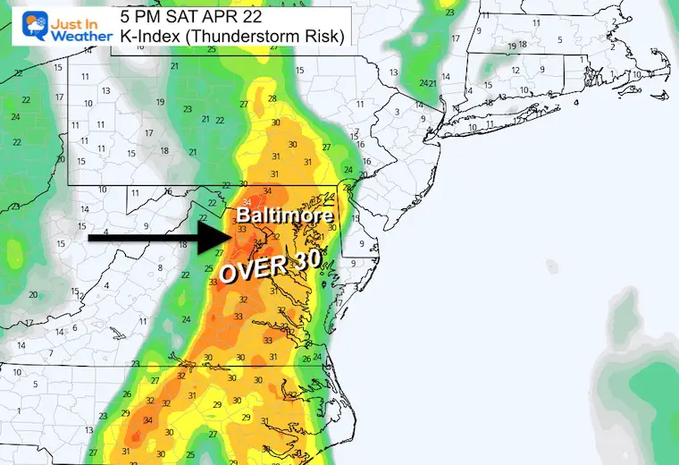
Central and Eastern Shore Areas = Saturday 4 PM to Midnight
4 PM
K-Index: Strong to Severe Storm Parameter
7 PM
10 PM
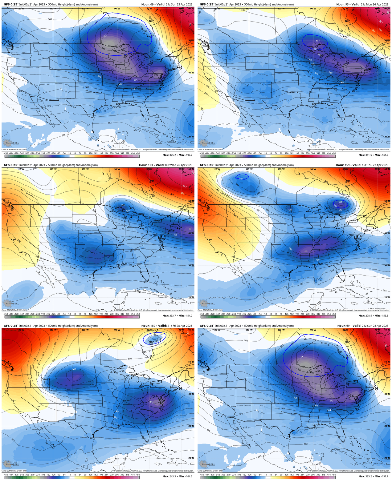
Cooler Jet Stream
Sunday Afternoon to Next Friday Afternoon
The upper air pattern will be dominated by a cooler air flow. The rest of the month will be cooler than average for the Eastern US.
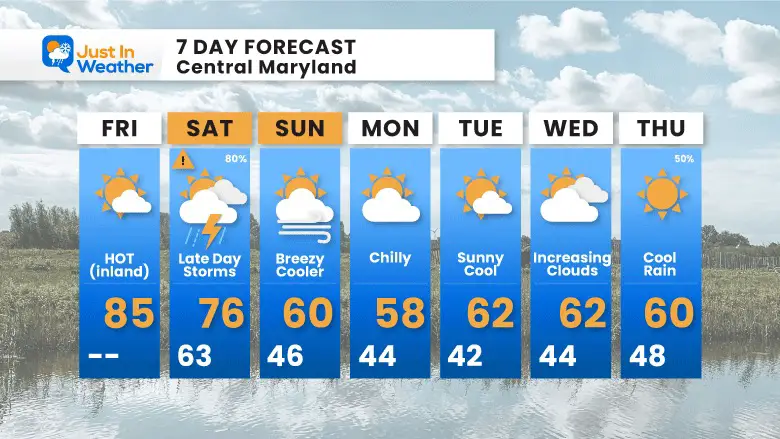
7 Day Forecast
Overcorrection? After a stormy Saturday, the afternoon temps next week may remain cooler than Saturday morning. This may include a morning or two with inland frost, then a chilly rain to end the week.
STEM Assemblies/In School Fields Trips Are Back
Click to see more and ‘Book’ a visit to your school
Please share your thoughts, best weather pics/videos, or just keep in touch via social media
-
Facebook: Justin Berk, Meteorologist
-
Twitter
-
Instagram
RESTATING MY MESSAGE ABOUT DYSLEXIA
I am aware there are some spelling and grammar typos, and occasional other glitches. I take responsibility for my mistakes, and even the computer glitches I may miss. I have made a few public statements over the years, but if you are new here you may have missed it: I have dyslexia, and found out during my second year at Cornell University. It didn’t stop me from getting my meteorology degree, and being first to get the AMS CBM in the Baltimore/Washington region. One of my professors told me that I had made it that far without knowing, and to not let it be a crutch going forward. That was Mark Wysocki and he was absolutely correct! I do miss my mistakes in my own proofreading. The autocorrect spell check on my computer sometimes does an injustice to make it worse. I also can make mistakes in forecasting. No one is perfect predicting the future. All of the maps and information are accurate. The ‘wordy’ stuff can get sticky. There has been no editor that can check my work when I needed it and have it ready to send out in a newsworthy timeline. Barbara Werner is a member of the web team that helps me maintain this site. She has taken it upon herself to edit typos, when she is able. That could be AFTER you read this. I accept this and perhaps proves what you read is really from me… It’s part of my charm.
#FITF


