Pennsylvania Clipper Snow Brings In Pattern Change And Lingering Winter Weather
March 6, 2023
Monday Night Update
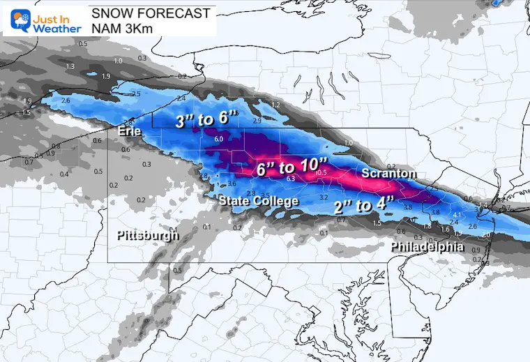
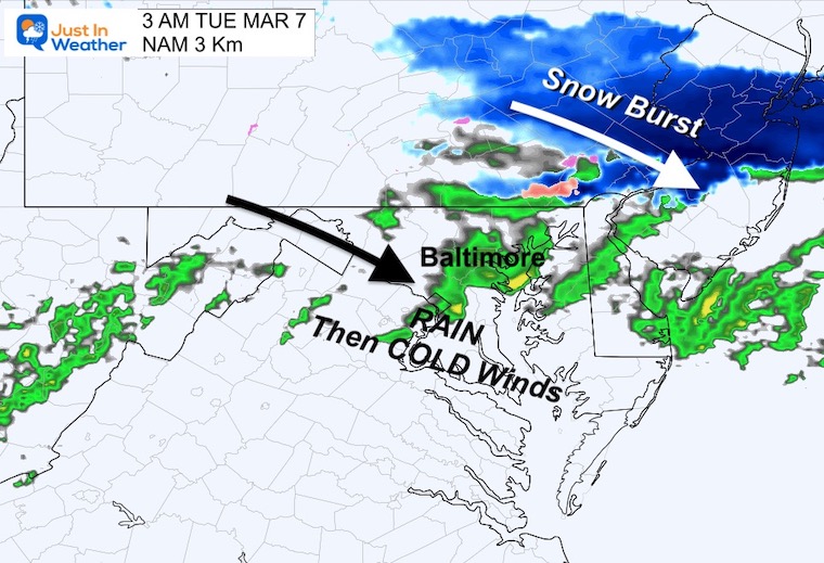
A quick moving clipper style weather system will be crossing Pennsylvania overnight. This will bring a narrow band of moderate to heavy snow, while rain into Maryland will lead the colder change. We will surely feel the strong cold winds by Tuesday Morning and perhaps a few snow flurries. The near 60-degree afternoons will be a distant memory for a while.
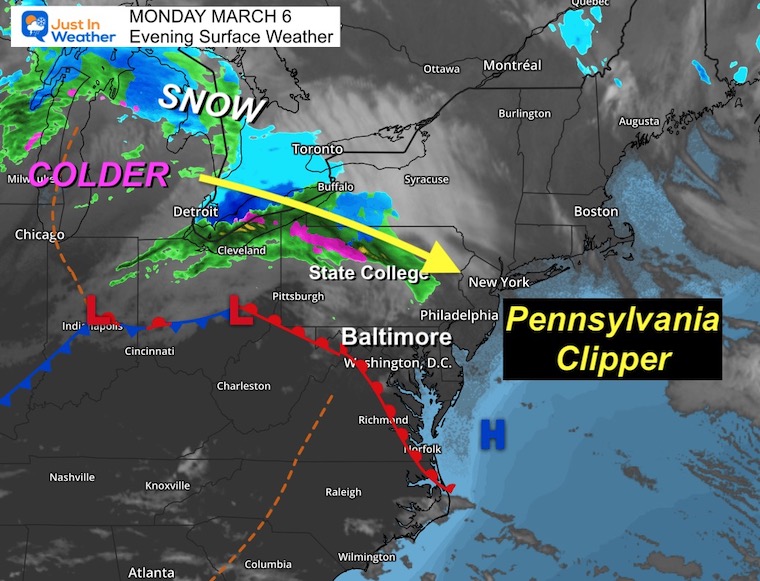
This snow is just north of my normal forecast region, but I want to show you the set up to highlight my point about the computer model performance. As we transition to a colder pattern, there will be a week or so of lingering winter weather events. The potential is there, but as I have been saying in recent reports I have low confidence. Looking at the spread of snow projections tonight helped cast the doubt to lock in on how Friday night will play out.
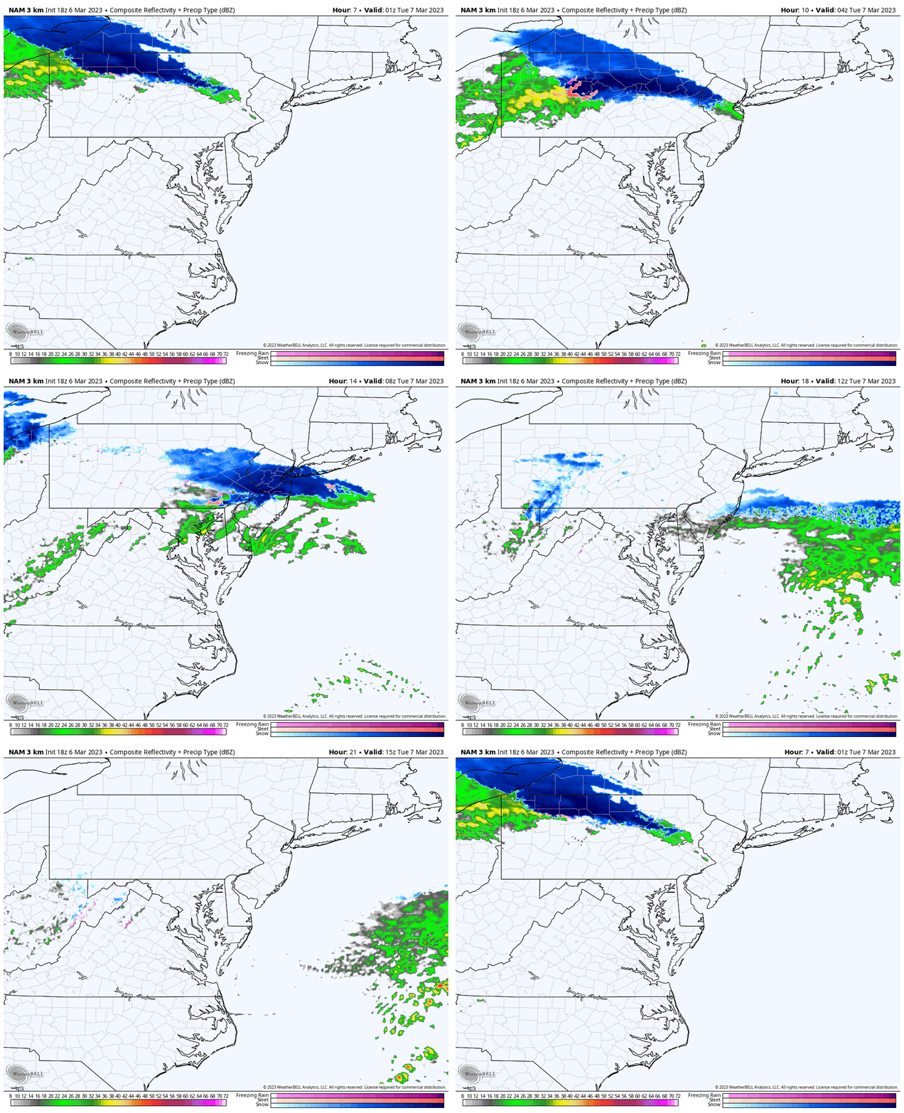
Overnight Radar Simulation
NAM 3 Km 8 PM to 10 AM
This burst of snow will pass through central PA, and move off the coast in the morning.
Rain showers will reach central Maryland, then the colder air will follow.
Snow Forecast Plots
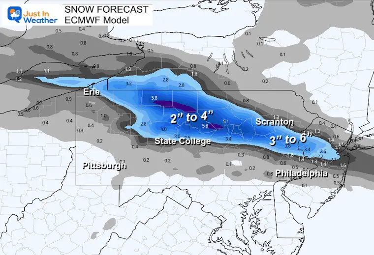
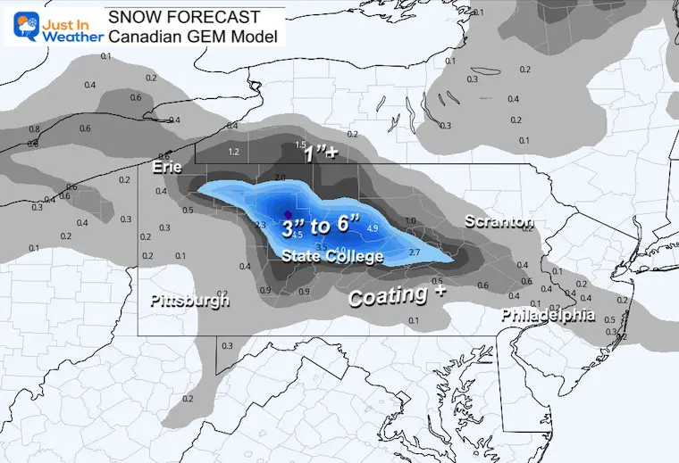
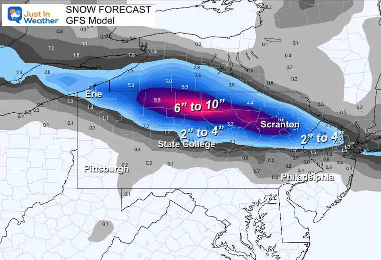
These FOUR Model plots show both the wide range of snow totals and location.
The lowest snow amounts from the European and Canadian Models are more realistic. The Highest amounts from the GFS and NAM take the 2 to 4 inches shown above up to 10 inches. With that much of a discrepancy tonight, the outlook in a few days is more glaring.
European ECMWF
Canadian GEM
NAM 3 Km
GFS Model
Local Focus
3 AM
The snow is not likely to reach us, but I’ve seen a suggestion that as far south as York and Lancaster could get some flakes between 2 AM and 4 AM.
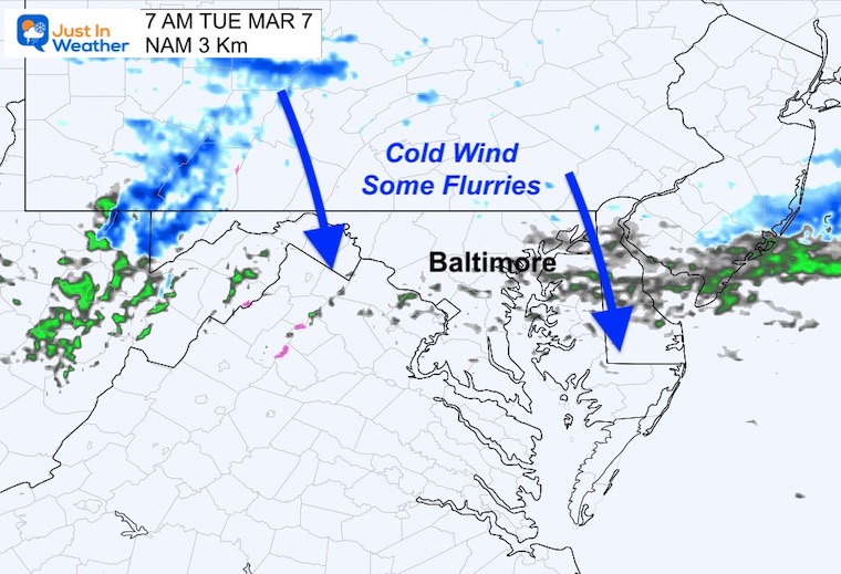
7 AM
While this system will be running its course by the morning commute, we may have some flurries with the gusty colder winds.
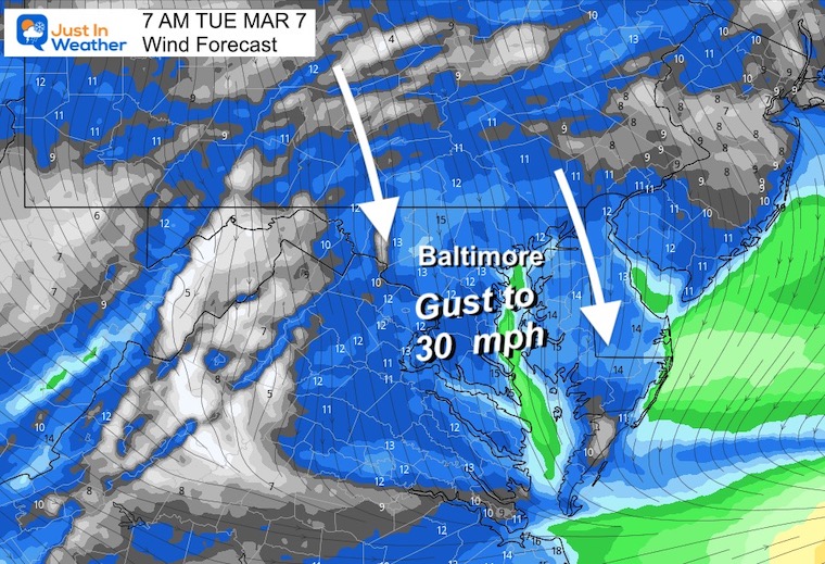
Wind Forecast
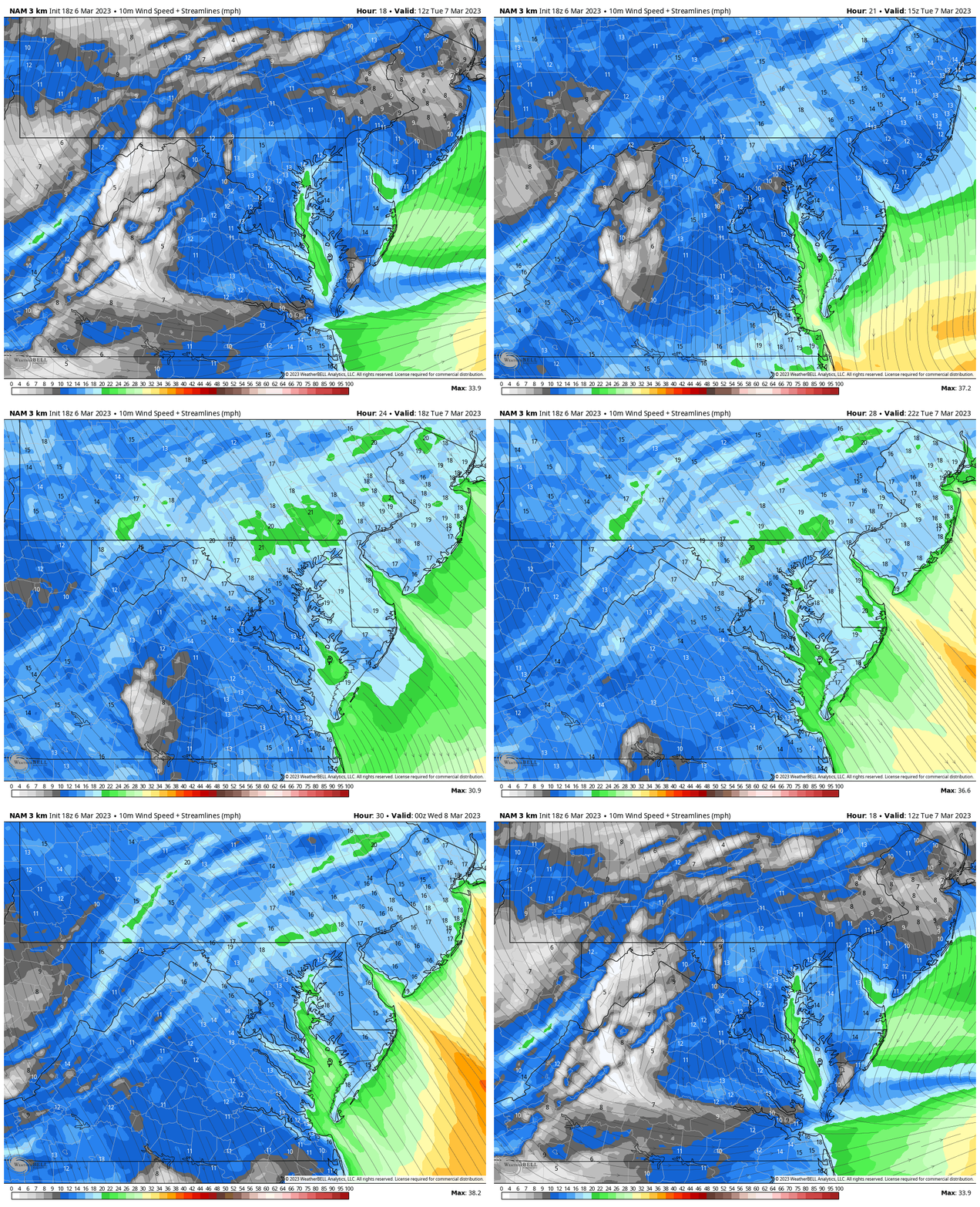
Gusts will be from the North up to 30 mph.
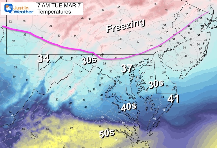
Temperatures
The freezing line will reach into northern Maryland, but don’t worry: Roads should be OK.
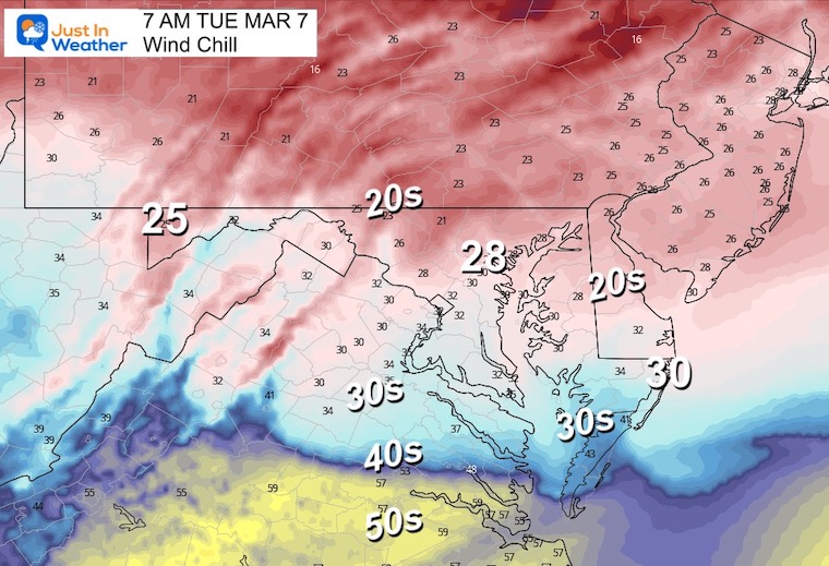
Wind Chill
With the gusts, it will feel like the 20s!
Wind Forecast Animation
7 AM to 7 PM
Strong cold North winds will continue and remain gusty for a few days.
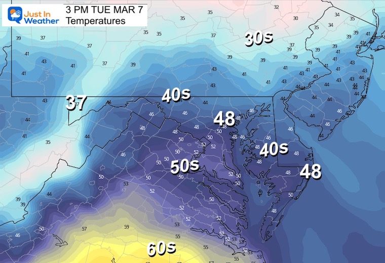
Afternoon Temperatures
This is NOT arctic air, but definitely colder than average.
End of Week Storm?
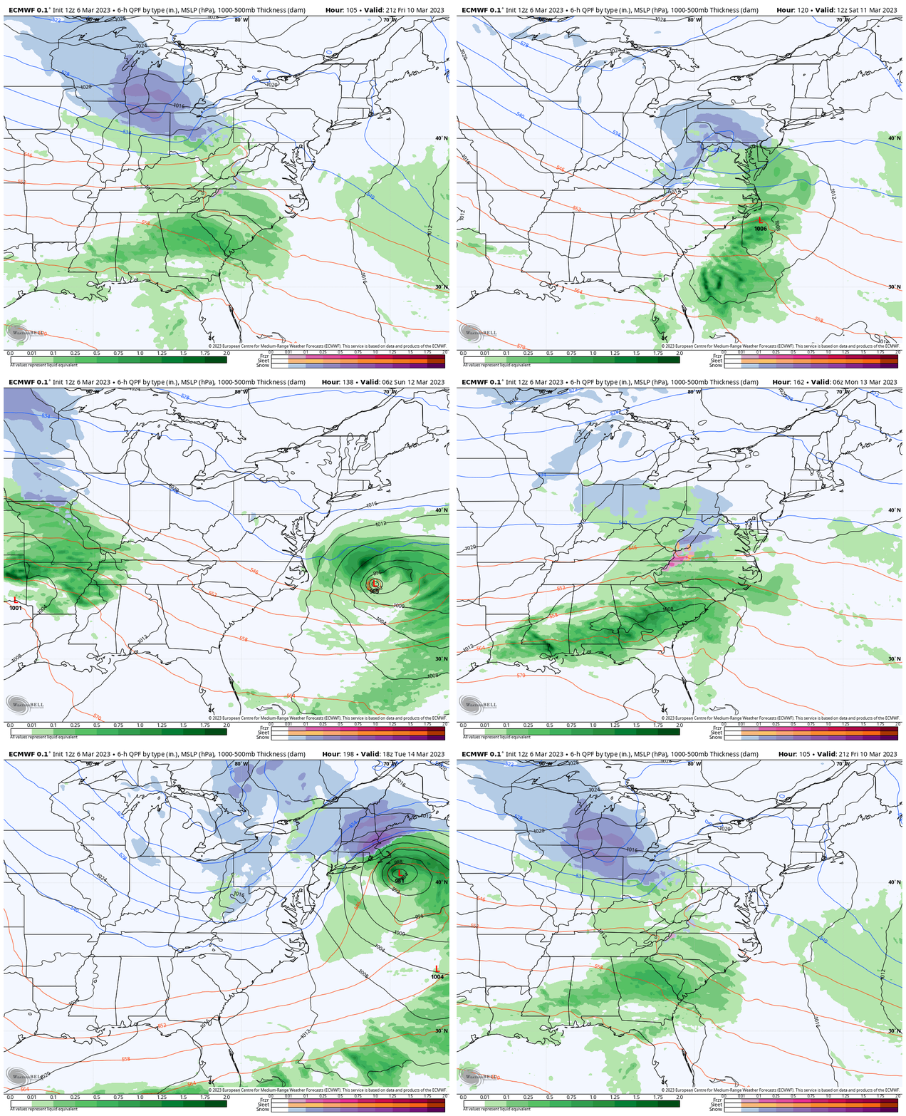
Here is the European Model plot: Friday Afternoon to NEXT Tuesday.
I am showing this because it is showing an active jet stream with the first wave Friday night into Saturday, then another attempt on Monday.
Model Comparison
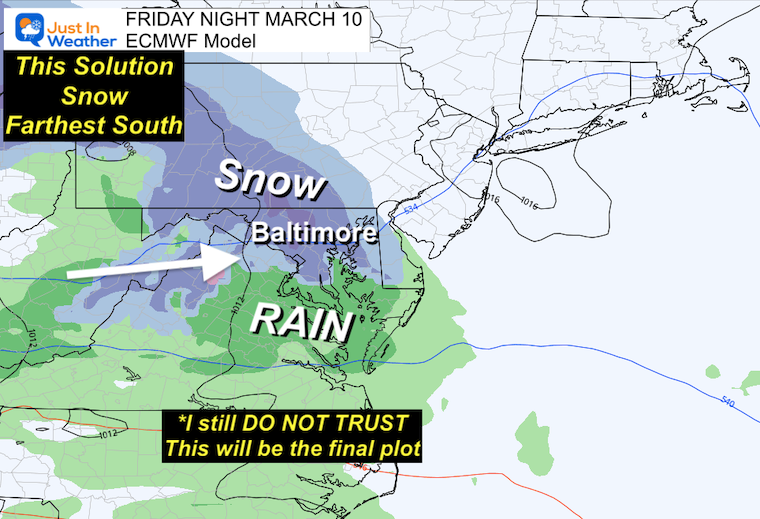
The European Model: Central Maryland Snow?
The most aggressive with this package is from today. However, this has been all over the place with solutions. Last night it was lost, while just two days ago it had a longer time window including the end of the weekend.
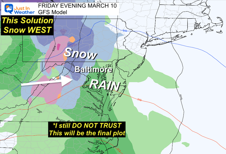
GFS Model: Snow Inland?
This model has a low performance however, this is a climatologically more likely outcome.
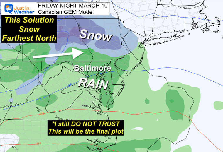
Canadian GEM: Snow Farther North?
This is the farthest north and warmest solution.
Take Away:
The pattern is still showing us that some event will work to develop on the coast, however, the specifics are still uncertain.
I truly HATE to be this vague, but the support has been letting us down ALL WINTER. So at this point, I am still skeptical.
The computers are still in a standoff, and I do not trust they have a handle on this yet.
Seeing which model performs best with the Pennsylvania snow totals tonight might make it jump to the lead of the pack with viability for the next event.
I would NOT trust any snow forecast maps for Friday or next week.
Anyone who promises what will happen, given this poor winter, is purely guessing. If you take their suggestion I hope they are right.
I am being sincerely honest and am NOT sure how this will play out at this time. While I have my justifiable doubts, it is prudent to keep an open mind with whatever March can bring us.
EXPLORE MORE:
March Snow and Extreme Weather History
Subscribe for eMail Alerts
Weather posts straight to your inbox
Sign up and be the first to know!
Also See:
Winter History: Low Snow And Late Starts
See my research based on Baltimore data since 1883.
STEM Assemblies/In School Fields Trips Are Back
Click to see more and ‘Book’ a visit to your school
My Winter Outlook: Not A Typical La Niña!
I see many factors to support colder influence with multiple systems. Early and later in winter. Check it out. https://justinweather.com/2022/11/22/winter-outlook-2023-for-snow-not-typical-la-nina-plus-polar-vortex-disruption/
Also See The Winter Outlook Series:
Farmer’s Almanac Comparison
September Starts Meteorological Autumn: Weather Climate Stats For Maryland at Baltimore
Triple Dip La Niña Winter
https://justinweather.com/2022/09/09/winter-outlook-2023-la-nina-triple-dip-expectations/
CONNECTION TO WINTER?
If you want a snowy winter, this is what you might want to look for in the rest of the tropical season. https://justinweather.com/2022/08/31/record-august-for-no-named-tropical-storms-closer-look-at-snow-following/
Woolly Bear Caterpillars
https://justinweather.com/2022/10/25/winter-weather-outlook-from-the-wooly-bear-caterpillar/
Persimmon Seeds
Click to see Top 20 and MORE
Normals And Records: Maryland and Baltimore Climate History
Please share your thoughts, best weather pics/videos, or just keep in touch via social media
-
-
Facebook: Justin Berk, Meteorologist
-
Twitter: @JustinWeather
-
Instagram: justinweather
-

RESTATING MY MESSAGE ABOUT DYSLEXIA
I am aware there are some spelling and grammar typos, and occasional other glitches. I take responsibility for my mistakes, and even the computer glitches I may miss.
I have made a few public statements over the years, but if you are new here you may have missed it:
I have dyslexia, and found out during my second year at Cornell University. It didn’t stop me from getting my meteorology degree, and being first to get the AMS CBM in the Baltimore/Washington region. One of my professors told me that I had made it that far without knowing, and to not let it be a crutch going forward. That was Mark Wysocki and he was absolutely correct!
I do miss my mistakes in my own proofreading. The autocorrect spell check on my computer sometimes does an injustice to make it worse. I also can make mistakes in forecasting. No one is perfect predicting the future.
All of the maps and information are accurate. The ‘wordy’ stuff can get sticky.
There has been no editor that can check my work when I needed it and have it ready to send out in a newsworthy timeline. Barbara Werner is a member of the web team that helps me maintain this site. She has taken it upon herself to edit typos, when she is able. That could be AFTER you read this.
I accept this and perhaps proves what you read is really from me…
It’s part of my charm.
#FITF


