


January 6 Weather Some Fog And Clouds Followed By The Warm Up With Rain By The Weekend
Tuesday, January 6, 2026 The storm track has shifted to the north. We are still on the edge, which is why we have areas of fog, and most of the…
March 6, 2023
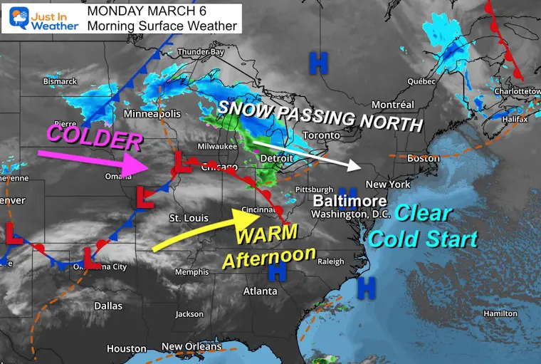
Monday Morning
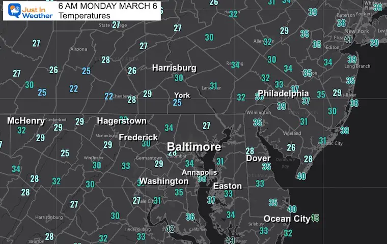
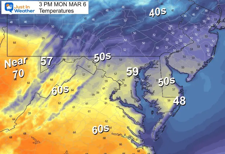
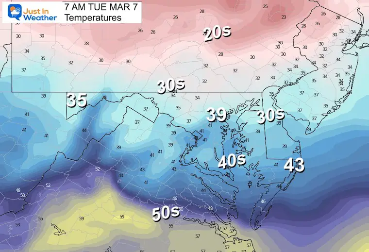
High Pressure has given us a clear and chilly start to the day. The afternoon will be mild ahead of the next weather system which will bring in rain showers overnight. This will lead the charge for cooler air and perhaps some flurries.
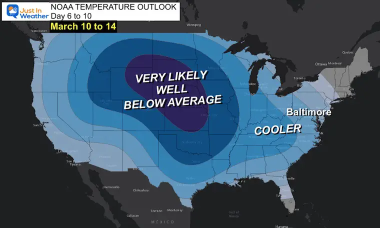
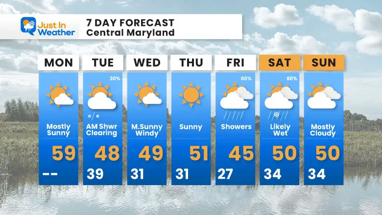
This week will be cooler, but NOT Cold! That is important as we now have validation for a cooler than average weather pattern. As for the next potential storm: The Computer Guidance is proving the same thing we saw all winter. I have one eye open and am shaking my head.
We get a sunny start and mild day in our region. There is snow from Northern Pennsylvania to central New York and a cold front that will swing through tonight. This is the tame part of the week ahead.
Morning
Afternoon
This will be our last warm day for a while.
Sign up and be the first to know!
Normal Low in Baltimore: 31ºF
Record 10ºF in 2015
SNOW: 10” in 1962
Normal High in Baltimore: 51ºF
Record 78ºF in 2022
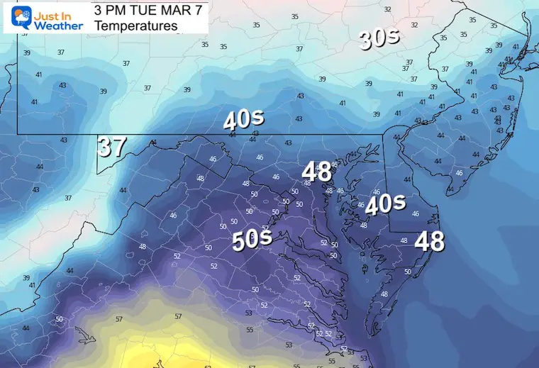
Here we see a band of rain after 9 PM, with snow well north into central Pennsylvania. Colder winds will follow, and we may have some flurries early Tuesday. That would be more for show than anything else… then clearing with colder winds during the day.
Morning
Afternoon
My REALISTIC Expectations for the COLD OUTLOOK
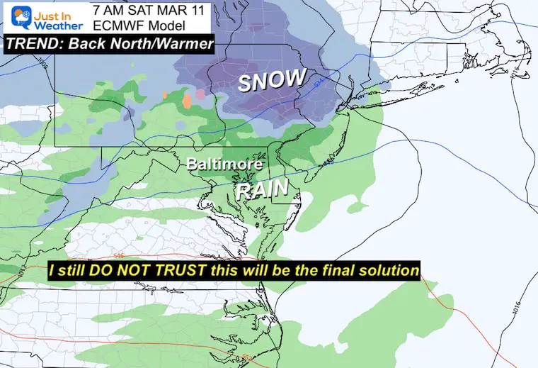
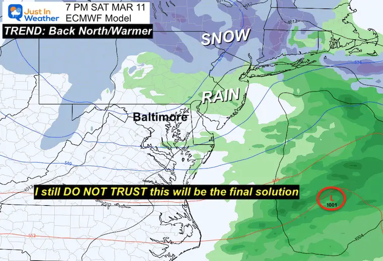
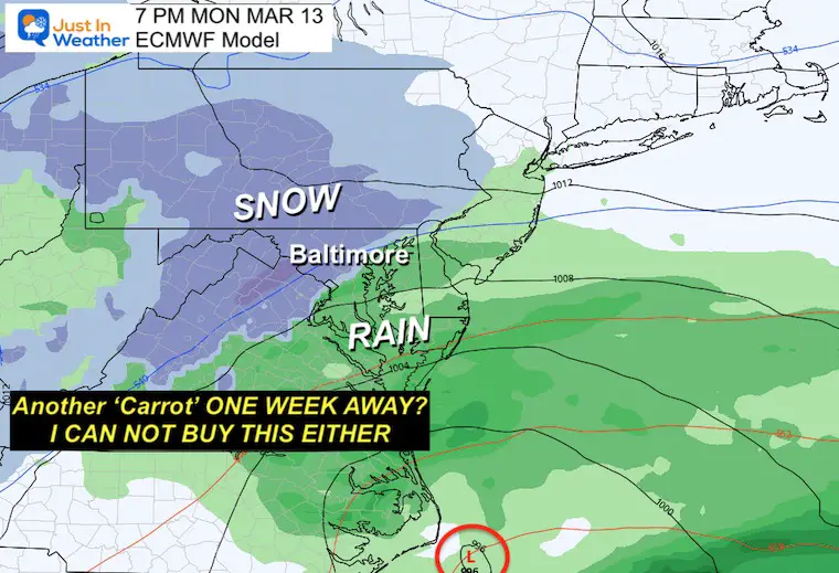
Our new look at the same European Model guidance shows another solution that has flipped. This time north and warmer for the weekend. That is much less organized and yet then shows a follow-up event early next week with snow.
I am showing daily for comparison, however I am with many of you and now viewing this as fiction.
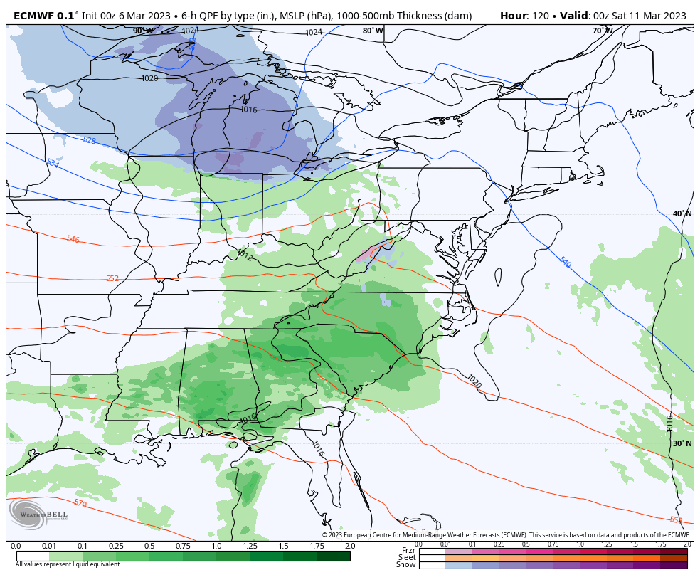
If you have been comparing, this looks very different than yesterday. I annotated before and will continue to show that I DO NOT TRUST this. It is obvious the modeling cannot handle the energy and organization of this storm.
Come On Man!?!
At this point I am almost laughing, but more frustrated. I’ve seen this so many times this winter… A phantom storm, then shifting the focus to another event a few days later.
This may turn into the flip-flop we are still watching for the weekend. It is March and anything is possible. History has shown us that. This winter has also shown us a cluster of strike-outs. So I am remaining very skeptical and doubtful.
We will end up with a week of temperatures cooler than average, but not winter cold! This is the seasonal perspective I mentioned.
The weekend storm does not look like much for us now… and that Carrot for next week is simply for conversation. I am not putting much into it now.
Sign up and be the first to know!
I am aware there are some spelling and grammar typos, and occasional other glitches. I take responsibility for my mistakes, and even the computer glitches I may miss.
I have made a few public statements over the years, but if you are new here you may have missed it:
I have dyslexia, and found out during my second year at Cornell University. It didn’t stop me from getting my meteorology degree, and being first to get the AMS CBM in the Baltimore/Washington region. One of my professors told me that I had made it that far without knowing, and to not let it be a crutch going forward. That was Mark Wysocki and he was absolutely correct!
I do miss my mistakes in my own proofreading. The autocorrect spell check on my computer sometimes does an injustice to make it worse. I also can make mistakes in forecasting. No one is perfect predicting the future.
All of the maps and information are accurate. The ‘wordy’ stuff can get sticky.
There has been no editor that can check my work when I needed it and have it ready to send out in a newsworthy timeline. Barbara Werner is a member of the web team that helps me maintain this site. She has taken it upon herself to edit typos, when she is able. That could be AFTER you read this.
I accept this and perhaps proves what you read is really from me…
It’s part of my charm.
#FITF
Winter History: Low Snow And Late Starts
See my research based on Baltimore data since 1883.

Click to see more and ‘Book’ a visit to your school

I see many factors to support colder influence with multiple systems. Early and later in winter. Check it out. https://justinweather.com/2022/11/22/winter-outlook-2023-for-snow-not-typical-la-nina-plus-polar-vortex-disruption/
September Starts Meteorological Autumn: Weather Climate Stats For Maryland at Baltimore
https://justinweather.com/2022/09/09/winter-outlook-2023-la-nina-triple-dip-expectations/
If you want a snowy winter, this is what you might want to look for in the rest of the tropical season. https://justinweather.com/2022/08/31/record-august-for-no-named-tropical-storms-closer-look-at-snow-following/
https://justinweather.com/2022/10/25/winter-weather-outlook-from-the-wooly-bear-caterpillar/

