March 4 Wind Advisory And First Look At Next Weekend Storm
March 4, 2023
Saturday Morning
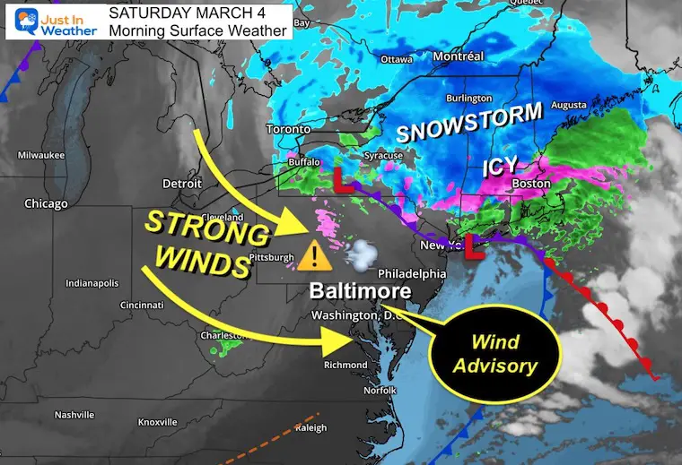
The latest storm crashed through overnight with some reports of lighting and thunder. The rainfall totals did surpass 1 inch for many, and now that storm is dropping a classic snow and ice mix across New England.
With a powerful winter storm, strong winds often follow and that is what we will experience today. A Wind Advisory is in place with peak winds expected this morning through early afternoon. Then we will end the weekend with a pleasant Sunday.
Looking ahead, a pattern shift (I know you have heard this before) will attempt to bring us a storm next weekend. I have my first look below.
Morning Surface Weather
The Storm is located in New England, with snow in the mountains. The ice and rain line pushed farther north for them than initially expected. This is important to note as it’s been our trend as well as the bullseye region all winter. I will consider this bias for next weekend.
Strong Winds for The Mid Atlantic as a result of the steep pressure gradient.
Wind Alerts
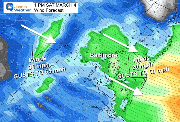
High Wind Warning for the mountains. Peaks could get gusts up to 65 mph.
Wind Advisory for most central and urban areas. Winds will average 25 mph and gust up to 50 mph.
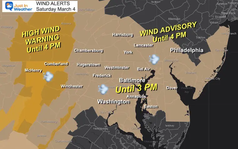
Wind Forecast Snapshot
High Wind Warning for the mountains. Peaks could get gusts up to 65 mph.
Wind Advisory for most central and urban areas. Winds will average 25 mph and gust up to 50 mph.
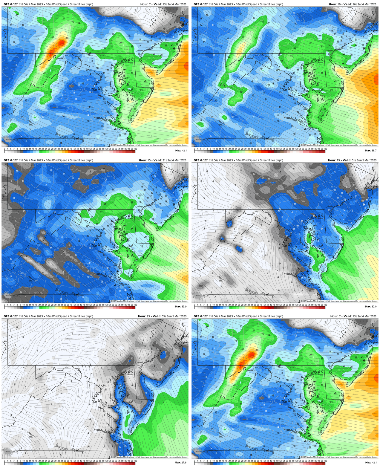
Wind Forecast Animation
8 AM to Midnight
The winds should peak midday then ease by the evening.
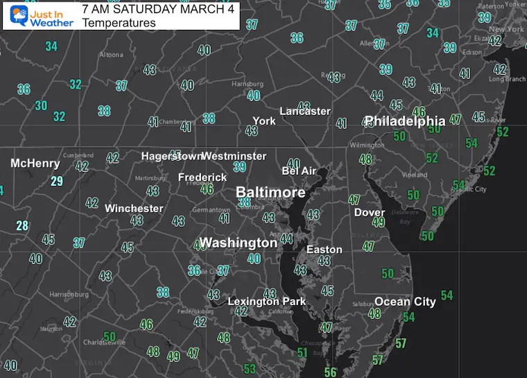
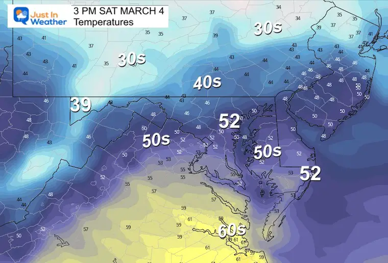
Temperatures
Morning
Afternoon
Subscribe for eMail Alerts
Weather posts straight to your inbox
Sign up and be the first to know!
CLIMATE DATA
TODAY March 4
Normal Low in Baltimore: 31ºF
Record 13ºF in 1966
SNOW: 7.8” in 1957
Normal High in Baltimore: 51ºF
Record 74ºF in 1982
March Snow and Extreme Weather History
https://justinweather.com/2023/02/28/march-snow-history-the-madness-of-weather-potential-this-month/
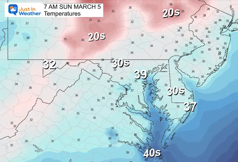
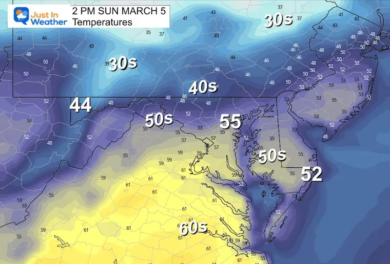
Sunday
This should end up a sunny and quiet day. Lighter wind and mild temperatures.
Morning
Afternoon
Looking Ahead
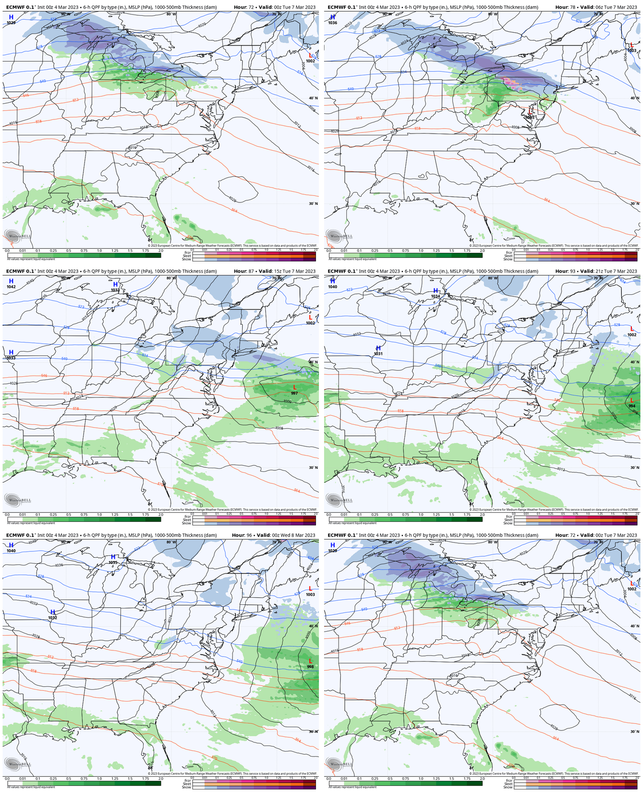
Monday Evening To Tuesday Evening
A weak system will pass through to our north. The moisture may not reach us with more than clouds, but it will shift the winds and start the cooling trend.
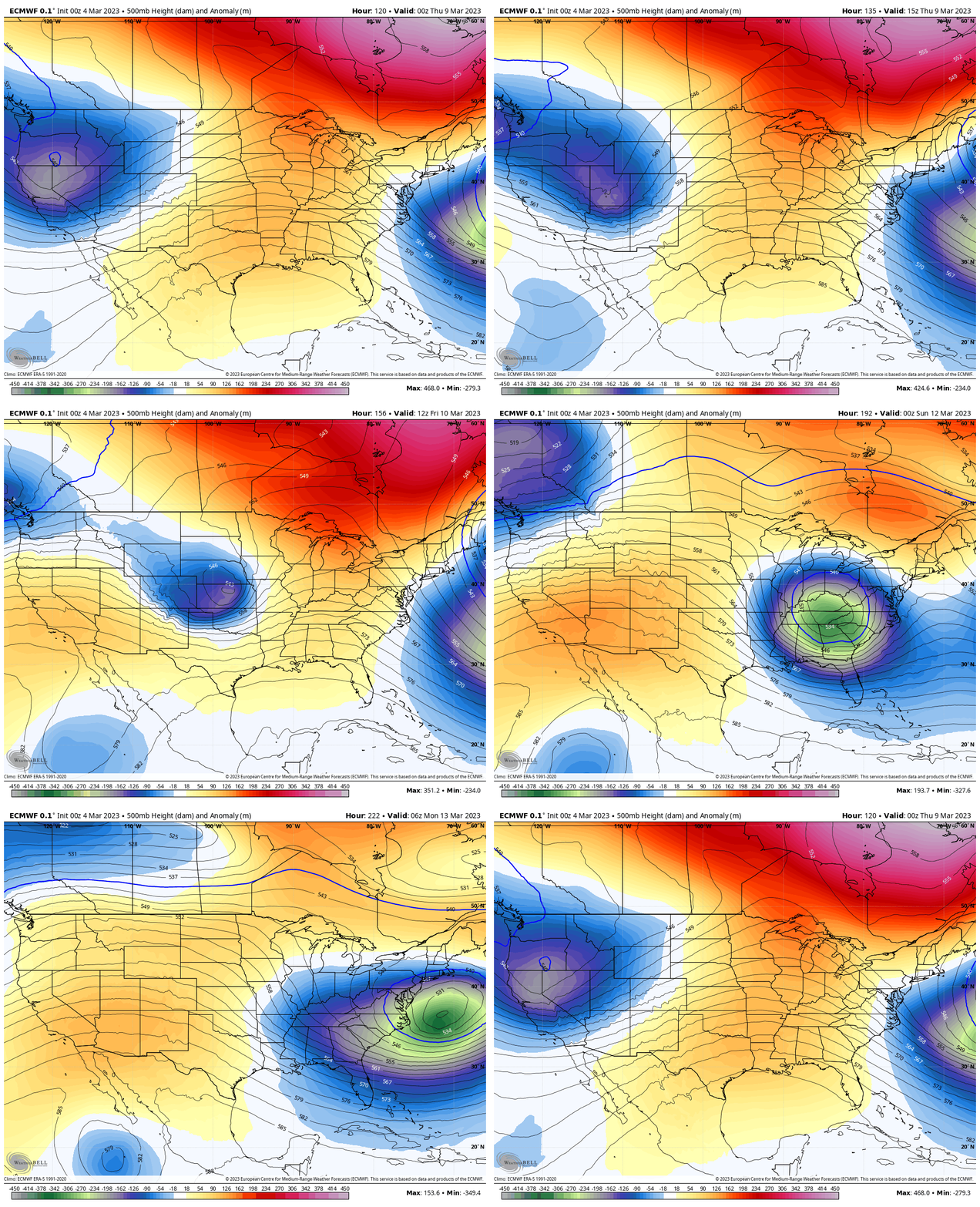
Jet Stream: Pattern Change
I know this has been expected many times this winter. Here we see it again and there is more ‘girth’ behind it.
Forecast Wednesday Evening To Monday Morning
Notice the Deep Trough (blue/green) building for the East Coast. That is the core of cold air and signal for a strong storm on the coast next weekend.
Jet Stream Snapshot Sunday
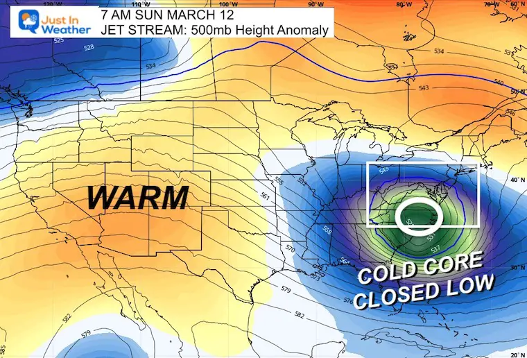
Storm Development?
ECMWF Model
Most events projected 1 week away have tended to verify farther north. So I am very skeptical of this. Just using this as a base to compare for daily trends.
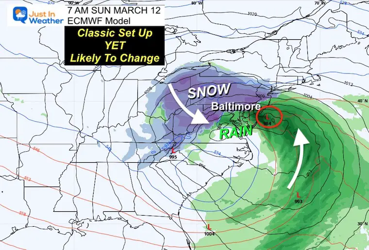
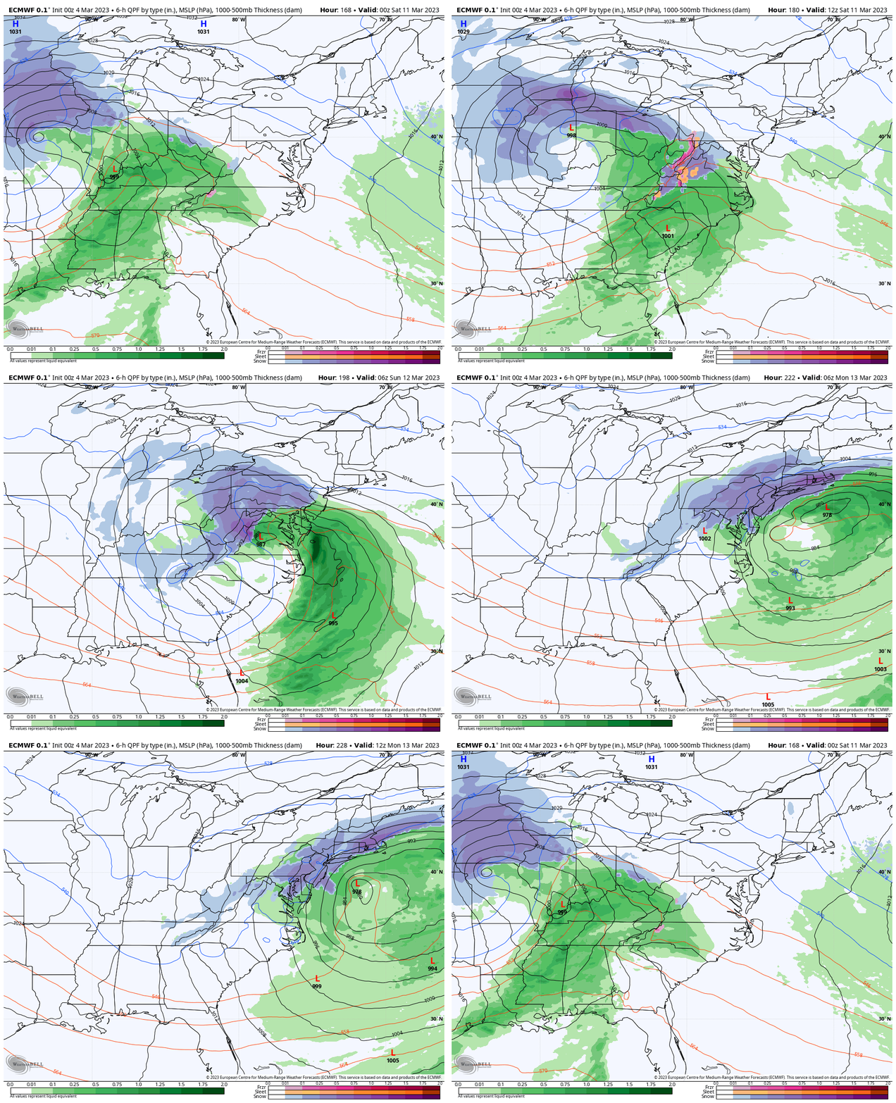
Animation: Friday Night to Monday Morning
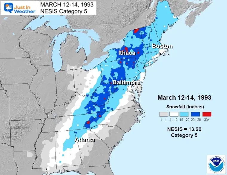
This solution from the European Model does suggest a long duration winter event. It comes on the anniversary of the 1993 Superstorm, but there is very good reason to be suspicious.
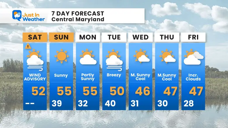
7 Day Forecast
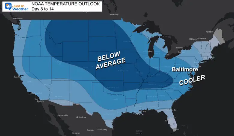
The noticeable mark on this outlook will be the cold front mid-week, trending cooler. This is what I mentioned in my March Outlook. It is possible to end up cooler than average and keep temps similar to most of this winter (when it was above average).
The potential storm I showed above may end up on Saturday and Sunday, so it’s not on this view yet.
EXPLORE MORE
RESTATING MY MESSAGE ABOUT DYSLEXIA
(I share this on my email newsletter)
I am aware there are some spelling and grammar typos, and other occasional glitches. I take responsibility for my mistakes, and even the computer glitches I may miss.
I have made a few public statements over the years, but if you are new here you may have missed it:
I have dyslexia, and found out during my second year at Cornell University. It didn’t stop me from getting my meteorology degree, and being the first to get the AMS CBM in the Baltimore/Washington region. One of my professors told me that I made it that far without knowing, so don’t let it be a crutch going forward. That was Mark Wysocki and he was absolutely correct! I kept it in my pocket hidden away until about 10 years ago.
I do miss my mistakes in my own proofreading. The auto-correct spell check on my computer sometimes does an injustice to make it worse. I can also make mistakes in forecasting. No one is perfect predicting the future.
All of the maps and information are accurate. The ‘wordy’ stuff can get sticky.
There has been no editor that can check my work when I need it and have it ready to send out in a newsworthy timeline. Barbara Werner is a member of the web team that helps me maintain this site. She has taken it upon herself to edit typos when she is able. I sincerely appreciate her for that. At times, her edits could be AFTER you read my posts.
I accept this and perhaps it proves what you read is really from me…
It’s part of my charm.
#FITF
Also See:
Winter History: Low Snow And Late Starts
See my research based on Baltimore data since 1883.
Subscribe for eMail Alerts
Weather posts straight to your inbox
Sign up and be the first to know!
STEM Assemblies/In School Fields Trips Are Back
Click to see more and ‘Book’ a visit to your school
My Winter Outlook: Not A Typical La Niña!
I see many factors to support colder influence with multiple systems. Early and later in winter. Check it out. https://justinweather.com/2022/11/22/winter-outlook-2023-for-snow-not-typical-la-nina-plus-polar-vortex-disruption/
Also See The Winter Outlook Series:
Farmer’s Almanac Comparison
September Starts Meteorological Autumn: Weather Climate Stats For Maryland at Baltimore
Triple Dip La Niña Winter
https://justinweather.com/2022/09/09/winter-outlook-2023-la-nina-triple-dip-expectations/
CONNECTION TO WINTER?
If you want a snowy winter, this is what you might want to look for in the rest of the tropical season. https://justinweather.com/2022/08/31/record-august-for-no-named-tropical-storms-closer-look-at-snow-following/
Woolly Bear Caterpillars
https://justinweather.com/2022/10/25/winter-weather-outlook-from-the-wooly-bear-caterpillar/
Persimmon Seeds
Click to see Top 20 and MORE
Normals And Records: Maryland and Baltimore Climate History
Please share your thoughts, best weather pics/videos, or just keep in touch via social media
-
-
Facebook: Justin Berk, Meteorologist
-
Twitter: @JustinWeather
-
Instagram: justinweather
-


