February 24 Colder Winds Today And Light Snow Saturday
February 24, 2023
Friday Morning
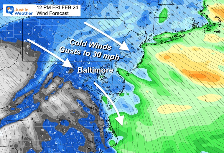
After reaching that record high yesterday (79ºF in Baltimore if you missed the report), today is our transition. Colder winds will gust to 30 mph and bring back a reality check. As the thermometer falls this morning, it should remain nearly steady this afternoon, then drop us below freezing by Saturday morning.
That will set us up for light snow. There is more agreement of the energy that will produce a few hours of light snow. The ambience and contrast to the recent heat is the main story. It will last a few hours, but struggle with stickage. We could get a coating on the grass, but roads will likely remain wet for most of the region Saturday afternoon.
What will follow will be a bump back to the mild air including another rain storm on Monday.
First Look:
I want to try something different this morning. WE will take a broad view, then a closer look below.
Morning Surface Weather
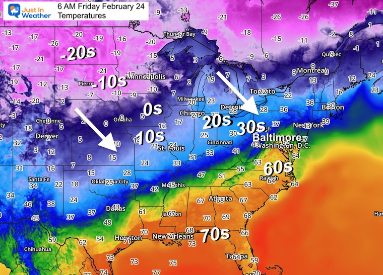
There is an arctic air mass spreading in this morning and we are just now getting the drop in temps.
The next system does not look like much, so let’s watch how it is forecast to evolve below.

Storm Animation
Friday Evening to Saturday Evening
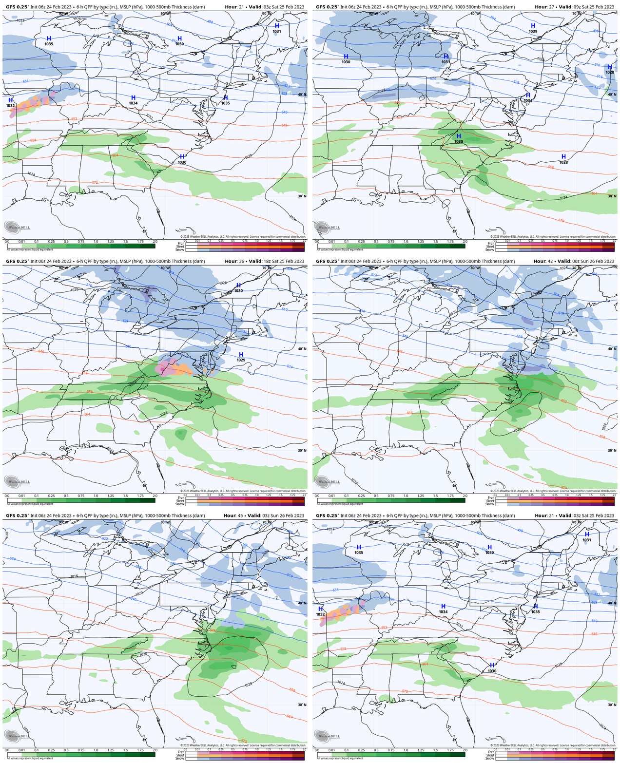
The notion is that the southern energy will pass directly over the Mid Atlantic with some merging of the northern branch of the jet stream. This will allow the enhancement, which will peak mid day Saturday.
Morning Temperatures
This helps show the arctic air over the northern plains where they have a few feet of snow. This is helping to refrigerate the atmosphere and allow that cold air to reach us.
Local Temperatures
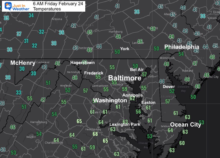
Colder air is on the move….
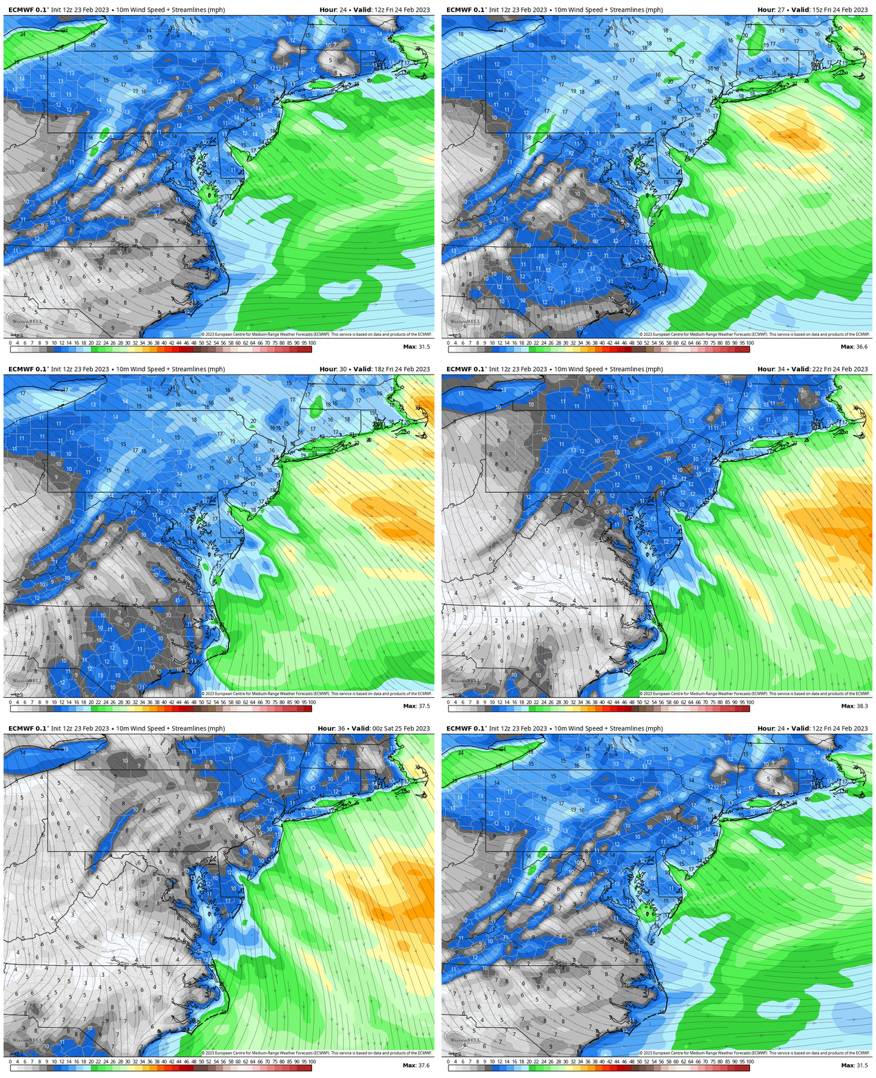
Wind Forecast: 7 AM to 7 PM
Strong winds from the Northwest will bring the reality check back in, holding temps near average into the afternoon.
Wind Forecast Snapshot
While winds will average 10 to 20 mph, we will have gusts to 30 mph. After near 80ºF yesterday, it will definitely FEEL Chilly!
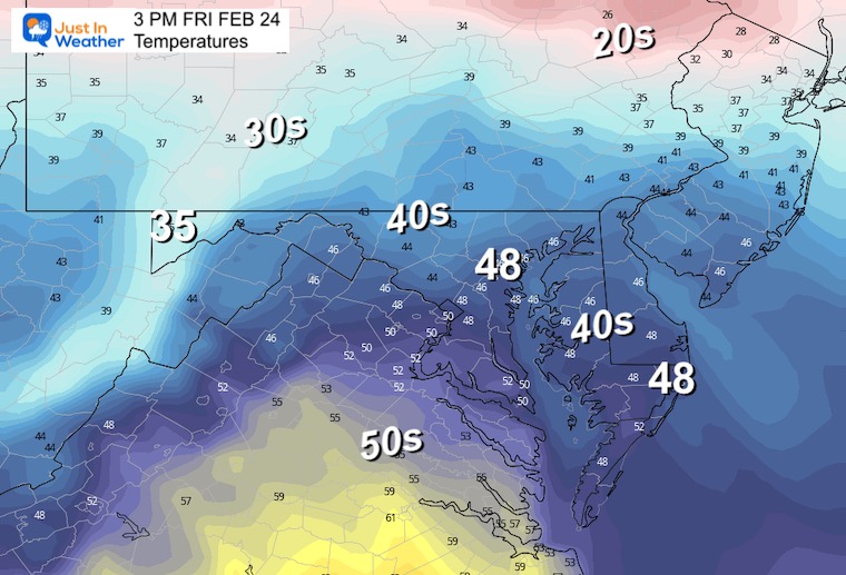
Afternoon Temperatures
Subscribe for eMail Alerts
Weather posts straight to your inbox
Sign up and be the first to know!
CLIMATE DATA
TODAY February 24
Normal Low in Baltimore: 29ºF
Record 2ºF in 1873
SNOW: 8.1” in 1966
Normal High in Baltimore: 49ºF
Record 79ºF in 1985
Saturday Weather
There is more agreement among the modeling that a few hours of light snow will spread across much of the region. Given the recent warmth, and the time of day, it is likely to end up with wet roads but perhaps a coating on the grass.
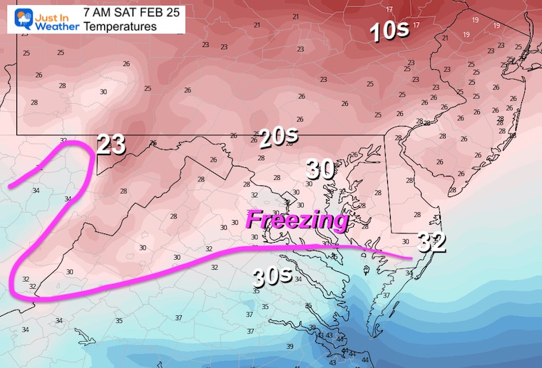
Temperatures Morning
Freezing air will extend through most of our region.
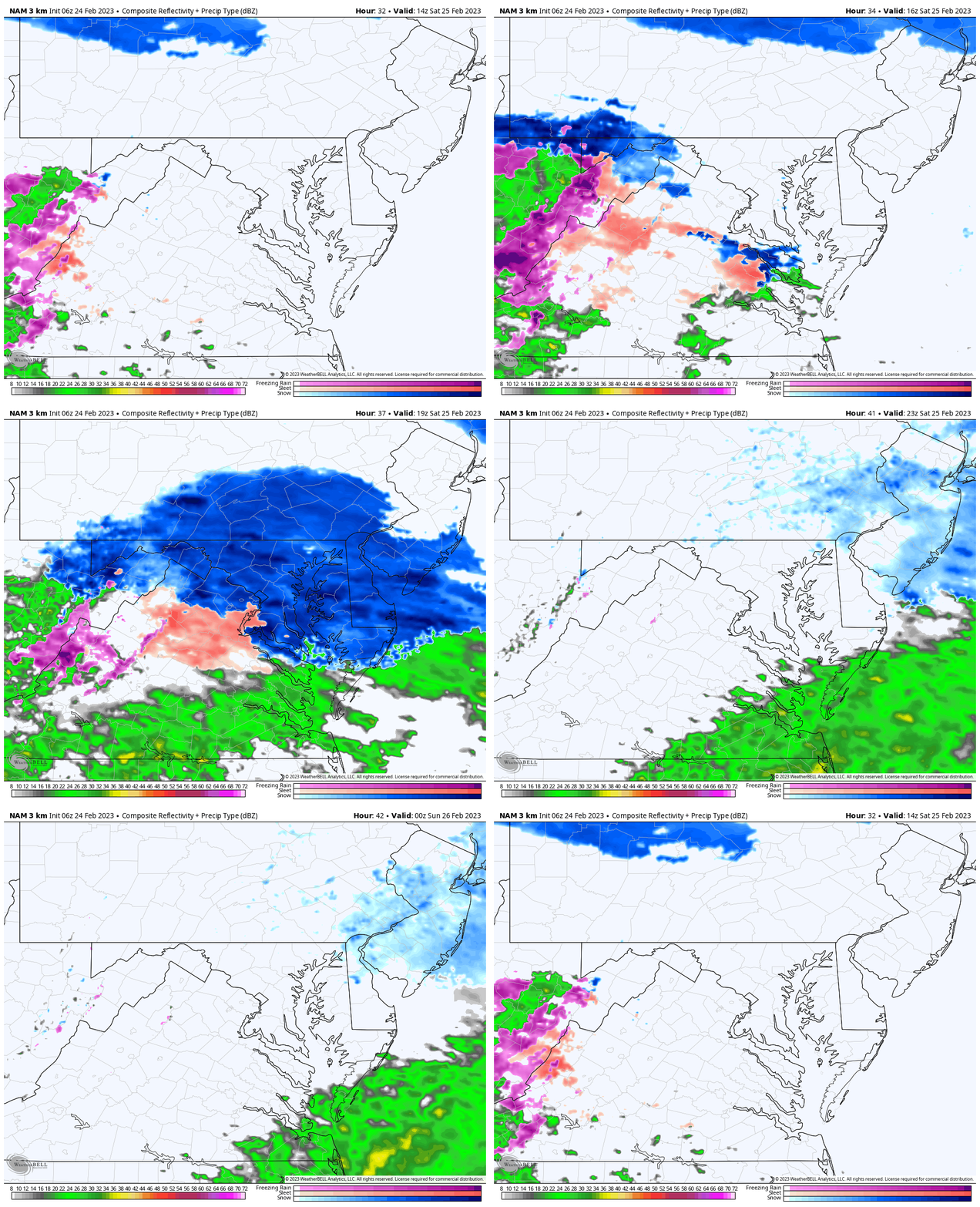
Radar Simulation
NAM 3 Km 9 AM to 7 PM
The best chance for light snow is from late morning through mid afternoon. Most locations will have a 2 to 4 hour window as it passes by.
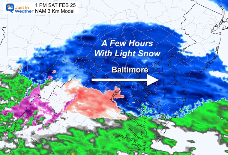
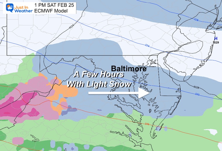
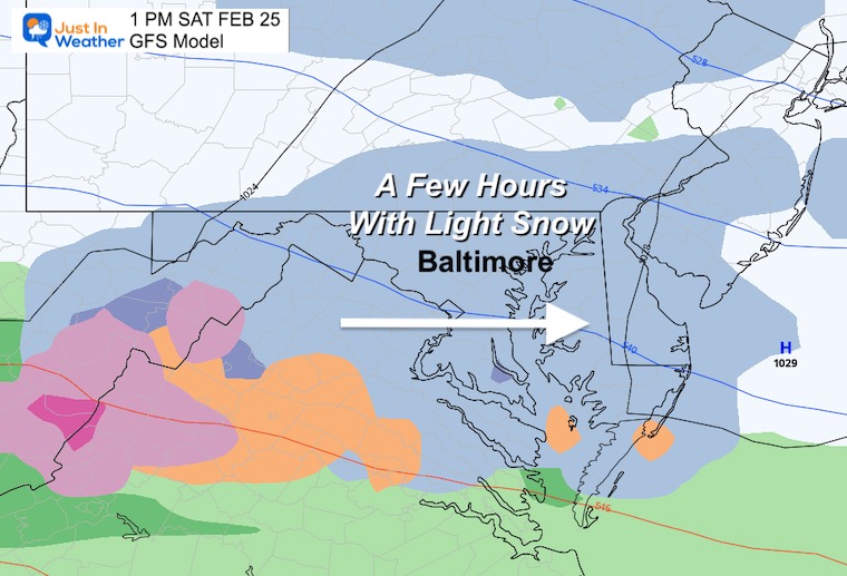
Snapshots at 1 PM
Note: This a blend of a few hours, peaking around lunchtime.
NAM 3 Km
This looks heavier on the display, but I’d call it light snow. Some areas may get a heavier burst briefly.
ECMWF Model
This has come around agreeing with shifting the southern energy farther north.
GFS Model
This is still more aggressive, but closer in line with the European model above.
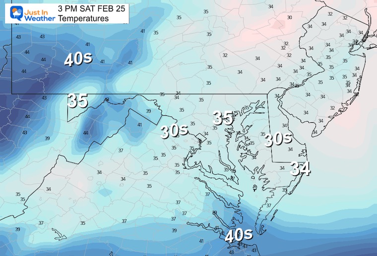
Afternoon Temperatures
It will be a chilly day, but getting above freezing. This will assist with melting and limiting stickage to the grassy areas.
Next Storm: Same Track Brings Us Rain
Monday Morning To Tuesday Evening
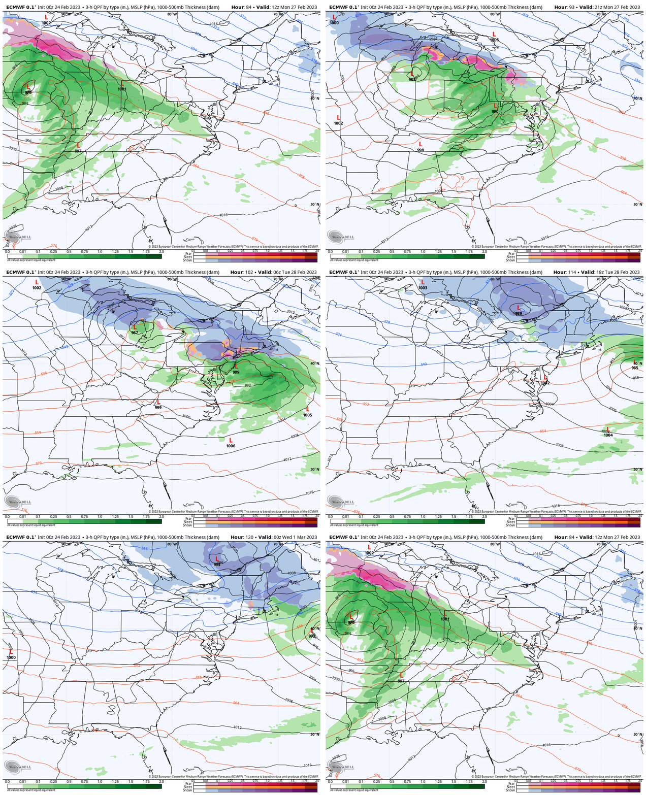
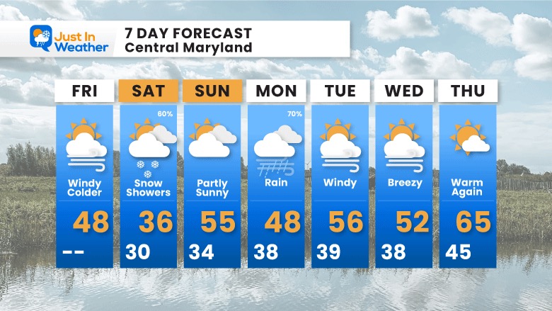
7 Day Forecast
The taste of winter on Saturday will be a blip, as we will be back to mild air with rain on Monday and the rest of the week that follows.
Also See:
Winter History: Low Snow And Late Starts
See my research based on Baltimore data since 1883.
Subscribe for eMail Alerts
Weather posts straight to your inbox
Sign up and be the first to know!
STEM Assemblies/In School Fields Trips Are Back
Click to see more and ‘Book’ a visit to your school 
My Winter Outlook: Not A Typical La Niña!
I see many factors to support colder influence with multiple systems. Early and later in winter. Check it out. https://justinweather.com/2022/11/22/winter-outlook-2023-for-snow-not-typical-la-nina-plus-polar-vortex-disruption/
Also See The Winter Outlook Series:
Farmer’s Almanac Comparison
September Starts Meteorological Autumn: Weather Climate Stats For Maryland at Baltimore
Triple Dip La Niña Winter
https://justinweather.com/2022/09/09/winter-outlook-2023-la-nina-triple-dip-expectations/
CONNECTION TO WINTER?
If you want a snowy winter, this is what you might want to look for in the rest of the tropical season. https://justinweather.com/2022/08/31/record-august-for-no-named-tropical-storms-closer-look-at-snow-following/
Woolly Bear Caterpillars
https://justinweather.com/2022/10/25/winter-weather-outlook-from-the-wooly-bear-caterpillar/
Persimmon Seeds
Click to see Top 20 and MORE
Normals And Records: Maryland and Baltimore Climate History
Please share your thoughts, best weather pics/videos, or just keep in touch via social media
-
-
Facebook: Justin Berk, Meteorologist
-
Twitter: @JustinWeather
-
Instagram: justinweather
-


