Winter Weather Pattern Shift Begins Sunday Into Next Week
January 18 2023
Wednesday Night Update
I have waited a few days to do a weather outlook for this pattern change. I had been locked in on around January 22, but wanted to wait until we got closer for a few reasons. First, I am approaching this with skeptical optimism. Yes, I am a weather guy that loves snow and winter sports. But I do not wish cast for the same personal and professional reasons: I want to get what I expect, not be disappointed.
The computer model guidance has been lackluster with snow potential beyond 5 days… Which brings us to this post.
We have a rain event in the eastern US for Thursday, then we look for the storm track to shift. This will begin on Sunday, then a follow up event next week that is appearing to shift south. This is a brief look at what the projections look like. Now we can start to track closer for trends.
Record Cold Building
We often look to Siberia for the source of arctic air that can spill across the Northern Hemisphere. This station broke its record 3 times already, and the coldest in Russia since 1982.
Siberia is getting colder and colder. 🥶 There was -62.7°C in Tongulakh this morning. This station broke its absolute minimum record for the third time of this month. It is coldest temperature recorded in Russia in January since 1982. https://t.co/Ybg6LALhYF pic.twitter.com/cNZE637dz7
— Ventusky (@Ventuskycom) January 18, 2023
Jet Stream: North America
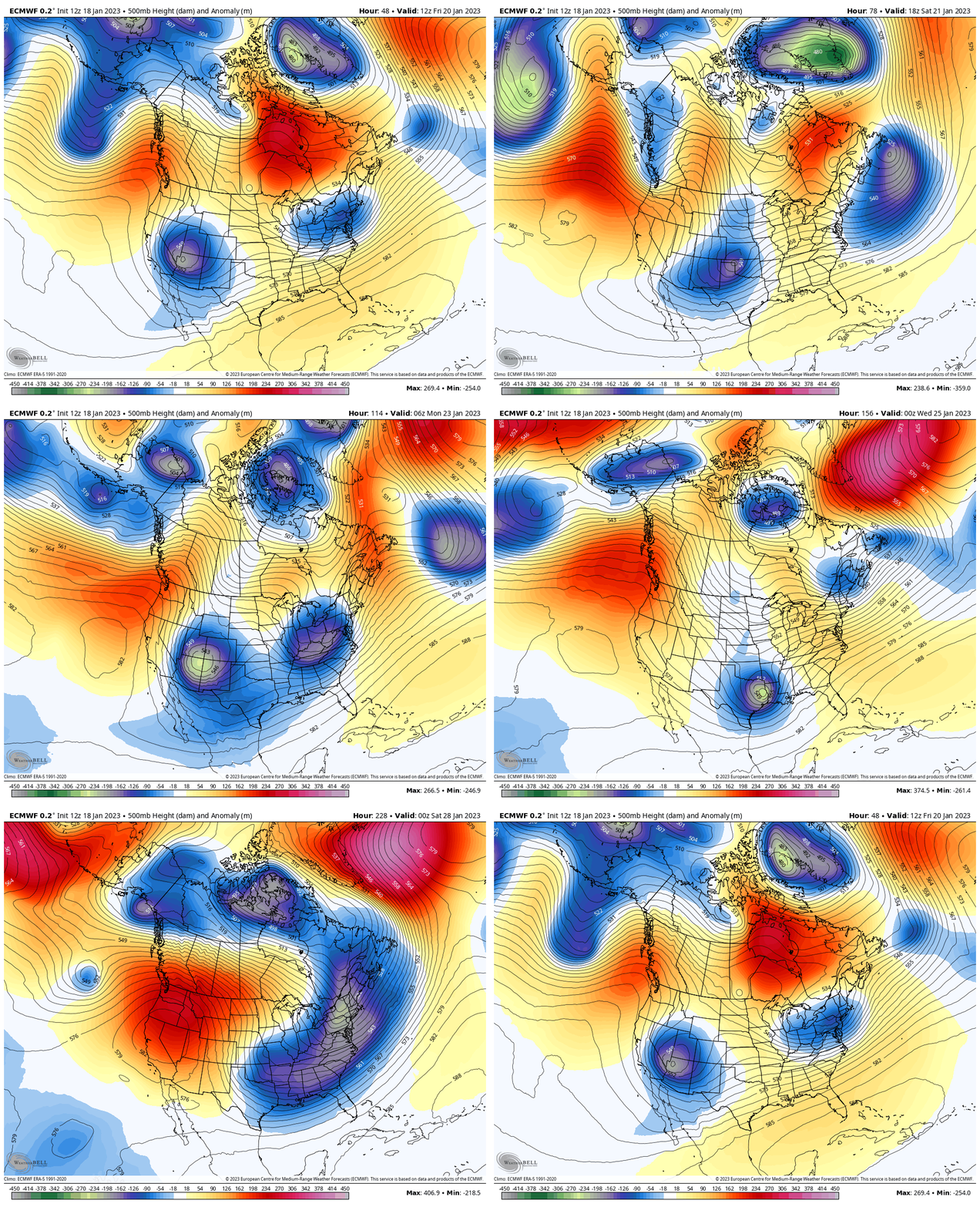
7 AM Fri Jan 20 to 7 AM Sat Jan 28
This is the European ECMWF Model looking out 10 days. Here it is showing the Eastern Ridge getting beat down, as the Polar Vortex gets stretched out and some of the arctic air will spill into Eastern North America (for us on the US East Coast).
Jet Stream United States
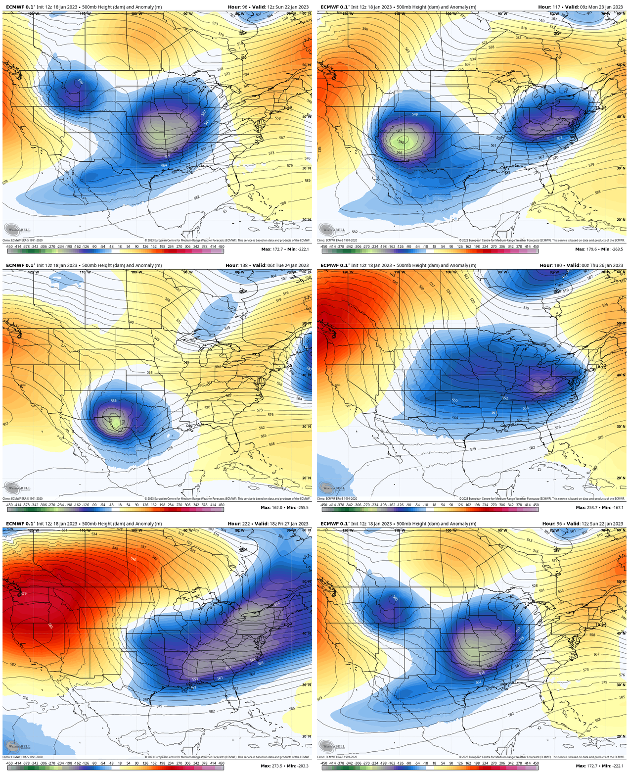
7 AM Sun Jan 22 to 7 AM Sat Jan 28
This helps show a better perspective for the eastern US.
Snapshots Corresponding To Winter Weather Events
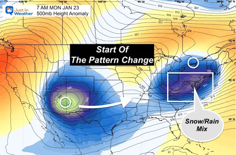
7 AM Monday
This will be following the end of weekend event. While we will see a wintry mix with rain likely for the cities and coast, it will help set up the pattern for what follows.
That next storm will move from the South West US during the week.
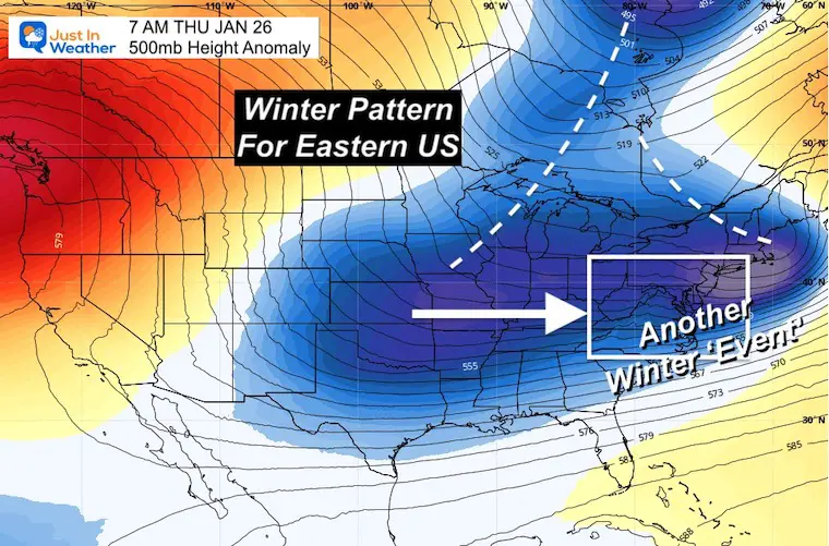
7 AM Thursday
This is the large trough for the Eastern US extending to a stretched out Polar Vortex at the end of next week.
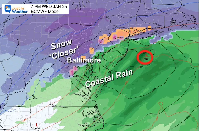
I know this is more than one week away, so I hesitate with any surface reflection (storm specifics). However, this is a good suggestion it will be colder, with snow closer to the cities.
Surface Storm Simulation
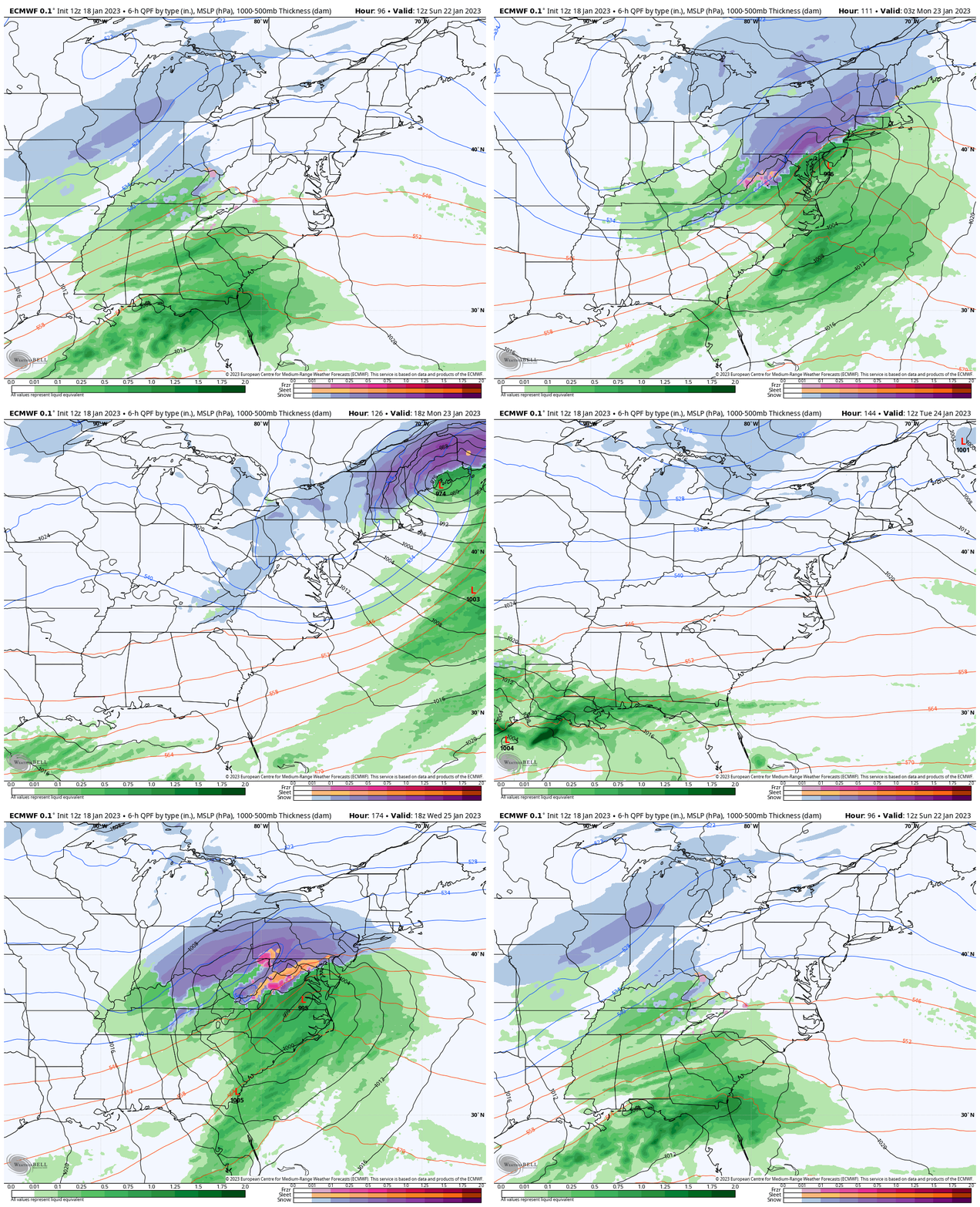
ECMWF Model: 7 AM SUN Jan 22 to 7 PM WED Jan 25
This model has the highest accuracy, but I still hesitate with specifics given the poor performance (so far) this winter.
For this exercise, we simply see the two storms across the Mid Atlantic with the second one bringing snow (blue) farther south and east.
Snapshots Sunday Night
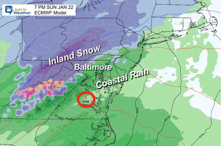
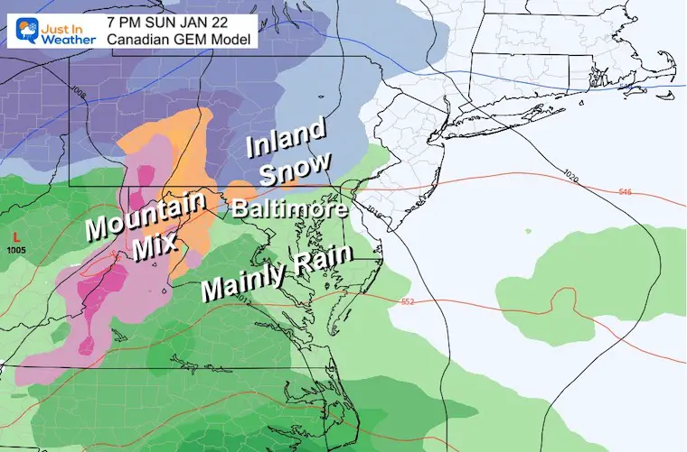
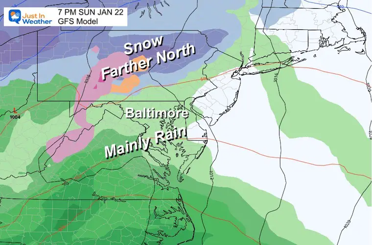
Please Note: The timing and snow line are likely to shift as we get closer.
ECMWF Model
This shows a realistic snow line west of Baltimore where the elevation is above 600 Ft. This is more likely early in a normal winter with warm ground and Bay temperatures. That mimics where we are now.
Canadian GEM
This is very similar to the European Model.
GFS Model
This has been a thorn in our side AND the model that is most likely used in your weather apps. So if you see a warm rain, this is why….
It has the system farther north with the snow also retreating farther north.
Looking Farther Ahead
Thursday Morning
I have less confidence in this look over one week ahead, but I wanted to simply show you the comparison…. Essentially the shift of the snow/mix line through Baltimore. This is definitely something to watch.
My Thoughts:
Yes, the pattern is changing and is on point with the ‘adjusted’ schedule. Please don’t ask how much snow we will get (yet). It is too soon to speculate. However, when we finally break the seal on winter, it is important to consider we have a warm ground and warm water nearby on the Bay. I will factor those in and let you in on how computer modeling may over estimate potential due to formula bias towards climatology (normal winters).
If you have held on to your Faith in the Flakes, this is what is all about: Most years, even when it looks bleak, winter will show up… eventually.
Subscribe for eMail Alerts
Weather posts straight to your inbox
Sign up and be the first to know!
Faith in the Flakes Gear
What is Faith in the Flakes?
It began with my son in 2009
SNOWSTIX – Available Now
STEM Assemblies/In School Fields Trips Are Back
Click to see more and ‘Book’ a visit to your school
My Winter Outlook: Not A Typical La Niña!
I see many factors to support colder influence with multiple systems. Early and later in winter. Check it out.
Also See The Winter Outlook Series:
Farmer’s Almanac Comparison
September Starts Meteorological Autumn: Weather Climate Stats For Maryland at Baltimore
Triple Dip La Niña Winter
CONNECTION TO WINTER?
If you want a snowy winter, this is what you might want to look for in the rest of the tropical season. (You might be seeing a lot of commercial snow removal people out this Winter).
Rainbow Ice Cave In Mt. Rainier A Very Rare Find: Photos And Video
Wooly Bear Caterpillars
https://justinweather.com/2022/10/25/winter-weather-outlook-from-the-wooly-bear-caterpillar/
Persimmon Seeds
Click to see Top 20 and MORE
Winter Weather Folklore Top 20 And More Outlook Signals From Nature For Cold And Snow
Normals And Records: Maryland and Baltimore Climate History
Please share your thoughts, best weather pics/videos, or just keep in touch via social media
-
Facebook: Justin Berk, Meteorologist
-
Twitter: @JustinWeather
-
Instagram: justinweather


