January 7 Cooler Breeze And Slushy Snow Back Closer To Normalcy
January 7 2023
Saturday Morning Report
Back to reality this weekend as more typical January weather has returned. We will get a cooler breeze today as temps stay in the 40s this afternoon.
We do not have a major cool down, but we will be on the marginal edge of freezing with the next weather system.
As of now, I see consistency in the split between the models as the individual outputs have been persistent. There is a good chance to see snow falling Sunday evening, but the ground is still warm so any road impact will be unlikely with the exception of higher elevations inland.
The week ahead is NOT our pattern change we have discussed. That is still for later this month. This week will be more seasonal as the dangling storm carrot will shoot to Friday. I’ll explain.
Climate Note: January Blizzard 1996
This is the Anniversary of the historic snow storm across the Mid Atlantic, followed by an overachieving clipper.
It produced 3-DAYS in a row of record snow that is still on the ‘books’.
- January 7=15.8”
- January 8 = 6.7”
- January 9 = 4.1”
Local Snow Totals: From The National Weather Service
Metro Baltimore and inland suburbs received between 2 and 3 FEET of snow.
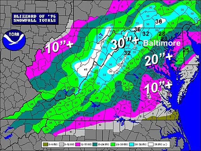
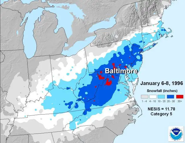
Mid Atlantic Storm Total Impact: From NOAA
This was considered a High Impact Event!
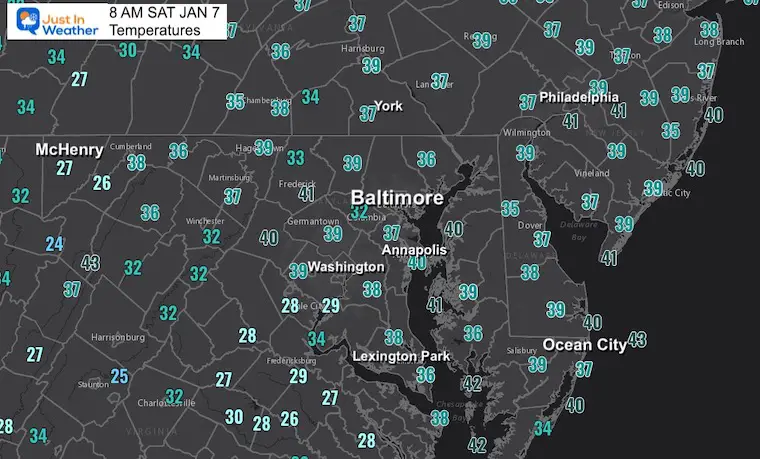
Morning Temperatures
This is more like it and very beneficial to southern PA Mountains blowing snow on the slopes. There is ‘skiable terrain’, but they will get more help with colder nights and mornings in the week ahead.
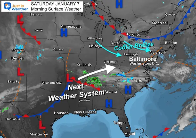
Surface Weather
Winds will pick up today and with the cooler air it will be noticeable.
The next weather system is centered in Arkansas this morning. That will head our way for Sunday evening. That track south or overhead is the question on the table we will look at below.
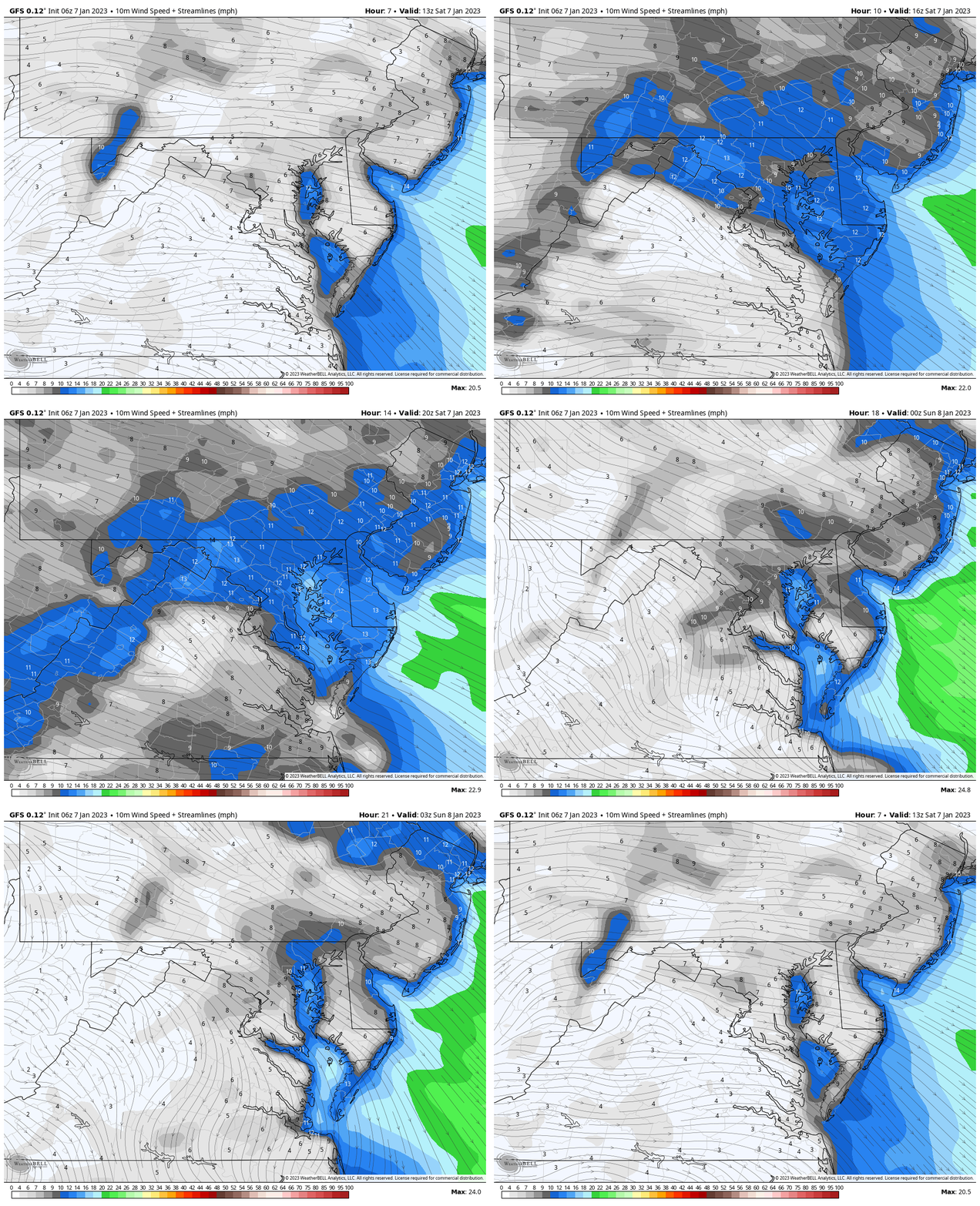
Wind Simulation – NAM 3 Km Model
8 AM to 10 PM
Winds between 10 to 20 mph with gusts of 25 mph or higher are possible today.
3 PM Temperatures
The high temperature may be earlier in the afternoon as the winds and variable clouds usher in the cool down.
Subscribe for eMail Alerts
Weather posts straight to your inbox
Sign up and be the first to know!
CLIMATE DATA
TODAY January 7
Normal Low in Baltimore: 26ºF
Record 1ºF in 2018
SNOW: 15.8” 1996
Normal High in Baltimore: 43ºF
Record 74ºF 1907
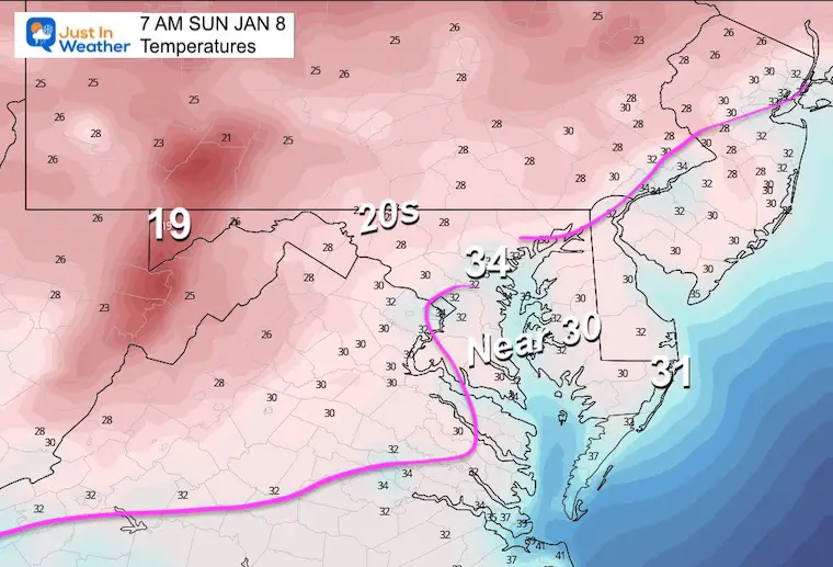
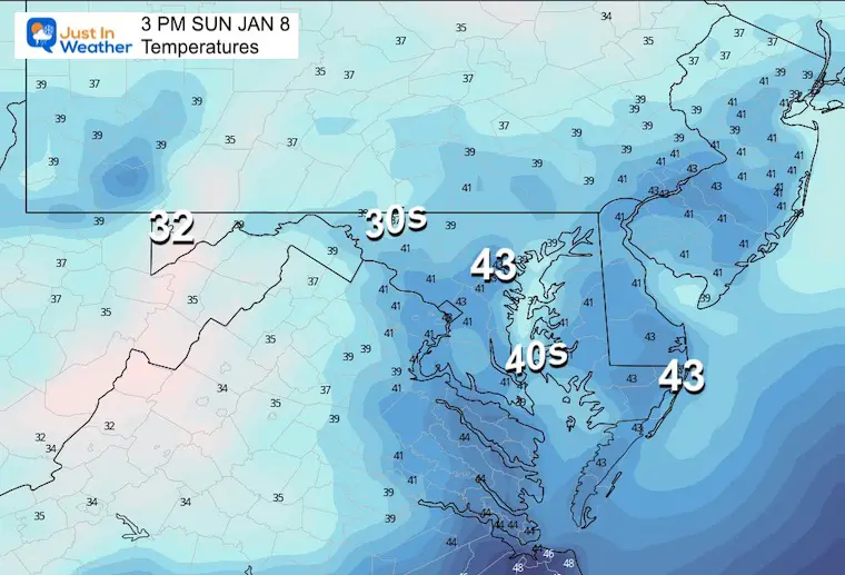
Sunday Temperatures
Morning
There will be a few hours below freezing to chill down some of the pavement inland.
Afternoon
Back above freezing during the day for most east of the mountains.
Sunday Sunday Simulations
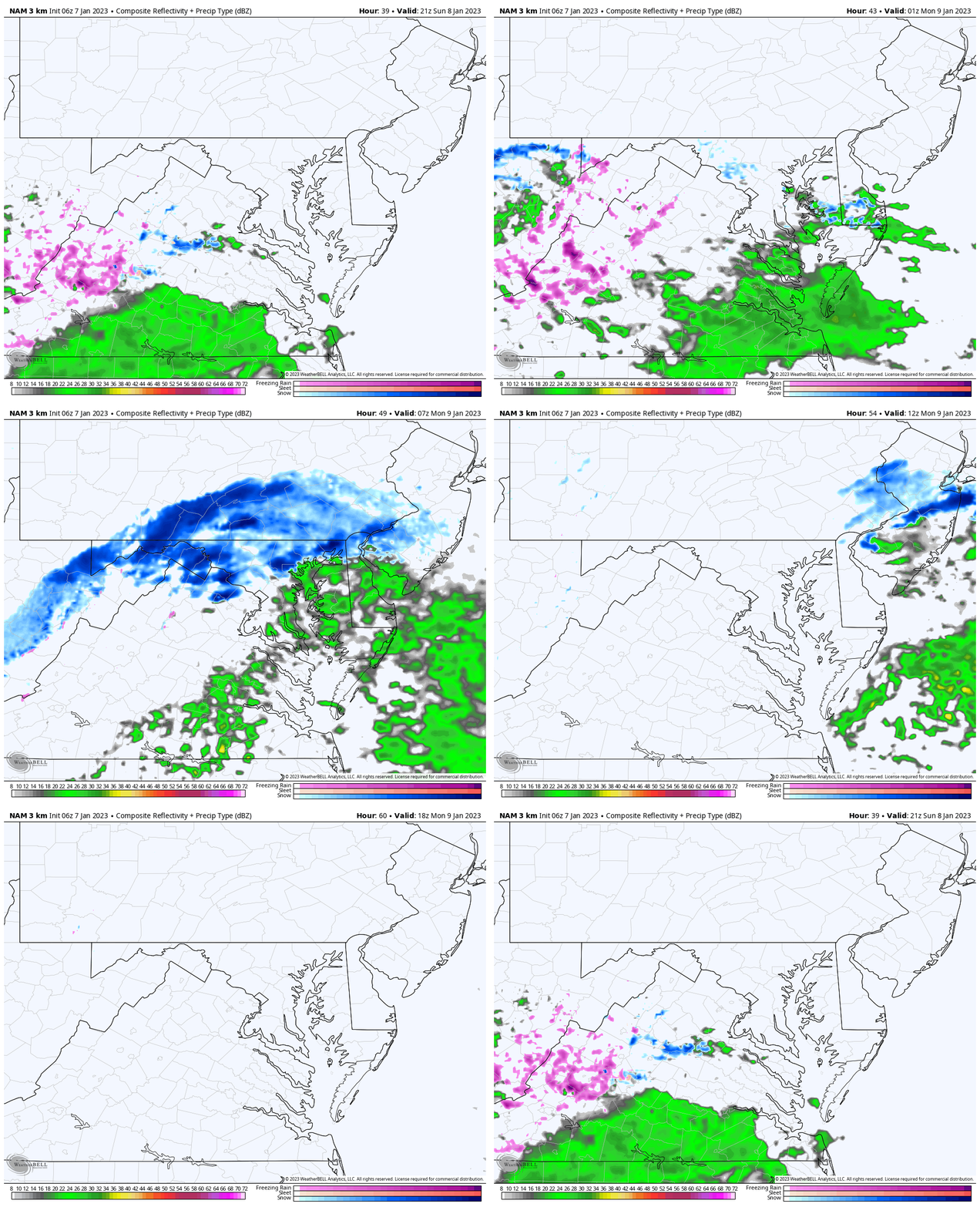
NAM 3 Km 4 PM SUN to 1 PM MON
Note: This shows snow falling, but does NOT account for melting or stickage.
Suggestion: Snow or mix develops in metro areas between 5 PM and 8 PM.
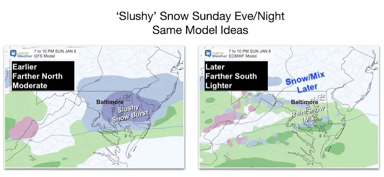
Main Model Comparison
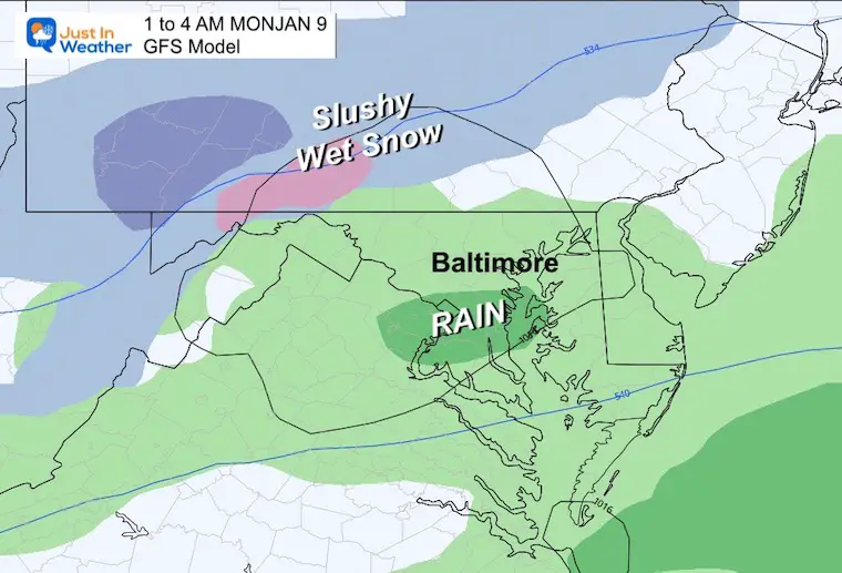
Both the GFS (American) and ECMWF (European) Models are still showing snow. The GFS is farther north and persistent with a heavier snow burst for a few hours. The ECWMF is farther south and weaker.
These are the major players I have been showing you. Let’s take a little closer look.
GFS Model Animation
1 PM SUN to 7 AM Mon
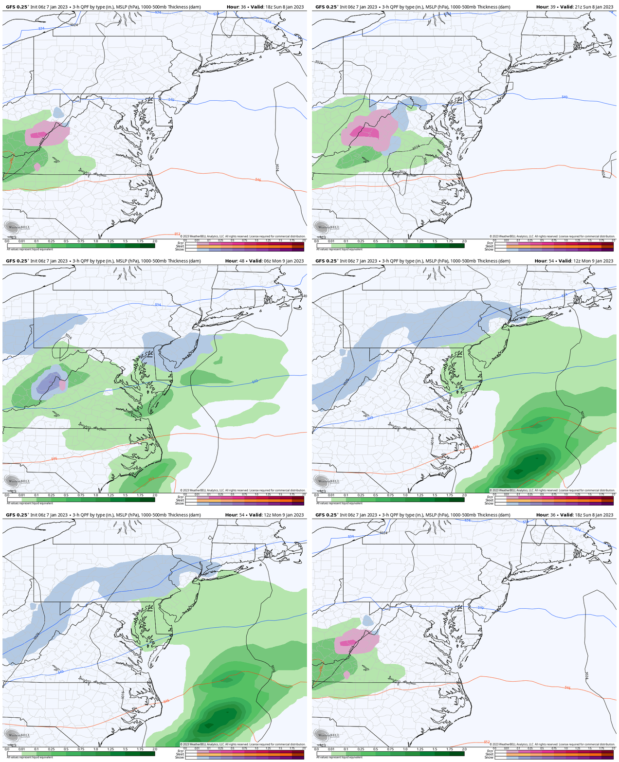
Snapshots
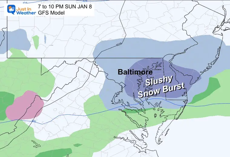
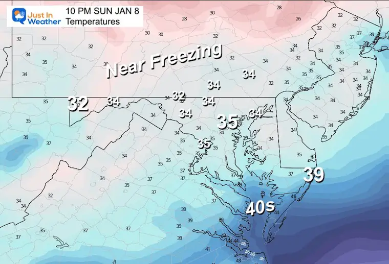
10 PM
A more aggressive slushy snow burst across central Maryland and Delmarva. This is based on a faster system catching up to the back edge of our chilly air mass.
Temperatures
Where is the freezing air? Not much of it on the surface. Combine this with the warm week we just had, and the roads still retaining that warmth, so melting is expected.
If there is a burst of moderate snow, there is a chance for stickage on the grass and maybe some slush on pavements west and north close to 1000 Ft elevation.
1 AM Monday
The transition to rain is likely with the exception of snow in the mountains of western Maryland and Pennsylvania.
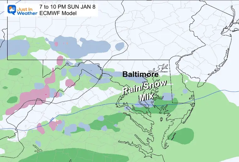
ECMWF Model
This plot is a little slower and farther south. The result is a weaker system, so even less ‘snow or mix’ to speak of.
Sunday Evening
A slower arrival would come in later. So this leading edge only shows light mixed precipitation.
Early Monday Morning
This slower solution comes in later, but still shows some snow for the inland suburbs west and north of Baltimore…
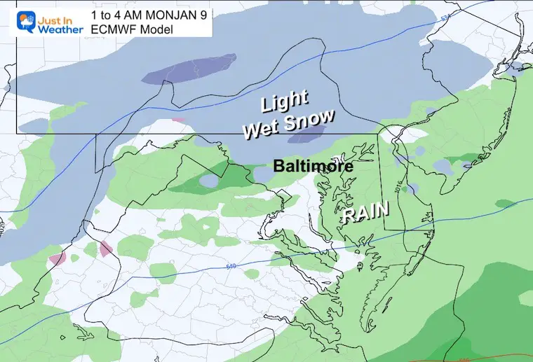
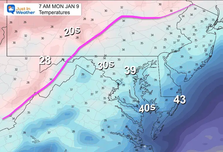
Monday Morning Temperatures
Above freezing means no road impact.
My Thoughts:
The GFS Model has lost some edge by overplaying a few events. This included that pre-Christmas Flash Freeze front.
I think a hybrid between these solutions is best, but it is important to see which is closer because: As we look at the next potential storm, the timing, and track south or north can result in a better handle on rain or snow Friday.
Looking Ahead:
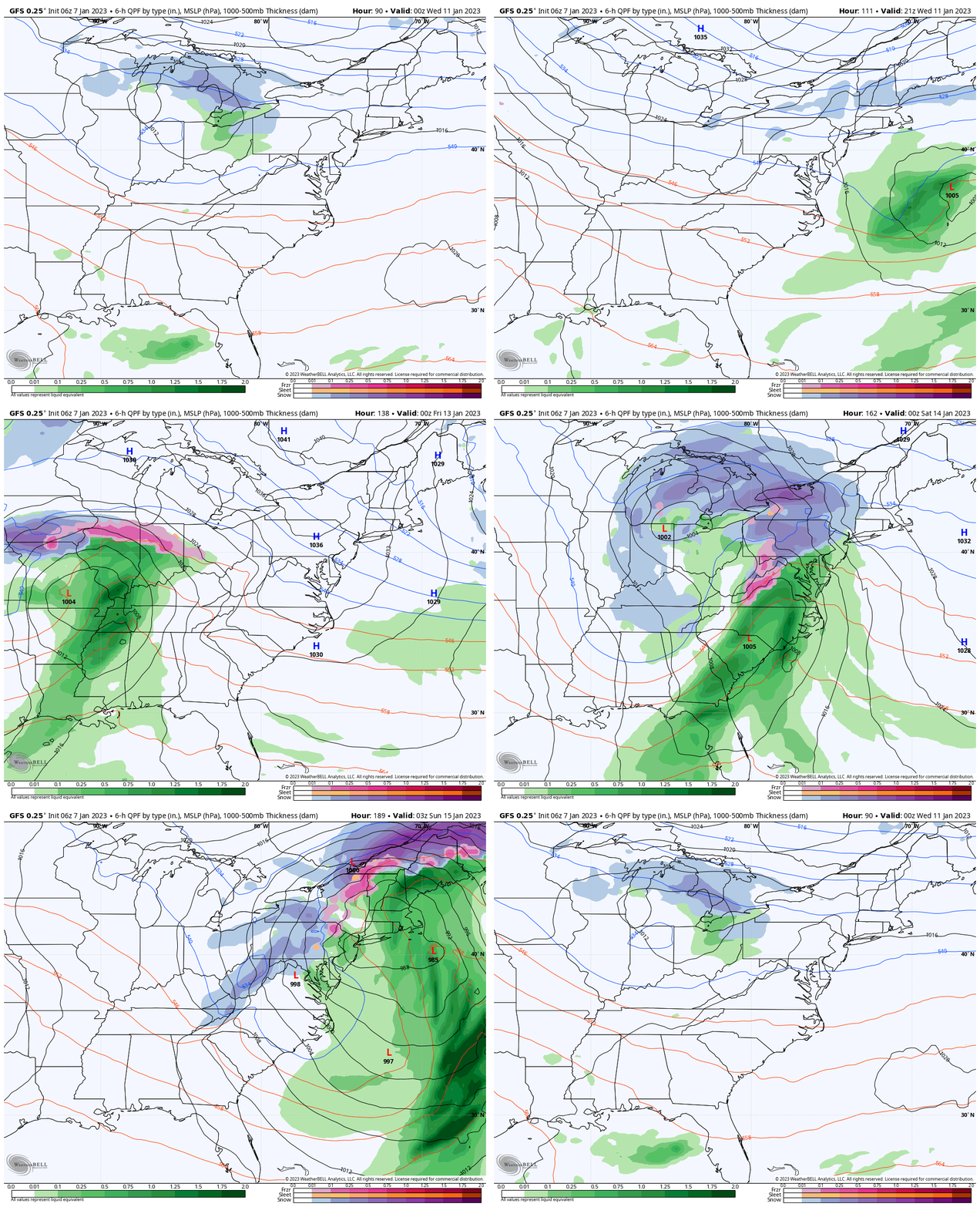
I am showing the GFS again because this American Model is the basis for weather on most weather apps, so it reflects what you may be seeing on your phone.
A brief shower is expected Wednesday morning, and a larger storm on Friday into Saturday. At this point, it may start and end with some snow, but rain in the middle. I expect this solution to change, but how is dependent on the timing and track. That is the work ahead this week… and the Sunday system may lead us with more guidance to see which model is handling the atmosphere better.
7 Day Forecast
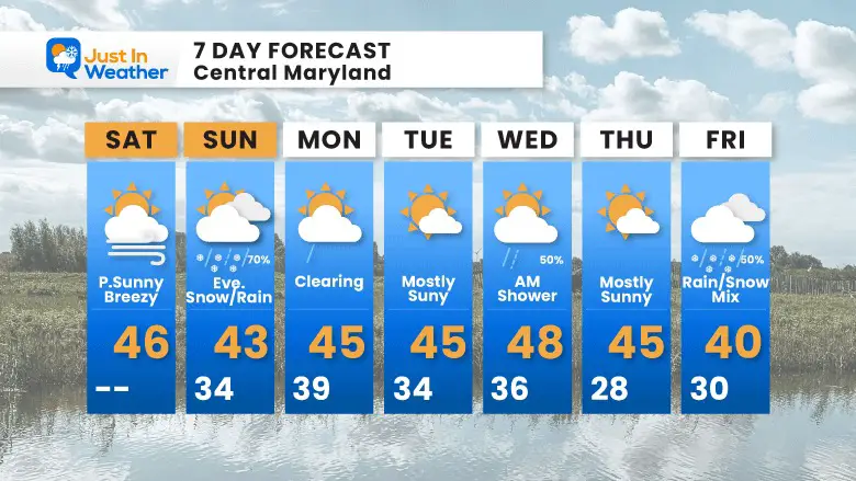
Next week will be closer to normal. That is cooler, but not arctic cold. As I discussed in a few prior reports: The month will be mild, but the trend is for more wintry for the later part of January.
Faith in the Flakes Gear
What is Faith in the Flakes?
It began with my son in 2009
October 27 Nor’easter Recap Still Breezy Then Next Storm Friday
SNOWSTIX – Available Now
STEM Assemblies/In School Fields Trips Are Back
Click to see more and ‘Book’ a visit to your school
My Winter Outlook: Not A Typical La Niña!
I see many factors to support colder influence with multiple systems. Early and later in winter. Check it out.
October 27 Nor’easter Recap Still Breezy Then Next Storm Friday
Also See The Winter Outlook Series:
October 27 Nor’easter Recap Still Breezy Then Next Storm Friday
Farmer’s Almanac Comparison
September Starts Meteorological Autumn: Weather Climate Stats For Maryland at Baltimore
Triple Dip La Niña Winter
CONNECTION TO WINTER?
If you want a snowy winter, this is what you might want to look for in the rest of the tropical season. (You might be seeing a lot of commercial snow removal people out this Winter).
Rainbow Ice Cave In Mt. Rainier A Very Rare Find: Photos And Video
Wooly Bear Caterpillars
https://justinweather.com/2022/10/25/winter-weather-outlook-from-the-wooly-bear-caterpillar/
Persimmon Seeds
Click to see Top 20 and MORE
Winter Weather Folklore Top 20 And More Outlook Signals From Nature For Cold And Snow
Normals And Records: Maryland and Baltimore Climate History
Please share your thoughts, best weather pics/videos, or just keep in touch via social media
-
Facebook: Justin Berk, Meteorologist
-
Twitter: @JustinWeather
-
Instagram: justinweather


