


January 4 Weather One More Cold Day Then January Thaw By Mid Week
Sunday, January 4, 2026 Overnight, there were some snow showers that crossed the region. I would not be surprised if there are reports of a fresh dusting of snow on…
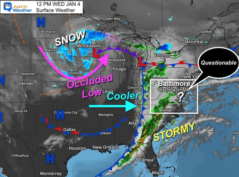
12 PM Wednesday January 4 2023
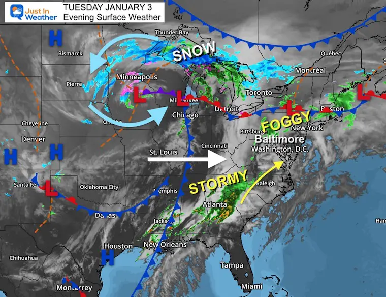
I am baffled by the morning short-range model update for the rain and possible thunderstorms today. The remnant energy from the active cold front and storm complex that produced severe weather is crossing to the coast today.
It had supported a line of rain and even promoted the potential rumbles of thunder with its passage this afternoon.
That is still possible, but the product of the latest model update is surprising. I truly do not know if it got bad data or is on to a more accurate solution. I will study the results to improve my understanding of the computer guidance benefits and flaws for future events. In this case, I am just a spectator and taking you on the ride. So let’s look.
Below is a brief comparison and the Live Doppler Radar Widget to keep tracking through the afternoon.
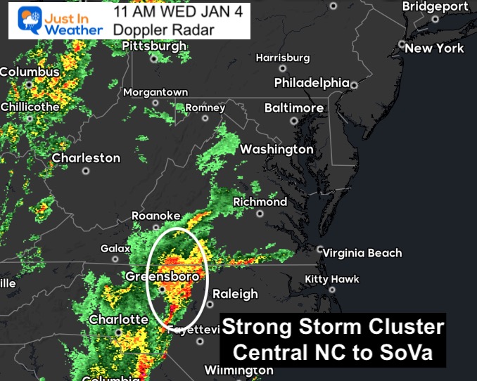
This showed a cluster of heavy rain from central North Carolina to south-central Virginia.
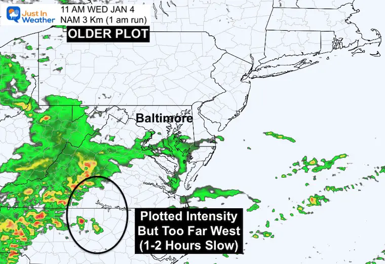
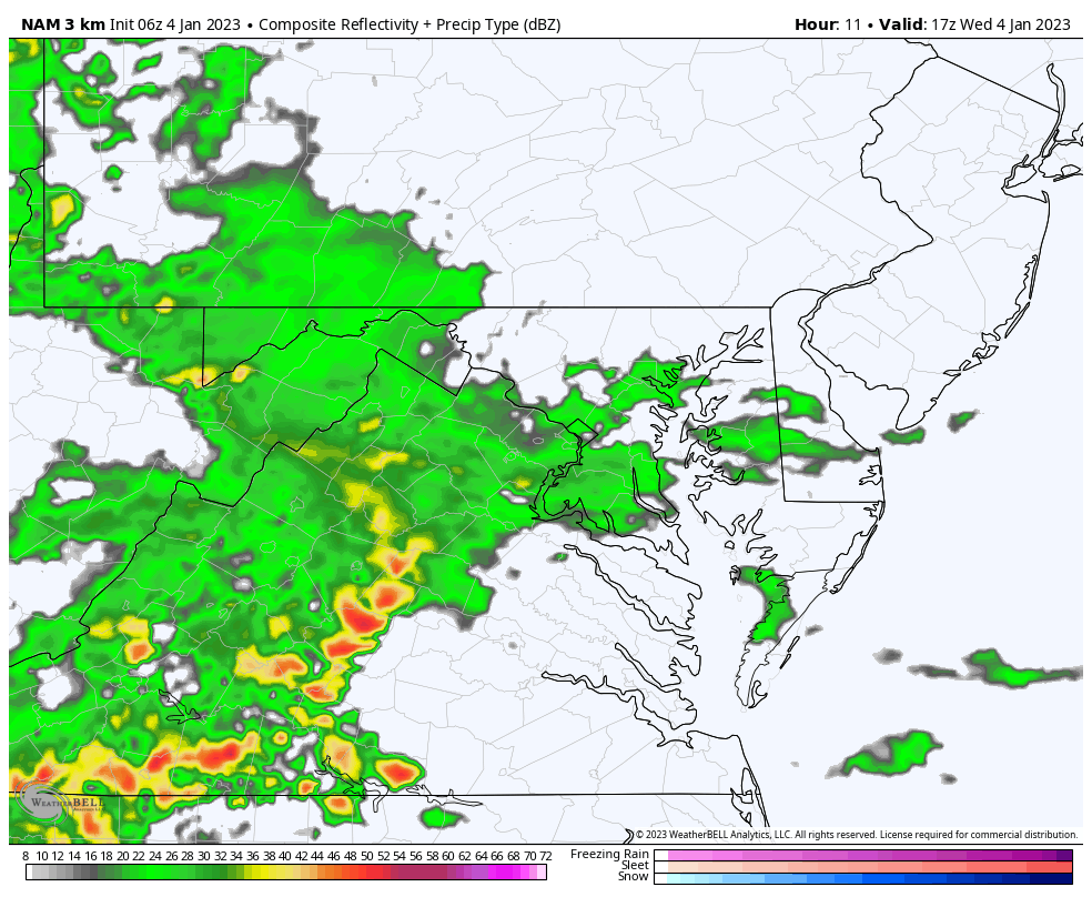
Model: NAM 3 Km
Made at 1 AM
This depicted a strong storm line, but farther west than verified. It supported my notion of being slow and west, about 1 to 2 hours behind schedule.
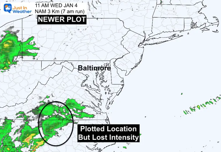
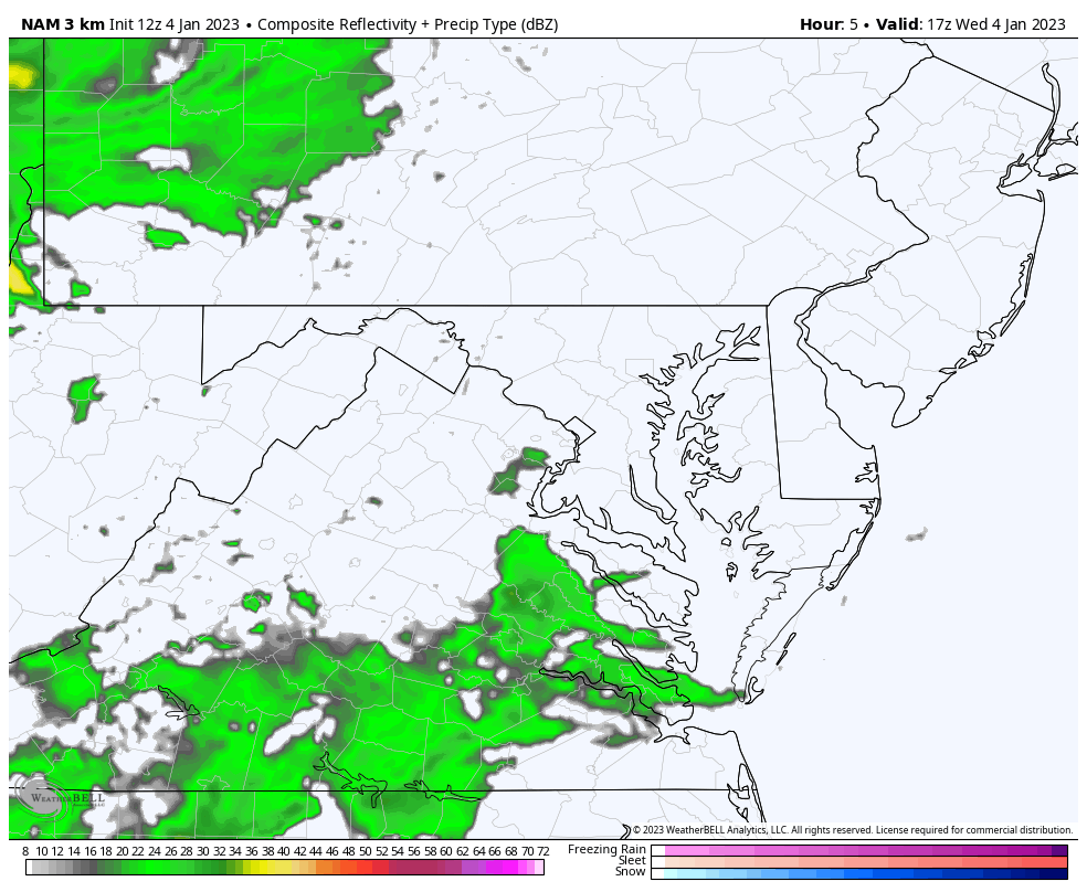
Model: NAM 3 Km
Made at 7AM
This LOST the storm intensity, but did a better job with the location.
If the newer model is correct, then most of our region in Maryland will get a less potent line of rain. But if this is already underplaying the intensity, it is very possibly missing out on the energy available.
The question for me is about the storm line ahead of the cold front extending through the Southeast US. Will some of that energy expand into Maryland, or remain confined to the south of us? That is the conundrum for us this afternoon.
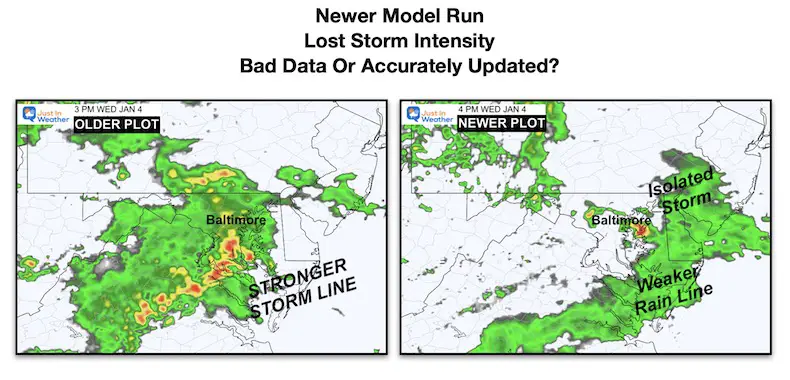
NOON to 7 PM
Made at 1 AM
NOON to 7 PM
Made at 7 AM
The older model shows a robust line of heavy rain and some thunderstorms reaching the Chesapeake Bay. The new Model is faster, but only has an isolated singular storm cell moving up the Chesapeake Bay separated from the main line.
If you are curious or not near a window, this will give you a way to track and plot how this behaves.

December 5th Snow In Baltimore And The Start Of Faith In The Flakes FITF

Click to see more and ‘Book’ a visit to your school

I see many factors to support colder influence with multiple systems. Early and later in winter. Check it out.
Winter Outlook 2023 For Snow Not Typical La Niña Plus Polar Vortex Disruption
Atmospheric Memory Suggests Active Winter Storm Pattern Outlook
Winter Outlook 2023 From NOAA Very Different Than Farmers Almanacs
Winter Outlook 2023 Early Look At Snow From Two Farmers Almanacs
If you want a snowy winter, this is what you might want to look for in the rest of the tropical season. (You might be seeing a lot of commercial snow removal people out this Winter).
Record August For No Named Tropical Storms: Closer Look At Snow Following
https://justinweather.com/2022/10/25/winter-weather-outlook-from-the-wooly-bear-caterpillar/
Winter Weather Folklore Top 20 And More Outlook Signals From Nature For Cold And Snow
