January 4 Possible Thunder Today And Shifting Snow Chance This Weekend
January 4 2023
Wednesday Morning Report
Yesterday was a warm day and despite the fog and showers, Baltimore’s BWI surged to 69ºF officially. There was an hour I saw 70ºF on the interim reports after 5:20 PM.
Climate Notes:
This still broke the record of 68ºF set in 2000. That was a year that ended the month of January with two record snow dates on January 20 (5.7”) and January 15 (14.9”). This still fits with the notion of a pattern flip later this month and one reason I am tracking any snow chances.
Headlines
- Today: Afternoon rain may have some thunder.
- Cooling off into the weekend.
- Snow ‘chance’ shifting to Sunday, and may continue to fluctuate.
Morning Temperatures
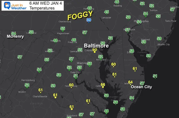
A mild start with heavier fog in the areas that got more rain yesterday.
Surface Weather
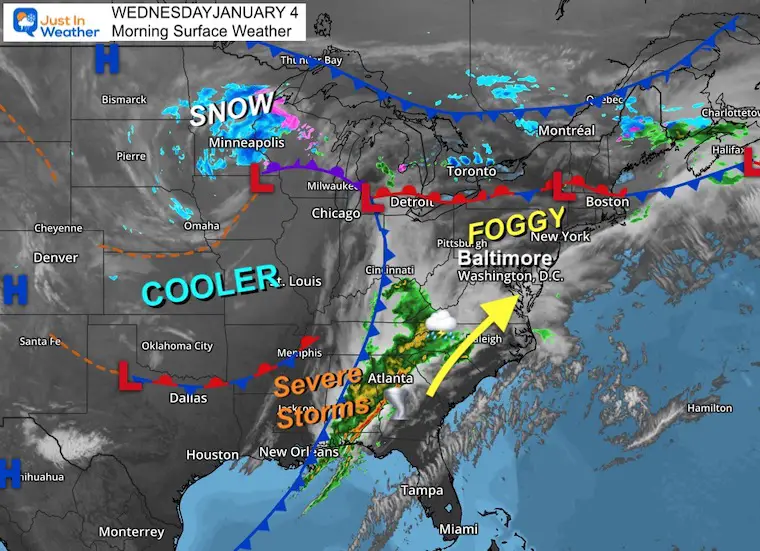
The core of cold air is locked up around Minnesota with snow. A trailing cold front has already ignited severe storms in Alabama and Georgia. There may be another tornado outbreak today, and some of the energy will ride along the front through Maryland this afternoon with thunder.
This morning is mild, with heavier fog in the areas that got more rain yesterday, including the mountains and into Pennsylvania.
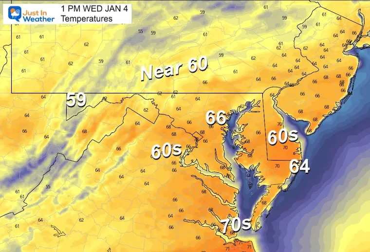
3 PM Temperatures
Another very warm day, but the highs will be before the rain arrives. This could be between Noon and 2 PM.
Radar Simulation – NAM 3 Km Model
10 AM to 10 PM
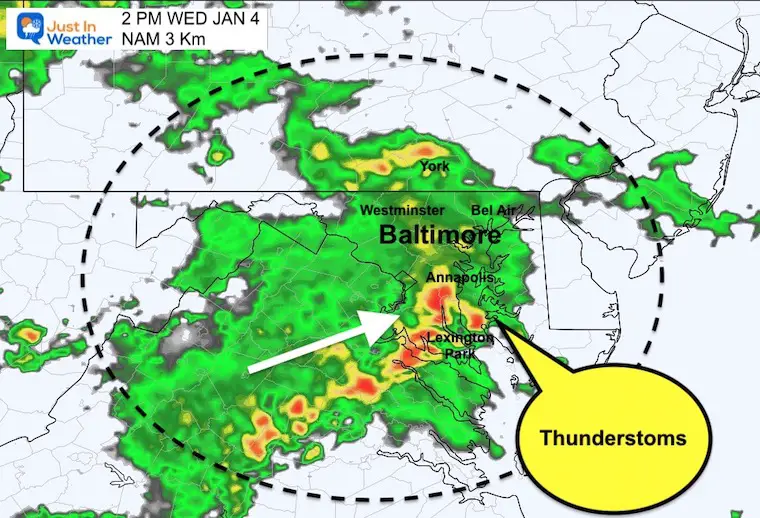
Showers will expand this morning, culminating with a line of heavier rain early to mid afternoon. This may include some thunderstorms.
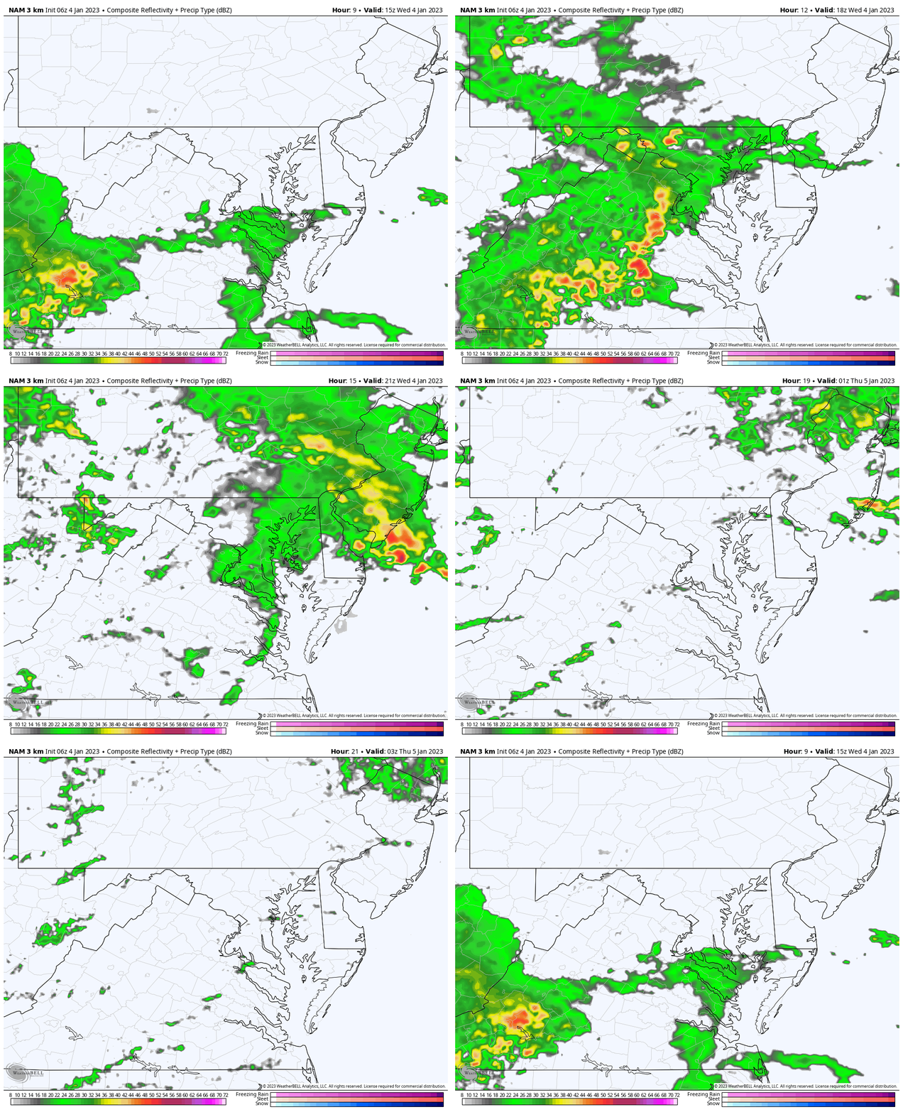
Snapshot
This suggestion shows heavy cells embedded mid afternoon. We have seen rain verify earlier than models have shown, so let’s allow the window of Noon to 4 PM for this to pass through.
Subscribe for eMail Alerts
Weather posts straight to your inbox
Sign up and be the first to know!
CLIMATE DATA
TODAY January 4
Normal Low in Baltimore: 26ºF
Record 4ºF in 1918
SNOW: 1.8” 1980
Normal High in Baltimore: 44ºF
Record 70ºF 2000
Polar Vortex Report
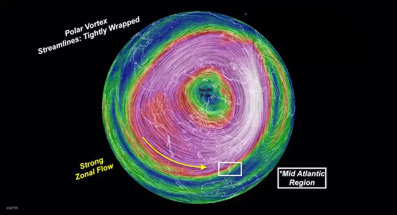
In case you missed this, I explain the stable circulation now and disruption forecast by mid January. Compare to 3 recent winters that were similar: Record warmth was followed by record snow.
Thursday
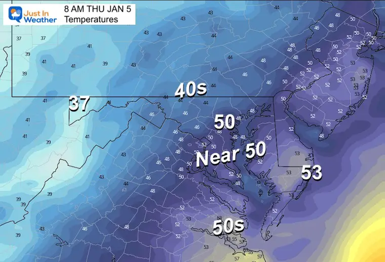
Morning
Still mild with most of the region between the mid 40s to lower 50s. This is higher than typical day time highs.
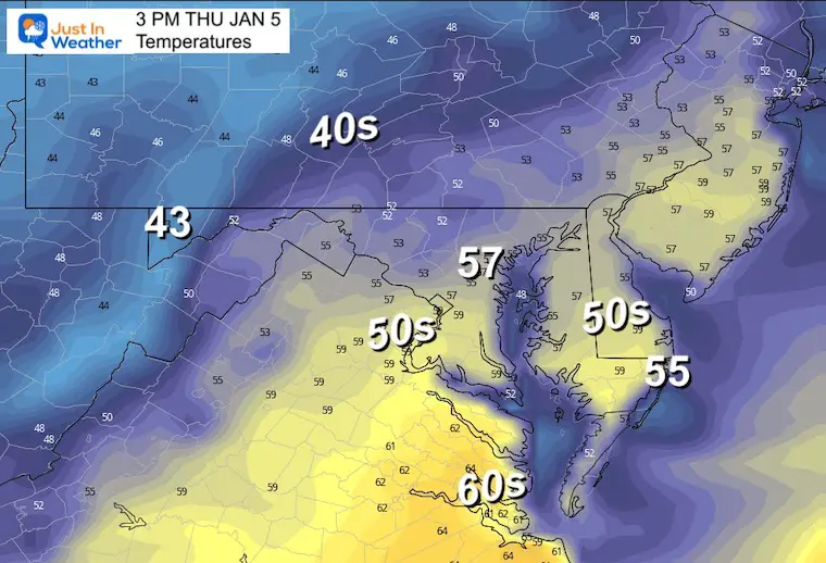
Afternoon
Still mild, and possibly warmer than models show here.
Looking Ahead To This Weekend
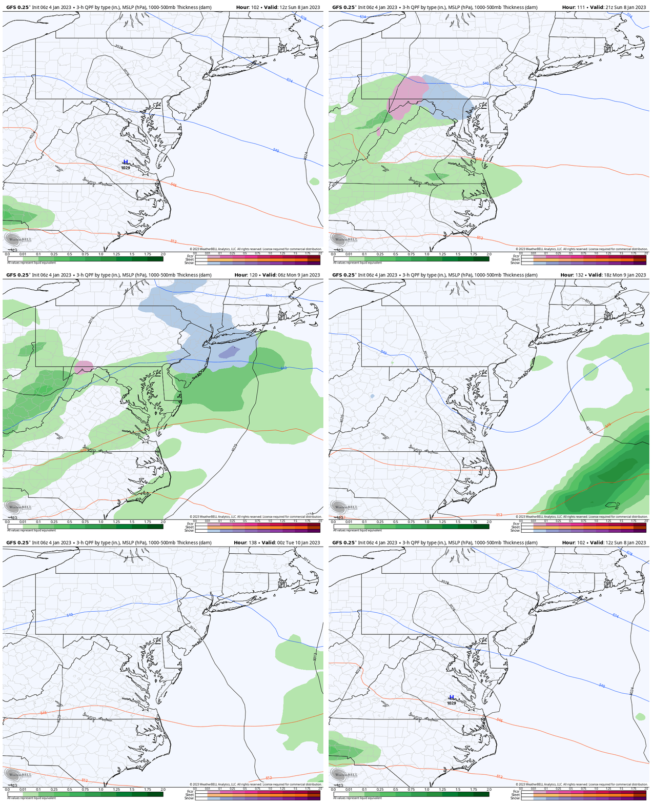
The energy keeps shifting and all I can do is show you what I see. It is painfully obvious that the models are having a tough time handling the data available. That is why I have been vague on purpose by saying, “something is trying to form this weekend”.
Last night I wrote a report about 2 Chances For Snow: Saturday and Monday. That was shown on the GFS Model, and yet the overnight model run is back in line with the ECWMF developing just a Sunday event.
This mention of snow will come with marginal temps. As I wrote last night, it appears too warm for road stickage for most of us.
Storm Animation: GFS MODEL
7 AM Sunday to 7 PM Monday
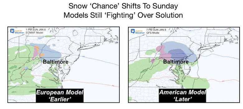
I am showing the GFS Model one last time. From this point forward, I will more likely lean towards the European Model which has been more consistent handling the energy.
Comparing the Models
Both Models show some light or slushy snow. The Euro is earlier with a mid day event, the GFS Model is later in the evening. Both show a slushy, marginal event transitioning to rain.
My Thoughts:
Winter Weather Folklore:
If in winter there is thunder, it may snow in one week or under.
I still believe ‘something’ will develop but as I wrote last night, the ground is too warm for much impact locally. However the focus on potential snow is in support of ski areas and a reminder of the season trying to return to normalcy.
We are in a warm pattern, and the change has been repeatedly suggested to be the second half of the month.
7 Day Forecast
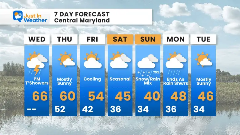
You may notice that this outlook does change each day with the forecast guidance. The computer models are having a really tough time trying to handle the colder air and potential snow. I expect there may be some additional fluctuation on the edge of the colder air.
Faith in the Flakes Gear
What is Faith in the Flakes?
It began with my son in 2009
October 27 Nor’easter Recap Still Breezy Then Next Storm Friday
SNOWSTIX – Available Now
STEM Assemblies/In School Fields Trips Are Back
Click to see more and ‘Book’ a visit to your school
My Winter Outlook: Not A Typical La Niña!
I see many factors to support colder influence with multiple systems. Early and later in winter. Check it out.
October 27 Nor’easter Recap Still Breezy Then Next Storm Friday
Also See The Winter Outlook Series:
October 27 Nor’easter Recap Still Breezy Then Next Storm Friday
Farmer’s Almanac Comparison
September Starts Meteorological Autumn: Weather Climate Stats For Maryland at Baltimore
Triple Dip La Niña Winter
CONNECTION TO WINTER?
If you want a snowy winter, this is what you might want to look for in the rest of the tropical season. (You might be seeing a lot of commercial snow removal people out this Winter).
Rainbow Ice Cave In Mt. Rainier A Very Rare Find: Photos And Video
Wooly Bear Caterpillars
https://justinweather.com/2022/10/25/winter-weather-outlook-from-the-wooly-bear-caterpillar/
Persimmon Seeds
Click to see Top 20 and MORE
Winter Weather Folklore Top 20 And More Outlook Signals From Nature For Cold And Snow
Normals And Records: Maryland and Baltimore Climate History
Please share your thoughts, best weather pics/videos, or just keep in touch via social media
-
Facebook: Justin Berk, Meteorologist
-
Twitter: @JustinWeather
-
Instagram: justinweather


