December 26 2022
Monday Morning Report
That now infamous Bomb Cyclone brought us the coldest Christmas Eve in 130 years, tying the record low afternoon in Baltimore at 20ºF, not seen since 1892. Since then, we have slowly turned the corner to trend upward.
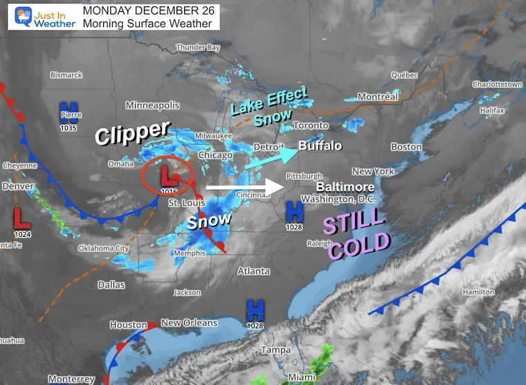
A clipper system is bringing snow to the Midwest, but it looks like it will fall apart after hitting western Maryland.
White Christmas Across The US
(In case you missed what I posted on my Facebook page)
Headlines
- Morning: Still Cold Today
- Mid Week: Warming
- New Year’s Weekend: Rain Storm Both Days
Most of the eastern half of the US is still under the influence of this arctic cold. It even brought some sleet/snow showers to east central Florida, but the main event has been in Buffalo. As of Christmas afternoon they had 43 inches of new snow. A fresh band of heavy snow has reached them this morning, which may help bring them to a final total of close to 6 Ft.
This storm has already resulted in 13 people dying in Buffalo. Here is a sample of what it has looked like there:
Lake Effect Snow in Buffalo:
Zero Visibility
What is amazing, is that daily routine goes on, such as this store remaining open with business traffic.
Bills Fans Clearing Cars Christmas Eve
This is the reward they get…
That is a 7 FOOT SNOW DRIFT
Weather Across The Nation
The clipper I mentioned a few days ago looks impressive on the map, but this is a Midwest thing. It will mostly bring just clouds east of the mountains.
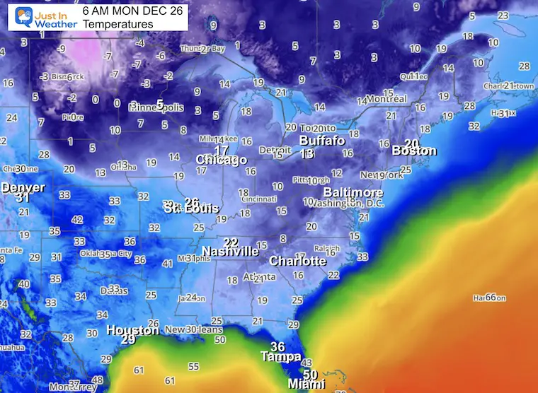
Temperatures This Morning
Still freezing all the way to northern Florida this morning. Even Miami is down to 50ºF.
The 20s have reached Houston and Nashville, Charlotte into the teens. Basically, it is still cold! But we are turning the corner.
Clipper Snow Simulation
Showers for western Maryland, but only clouds expected east of the mountains.
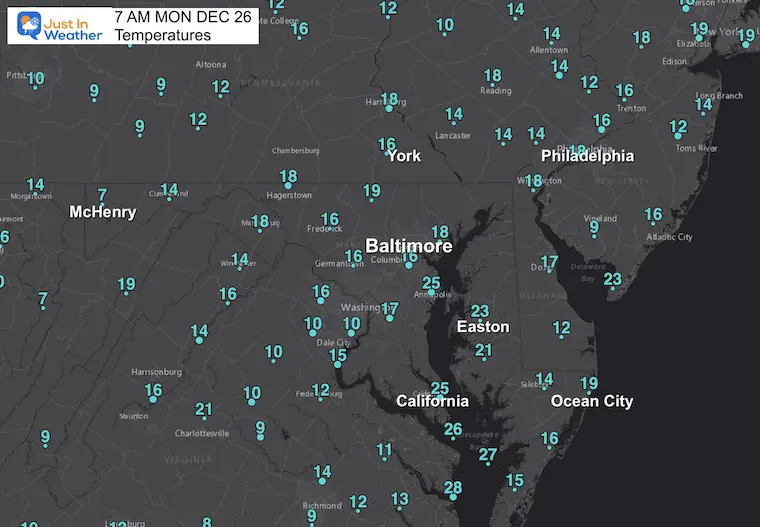
Morning Local Temperatures
Still very cold with teens reported all the way to Ocean City.
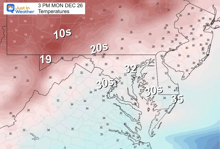
3 PM Temperatures
Back to Freezing for Baltimore. Still in the 20s and teens inland.
Subscribe for eMail Alerts
CLIMATE DATA
TODAY December 26
Normal Low in Baltimore: 28ºF
Record 2ºF in 1983
SNOW: 4.4” 1933
Normal High in Baltimore: 45ºF
Record 73ºF 1964
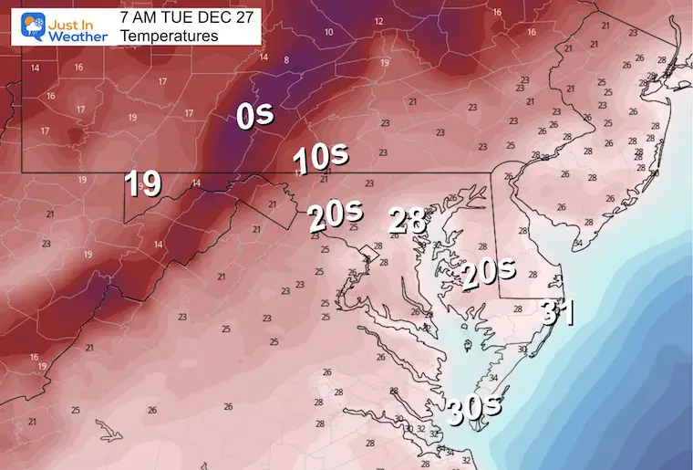
Tuesday
Morning
Not as cold as it has been. These numbers in the morning will be warmer than it was during the afternoons over the weekend for most of us.
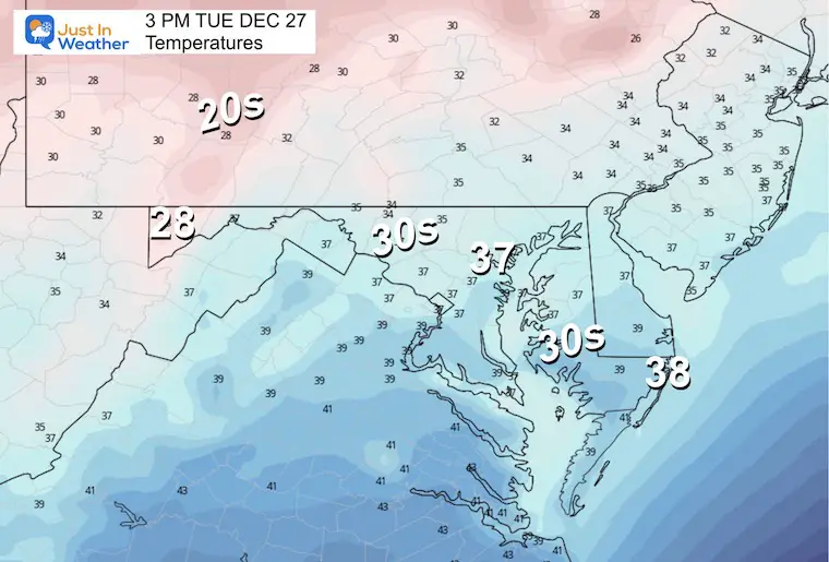
Afternoon
Next Storm: New Year Weekend
Friday Morning To Sunday Afternoon
A moderate rain event is expected Saturday into Sunday. This may push temps into the mid to upper 50s on Sunday.
Extended Look: Jet Stream
This longer loop extends to January 8. We can see the start with cold (blue) in the eastern US, then warming with our next storm, which may last through the first week of January.
The next suggestion of colder air and a storm will show up by January 8 into the middle of the month.
My thoughts:
A large variation of record cold to warmth, shows a highly amplified and energized jet stream. There is more to be shown and winter is just getting started. Like last year, I believe it will get very active here in January and February. Faith in the Flakes.
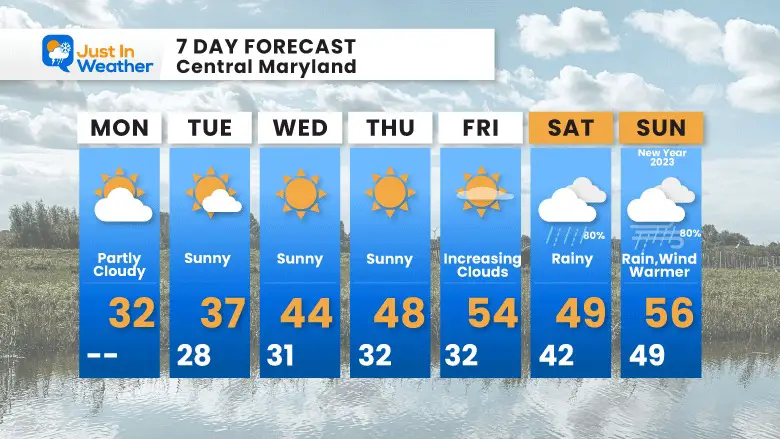
7 Day Forecast
Warming up with the storm next weekend.
Faith in the Flakes Gear

What is Faith in the Flakes?
It began with my son in 2009
October 27 Nor’easter Recap Still Breezy Then Next Storm Friday
SNOWSTIX – Available Now

STEM Assemblies/In School Fields Trips Are Back
Click to see more and ‘Book’ a visit to your school

My Winter Outlook: Not A Typical La Niña!
I see many factors to support colder influence with multiple systems. Early and later in winter. Check it out.
October 27 Nor’easter Recap Still Breezy Then Next Storm Friday
Also See The Winter Outlook Series:
October 27 Nor’easter Recap Still Breezy Then Next Storm Friday
Winter Outlook 2023 La Niña Triple Dip Expectations
Farmer’s Almanac Comparison
September Starts Meteorological Autumn: Weather Climate Stats For Maryland at Baltimore
Triple Dip La Niña Winter
Winter Outlook 2023 La Niña Triple Dip Expectations
CONNECTION TO WINTER?
If you want a snowy winter, this is what you might want to look for in the rest of the tropical season. (You might be seeing a lot of commercial snow removal people out this Winter).
Rainbow Ice Cave In Mt. Rainier A Very Rare Find: Photos And Video
Wooly Bear Caterpillars
https://justinweather.com/2022/10/25/winter-weather-outlook-from-the-wooly-bear-caterpillar/
Persimmon Seeds
Winter Weather Outlook: Persimmon Seeds And Snow Folklore
Click to see Top 20 and MORE
Winter Weather Folklore Top 20 And More Outlook Signals From Nature For Cold And Snow
Normals And Records: Maryland and Baltimore Climate History

Please share your thoughts, best weather pics/videos, or just keep in touch via social media


