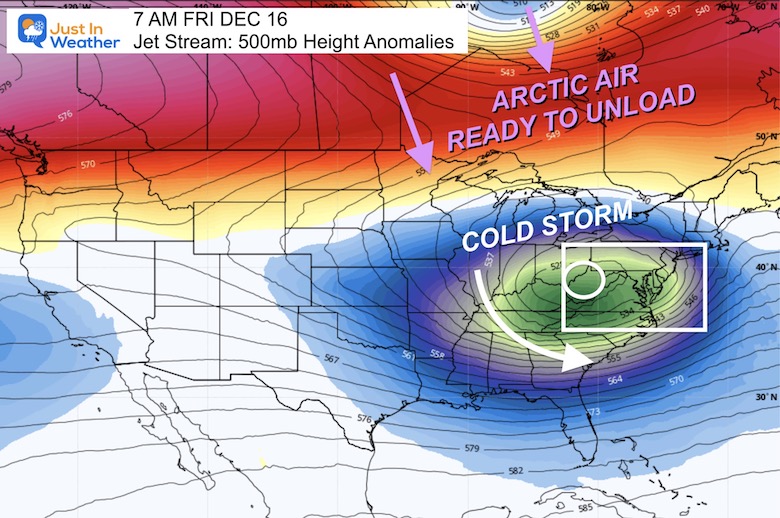
December 10 Light Event Sunday Bigger Winter Event Next Week
December 10 2022
Saturday Morning Update
The cold air is in place. It’s not the mother load yet, and I’ve heard from doubters, but we will remain with high temps below average for the foreseeable future. The true arctic air is on the way Christmas week, which may have a winter weather event to lead the charge. Lots to talk about today.
Morning Temperatures
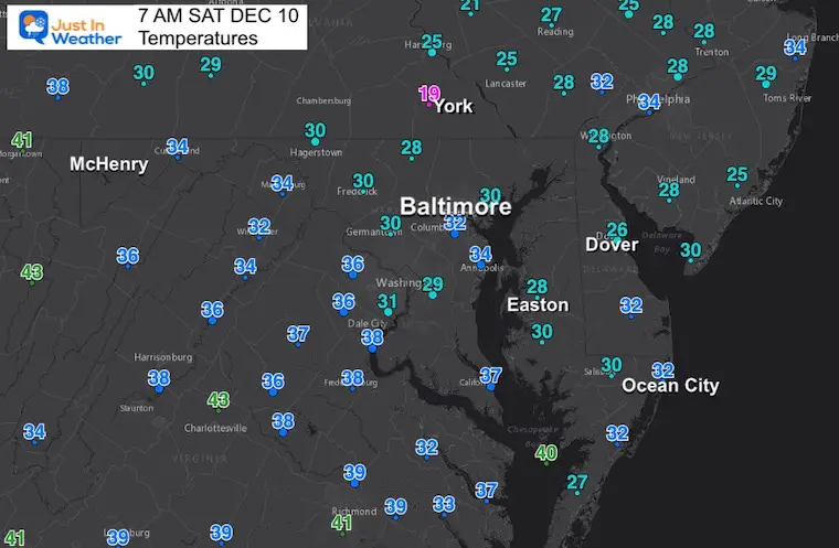
Before sunrise, most of our region was down below or near freezing, even on Delmarva. Temps dropped into the teens in York, PA.
Headlines
- Sunday: Showers with wintry ‘stuff’ north.
- Next Week: Winter Event (ice/snow): Wed night to Friday
- Christmas Week: Polar Vortex sends Arctic Air Our Way
Morning Surface Weather
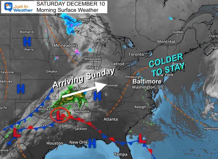
Our cold morning under a clear sky will give way to more clouds. The light snow we talked about all week actually did reach the mountains, but didn’t cross over. That will dry out but provide increasing clouds.
The next weather system is in the Lower Mississippi River Valley and will reach us tomorrow. More on that impact below.
Afternoon Temperatures
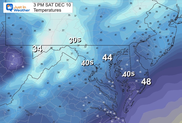
These are below average and will feel colder with increasing clouds.
CLIMATE DATA
TODAY December 10
Normal Low in Baltimore: 31ºF
Record 1ºF in 1876
SNOW: 9.5 inches in 1904
Normal High in Baltimore: 49ºF
Record 72ºF 1966
Subscribe for eMail Updates
Weather posts straight to your inbox
Sign up and be the first to know!
NEW REPORT
La Niña Forecast To End This Winter: Boosting Snow Odds
October 27 Nor’easter Recap Still Breezy Then Next Storm Friday
Sunday Weather
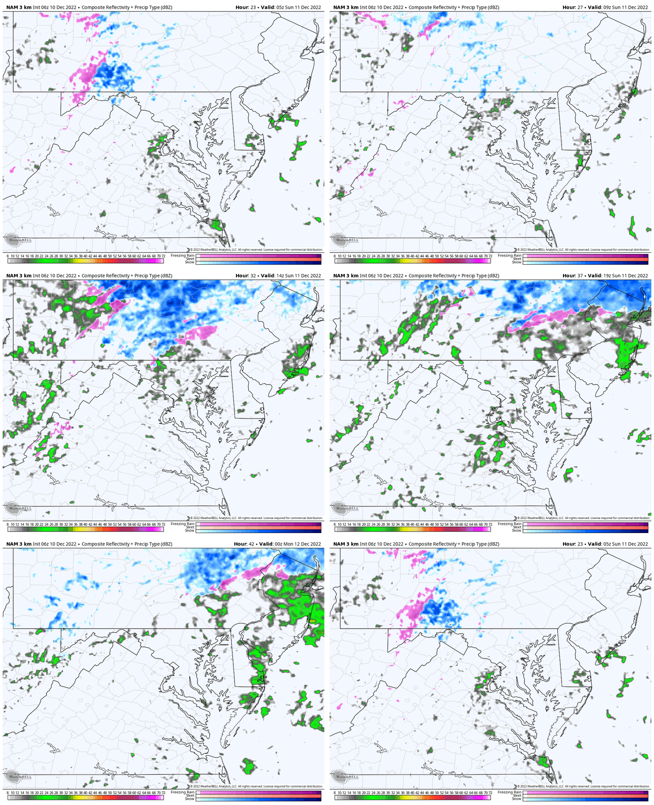
Radar Simulation Midnight to 7 PM
This may begin with flurries overnight, then light rain. Snow with an impact is more likely north of Harrisburg, PA.
Sunday Temperatures
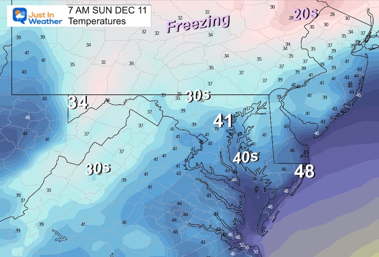
Morning
Even if we get flurries or light snow, local temps should remain above freezing.
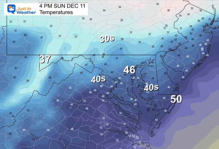
Afternoon
Still a few degrees colder than average.
Looking Ahead: Winter Is Trying
Wed Dec 14 to Fri Dec 16
We have talked about the big change and it will try to kick off with a storm. At this point the ingredients are evident, but the models put the intensity and timing together differently. This is why we have such a wide range of solutions.
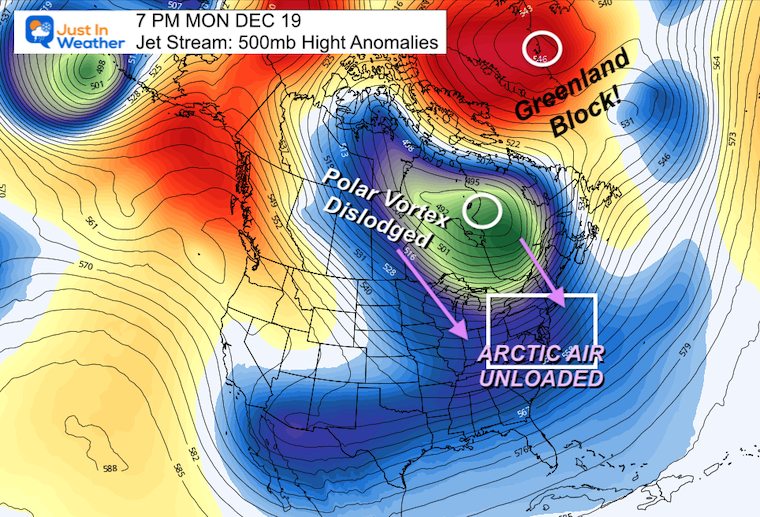
First, let’s look at key time frames of each, and I’ve picked the two more interesting solutions to animate below. This will be followed the Greenland Block and dislodging of the Polar Vortex. Then the arctic air will unload on us during Christmas Week.
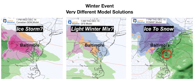
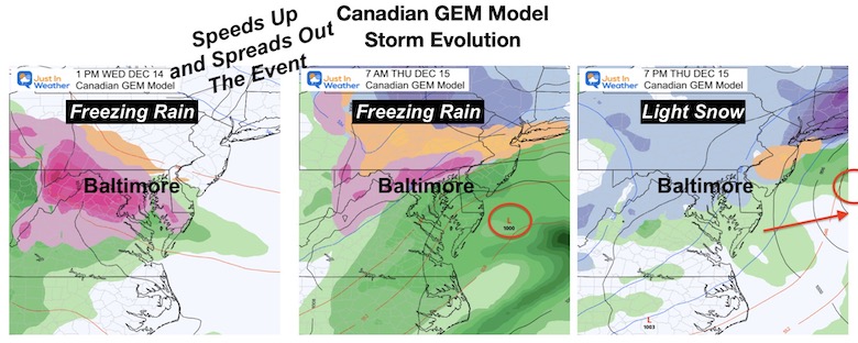
Canadian Model:
This speeds up the arrival on Wednesday, and extends it through Friday. Primarily a freezing rain/icing event.
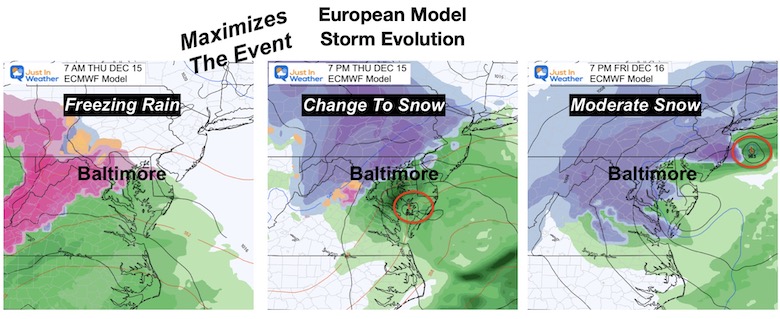
European Model:
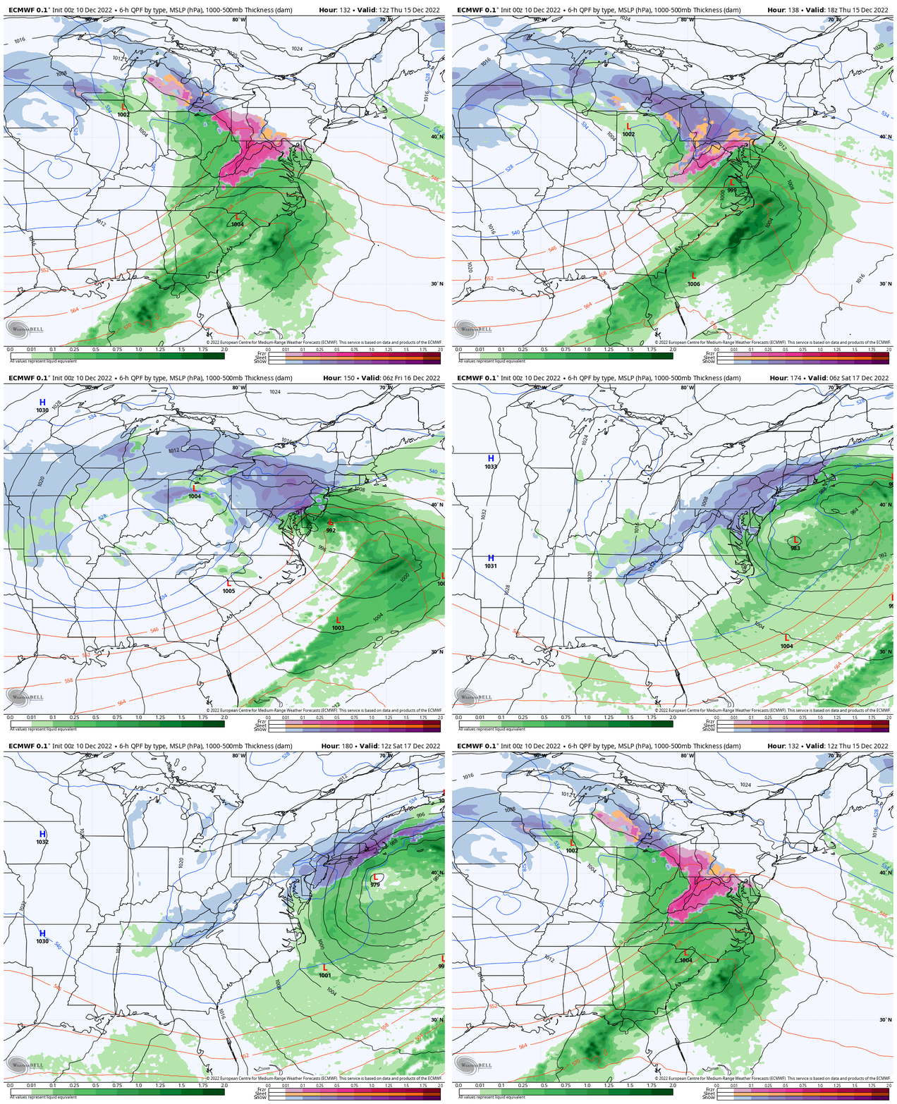
This starts Thursday morning, then transitions from a freezing rain event, to a slow coastal Low that wraps in colder air and turns into a snow storm inland with the edge around I-95 and the Bay.
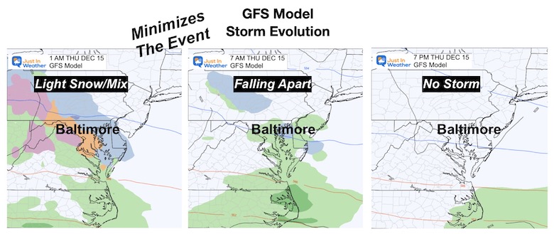
The GFS Model is the weakest solution and only shows a light winter mix event.
Just for Fun… Storm Animations
I am still not convinced, and in all honestly I am posting this for entertainment at this point. I will share each day and each adjustment to see any trends, consistency, or to refer back for review of how quickly new data can change the results.
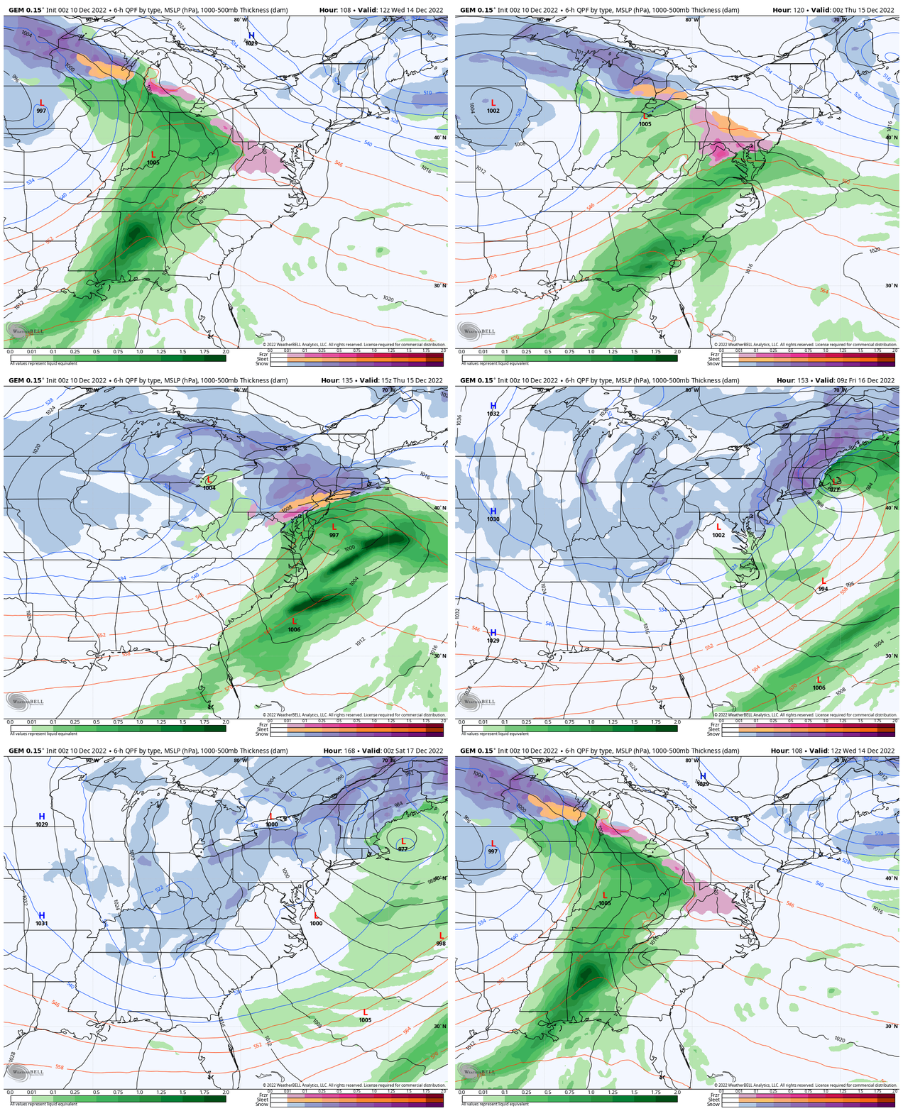
Canadian GEM Model
Wednesday 7 AM to Friday 7 PM
This spreads out the event with mostly freezing rain (pink).
European Model
Thursday 7 AM to Saturday 7 AM
This is the most impressive and possibly exaggerated transition from freezing rain to a slow moving snow storm.
After This…
The Greenland Block with help dislodge the Polar Vortex. We can anticipate arctic air arriving at the start of Christmas Week.
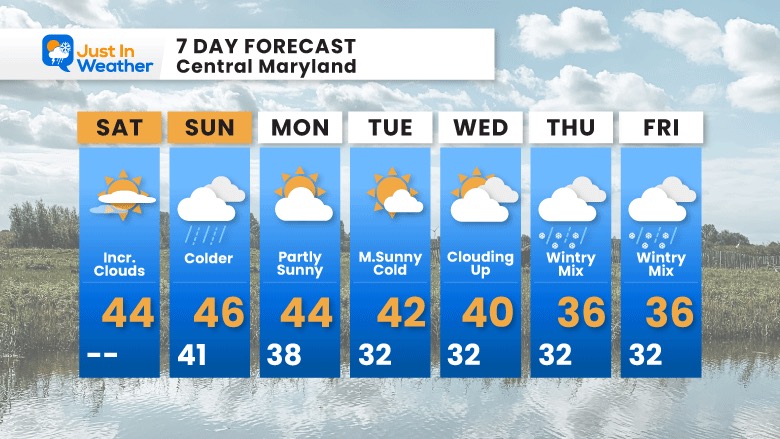
Faith in the Flakes.
7 Day Forecast
Click here to see more about the overall pattern:
STEM Assemblies/In School Fields Trips Are Back
Click to see more and ‘Book’ a visit to your school
My Winter Outlook: Not A Typical La Niña!
I see many factors to support colder influence with multiple systems. Early and later in winter. Check it out.
October 27 Nor’easter Recap Still Breezy Then Next Storm Friday
Also See The Winter Outlook Series:
October 27 Nor’easter Recap Still Breezy Then Next Storm Friday
Farmer’s Almanac Comparison
September Starts Meteorological Autumn: Weather Climate Stats For Maryland at Baltimore
Triple Dip La Niña Winter
CONNECTION TO WINTER?
If you want a snowy winter, this is what you might want to look for in the rest of the tropical season. (You might be seeing a lot of commercial snow removal people out this Winter).
Rainbow Ice Cave In Mt. Rainier A Very Rare Find: Photos And Video
Wooly Bear Caterpillars
https://justinweather.com/2022/10/25/winter-weather-outlook-from-the-wooly-bear-caterpillar/
Persimmon Seeds
Click to see Top 20 and MORE
Winter Weather Folklore Top 20 And More Outlook Signals From Nature For Cold And Snow
Faith in the Flakes Gear
SNOWSTIX – Available Now
Normals And Records: Maryland and Baltimore Climate History
Please share your thoughts, best weather pics/videos, or just keep in touch via social media
-
Facebook: Justin Berk, Meteorologist
-
Twitter: @JustinWeather
-
Instagram: justinweather


