December 5 Weather Cold Start Rain Tomorrow And Possible Snow To End The Week
December 5 2022
Monday Morning Update
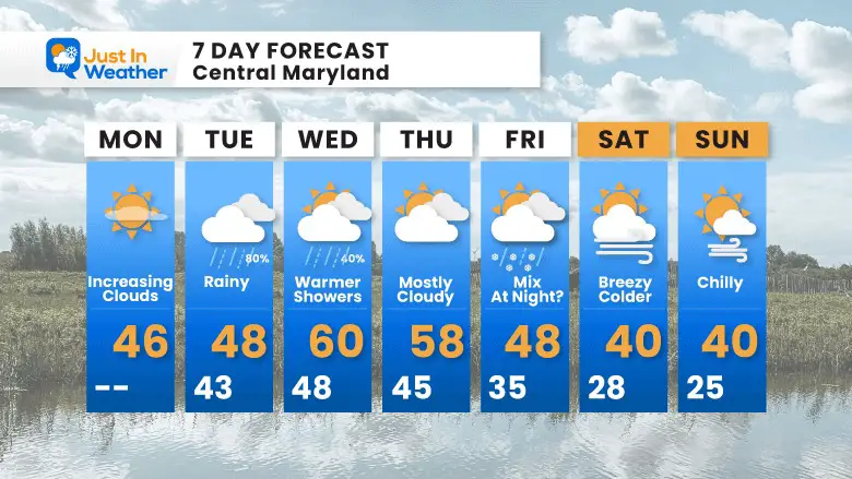
We start the work week on a cold note with a clear sky. There has already been a lot of reports of frost, so if you have a vehicle outside it might be best to warm it up and let it thaw for a few minutes. Clouds will be on the increase during the day, which means dimming of the sun and maybe another chance to see sun dogs and solar halos. Then we continue our string of rain every third day, with the next event arrive as soon as tomorrow morning.
The signal for the change will be with warmer temps mid week, then an attempt to collapse the colder air Friday night and a hint it may arrive with snow. That still depends on which model you want to follow, so it may not show up on your weather app (yet).
Headlines
- Today: Cold Today With Increasing Clouds
- Tomorrow: Rain again
- Mid Week: Warmer
- Friday: Chance For Snow?
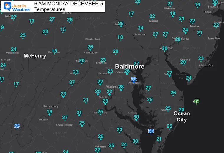
Morning Temperatures
Seasonably cold morning. Lots of frost reports this morning, so if you don’t want to scrape, perhaps let your vehicle warm for 10 minutes.
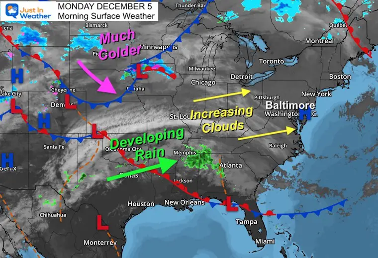
Morning Surface Weather
High Pressure in control means a dry start. The next rain event is like the last few, not looking like much now, but organizing to peak as it passes us tomorrow.
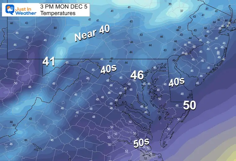
Afternoon Temperatures
It will be cold, but the winds will settle down.
Subscribe to my Newsletter
Weather posts straight to your inbox
Sign up and be the first to know!
CLIMATE DATA
TODAY December 5
Normal Low in Baltimore: 32ºF
Record 16ºF in 1966
SNOW: 7.4 inches in 2002
FITF DAY – Later Today I will publish: The history of Faith in the Flakes
Normal High in Baltimore: 50ºF
Record 75ºF 2001
NEW Faith In The Flakes Gear
NEW REPORTS
Comparing The Snow In Decembers With Similar Patterns
Tuesday Weather:
Radar Simulation: 5 AM to Midnight
Another day starting with showers. There could be a break in the afternoon, then a final push in the evening may come with heavier cells.
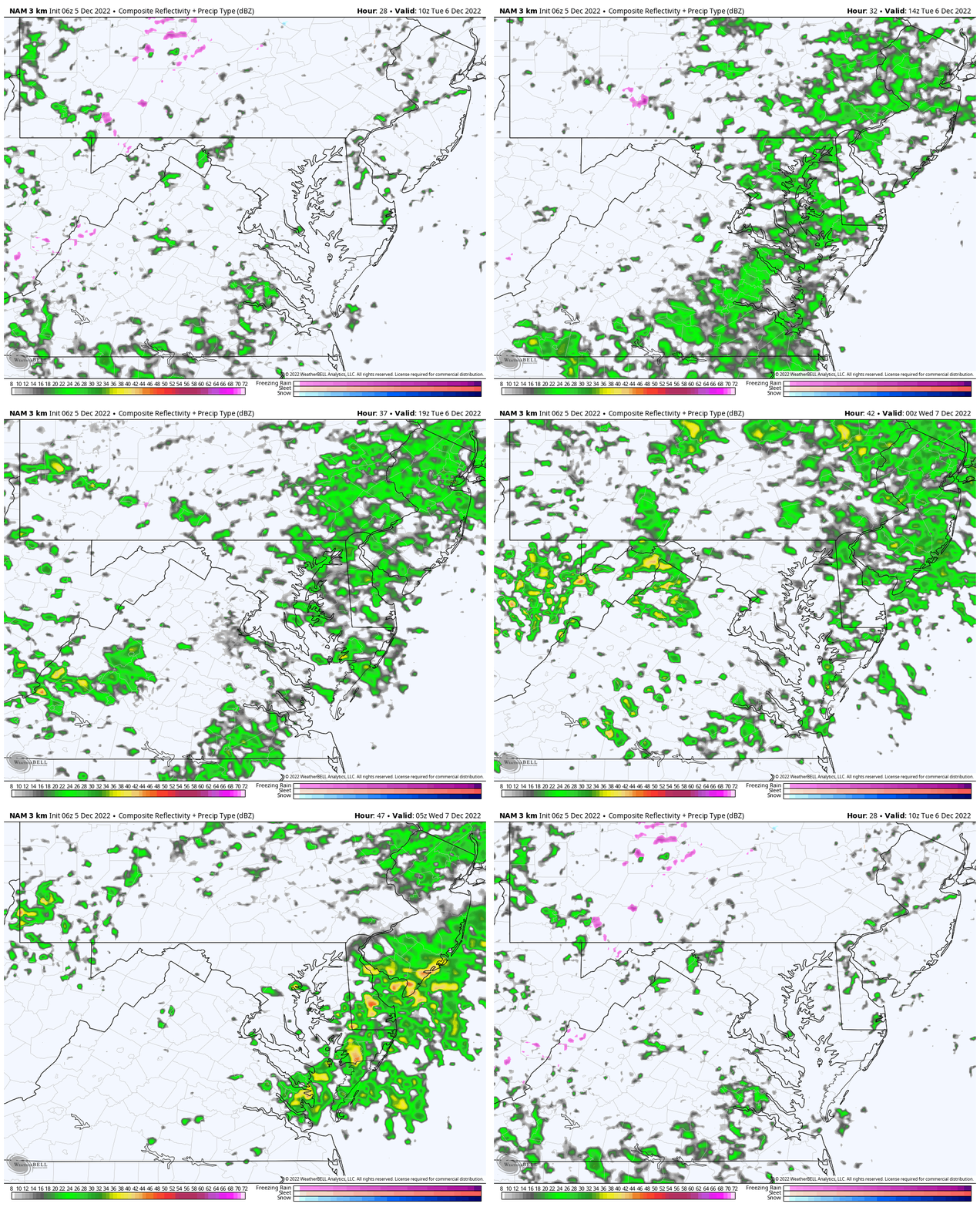
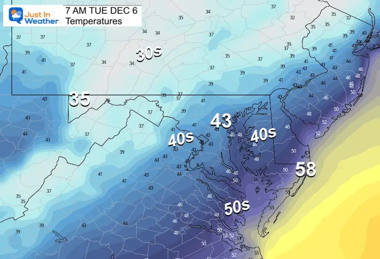
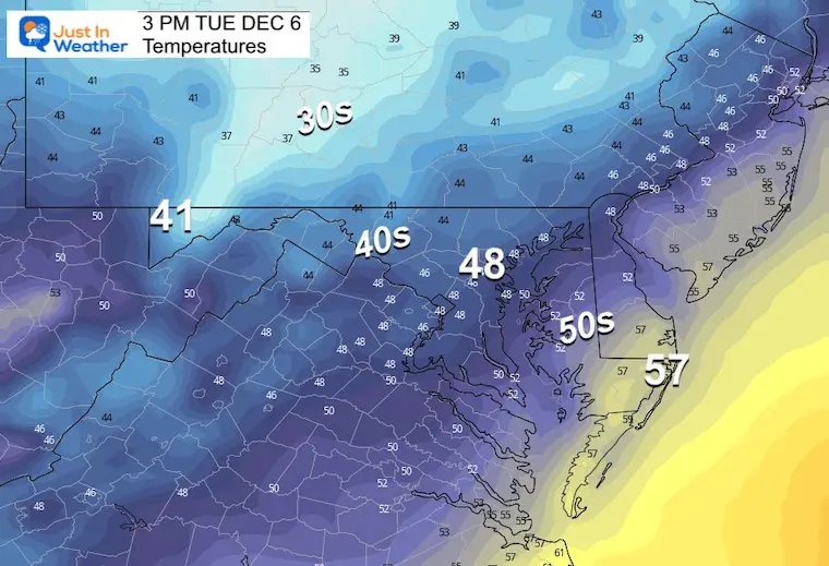
Temperatures
Morning
Chilly temps with the rain arriving in the morning.
Afternoon
Still near seasonably levels with the rain.
Looking Ahead
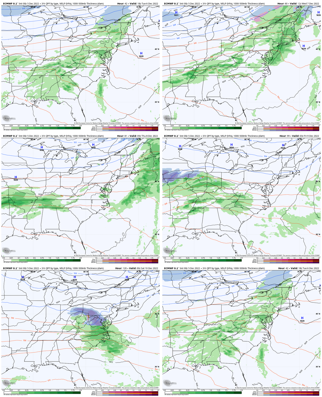
ECMWF Model: Tuesday to Friday Night
This is the colder solution showing our rain event followed by an end of week colder event that may try to bring us a band of snow late Friday.
If your weather app is NOT showing this, here is why:
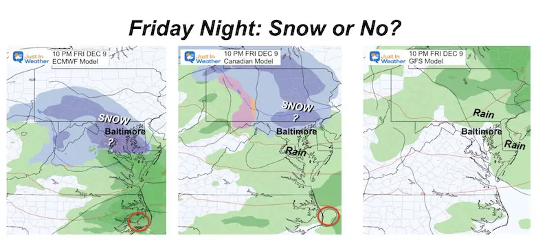
Model Comparison: Late Friday Night
- The ECMWF and Canadian Models are colder than the GFS
- Most Apps use the America GFS Model.
- It has a history of being less accurate than the European ECMWF.
- I will start a closer look at this later today.
7 Day Forecast
RELATED REPORTS
Record Snow Cover Across The Northern Hemisphere
My Winter Outlook: Not A Typical La Niña!
I see many factors to support colder influence with multiple systems. Early and later in winter. Check it out.
October 27 Nor’easter Recap Still Breezy Then Next Storm Friday
Also See The Winter Outlook Series:
October 27 Nor’easter Recap Still Breezy Then Next Storm Friday
Farmer’s Almanac Comparison
September Starts Meteorological Autumn: Weather Climate Stats For Maryland at Baltimore
Triple Dip La Niña Winter
CONNECTION TO WINTER?
If you want a snowy winter, this is what you might want to look for in the rest of the tropical season. (You might be seeing a lot of commercial snow removal people out this Winter).
Rainbow Ice Cave In Mt. Rainier A Very Rare Find: Photos And Video
Wooly Bear Caterpillars
https://justinweather.com/2022/10/25/winter-weather-outlook-from-the-wooly-bear-caterpillar/
Persimmon Seeds
Click to see Top 20 and MORE
Winter Weather Folklore Top 20 And More Outlook Signals From Nature For Cold And Snow
Faith in the Flakes Gear
SNOWSTIX – Available Now
Normals And Records: Maryland and Baltimore Climate History
STEM Assemblies/In School Fields Trips Are Back
Click to see more and ‘Book’ a visit to your school
Please share your thoughts, best weather pics/videos, or just keep in touch via social media
-
Facebook: Justin Berk, Meteorologist
-
Twitter: @JustinWeather
-
Instagram: justinweather


