Radar Viewers For Snow And Sleet Arrival Test November 15
November 15 2022
Late Tuesday Morning Update
As the first taste of winter weather approaches, I wanted to share a few radar options to see which performs best here on the site. The initial precipitation appears to be arriving earlier than models had forecast. That has been the trend we’ve seen for a few months.
It is important with winter weather to consider Virga, the snow, sleet, or rain sublimating/evaporating on the way down. So it may show falling from the clouds on radar, but not reach the surface. If and when that happens, it also serves to cool the air and support a drop in temps along with more frozen precipitation when it does actually reach the ground.
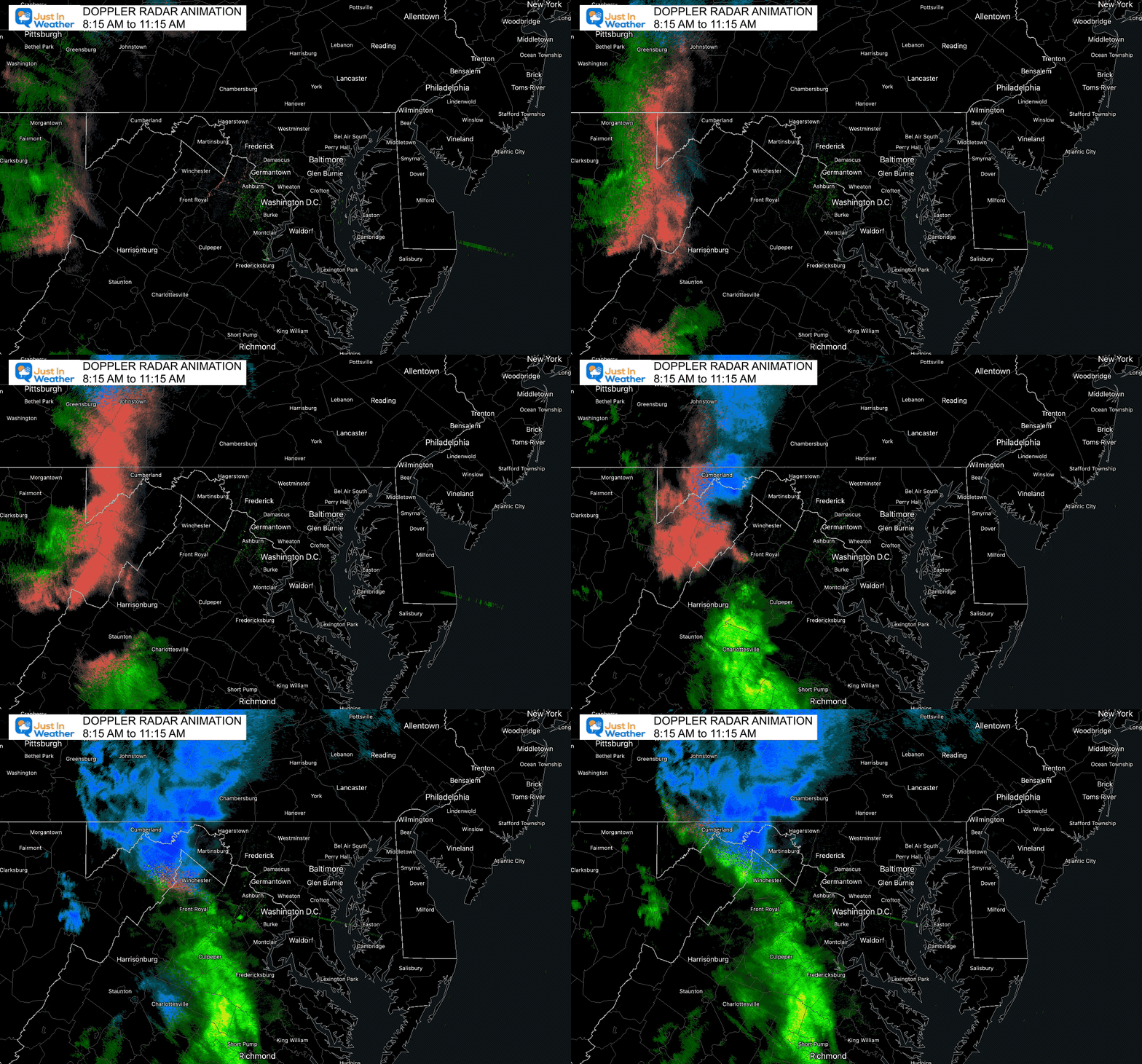
This first animation I recorded, so it will not update. Below the third radar is a look at the morning forecast maps. I will have an update this afternoon.
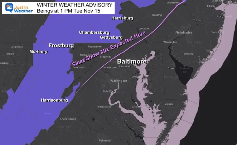
Winter Weather Advisory
Reminder that I expect snow and sleet to fall (not stick) EAST of the Advisory Counties.
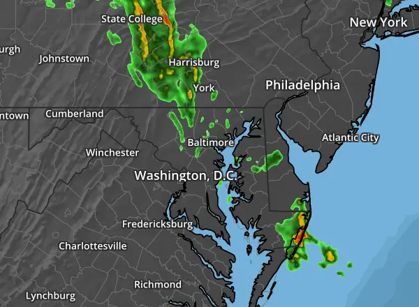
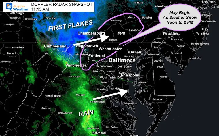
Doppler Radar Snapshot at 11:15 AM
The leading edge may not reach the ground, but the next few hours will fill in and perhaps start with sleet or snow-flakes in the zone highlighted. Even if it begins with high rain, this region may turn to sleet and snow during the afternoon and early evening.
Doppler Radar: Winter Mode
3 Hour Loop Ending 11:15 AM
IF YOU ARE NOT SEEING MANY POSTS ON FACEBOOK
PLEASE SIGN UP FOR EMAIL UPDATES
Weather posts straight to your inbox
Sign up and be the first to know!
Doppler Radar Loops
Radar Loop Past 2 Hours
This has a glitch we are working to fix..
Showing LAST 2 HOURS Radar map data
RAINVIEWER: Interactive
This is a new element I am testing that does show winter mode. However, I believe the leading edge is Virga, so not all reaching the ground.
Windy Radar: Interactive
Does NOT show winter mode, so rain, sleet, and snow not identified.
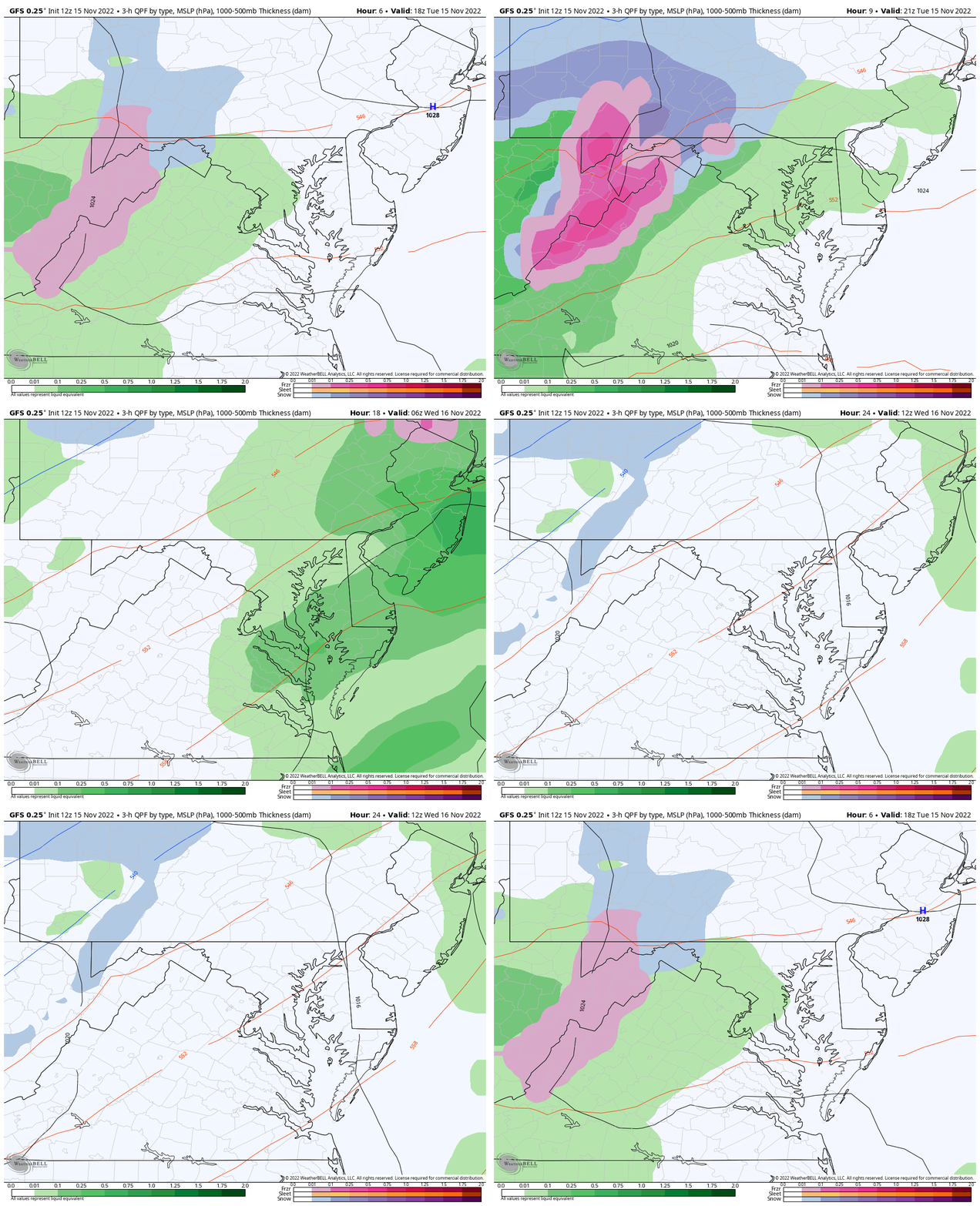
GFS Model Forecast
3 Hour Increments 1 PM Tue to 7 AM Wed
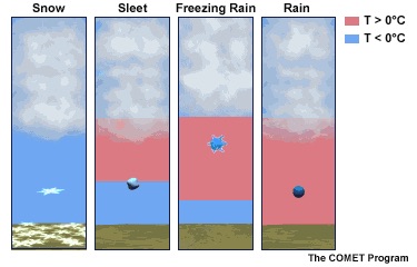
Winter Precipitation Explanation
Click Here:
See more about rain vs. sleet vs. snow
Computer Model Forecast/Comparisons
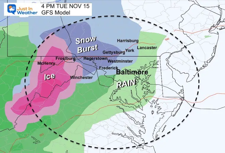
4 PM
- Snow or sleet develops quickly between 1 and 4 PM.
- This is shown to include Frederick, Carroll, and NW Baltimore Counties in Maryland.
- Also into York and Harrisburg in PA.
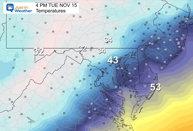
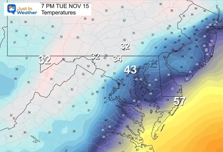
Temperatures
Expect a drop in temperatures with the start of the precipitation. The wintry mix areas will be in the 30s, with the freezing line close to Hagerstown and westward.
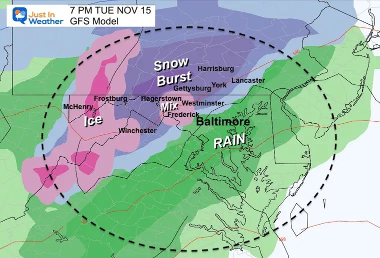
7 PM
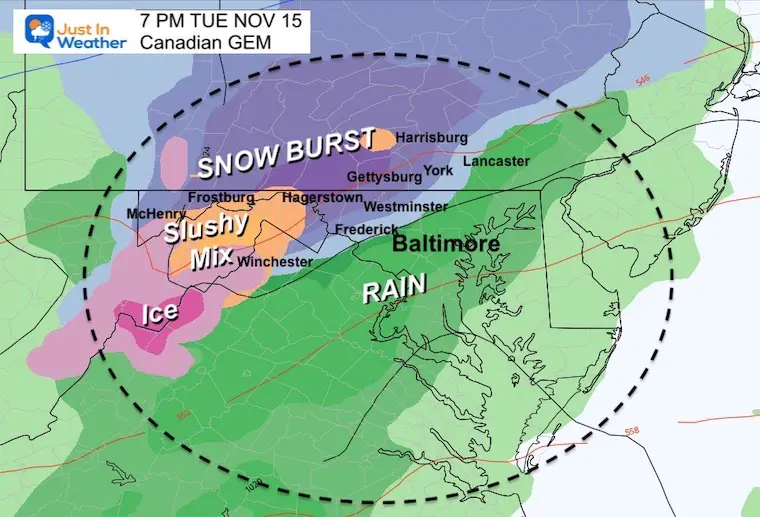
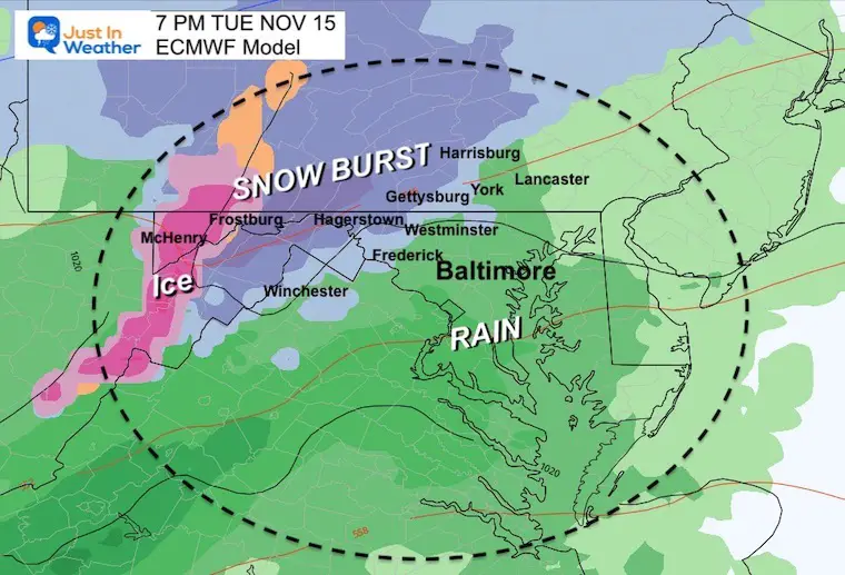
- Burst of Snow and sleet in those Northwest suburbs may last for a few hours….
- Heavier snow with stickage more likely along Rt 15 and I-81.
Temperatures
The freezing line may get closer to Westminster and York.
Other Models
Canadian GEM
European ECMWF
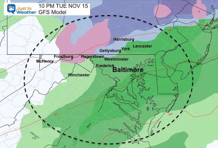
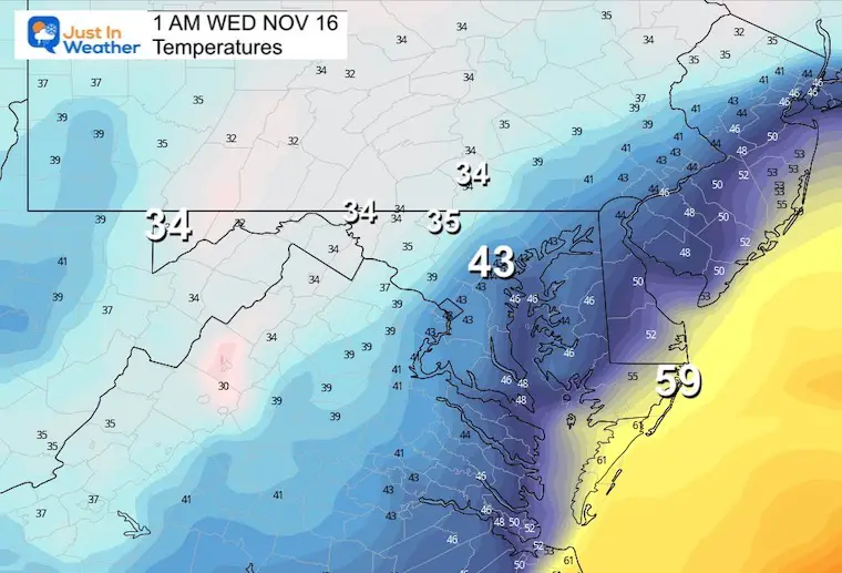
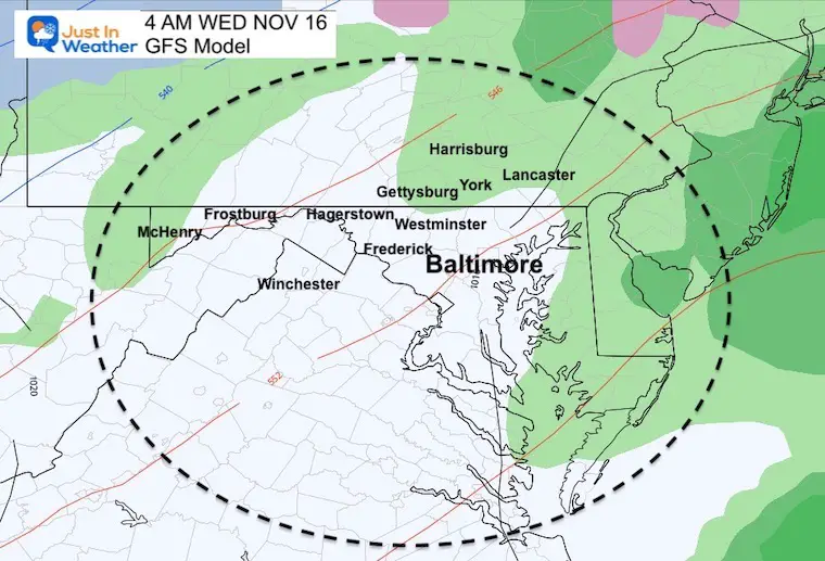
Rest Of The Night (GFS)
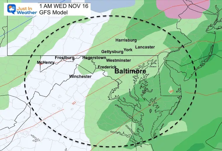
Turning to rain with slightly warmer air moving in from the south.
10 PM
1 AM Wednesday
4 AM Wednesday
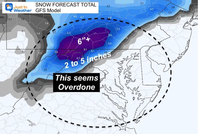
GFS Model Snow?
This is the high end of potential within reason
I do not trust the 2 to 5 inches between Westminster and York. This is assuming all stickage and does not account for melting. But I needed to share with you just in case there is a surprise burst this evening.
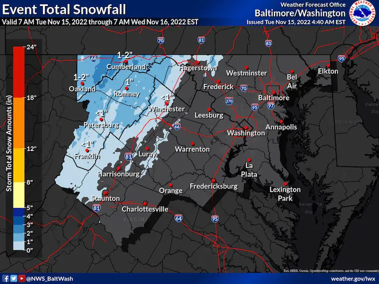
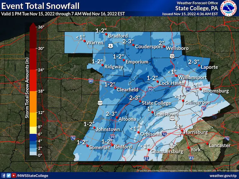
National Weather Service Snow Forecasts
Maryland/Virginia
Pennsylvania
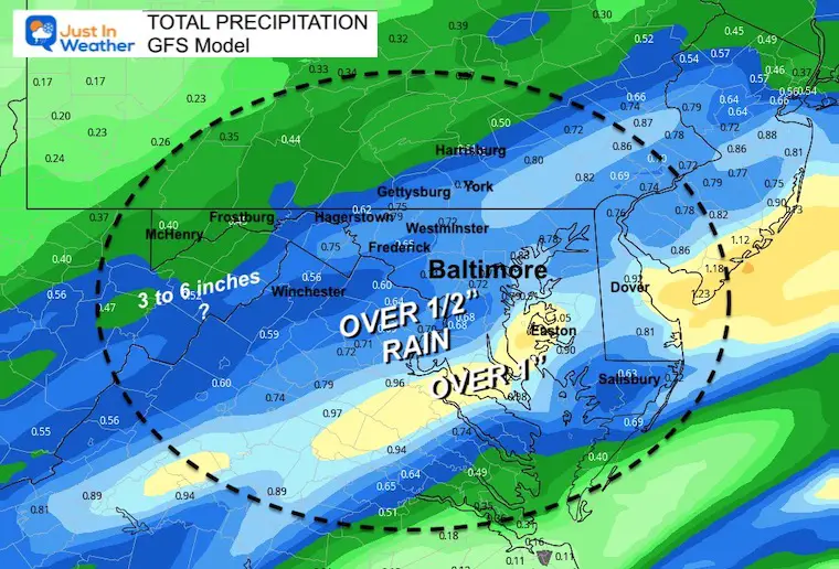
Rain/Precipitation Total
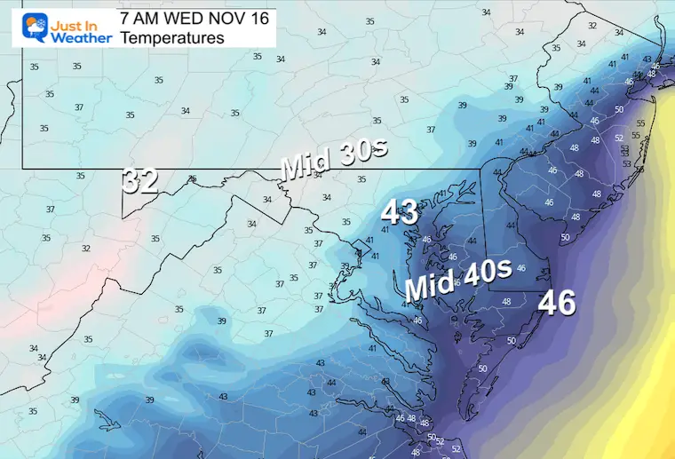
Wednesday Morning
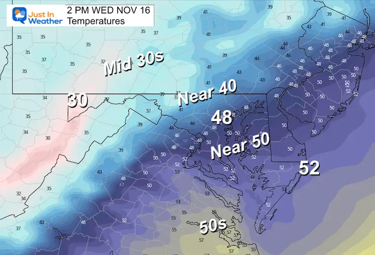
Wednesday Afternoon
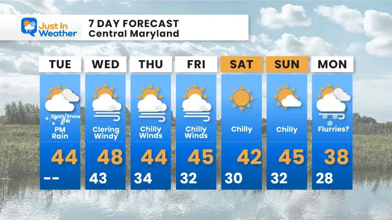
7 Day Forecast
STEM Assemblies/In School Fields Trips Are Back
Click to see more and ‘Book’ a visit to your school
Also See: Winter Outlook Series:
ALSO, SEE THESE OTHER WINTER OUTLOOK REPORTS
Farmer’s Almanac Comparison
September Starts Meteorological Autumn: Weather Climate Stats For Maryland at Baltimore
Triple Dip La Niña Winter
CONNECTION TO WINTER?
If you want a snowy winter, this is what you might want to look for in the rest of the tropical season. (You might be seeing a lot of commercial snow removal people out this Winter).
Rainbow Ice Cave In Mt. Rainier A Very Rare Find: Photos And Video
Wooly Bear Caterpillars
https://justinweather.com/2022/10/25/winter-weather-outlook-from-the-wooly-bear-caterpillar/
Persimmon Seeds
Click to see Top 20 and MORE
Winter Weather Folklore Top 20 And More Outlook Signals From Nature For Cold And Snow
Normals And Records: Maryland and Baltimore Climate History
Faith in the Flakes Gear
SNOWSTIX – Available Now
Please share your thoughts, best weather pics/videos, or just keep in touch via social media
-
Facebook: Justin Berk, Meteorologist
-
Twitter: @JustinWeather
-
Instagram: justinweather


