Tuesday Brings A Freeze Warning A Winter Weather Advisory With Snow Or Sleet In Between
November 14 2022
Monday Evening Update
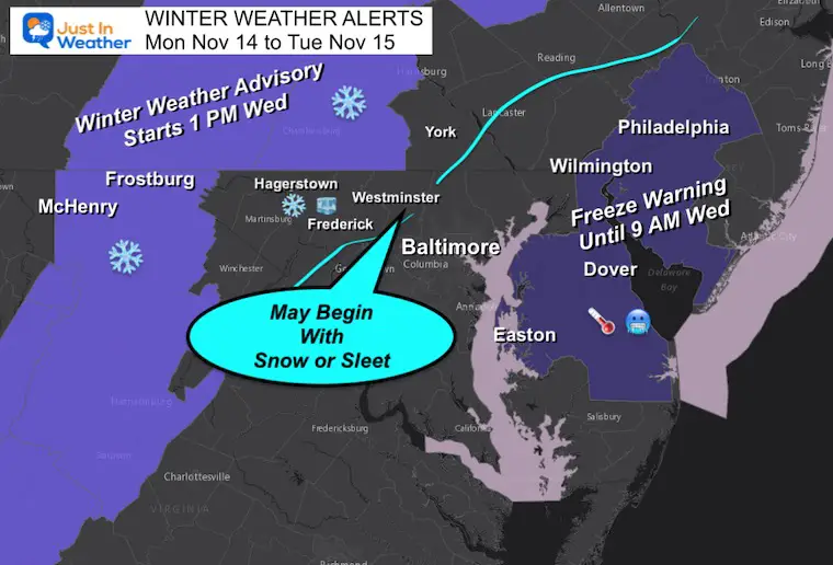
The first taste of winter shows up in two separate weather alerts for Tuesday. What I want to highlight again in this post is that I believe there will be more areas that might see their first flakes or sleet pellets not shown on this map. I do have more maps that help support that for more of Central Maryland and Southern Pennsylvania.
Winter Weather Alerts:
Freeze Warning: Delmarva will give it another try after not getting to 32ºF Monday morning.
Winter Weather Advisory: Some stickage may affect travel on I-68, I-70 west of Breezewood, and I-81.
I have colored in a section left of the light blue line where I believe a period of snow or sleet may fall, which I’ll explain below.
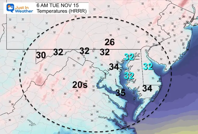
Tuesday Morning Temperatures
This is the HRRR Model, which is the coldest outlook for low temps. Here I’ve highlighted the areas in the Freeze Warning that might get to 32ºF.
Let’s Back Up To The Weather System
UPDATE: NEW DATA/FORECAST
TUESDAY MORNING: Click here
Winter Weather Folklore Top 20 And More Outlook Signals From Nature For Cold And Snow
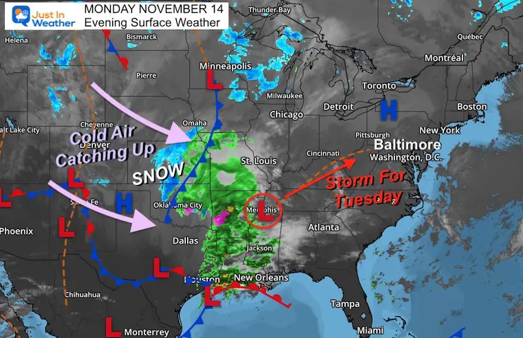
Monday Evening Surface Weather
Low Pressure is identified near Memphis, with a Cold Front reaching Oklahoma City bringing in really cold air and snow. The race for these two is on as this complex develops and heads towards Maryland on Tuesday afternoon.
GFS Model: 7 AM Tuesday to 1 PM Wednesday
This has constantly been showing the snow and icy mix just inland from Baltimore. It has been trending colder and closer…
It will bring in warmer air overnight, then race out of here by Wednesday as it heads toward New England.
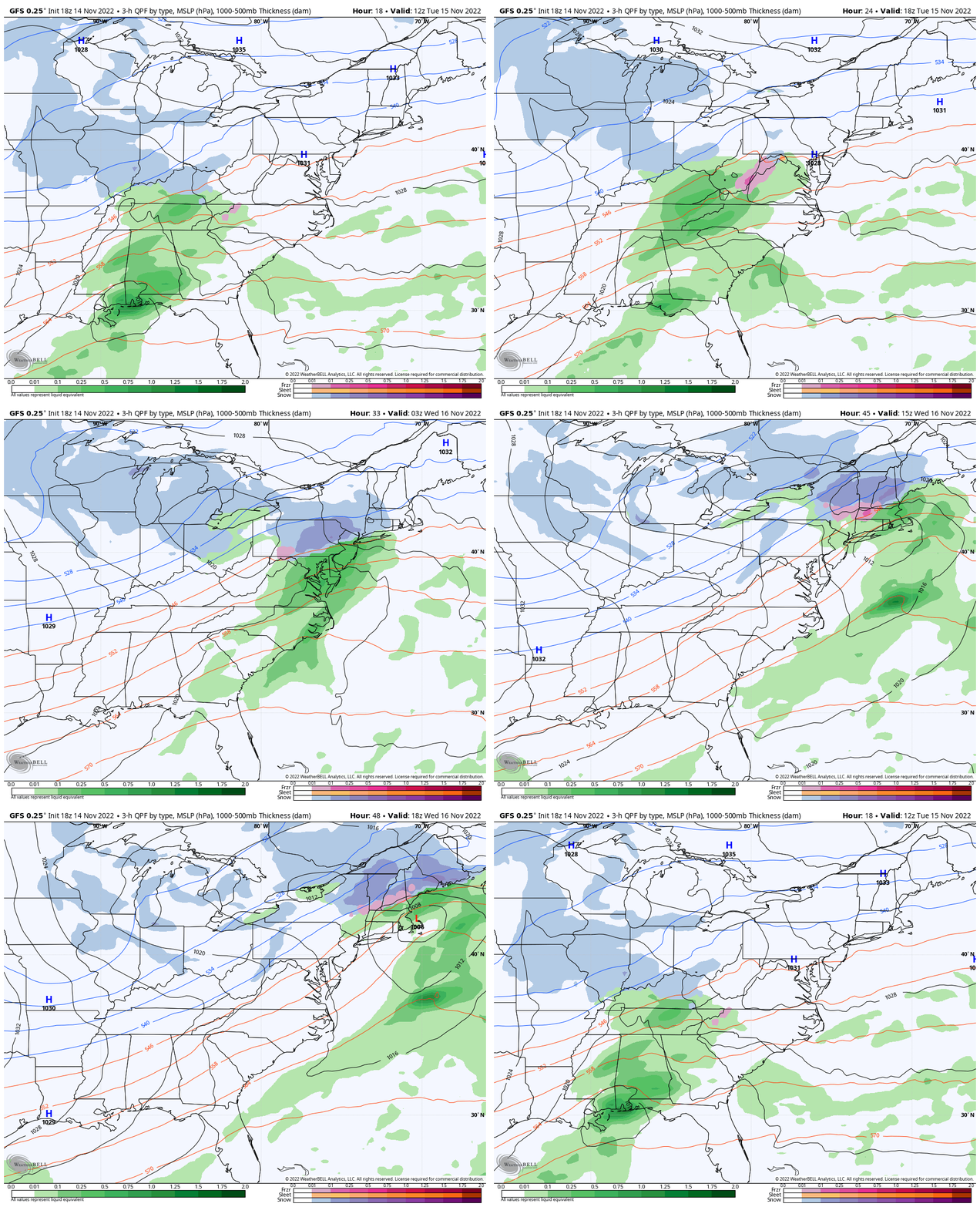
Closer Look: 1 PM Tue to 1 PM Wed
I would expect precipitation to begin in central Maryland between 1 PM and 4 PM. It may start with light rain or sleet, then the wintry precipitation will expand inland 4 PM to 7 PM. Then, warming later in the night.
Heavier snow will fall in the mountains, followed by Lake Effect Snow on Wednesday in and around Garrett County.
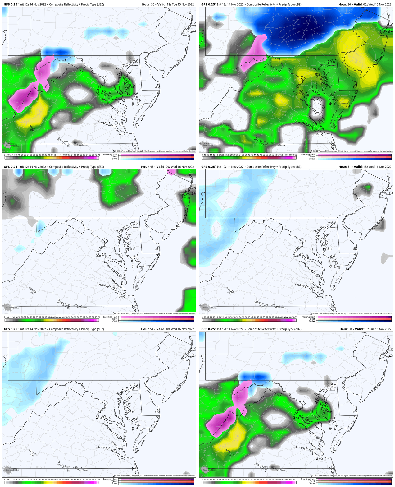
Snapshots at 7 PM
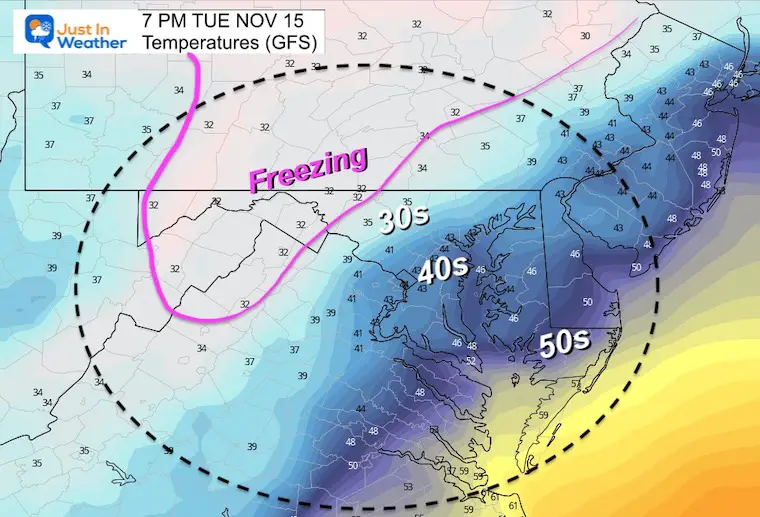
Temperatures – Surface
Most of the region will be above freezing, but chilly. That freezing line may get into parts of York County in PA to Frederick County in Maryland.
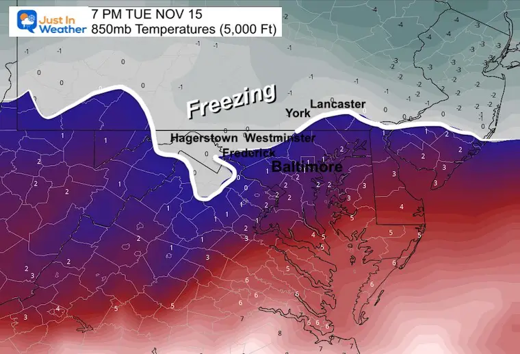
Temperatures Aloft:
850mb level is roughly around 5,000 Ft above the ground and a key level for cloud temps. Here we see the freezing line supporting frozen precipitation near Frederick, Westminster, Shrewsbury, and Lancaster.
Comparing Model Plots:
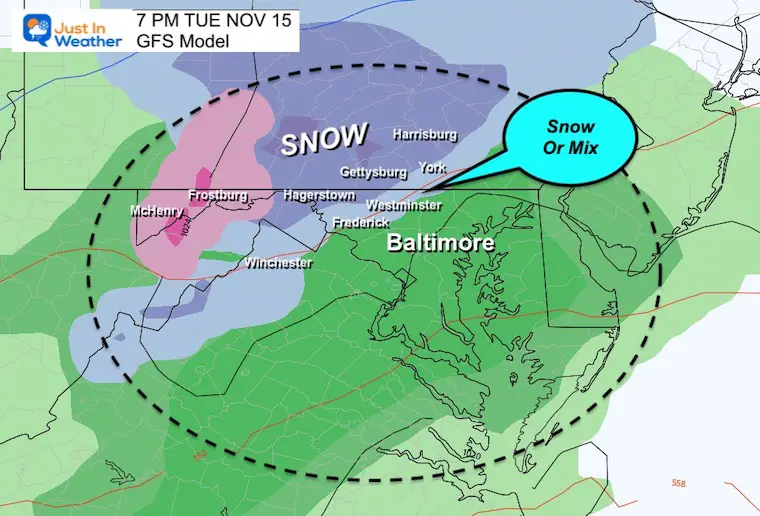
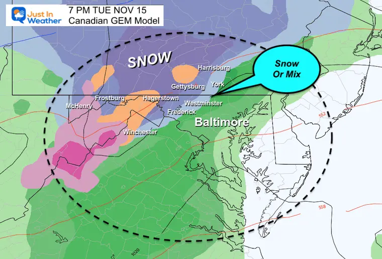
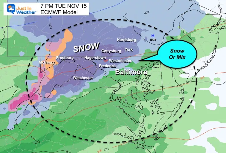
All of them do show some snow or sleet falling farther east than the Advisory area. This suggests falling but not necessarily sticking.
I’ve highlighted some key towns, and we can see that snow potential exists for Frederick, Westminster, Hereford, through to York PA.
GFS Model
This continues to show snow and or sleet falling in the NW suburbs of Baltimore to the PA line near the Hereford Zone and around the York region.
Canadian Model
This is very close to the GFS plot, with more icy mix shown in that peach color.
European ECMWF Model
This is actually the colder plot now, showing a chance for snow even into parts of Baltimore.
Also see:
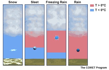
Explain Winter Weather Precipitation: Snow, Sleet, and Freezing Rain
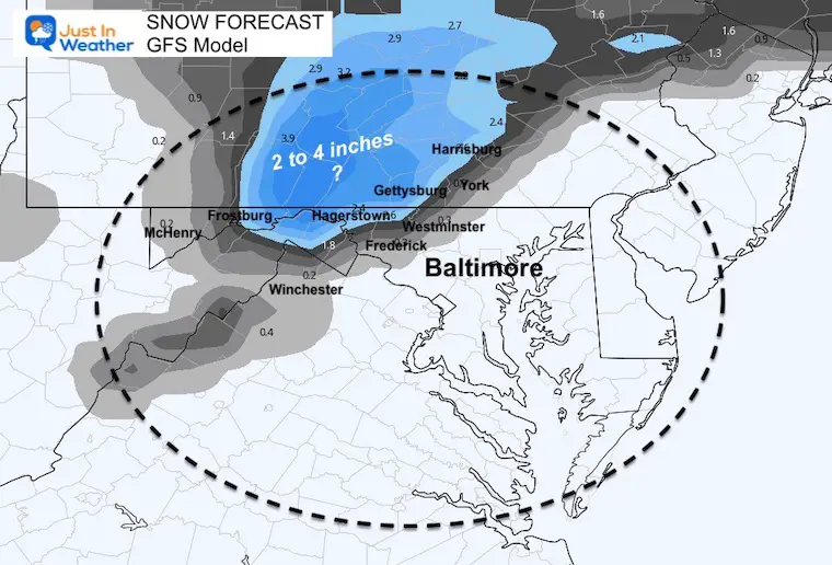
How much snow?
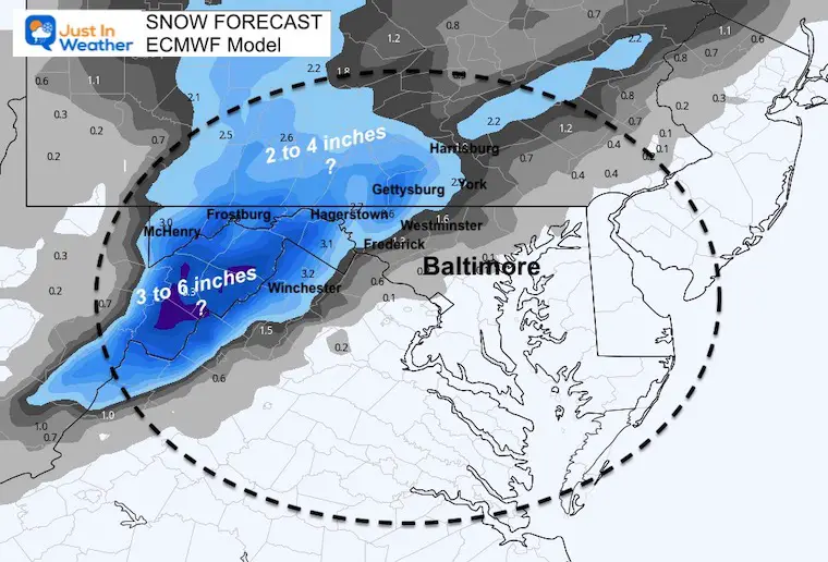
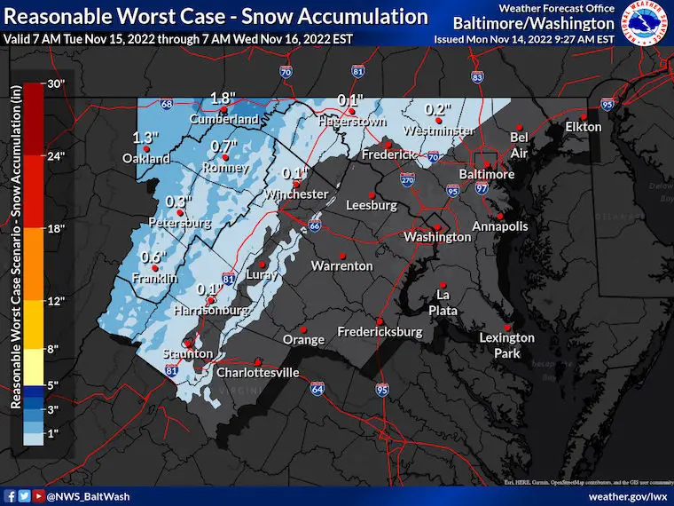
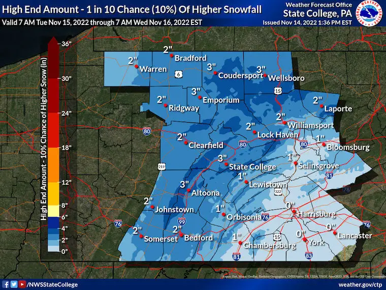
This is where it gets tricky. These models tend to oversell the snowfall and don’t necessarily account for melting on warmer ground. I am showing you the raw snow total plots which dramatically disagree with the official National Weather Service numbers (even on their high end).
No comment on the models. This is simply for fun (or posterity). If they are closer to being correct I will be sure to give the proper credit and account for future events.
GFS Model
Most practical and closer to the NWS forecasts.
Canadian Model
Same general region, but higher snow burst zone.

European ECMWF Model
This is colder and shows accumulation farther east. I would take this one with a grain of salt.
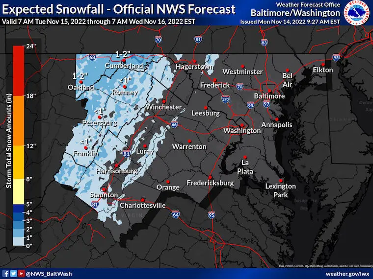
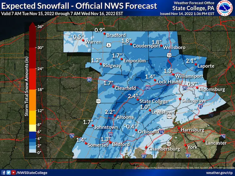
National Weather Service Snow Plots
Maryland (Baltimore/Washington Office)
High End Snow Potential
Pennsylvania (State College Office)
High End Snow Potential
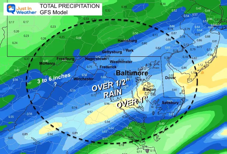
Rain/Precipitation Total
This will be a potent little system and may burst a band close to 1 inch of rain around the Chesapeake Bay.
I will aim to have my full morning update posted close to 6 AM on Tuesday.
Please sign up for the email alerts to get al updates in your inbox first.
Weather posts straight to your inbox
Sign up and be the first to know!
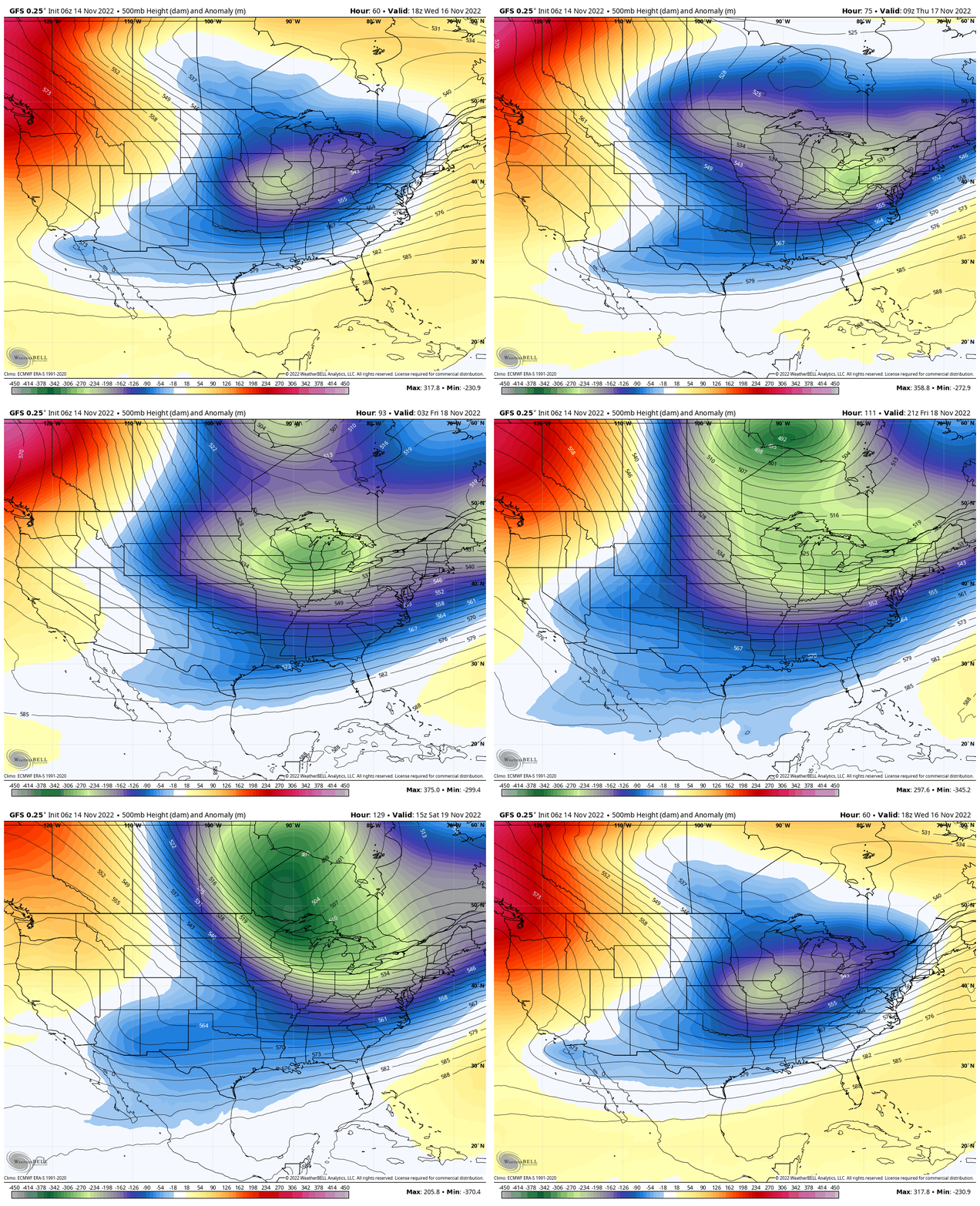
Jet Stream: Wednesday to Saturday
Keeping trough of cold air for the eastern US.
STEM Assemblies/In School Fields Trips Are Back
Click to see more and ‘Book’ a visit to your school
Also See: Winter Outlook Series:
ALSO, SEE THESE OTHER WINTER OUTLOOK REPORTS
Farmer’s Almanac Comparison
September Starts Meteorological Autumn: Weather Climate Stats For Maryland at Baltimore
Triple Dip La Niña Winter
CONNECTION TO WINTER?
If you want a snowy winter, this is what you might want to look for in the rest of the tropical season. (You might be seeing a lot of commercial snow removal people out this Winter).
Rainbow Ice Cave In Mt. Rainier A Very Rare Find: Photos And Video
Wooly Bear Caterpillars
https://justinweather.com/2022/10/25/winter-weather-outlook-from-the-wooly-bear-caterpillar/
Persimmon Seeds
Click to see Top 20 and MORE
Winter Weather Folklore Top 20 And More Outlook Signals From Nature For Cold And Snow
Normals And Records: Maryland and Baltimore Climate History
Faith in the Flakes Gear
SNOWSTIX – Available Now
Please share your thoughts, best weather pics/videos, or just keep in touch via social media
-
Facebook: Justin Berk, Meteorologist
-
Twitter: @JustinWeather
-
Instagram: justinweather


