November 14 Morning Freeze Today The Rain May Start With Icy Mix Or Snow Tuesday
November 14 2022
Monday Morning Update
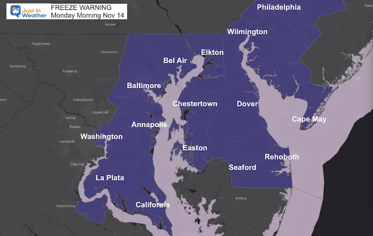
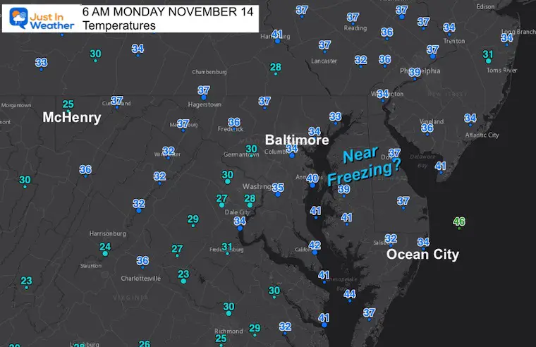
This morning the clear sky has allowed temps to drop to near freezing around the big cities, Chesapeake Bay, and Delmarva. This is the Freeze Warning region getting into these temps for the first time this season.
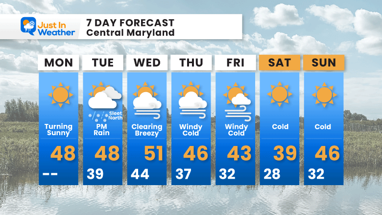
Tomorrow the next storm system will bring mostly rain, however it could begin with some snow and sleet for the inland suburbs. Farther inland a quick 1 inch of snow possible. Then the rest of the week will remain cold!
Freeze Warning
All the counties in the alert this morning for the first day of the season at or below 32ºF. However, not all made it there. See the temps below.
Morning Temperatures
Delmarva is near freezing, but many reporting stations not there yet.
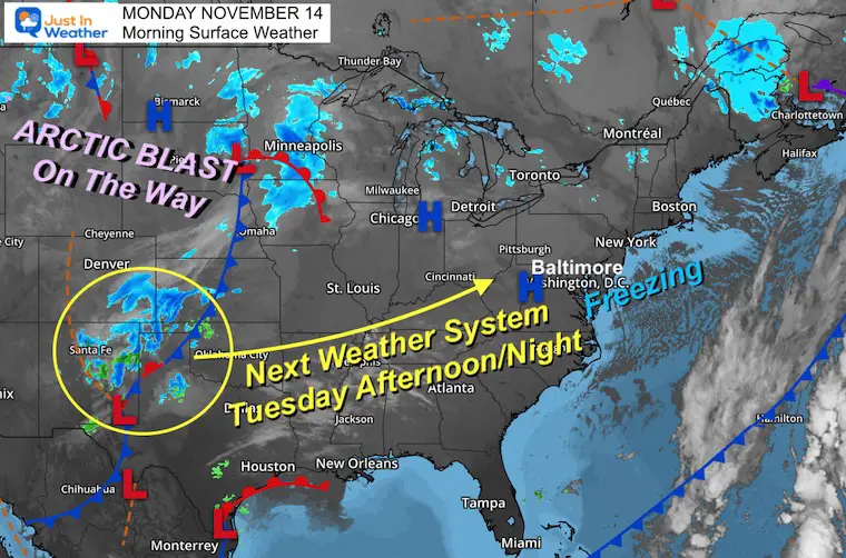
Morning Surface Weather
High Pressure is dominating most of the Eastern US. The next system to our west has snow in New Mexico and entering The Texas Panhandle. This is what we will track into Tuesday afternoon that may bring a start with wintry weather in our interior locations.
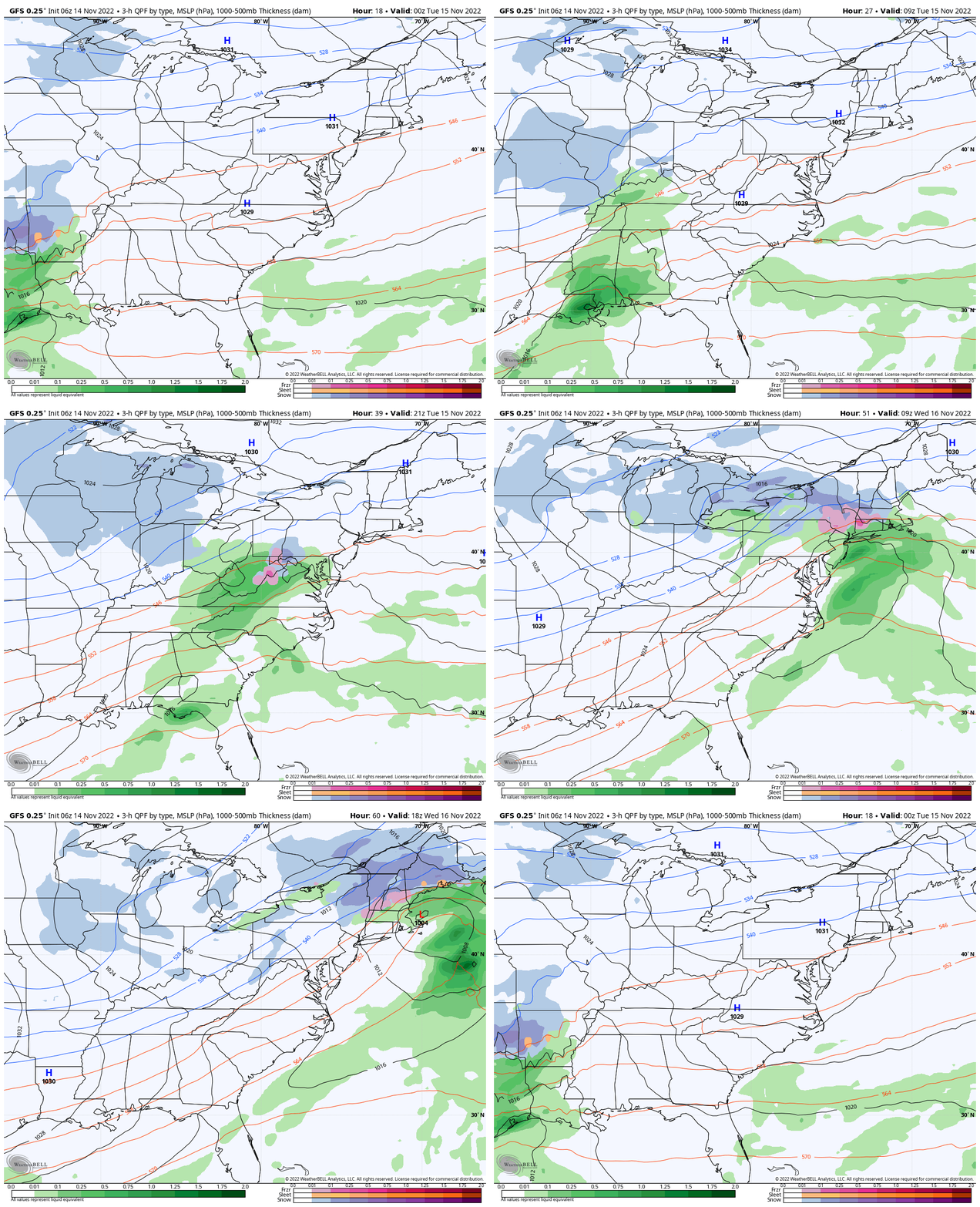
Wide View Forecast
We will get a chilly rain arriving Tuesday afternoon, with some mix inland and high mountain snow. A closer more detailed look at this event below.
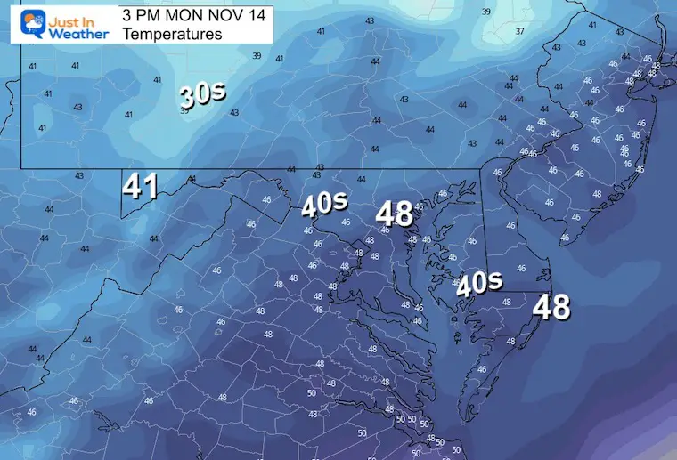
Afternoon Temperatures
CLIMATE DATA
TODAY November 14
Normal Low in Baltimore: 37ºF
Record 18ºF in 2086
SNOW: 3.6” 1908
Normal High in Baltimore: 58ºF
Record 77ºF 1989
Weather posts straight to your inbox
Sign up and be the first to know!
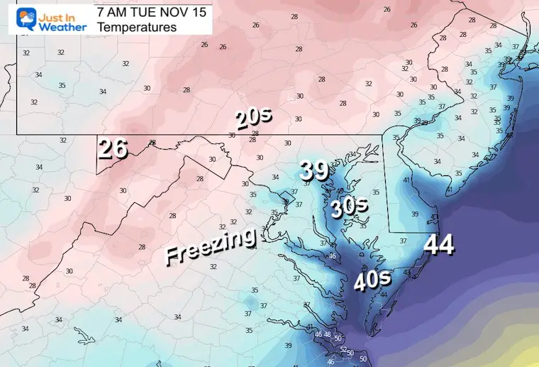
Tuesday Morning
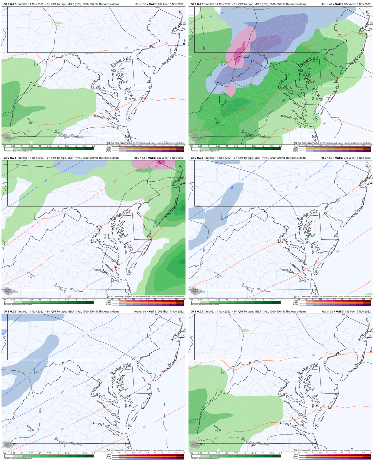
Storm Forecast
Tuesday Afternoon to Wednesday Evening
After the chilly mess locally, an extended period of snow will fall over the high mountains, including Garrett County MD.
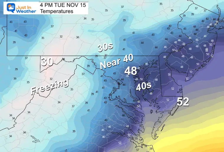
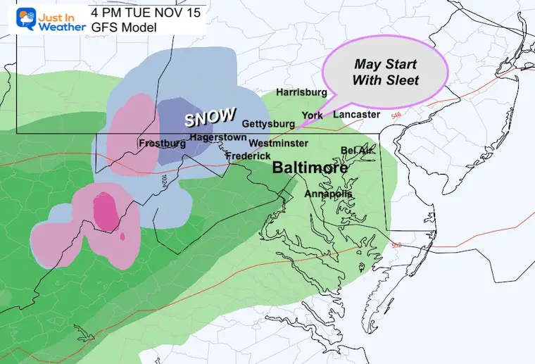
Tuesday Afternoon
Temperatures
Weather
Rain will arrive for most, with interior locations possibly starting with sleet or snow mix. Farther inland steady snow could drop a coating to a quick inch near Hagerstown and Frostburg.
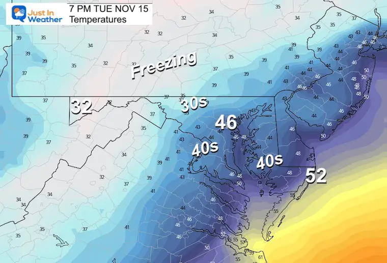
Tuesday Evening
Temperatures
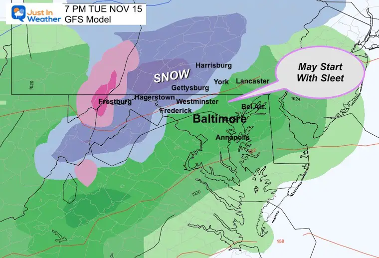
Weather
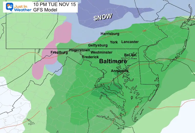
The chance for snow or sleet mixed in could reach Frederick, Carroll, northern Baltimore Counties in Maryland and southern PA between Gettysburg, York, and Harrisburg.
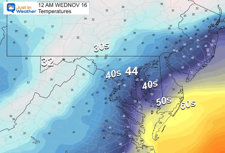
Tuesday Night
Temperatures
Weather
If anyone locally has a wintry mix, it will turn to rain by this time.
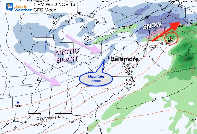
Wednesday
This Low Pressure will race into New England as an Arctic Blast spreads Eastward.
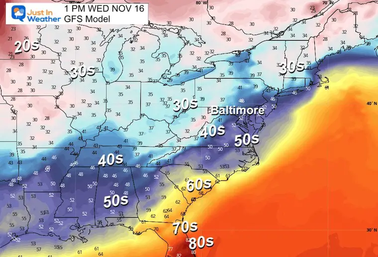
Temperatures
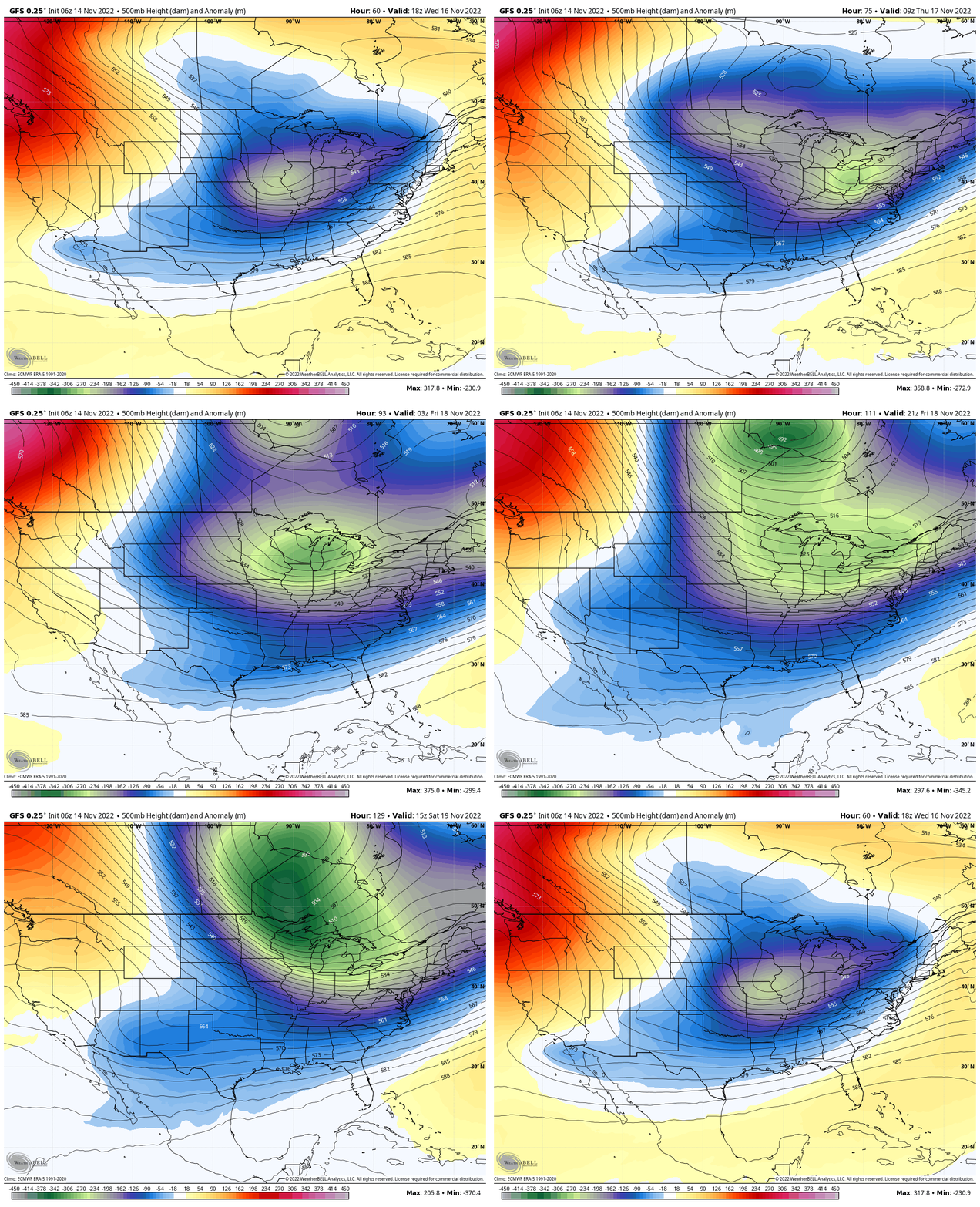
Jet Stream: Wednesday to Saturday
Keeping trough of cold air for the eastern US.
7 Day Forecast
Getting even colder into the weekend.
STEM Assemblies/In School Fields Trips Are Back
Click to see more and ‘Book’ a visit to your school
Also See: Winter Outlook Series:
ALSO, SEE THESE OTHER WINTER OUTLOOK REPORTS
Farmer’s Almanac Comparison
September Starts Meteorological Autumn: Weather Climate Stats For Maryland at Baltimore
Triple Dip La Niña Winter
CONNECTION TO WINTER?
If you want a snowy winter, this is what you might want to look for in the rest of the tropical season. (You might be seeing a lot of commercial snow removal people out this Winter).
Rainbow Ice Cave In Mt. Rainier A Very Rare Find: Photos And Video
Wooly Bear Caterpillars
https://justinweather.com/2022/10/25/winter-weather-outlook-from-the-wooly-bear-caterpillar/
Persimmon Seeds
Click to see Top 20 and MORE
Winter Weather Folklore Top 20 And More Outlook Signals From Nature For Cold And Snow
Normals And Records: Maryland and Baltimore Climate History
Faith in the Flakes Gear
SNOWSTIX – Available Now
Please share your thoughts, best weather pics/videos, or just keep in touch via social media
-
Facebook: Justin Berk, Meteorologist
-
Twitter: @JustinWeather
-
Instagram: justinweather


