November 11 Nicole Brings Rain And Severe Storm Risk
November 11 2022
Friday Morning Update
Today is our date with Nicole. In my home we get the additional honor of celebrating Veteran’s Day with my younger son’s birthday. He has been raised to honor and appreciate your service!
This is going to be wet and possibly stormy. The rain will come in waves, but some cells have the chance to turn severe… especially farther south.
The winds with this storm will pump in warm air through tonight, then followed by very chilly air to end the weekend.
Looking farther ahead, a new storm next week may look like a winter set up with snow not too far away inland.
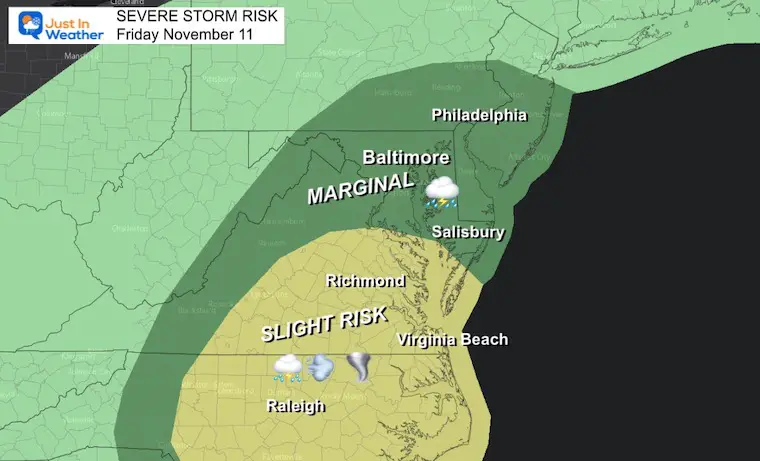
NOAA Severe Storm Risk
Today AND TONIGHT!
This highlights the chance for thunderstorms to turn severe. That would bring damaging winds over 58 mph and or isolated tornadoes. The chance for thunder and gusty winds will cover a wider area, including much of Maryland.
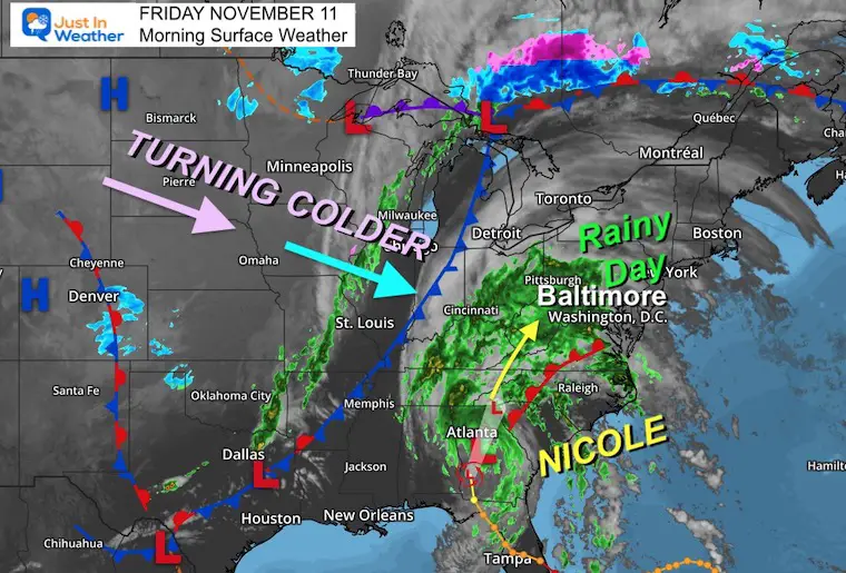
Morning Surface Weather
Tropical Depression Nicole has winds of 35 mph, but it covers a large area. As rain spreads north, the heaviest is expected to fall across Tennessee, Kentucky, and Ohio where 2 to 4 inches is expected, but they may have local spots up to 8 inches.
Here in the Mid Atlantic we expect 1 to 3 inches of rain.
The cold front is helping to steer and speed this up. It will be followed by much colder air and gusty winds.
LIVE RADAR WIDGET
Controls for panning, zooming, and looping the rain.
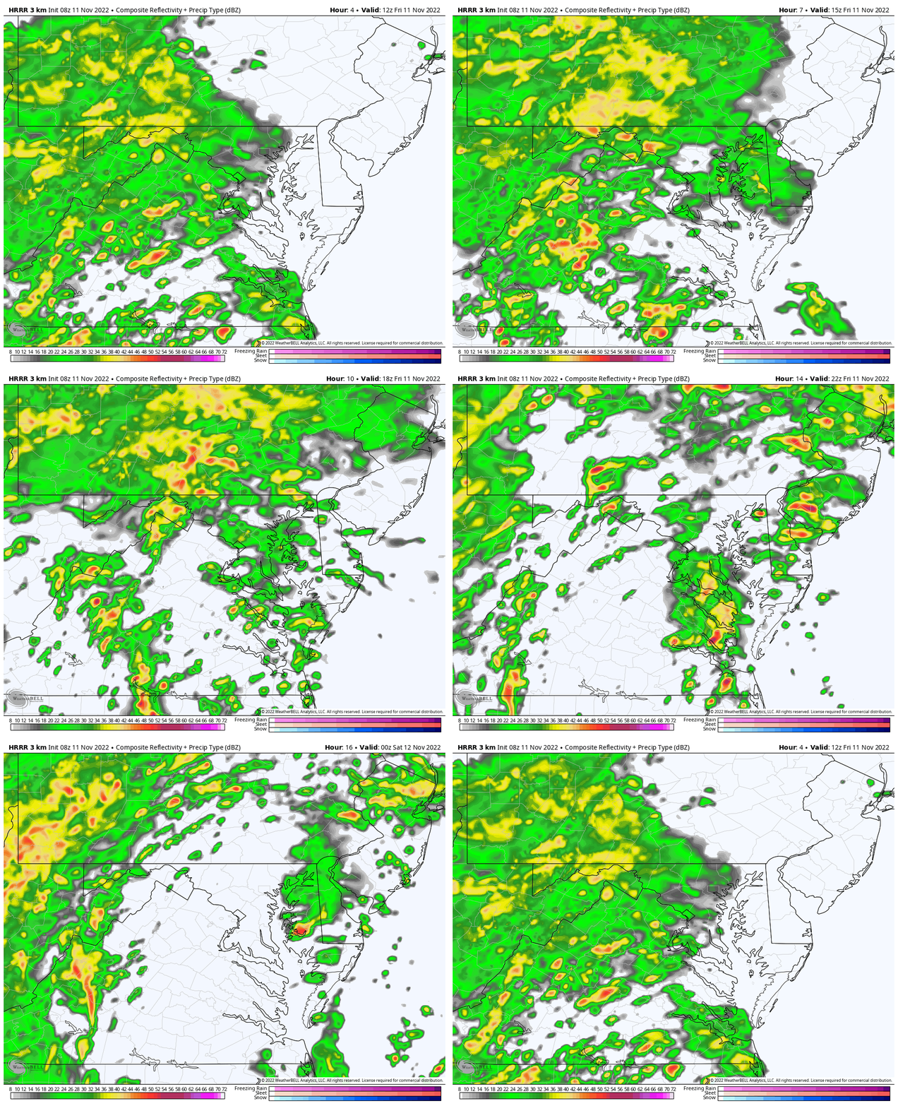
Forecast Animation – HRRR Model
7 AM FRI to 7 PM FRI
(See the second part below)
Bands of rain may have heavier cells, but there will also be a few lulls. There should be a break for metro areas this evening.
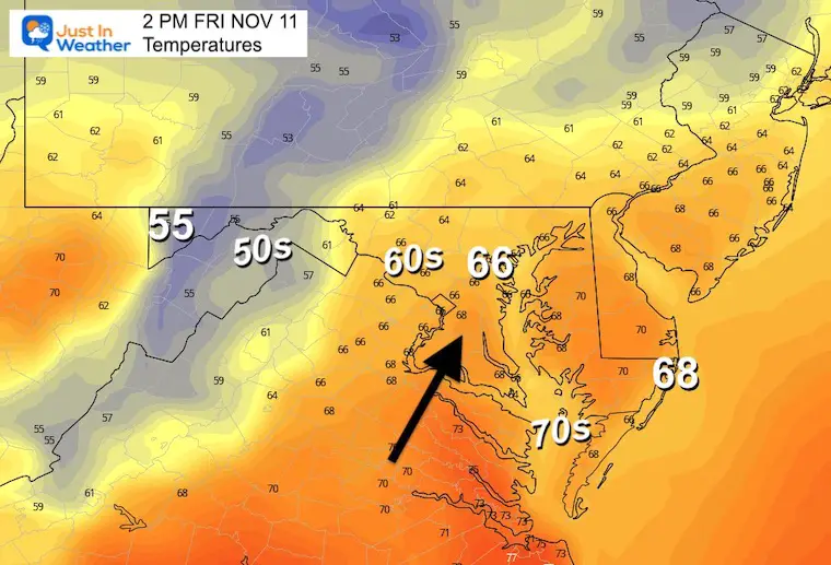
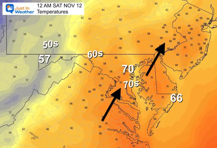
Temperatures
Afternoon
Warmer air will be pushed in ahead of the storm.
Tonight
Temps may reach the daily high right before midnight.
Weather posts straight to your inbox
Sign up and be the first to know!
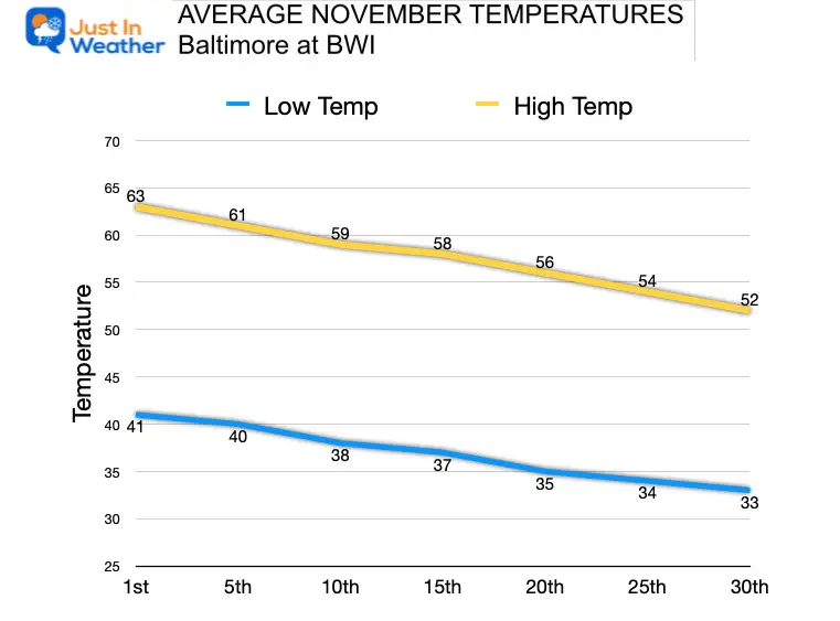
CLIMATE DATA
TODAY November 11
Normal Low in Baltimore: 38ºF
Record 21ºF in 2017
SNOW: 6″ in 1987 – VETERAN’S DAY STORM
Normal High in Baltimore: 59ºF
Record 77ºF 2006
Average Temperatures Trending Cooler
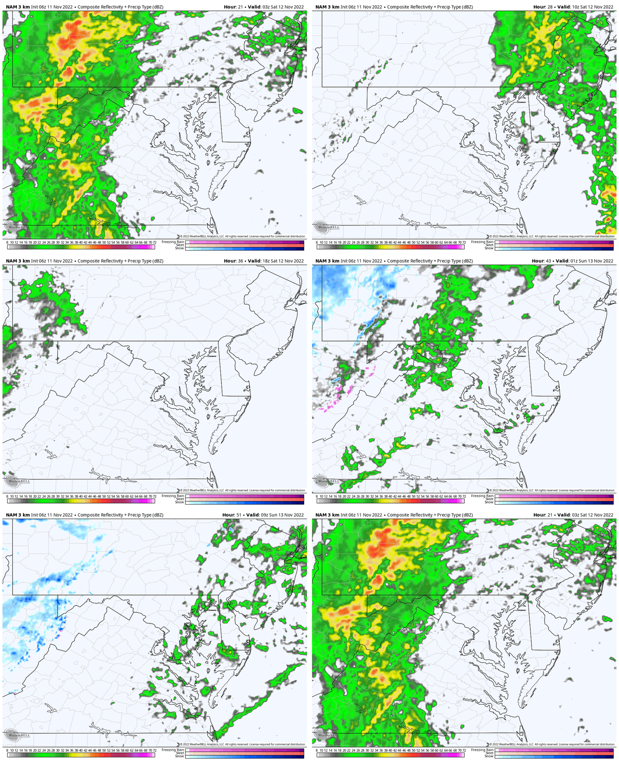
Forecast Animation – NAM 3 Km Model
10 PM FRI to 7 AM SAT
The next wave of heavy rain will fall overnight, then race out of here before sunrise on Saturday.
Saturday Temperatures
Still mild behind the storm, but turning windy. Note that a disturbance may bring a round of showers late in the day, with snow in the higher mountains (Garrett County).
Morning
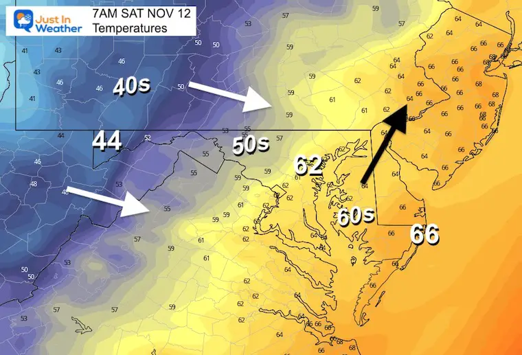
Afternoon

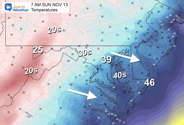
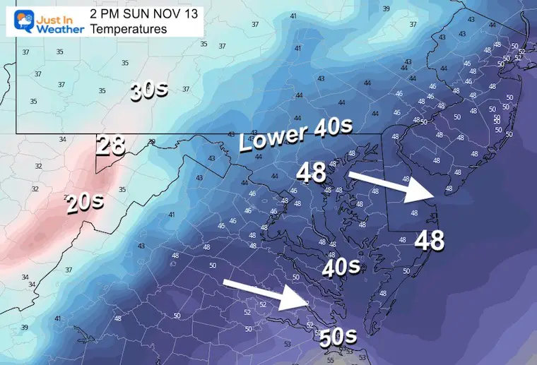
Sunday Temperatures
Much Colder
Morning
Afternoon
Next Week: Next Storm
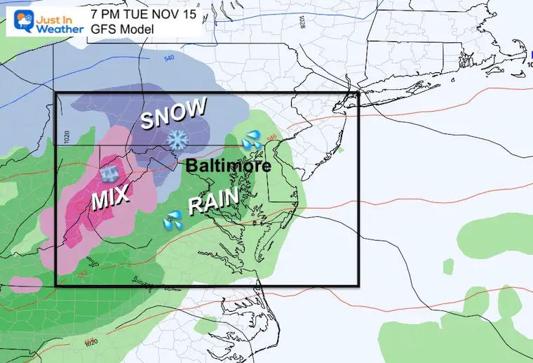
GFS Model Tuesday Night
I will have more on this later… But there has been some consistency that ‘something’ will ride along the active jet stream next week and tap into colder air.
The timing has been the challenge. Here we see it developing Tuesday. Check back for an update mid day.
7 Day Forecast
Colder air will follow Nicole and next week may look like early winter. These are temps for Baltimore. It will be colder inland!
The pattern is trying to develop a storm with inland snow next week. This is still a challenge to determine which day this may develop… stay tuned.

NEW: November Outlook Map From NOAA Showed This For The First Time
Winter Weather Folklore Top 20 And More Outlook Signals From Nature For Cold And Snow
STEM Assemblies/In School Fields Trips Are Back
Click to see more and ‘Book’ a visit to your school
Also See: Winter Outlook Series:
ALSO, SEE THESE OTHER WINTER OUTLOOK REPORTS
Farmer’s Almanac Comparison
September Starts Meteorological Autumn: Weather Climate Stats For Maryland at Baltimore
Triple Dip La Niña Winter
CONNECTION TO WINTER?
If you want a snowy winter, this is what you might want to look for in the rest of the tropical season. (You might be seeing a lot of commercial snow removal people out this Winter).
Rainbow Ice Cave In Mt. Rainier A Very Rare Find: Photos And Video
Wooly Bear Caterpillars
https://justinweather.com/2022/10/25/winter-weather-outlook-from-the-wooly-bear-caterpillar/
Persimmon Seeds
Click to see Top 20 and MORE
Winter Weather Folklore Top 20 And More Outlook Signals From Nature For Cold And Snow
Normals And Records: Maryland and Baltimore Climate History
Faith in the Flakes Gear
SNOWSTIX – Available Now
Please share your thoughts, best weather pics/videos, or just keep in touch via social media
-
Facebook: Justin Berk, Meteorologist
-
Twitter: @JustinWeather
-
Instagram: justinweather


