September 29 Remaining Cool As Rain From Ian Arrives Friday
September 29, 2022
Thursday Morning Update
Cool and Calm before The Storms. We have settled into true Fall Fashion locally, and it looks like the rain from Ian may reach us earlier. Rain could arrive later on Friday and last into the weekend while remaining chilly! We need to consider the initial rain from Ian may split off and give us a break later Saturday, before redeveloping Sunday.
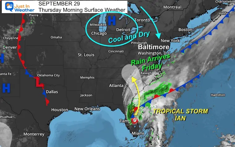
Morning Surface Weather
Our setup includes strong High Pressure to the North and Ian to the south. Today here in the Mid Atlantic region we will be in full Fall mode with sunshine and a cool, dry breeze.
Ian is now a Tropical Storm with 65 mph winds this morning. It is forecast to reemerge over the water of the Atlantic and turn up the coast to South Carolina. The rain should reach Maryland later on Friday, bumping up against that dry air. That boundary should be to our north, so we get in on the rain and will keep that pattern through early next week.
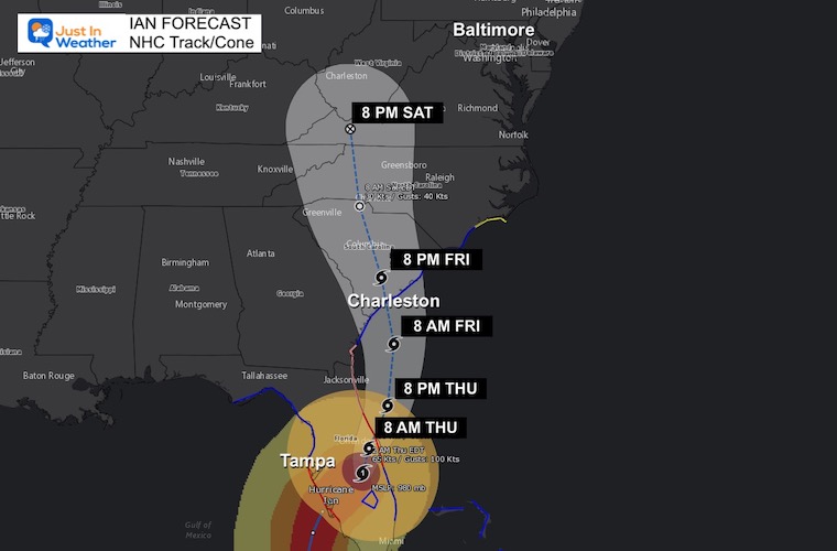
Track For Ian
NHC has it remaining a Tropical Storm, but I believe it has a chance to regain intensity to a Category 1 Hurricane before the second landfall.
Tropical Ian Morning Update and NEW LANDFALL STORM VIDEOS:
Click for full report
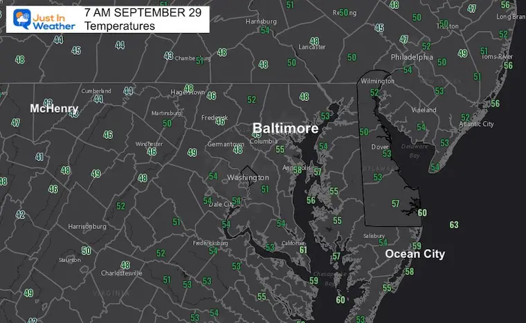
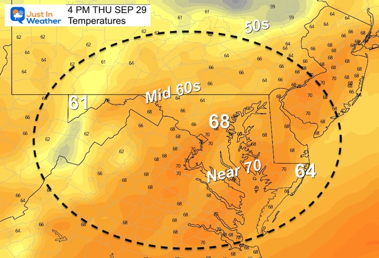
Morning Temperatures
Afternoon Temperatures
CLIMATE DATA
TODAY September 29
Normal Low in Baltimore: 54ºF
Record 38ºF in 1951
Normal High in Baltimore: 75ºF
Record 91ºF 1945
Weather posts straight to your inbox
Sign up and be the first to know!
When Is The First Frost?
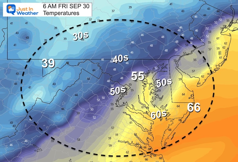
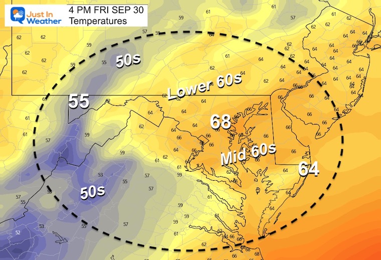
Friday Weather
Morning
Afternoon
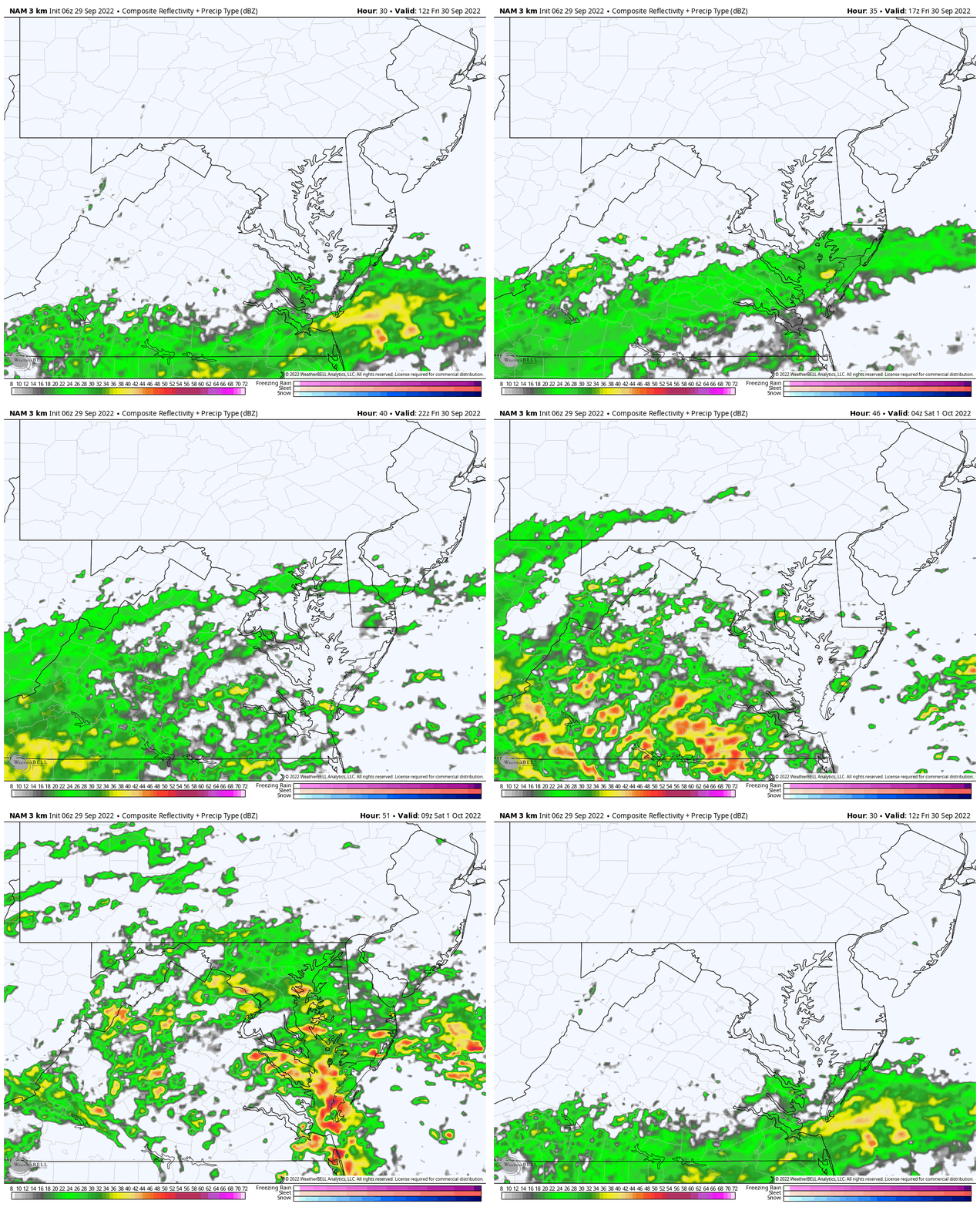
Rain From Ian
Simulation Radar: 8 AM Fri to 6 AM Sat NAM 3 Km
Long Range Forecast For Ian
ECMWF Model: Thursday Morning to Tuesday Afternoon
We need to consider the initial rain from Ian may split off and give us a break later on Saturday, before redeveloping Sunday.
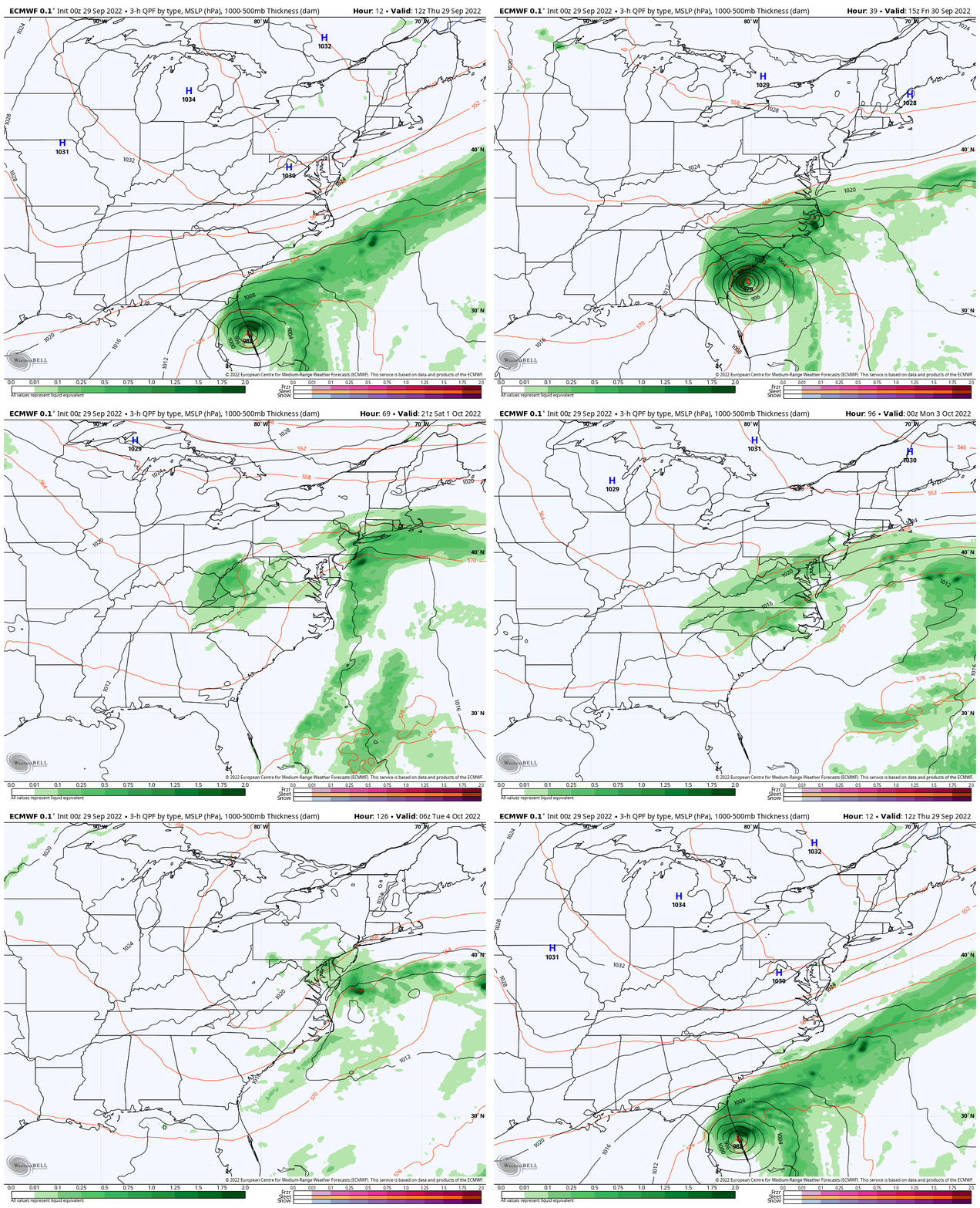
Flash Flood Potential: National Hurricane Center
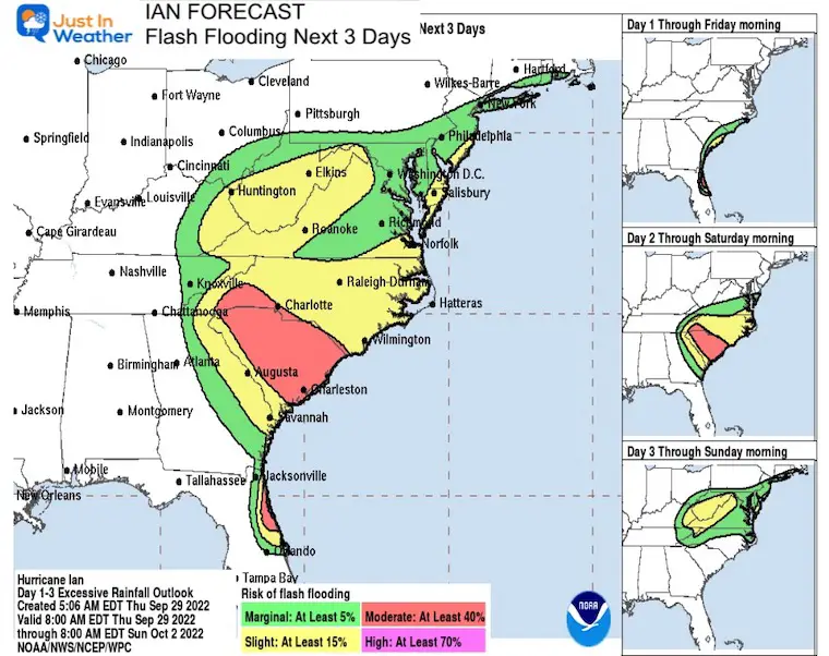
Rainfall Potential: ECMWF Model
These totals will adjust with each model run tracking the remains of Ian. The consistency has been over a few inches widespread between Friday to Tuesday. This may produce some local flooding.
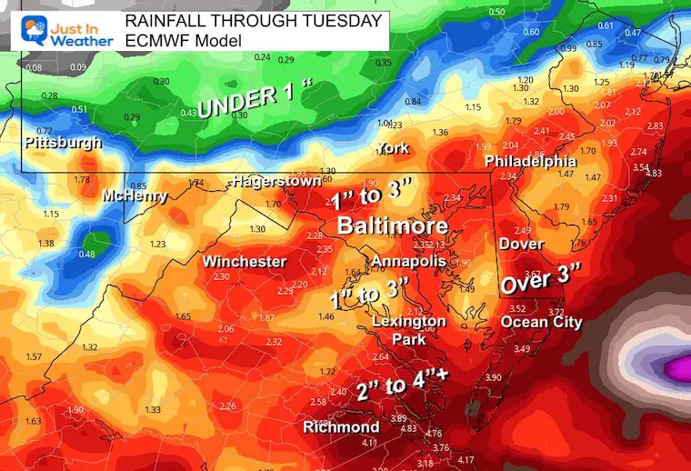
7 Day Forecast
Rainfall will depend on how Ian behaves. The initial rain will push in Friday, then split from the Upper-Level Low. That leftover circulation will keep showers around and may redevelop into a new storm to bring additional rain or showers through Tuesday.
Temps will remain unseasonably chilly.
Golf Tournament: Join My Son And Me….
We are thrilled they will be dedicating proceeds to our nonprofit Just In Power Kids
PATTERN CHANGER?
CONNECTION TO WINTER?
If you want a snowy winter, this is what you might want to look for in the rest of the tropical season.
Rainbow Ice Cave In Mt. Rainier A Very Rare Find: Photos And Video
Weather posts straight to your inbox
Sign up and be the first to know!
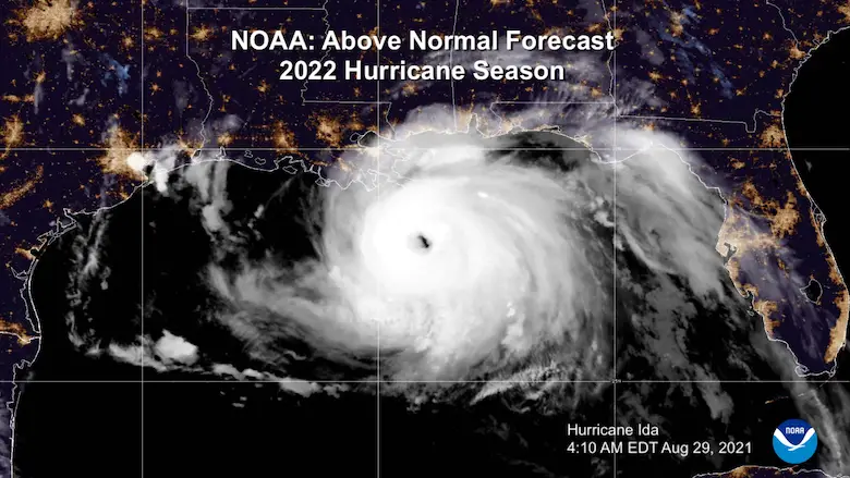
Hurricane Season Forecast: June 1 Through November 30
NOAA 2022 Hurricane Forecast- Above Normal Again
Related Posts
NOAA Study: Reducing Air Pollution INCREASED Tropical Storms
Atlantic Tropical History: Maps of Origin Regions Every 10 Days
Please share your thoughts, best weather pics/videos, or just keep in touch via social media
-
Facebook: Justin Berk, Meteorologist
-
Twitter: @JustinWeather
-
Instagram: justinweather


