


Severe Thunderstorm Watch and Flood Watch Tuesday
Tuesday Afternoon Update July 1 2024 The atmosphere is juicy! Dew points are high in the mid to upper 70s, which means there is the potential for heavy rainfall and…
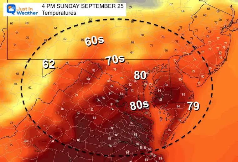
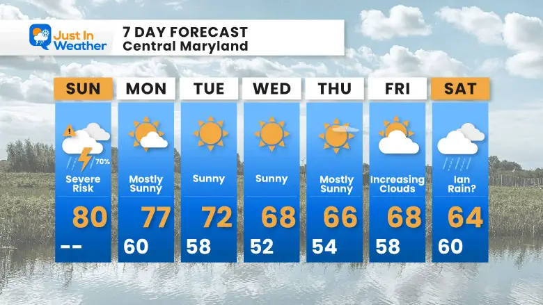
September 25 2022
Sunday Morning Update
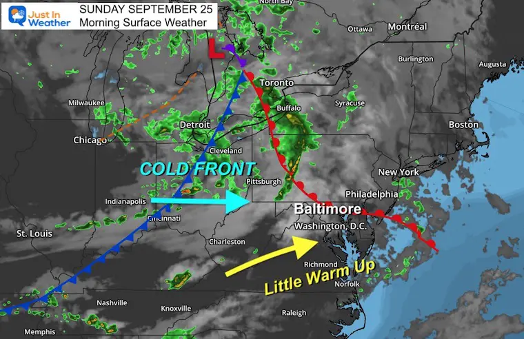
The weather system moving through today has been pushing slightly warmer air in this morning along with a few light showers. The main impulse will be with a strong cold front this afternoon and evening. Storm timeline and live radar are below.
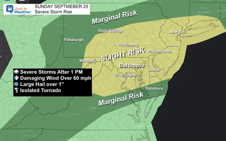
It looks like a few rounds of storms will move through any time after 1 PM. They will come with the risk of damaging winds, large hail and even a tornado. So there may be a Watch issued for the region and or local warnings for individual cells. Outdoor plans may need a plan B approach to play it safe.
Farther out we need to watch the progress of Tropical Storm Ian. It is expected to become a major hurricane before reaching Florida (the track keeps shifting west), then bring us heavy rain next weekend.
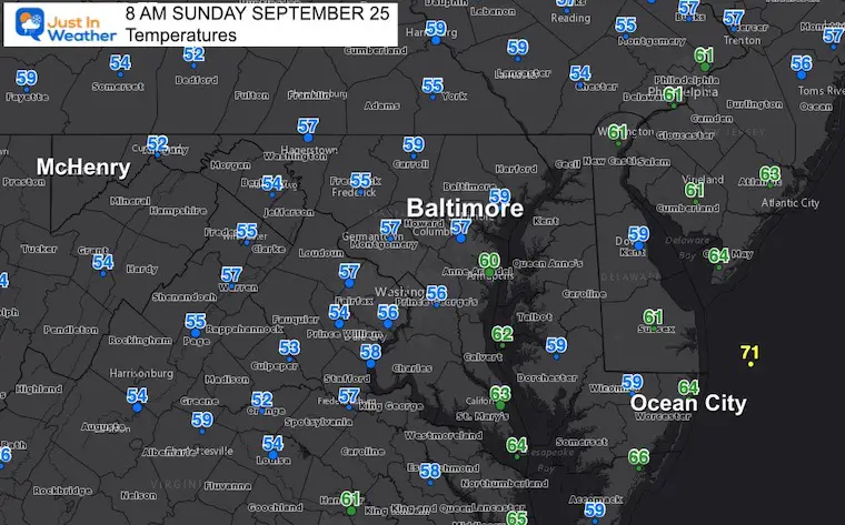
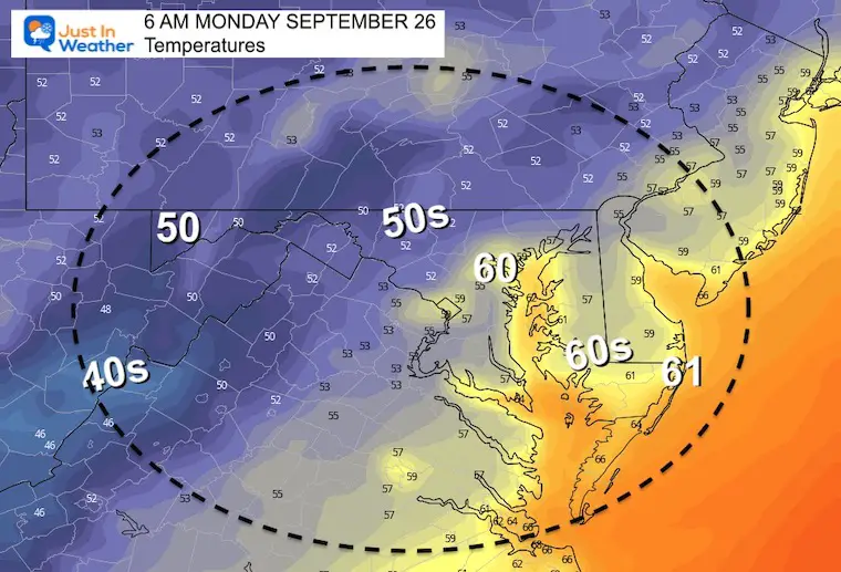
Still cool this morning with most of the region in the 50s and under cloud cover.
A warm front is moving through with a line of showers right along the Maryland and Pennsylvania border. More rain on the north side with this initial impulse. Multiple lines of storms will form ahead of the cold front today which will expand into the rest of our region.
Most of the region is under a risk for severe storms. To be considered Severe and warrant a Watch or Warning, storms must contain winds over 58 mph, hail over 1 inch in diameter, or even have an isolated tornado. Torrential downpours are possible but will be brief. Lighting is a risk with any storm, even if not severe.
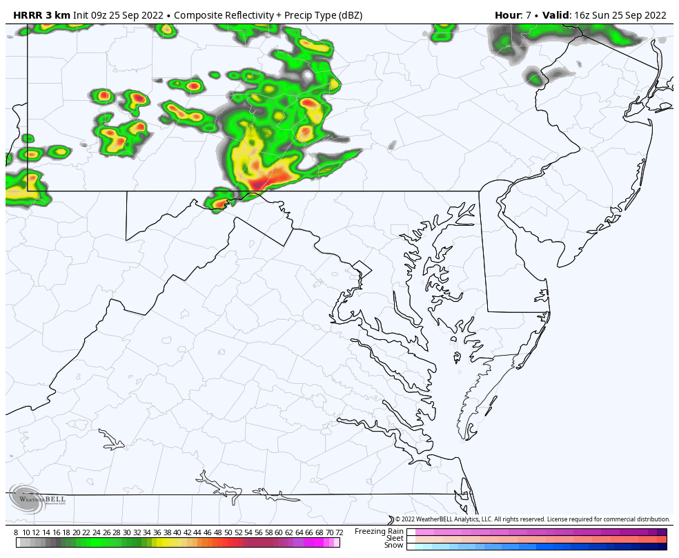
Radar and lighting display. The morning showers will be along the Maryland and Pennsylvania line with heavier cells over the mountains and north of the border.
The second push is likely after 12 PM.
Please note that this product has often been under estimating rainfall coverage, intensity, and slower/later than verifying.
HRRR Animation: 12 PM to 11 PM
We need to consider a risk for storms any time this afternoon… Especially after 2 PM in metro areas. This may linger through midnight on the Lower Eastern Shore.
This is the same as above with you controlling the snapshots.
Consider a buffer of around 1 hour earlier than shown.


Space X had a rocket launch and it was seen across the entire Mid Atlantic region. This was the first video I was able to get uploaded to Facebook, and I realize many of you may have missed that. So here it is. I hope you get a chance to see the comments. There are numerous additional videos and photos, I lost count. But more are being added and its amazing to see both the different perspectives and reactions.
TODAY September 25
Normal Low in Baltimore: 55ºF
Record 35ºF in 1963
Normal High in Baltimore: 76ºF
Record 97ºF 1970
The track keeps shifting west, and the GFS is one of the farthest west. This adjustment still brings rain for us next Saturday, and now lingers it into Sunday.
Also note: We will be in a chilly air mass, so despite the remains of a tropical system, we should get a chilly rain.
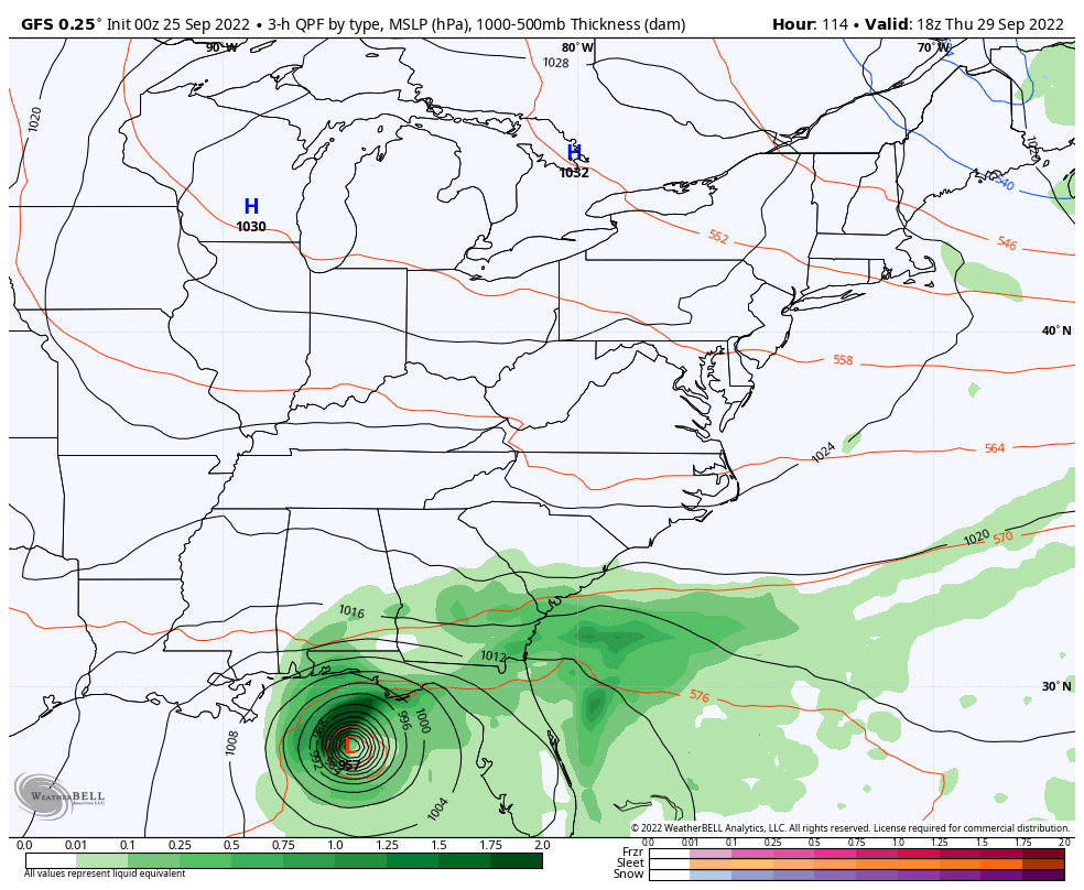
Most of next week will be dry and seasonal, trending cooler. Rainfall next weekend will depend on how Ian behaves. Slight adjustment to the track up to landfall will determine how strong and how much moisture it can push inland.
If you want a snowy winter, a busy tropical season AFTER a quiet August has done it before.
Record August For No Named Tropical Storms: Closer Look At Snow Following
NOAA Study: Reducing Air Pollution INCREASED Tropical Storms

Atlantic Tropical History: Maps of Origin Regions Every 10 Days


Winter Outlook 2023 Early Look At Snow From Two Farmers Almanacs