Monday Afternoon Update
September 12, 2022
Two things of important note today. First, the sun broke out and that is fuel for stronger storms. Second, the storms have erupted even earlier than I suggested. Despite trying to stay ahead of the model flaw, we continue to get more activity sooner than guidance has shown.
Please keep in mind that some storms may turn severe. If so, warnings could be issued for storms that may contain damaging winds, large hail, or flooding in progress. Please stay alert to that possibility through tonight.
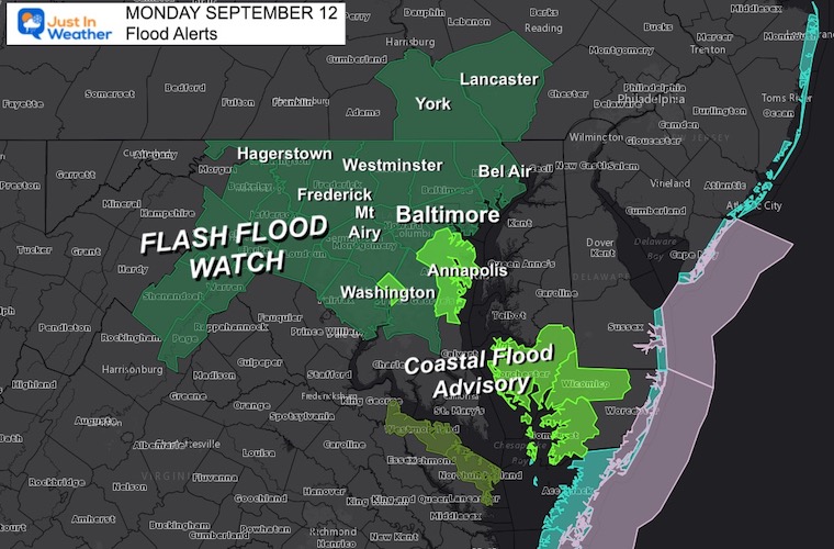
Flood Watch
Heavy rain and strong storms through the evening could top 1 to 3+ inches of rain. A Flood Watch includes central Maryland west of the Chesapeake Bay and Southern Pennsylvania through York and Lancaster Counties.
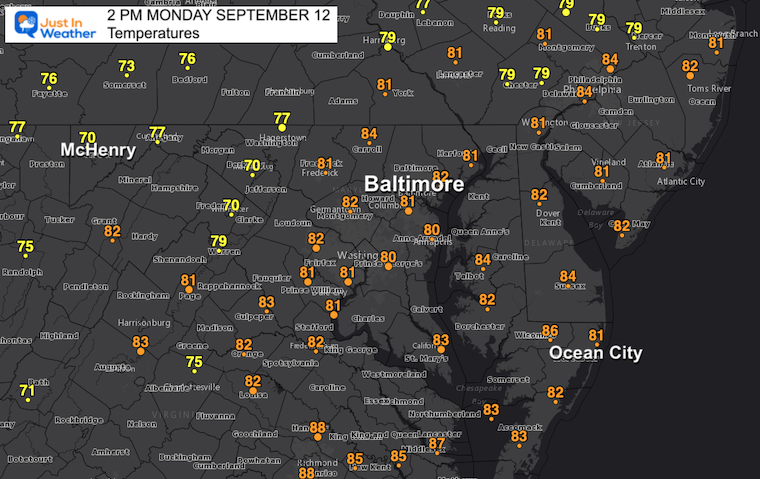
2 PM Conditions
Temperatures
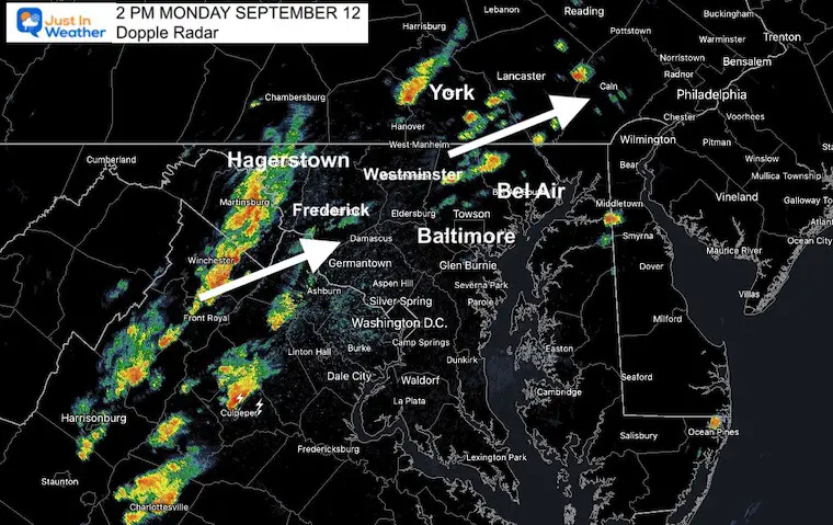
Doppler Radar Snapshot
This is much more active than expected at this time. Storms in Northern Baltimore Counties to southern PA… The line moving across I-81 between Winchester and Hagerstown is the one to watch for the next few hours.
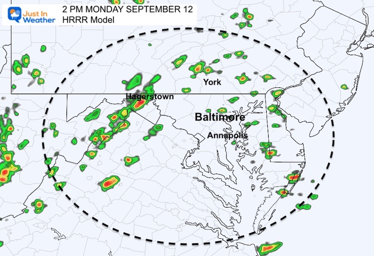
Radar Simulation: HRRR Snapshot
This short-term forecast from a few hours earlier finally caught up to reality. At least closer than earlier today.
LIVE RADAR and LIGHTNING WIDGET
Compare to the forecast animation below
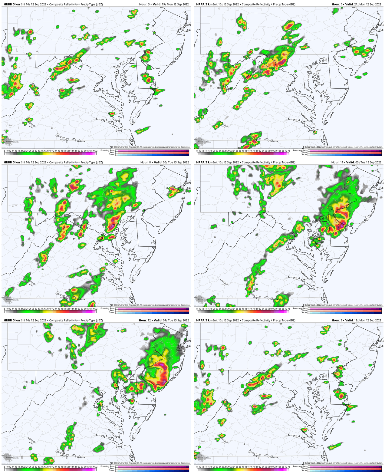
Forecast Animation 3 PM to Midnight
Here we see the line forming which may turn severe between 4 PM and 7 PM when reaching the western Baltimore and Washington suburbs. The risk of showers and storms will shift to Delmarva and continue through Midnight.
Weather posts straight to your inbox
Sign up and be the first to know!
STEM Assemblies/In School Fields Trips Are Back
Click to see more and ‘Book’ a visit to your school
September Begins Meteorological Autumn
Climate Data/Weather Stats For The Month
Rainbow Ice Cave In Mt. Rainier A Very Rare Find: Photos And Video
In Case You Missed It: Seem Early Winter Outlooks
COMPARE TO THE PAST
If you want a snowy winter, this is what you might want to look for in the rest of the tropical season.
Rainbow Ice Cave In Mt. Rainier A Very Rare Find: Photos And Video
Hurricane Season Forecast: June 1 Through November 30
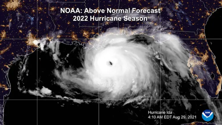
NOAA 2022 Hurricane Forecast- Above Normal Again
Forecast From Colorado State University
Related Posts
NOAA Study: Reducing Air Pollution INCREASED Tropical Storms
Atlantic Tropical History: Maps of Origin Regions Every 10 Days
Rainbow Ice Cave In Mt Rainier
Rainbow Ice Cave In Mt. Rainier A Very Rare Find: Photos And Video
Please share your thoughts, best weather pics/videos, or just keep in touch via social media
-
Facebook: Justin Berk, Meteorologist
-
Twitter: @JustinWeather
-
Instagram: justinweather


