July 17 2022
Sunday Morning Update
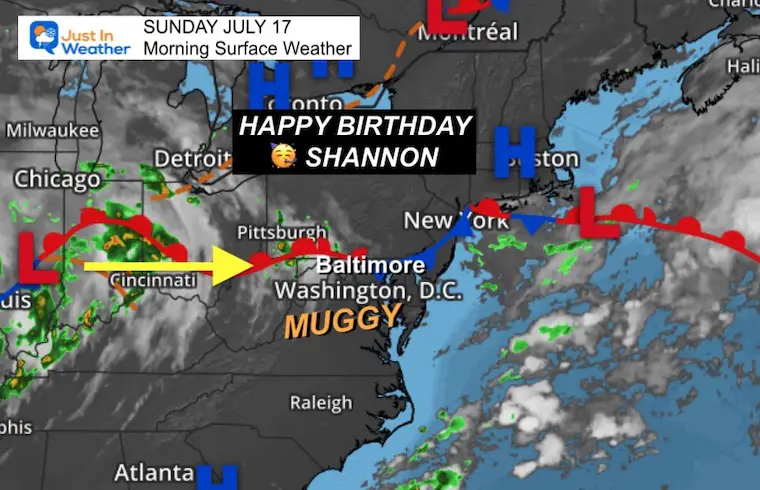
Before we get started, I want to say this is a very special day! Today is my wife Shannon’s Birthday. Not only is this important to our family, but it means we will be out in the building humidity with more possible storms. I may post an update or two, but my day is dedicated to spending time with her.
It is also really unique in the climate records… Which I highlighted below.
Recapping The Rain
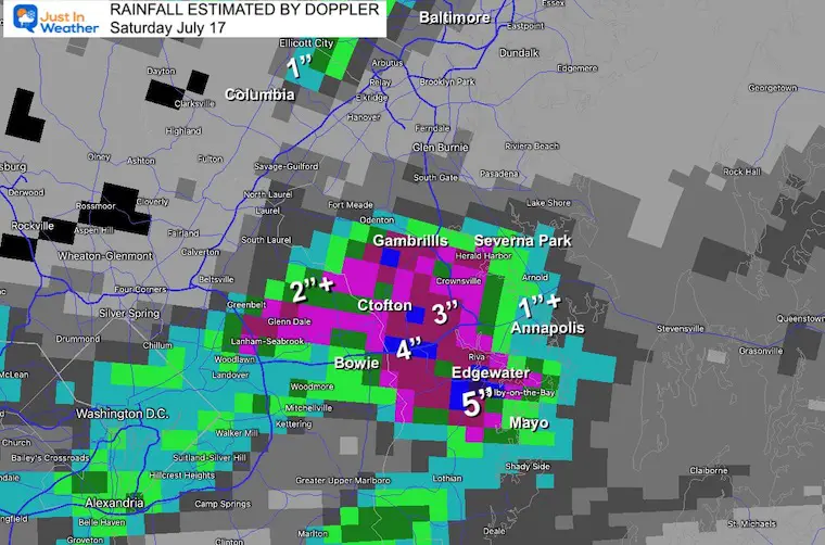
Saturday brought big rains to parts of our area, with the hardest hit in central Anne Arundel Couty. Doppler radar has ‘estimated’ the amount of rain. It has been suggested that this is lower that what some have recorded, but does illustrate where the heavy led to flash flooding.
Anne Arundel County
This was due to a stalled boundary leading to repeating slow moving cells in the late afternoon and evening.
Between 3 and 5 Inches of rain fell around Crofton, Bowie, and Edgewater (top mark).
Annapolis had around 1 inch of rain as depicted here.
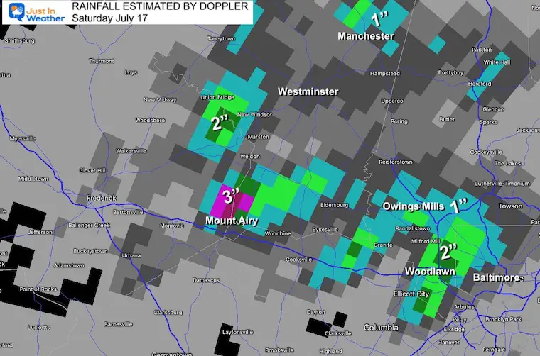
Mount Airy-Westminster
Storms in this area hit earlier in the day and erupted with plenty of lightning.
3 Inches Of Rain fell on the north side of Mount Airy.
Video: Sincere Sweet Sportsmanship
This baseball game in Westminster led to a Tic-Tac-Toe game between teams in opposing dugouts.
This Morning
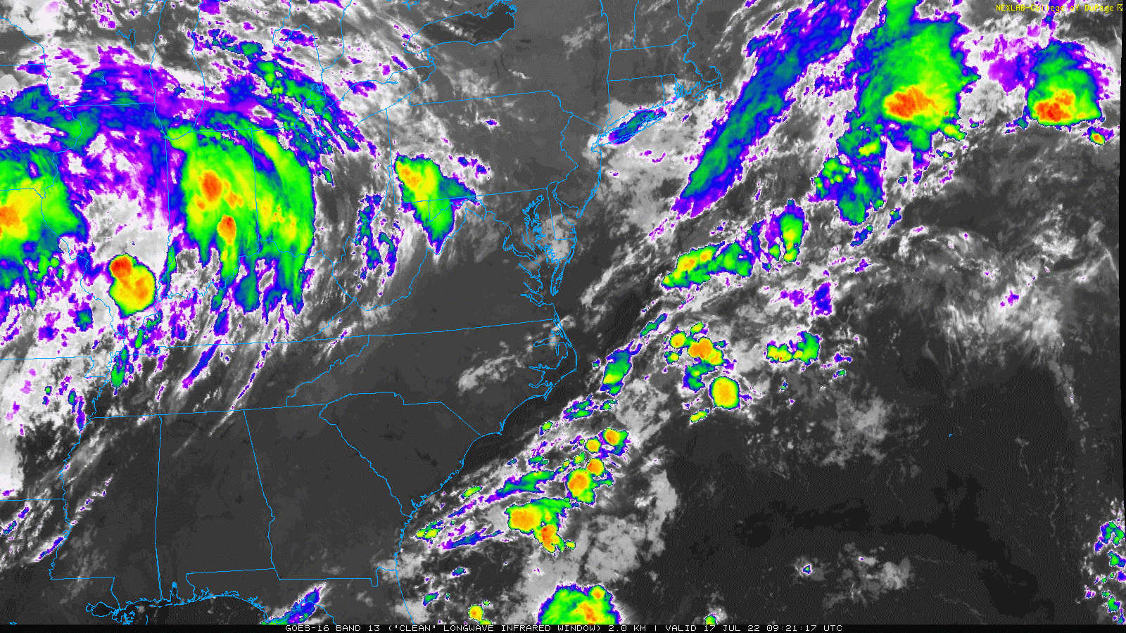
Satellite Loop 5:30 AM to 7:30 AM
More clouds and impulses to our west will be on the move. Expect more clouds to build and spark scattered storms today.
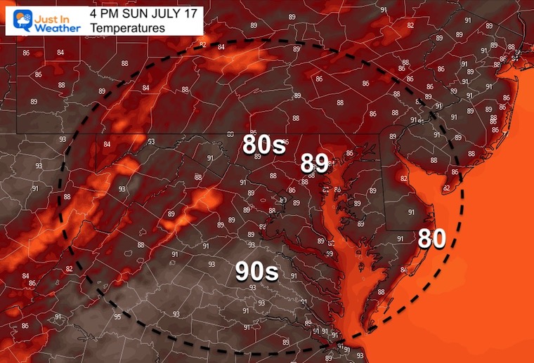
Afternoon Temperatures
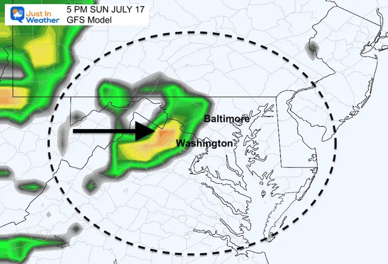
Radar Simulations
We are in the season with pop up storms that models can’t handle well. I mentioned this yesterday and we saw it play out. Please take these maps as suggestions, but plan for more activity likely.
GFS Highlights a cluster to the west of Washington and Baltimore at 5 PM
The track will be to the east..
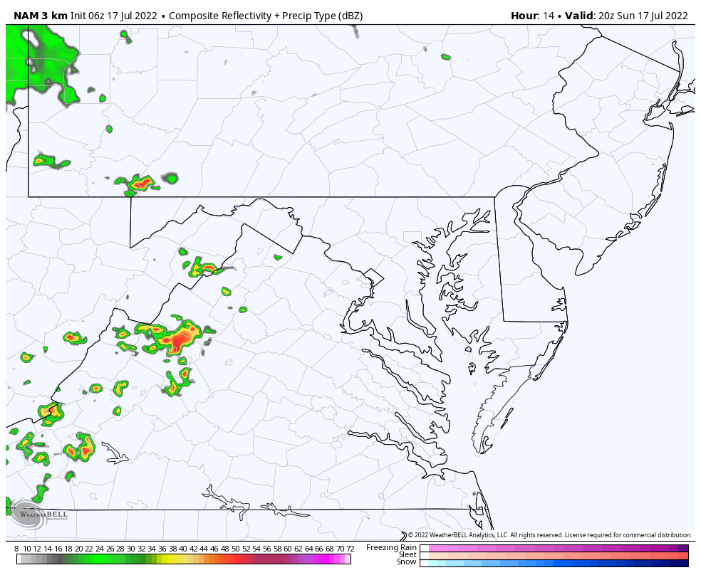
NAM 3Km 4 PM to Midnight
This model is later with the storm cluster for metro areas – tonight.
As we have seen many times, this produce may be slow… meaning we could expect development and arrival earlier than suggested here.
It still looks like the better chance for showers and storms will be later in the day.
CLIMATE DATA
TODAY July 17th
UNIQUE ABOUT THIS DAY:
Record High and Low Set 1 Year Apart
Normal Low in Baltimore: 67ºF
Record 58ºF in 1987
Normal High in Baltimore: 88ºF
Record 101ºF 1988
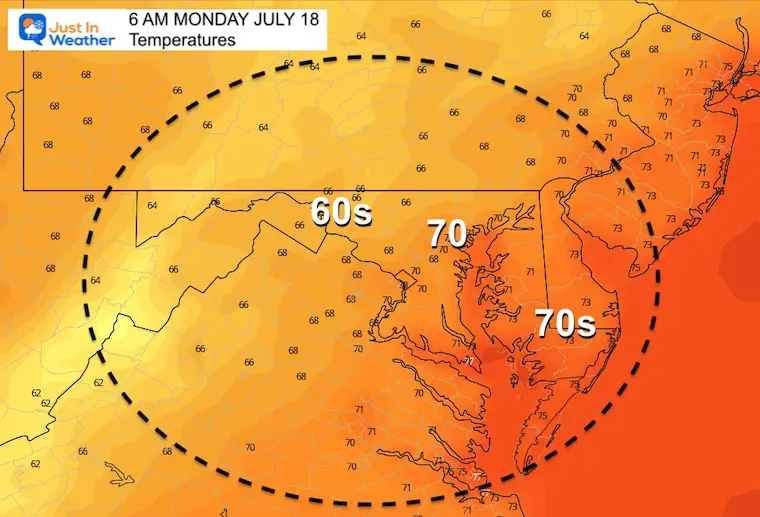
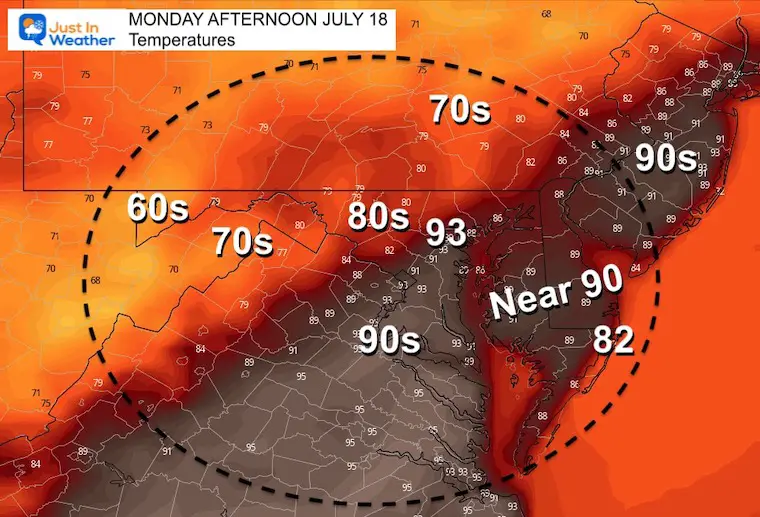
Monday Temperatures
Morning
Afternoon
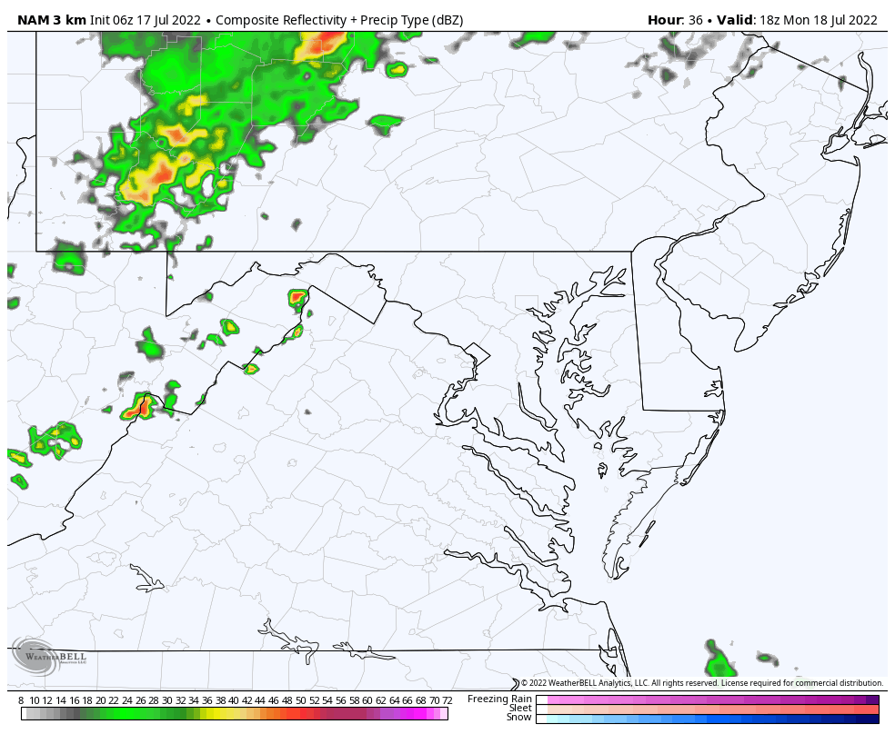
Radar Simulation
A much more active storm pattern for Monday. This has a greater risk for severe storms. Stay tuned…
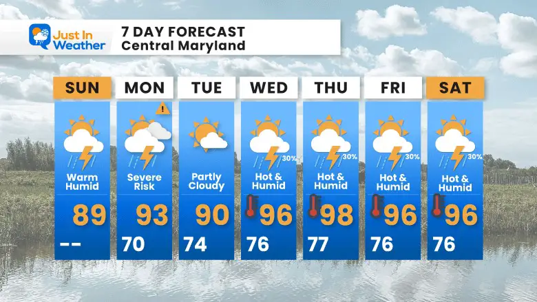
7 Day Forecast
The bigger storm day may be Monday. Then we watch HIGH HEAT during the week. This will be our first true heat wave of the summer. Each day can bring storms which can be very strong, but also isolated.
Storm Reports (preliminary) : Tuesday July 12
Was there a tornado? Here are my reports.
Still no formal statement from The National Weather Service
July 12 Severe Storm Radar Scans: Was There A Tornado Or Not?
July 12 Storm Reports Pics And Videos


