May 26 2022 Evening Report
A large storm in the Midwest continues to show a strong circulation has it moves east. This is pumping in tropical moist from the Gulf of Mexico, making for an unstable environment. The result will be the increase in severe storm potential for our region on Friday.
I have been asked by many people for an idea of the storm timing for various events. While the simulations are not perfect, I wanted to share a suggestion now to give you an idea to plan around.
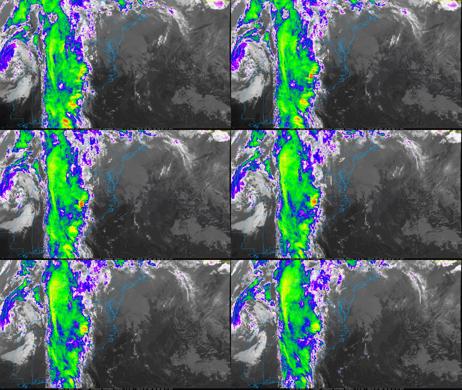
Thursday Satellite Loop: 7 PM to 9 PM
Notice the storm circulation on the left side of the animation.
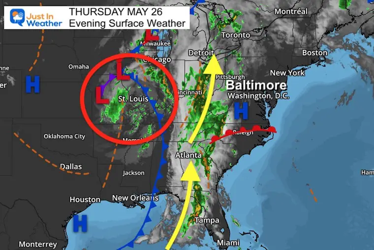
Thursday Evening Surface Weather
Low Pressure is centered in Missouri, with the strong flow of moisture from Tampa northward to Detroit. The is the band of rain and storms we expect on Friday.
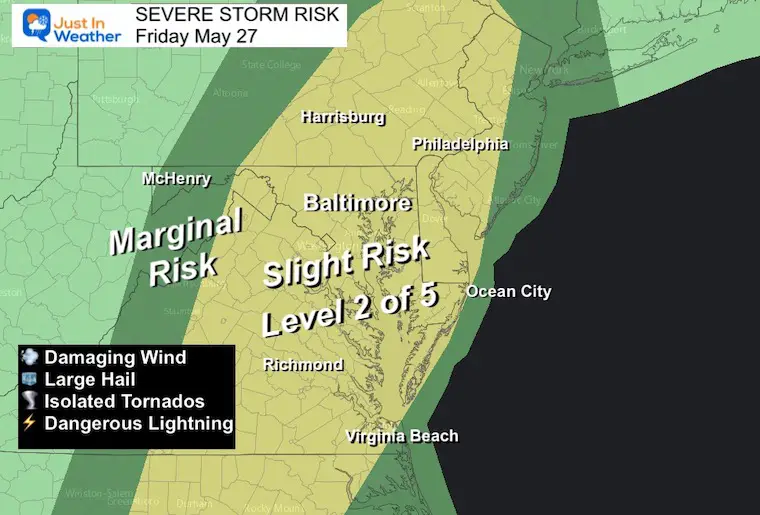
Severe Storm Risk Friday
NOAA has issued a Slight Risk, or Level 2 of 5 for our region.
This means that any storm has the chance, but not a promise to turn severe.
The threats include:
- Damming Winds over 60 mph
- Large Hail over 1 inch
- Flash Flooding
- Isolated Tornado
- Dangerous Lightning
Alert Reminder:
Watch means it might happen. This is often issued for a large area over a 6 hour period.
Warning means IT IS HAPPENING NOW! This will be issued for a severe storm being tracked with a list of towns to be tracked over a 30 to 45 minute time frame.
Radar Simulaiton
NAM 3 Km Model 10 AM Friday to Midnight
This model has underplayed previous events, but it does suggest a few broken lines and clusters of storms developing through the day.
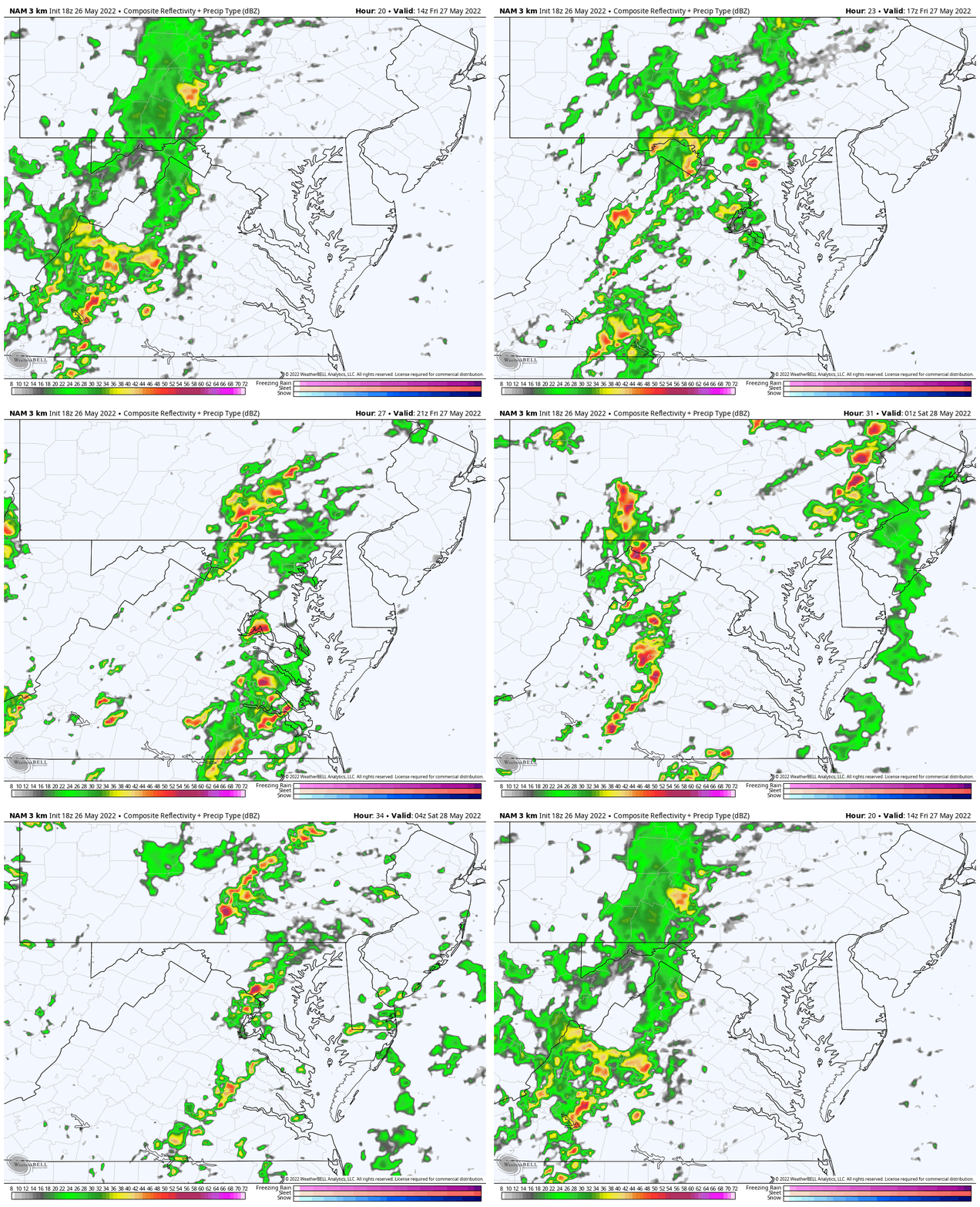
Key Timeframe Snapshots
*Suggestions- NOT Guarantee. I will have an update in my Friday morning report.
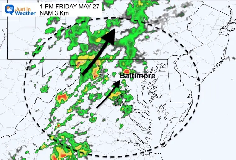
1 PM
Cells and storm clusters will be moving to the Northeast
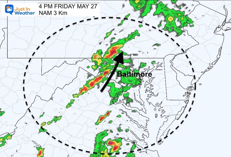
4 PM
The strong line should be moving through the Catoctin Mountains
6 PM
Leading edge of energy should reach the Chesapeake Bay and continue to be moving to the north.
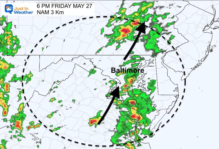
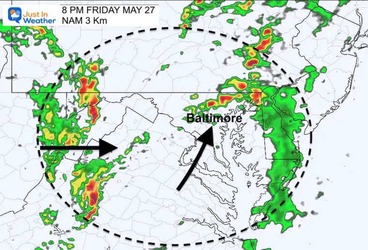
8 PM
While we watch storms around the Bay, the main cold front will be approaching from the mountains to our west.
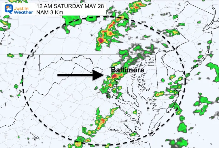
Midnight
This should be the cold front and final push through metro areas. The line will be moving from west to east…
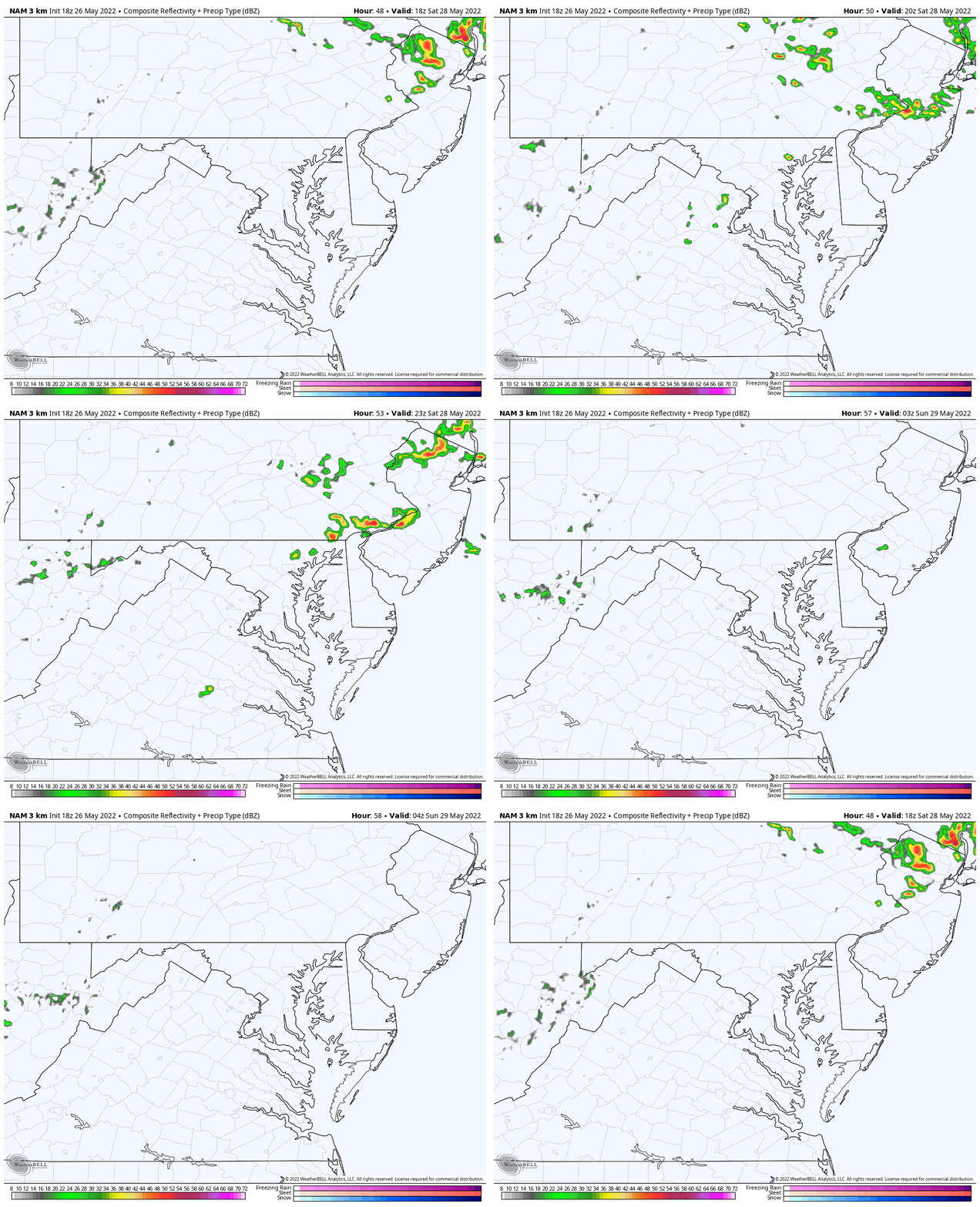
Looking Ahead To Saturday
2 PM to Midnight
This looks like scattered showers in the afternoon and evening.
Next Update: My Friday morning report posted around 6:30 AM
Weather posts straight to your inbox
Sign up and be the first to know!
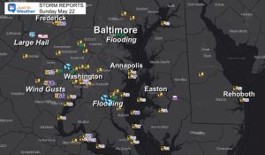
Storm Reports
May 16 Large Hail Videos And Storm Tracking Map
Tropical Season Begins June 1
Related Posts
NOAA Study: Reducing Air Pollution INCREASED Tropical Storms
Atlantic Tropical History: Maps of Origin Regions Every 10 Days
Please share your thoughts, best weather pics/video, or just keep in touch via social media
Facebook: Justin Berk, Meteorologist
Twitter: @JustinWeather
Instagram: justinweather
*Disclaimer due to frequent questions:
I am aware there are some spelling and grammar typos. I have made a few public statements over the years, but if you are new here you may have missed it:
I have dyslexia, and found out at my second year at Cornell. I didn’t stop me from getting my meteorology degree, and being first to get the AMS CBM in the Baltimore/Washington region.
I do miss my mistakes in my own proofreading. The autocorrect spell check on my computer sometimes does an injustice to make it worse.
All of the maps and information are accurate. The ‘wordy’ stuff can get sticky.
There is no editor that can check my work when I need it and have it ready to send out in a newsworthy timeline.
I accept this and perhaps proves what you read is really from me…
It’s part of my charm.
VOTE: Best ‘Meteorologist’
Of Baltimore (Reader’s Poll)
Through May 29 at 5 PM
Click here to access The Baltimore Sun


