May 21 2022
Saturday Morning Report
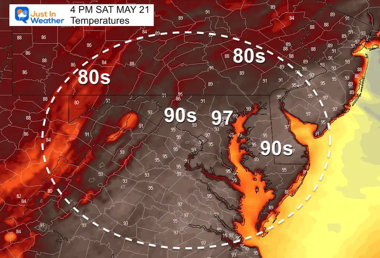
When you step outside you will feel the heat already. We will be aiming close to a record high, and one of the hottest Preakness events in the 147 years. We have it on authority from a professional veterinarian that horses sweat and they are conditioned to deal with this weather.
Humans and pets are different. If you have outside plans, hydrate early with an extra cup our two of water early in the day. As for your pets, consider keeping them inside, or avoiding the dog walk during the afternoon as pavement temps can burn paws.
Morning Set Up
Temperatures At 7 AM
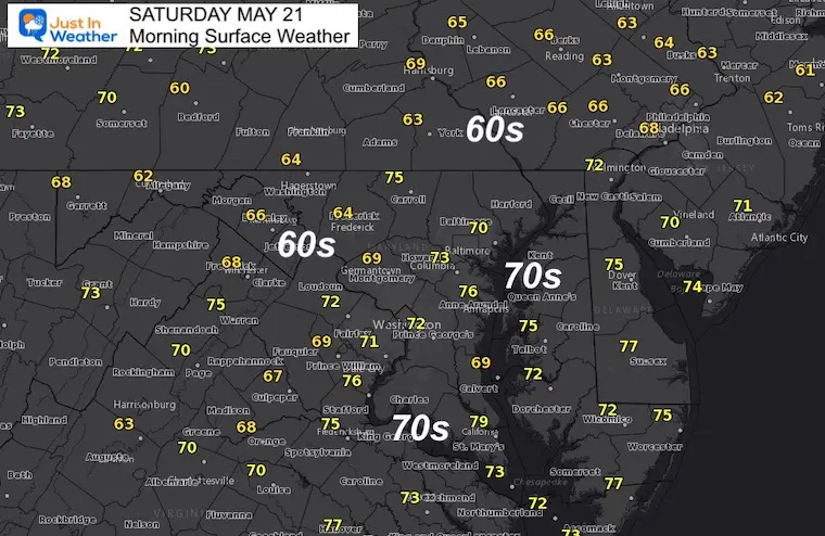
Surface Weather
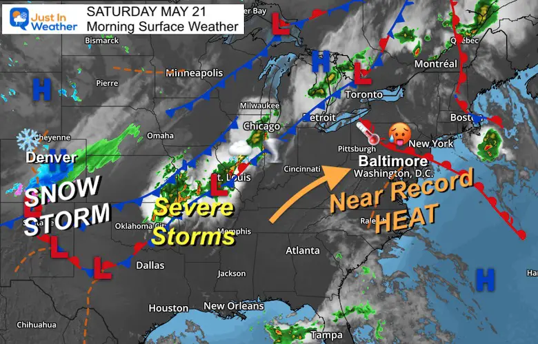
- Meanwhile in Colorado… A Snowstorm in the Rockies has produced heavy snow. Metro Denver has 4 to 8 inches of snow on the ground a day after it hit the upper 80s! The mountains have surpassed 12 inches
- Severe Storms will track up the Mississippi River Valley.
- Eastern US baking in the heat to challenge records from the 1930s.
Afternoon Temperatures
RECORD HIGH: 96ºF in 1934
Storm Risk Mainly West Today
Radar Simulation Animations
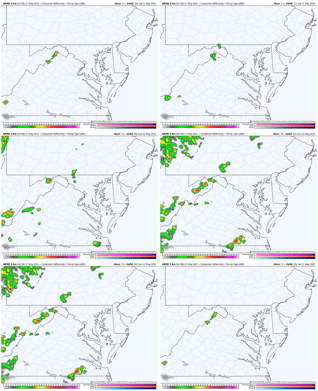
HRRR Model – 4 PM to 10 PM
This view keeps the activity this afternoon in the mountains and leaving the metro areas dry…
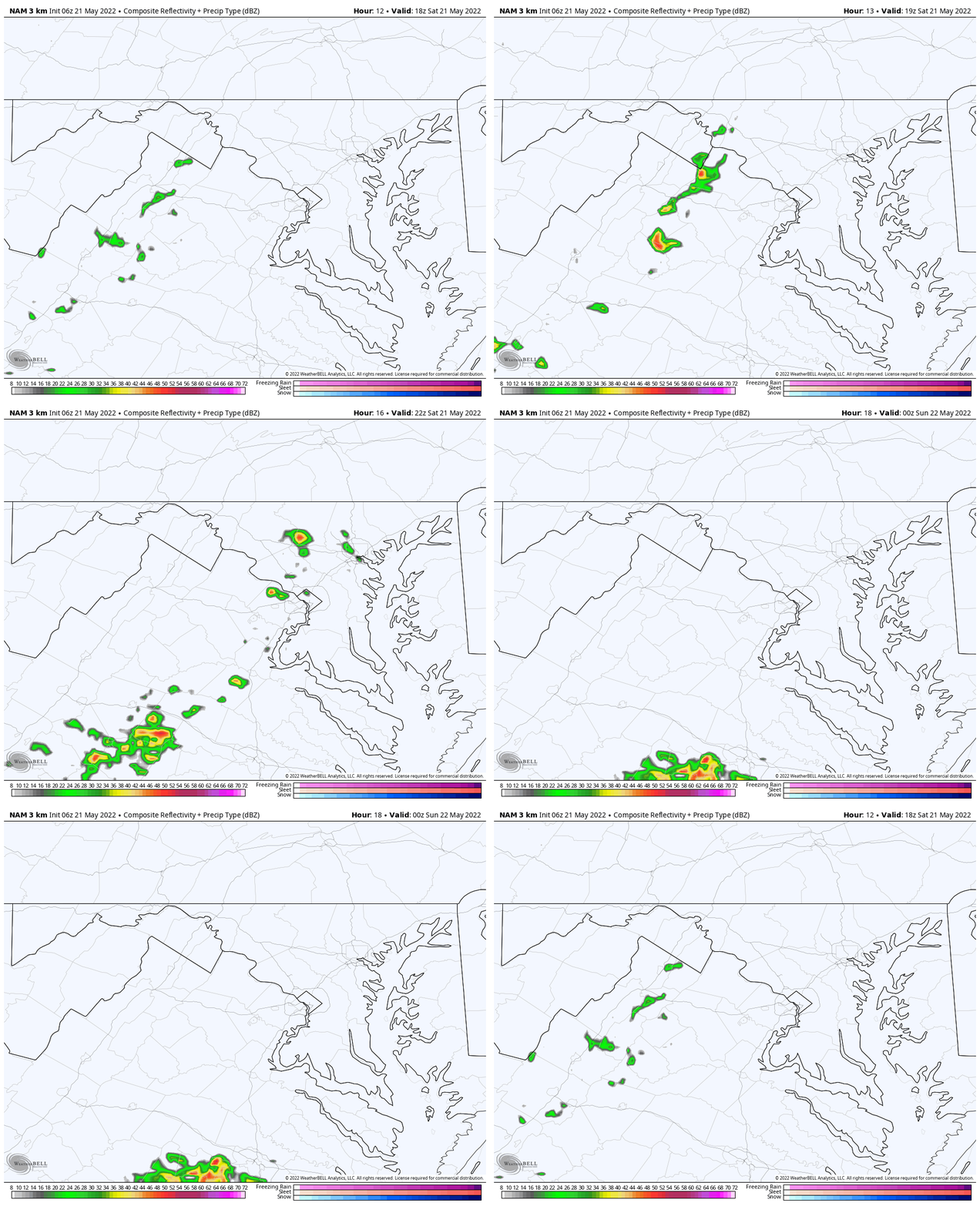
NAM 3 Km – 2 PM to 10 PM
This close up view shows the small chance for a brief shower reaching metro Baltimore between 5 PM and 7 PM
CLIMATE DATA
TODAY May 21st
Normal Low in Baltimore: 54ºF
Record 33ºF in 2002
Normal High in Baltimore: 75ºF
Record 96ºF 1934
VOTE: Best ‘Meteorologist’
Of Baltimore (Reader’s Poll)
Through May 29 at 5 PM
Click here to access The Baltimore Sun
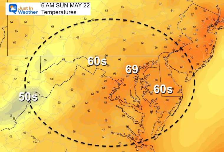
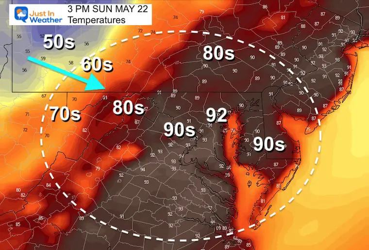
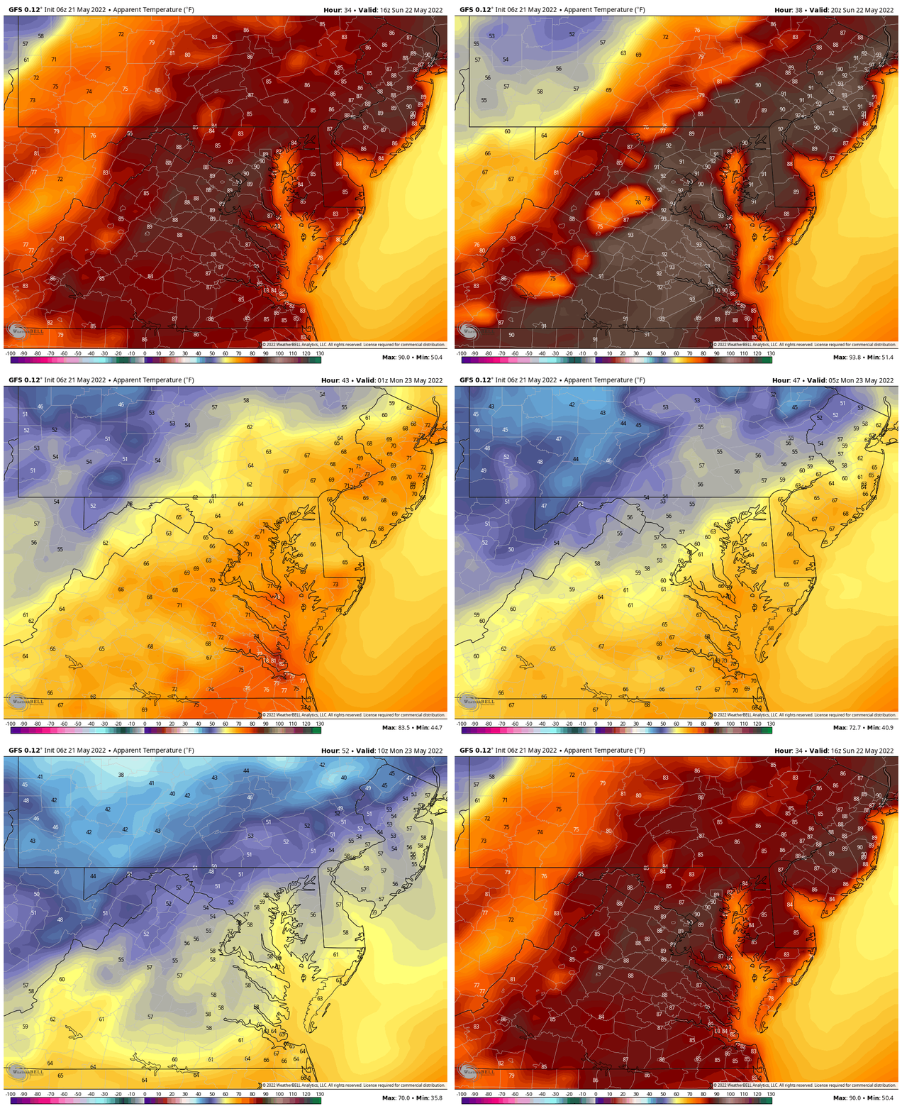
Sunday Temperatures
Morning
Afternoon
Animation Through Monday Morning
The strong cold front will bring in a dramatic drop in temps with a new air mass to start next week.
Sunday Storms: Late Afternoon/Evening
Watching for a line of strong storms forming in the mountains by 4 PM. This may turn severe as it crosses metro areas 6 PM to 8 PM. Rain in Southern Maryland through the evening and midnight.

Weather posts straight to your inbox
Sign up and be the first to know!
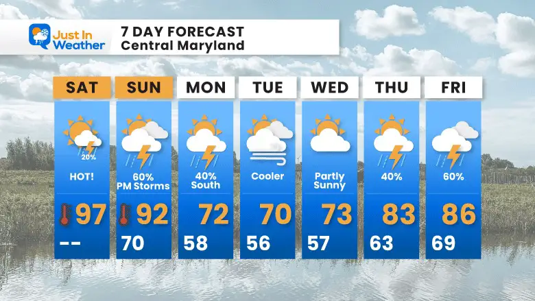
7 Day Forecast
Cooler winds from the ocean will keep us in the lower 70s with additional clouds for a few days. Warmer air and more active weather will return by the end of the work week.
Tropical Season Begins June 1
Related Posts
NOAA Study: Reducing Air Pollution INCREASED Tropical Storms
Atlantic Tropical History: Maps of Origin Regions Every 10 Days
Please share your thoughts, best weather pics/video, or just keep in touch via social media
Facebook: Justin Berk, Meteorologist
Twitter: @JustinWeather
Instagram: justinweather
*Disclaimer due to frequent questions:
I am aware there are some spelling and grammar typos. I have made a few public statements over the years, but if you are new here you may have missed it:
I have dyslexia, and found out at my second year at Cornell. I didn’t stop me from getting my meteorology degree, and being first to get the AMS CBM in the Baltimore/Washington region.
I do miss my mistakes in my own proofreading. The autocorrect spell check on my computer sometimes does an injustice to make it worse.
All of the maps and information are accurate. The ‘wordy’ stuff can get sticky.
There is no editor that can check my work when I need it and have it ready to send out in a newsworthy timeline.
I accept this and perhaps proves what you read is really from me…
It’s part of my charm.


