


July 12 Very Humid With Scattered Thunderstorms Later And More Storms Tomorrow
Saturday, July 12, 2025 Morning Report This may sound familiar: We remain in the ambiguous humid air mass. There is thick fog this morning, and the sun will dominate the…
May 20 2022
Friday Morning Report
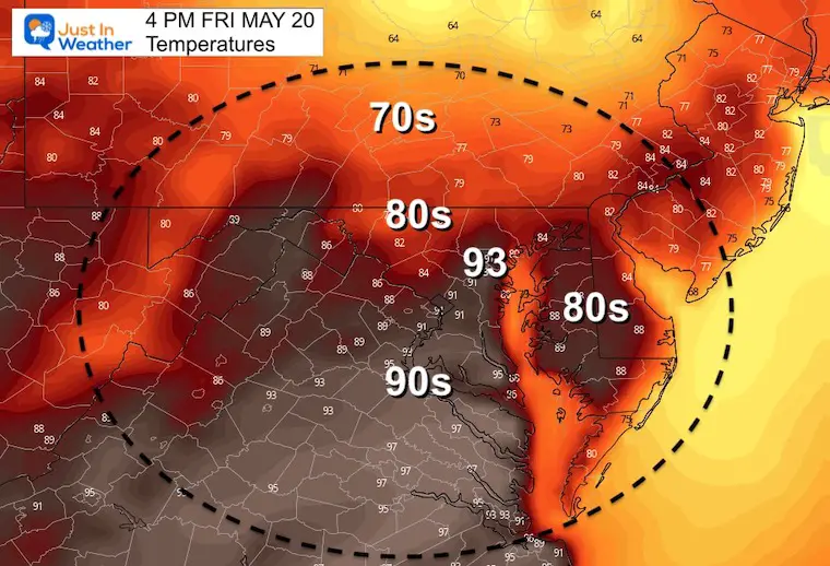
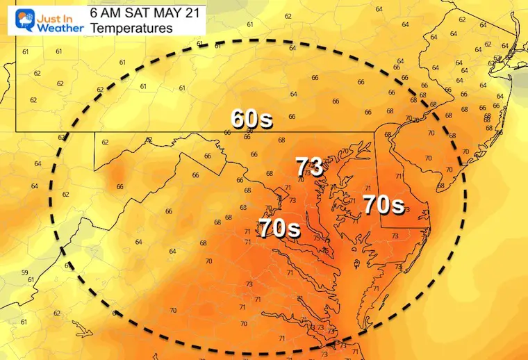
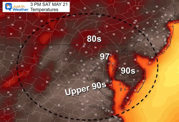
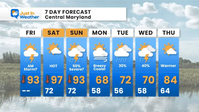
Baltimore is front and center in the sports world this weekend with Preakness, and on the edge of some weather headlines. We have been expecting high heat this weekend, and there has been a Special Statement about that from the National Weather Service. In fact a new record high may be set for the date.
But first, we need to track some storm clusters including this morning.
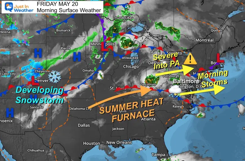
Morning Set up- Close
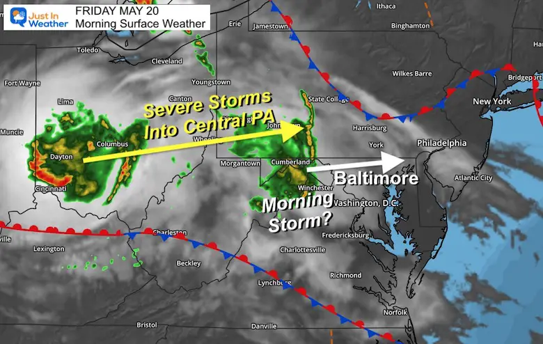
Surface Weather
Two bands of storms are being tracked to start the day. The leading edge is moving through western Maryland and has produced lightning and thunder with downpours. This may clip metro areas and especially north of Baltimore this morning.
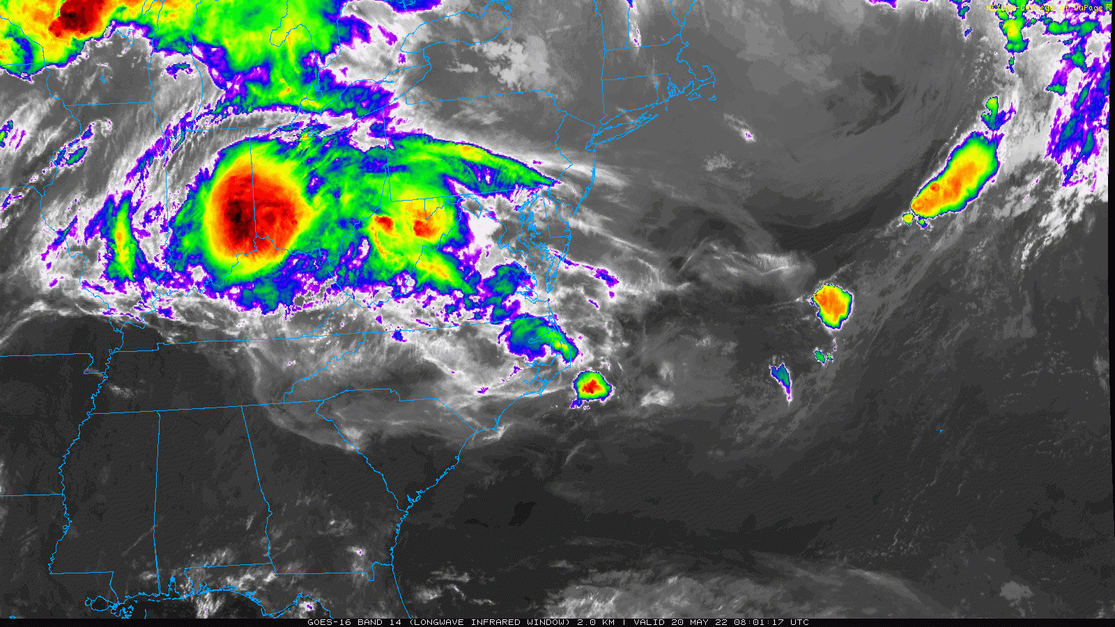
The second cluster in Ohio is a Mesoscale Convective Complex (MCC). This has broad circulation and will produce severe storms in the path. This is tracking into central Pennsylvania through early this afternoon.
That MCC looks impressive. Here we can see that Ohio storm tracking to the east-northeast and will be heading into PA.
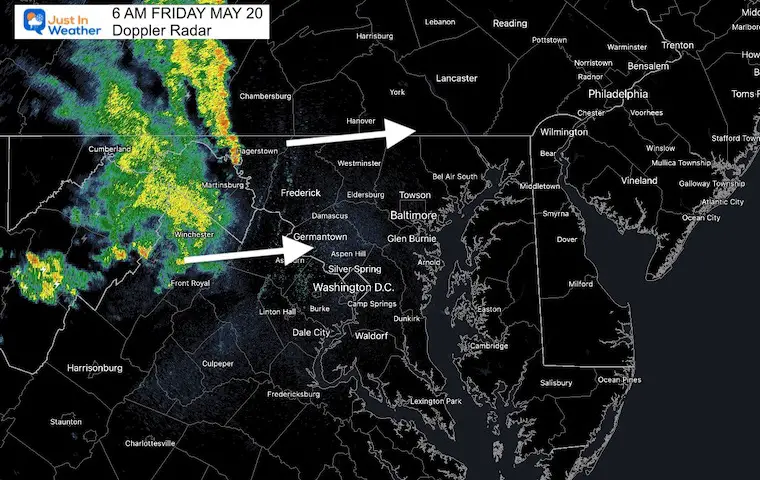
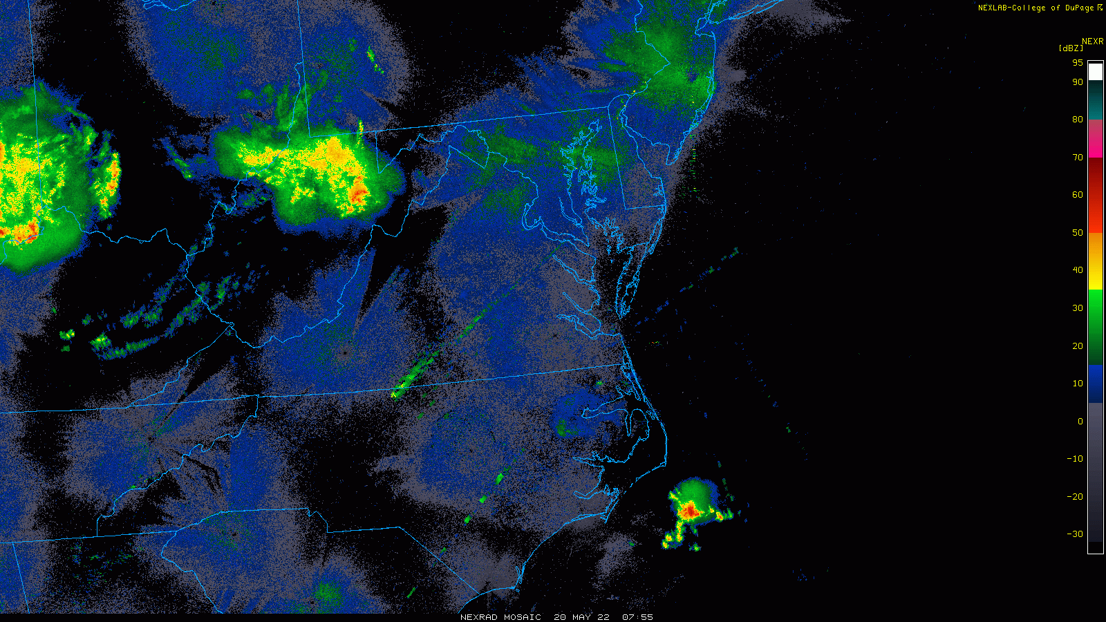
That cluster will weaken as it crosses the mountains, by some energy may clip metro Baltimore during the morning commute. This will help increase the humidity today.


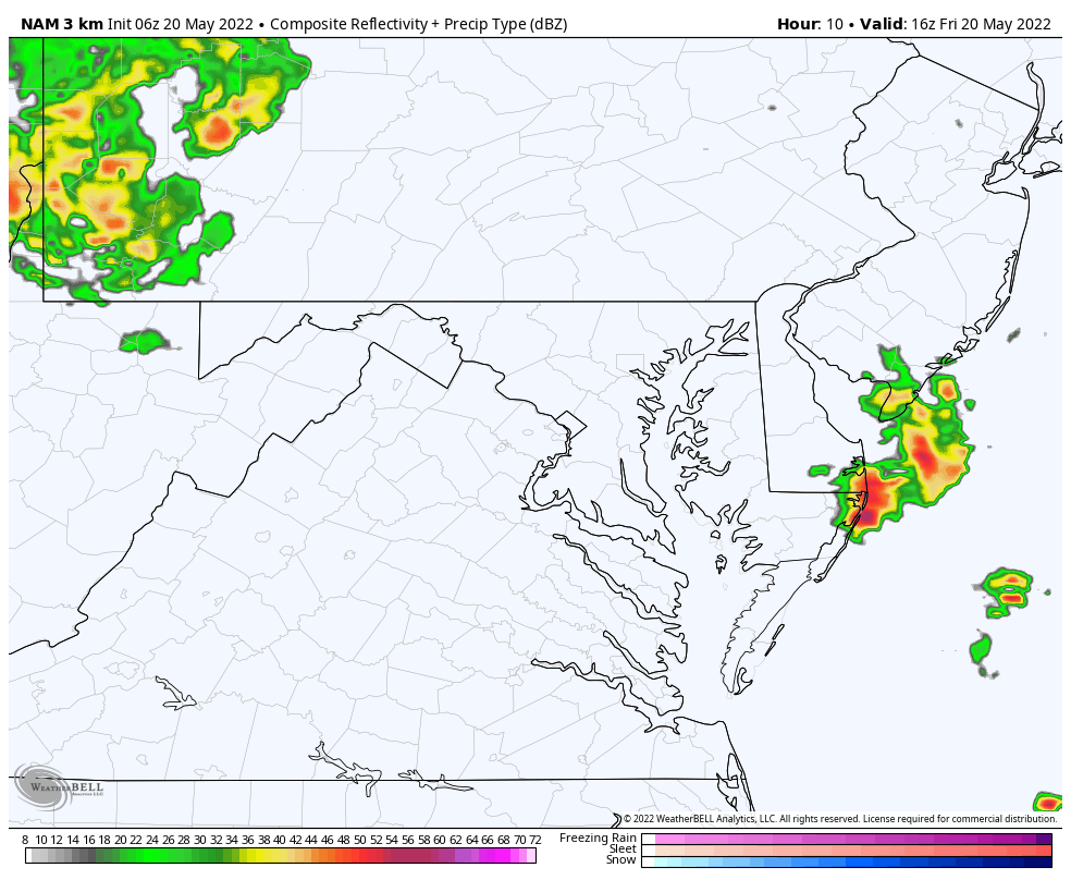
NAM 3 Km shows this mostly for central PA
HRRR Model shows that MCC possibly tracking south and clipping northern Maryland just north of Baltimore. This is worth watching for any lightning strikes on the outer edges.
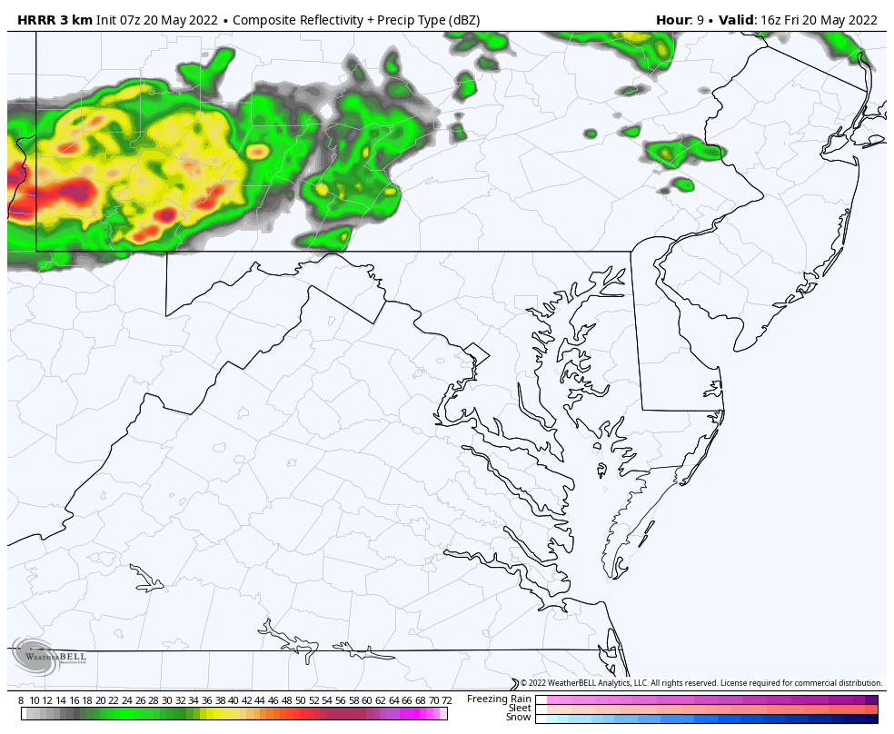
Note the cooler temps farther north. This will be impacted by clouds and downdrafts closer to that MCC in PA.
While we track severe storms and record heat here in the east, a snowstorm is forming in the Rockies. Metro Denver may get over 6 inches of snow with over 1 foot in the high mountains into this weekend.
Normal Low in Baltimore: 53ºF
Record 39ºF in 2002
Normal High in Baltimore: 75ºF
Record 95ºF 1962
Click here to access The Baltimore Sun

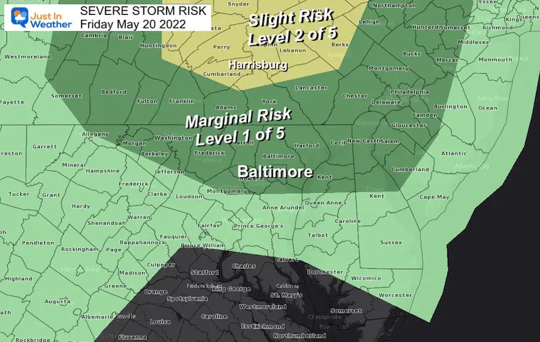
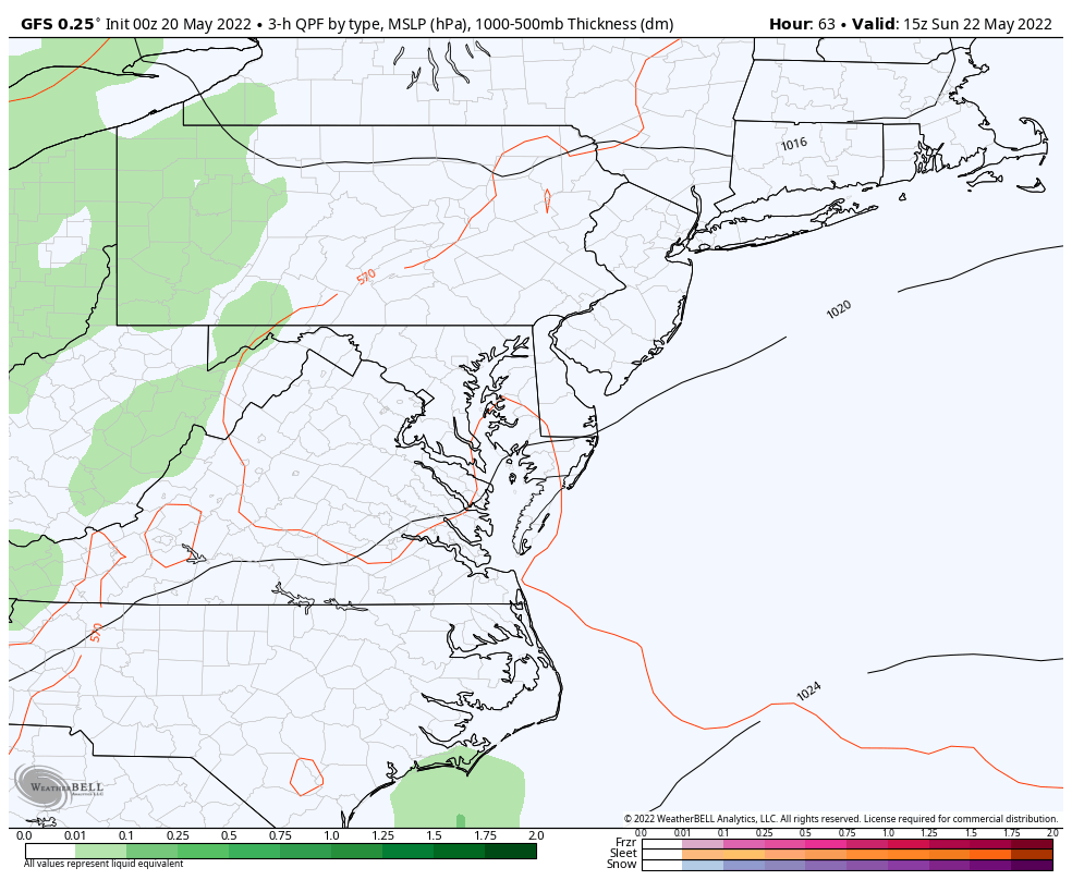
I know the models had lowered the chance yesterday, but it looks like we will still be tracking at least a 50% chance for storm and a severe risk mid afternoon and evening. This will be followed by a sharp cool down Monday.
Sign up and be the first to know!
Humidity builds today then just plain HOT Friday into the weekend.
Preakness should dry with a slight chance for storms that night.
Rain risk increases on Sunday to break the heat next week.

NOAA Study: Reducing Air Pollution INCREASED Tropical Storms

Atlantic Tropical History: Maps of Origin Regions Every 10 Days


*Disclaimer due to frequent questions:
I am aware there are some spelling and grammar typos. I have made a few public statements over the years, but if you are new here you may have missed it:
I have dyslexia, and found out at my second year at Cornell. I didn’t stop me from getting my meteorology degree, and being first to get the AMS CBM in the Baltimore/Washington region.
I do miss my mistakes in my own proofreading. The autocorrect spell check on my computer sometimes does an injustice to make it worse.
All of the maps and information are accurate. The ‘wordy’ stuff can get sticky.
There is no editor that can check my work when I need it and have it ready to send out in a newsworthy timeline.
I accept this and perhaps proves what you read is really from me…
It’s part of my charm.