


May 8 After Morning Storms Summer Heat This Afternoon
Wednesday, May 8 Morning Report This morning, a line of thunderstorms developed across central Pennsylvania to parts of north central Maryland. This is part of a trough in the atmosphere,…
May 5 2022
Late Thursday Evening Update
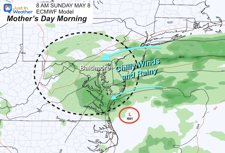
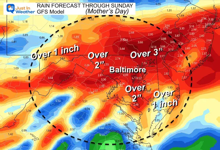
There is a lot of focus on the long duration rain event starting Friday and lasting into Mother’s Day. It is possible our region gets between 1 and 3 inches of rain, along with chilly winds.
I have not said much about my plans, but I have my first scheduled 100 mile (century) bike event in Cambridge on Saturday. The Six Pillars Century is a major event with hundreds of cyclists, and I have been excited to join in. Our rainy outlook is NOT how I want it to got. I still plan on attending, and posting some video updates on my Facebook page from there to discuss our group’s plan.
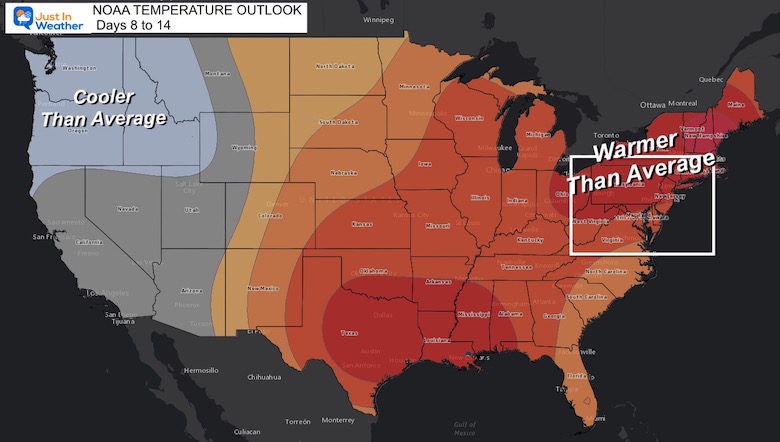
Whatever your plans into the weekend or Mother’s Day, I feel you! So I wanted to look ahead and give you some home for what may follow. This includes the NOAA Outlooks for summer heat, and we could get in on it by next weekend.
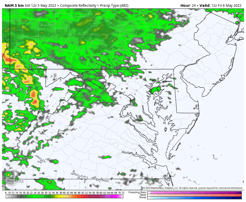
The NAM 3 Km Model shows the rain developing in the morning, with heavier bands and even some thunder with downpours Friday night.
ECMWF (European) Model
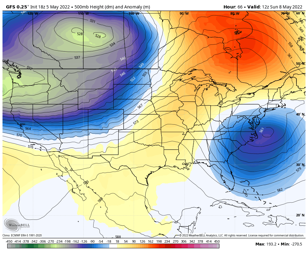
Here we can see the closed Low crawling or even stalling over our region, keeping the chilly wind and rain in place.
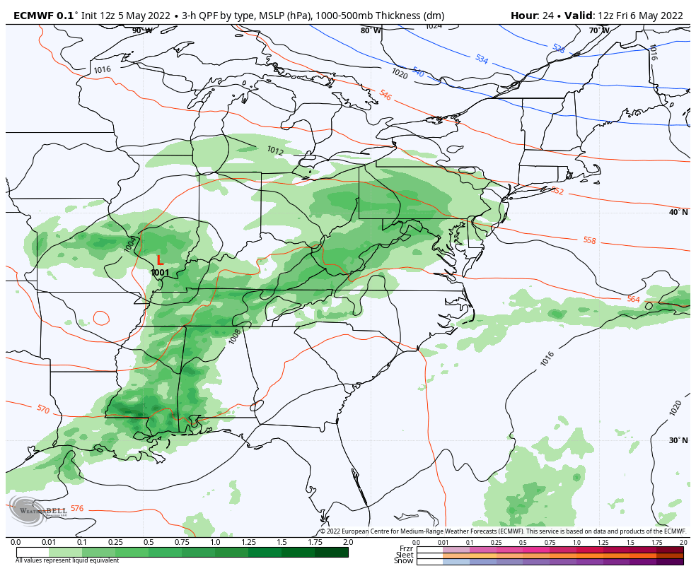
Low Pressure off of the Mid Atlantic will be responsive for determining how long the rain lingers. Each model run keeps this hanging around longer.
Models have been shifting the heaviest of the rain bands, so this map from my morning report may look a little different in my next update. I will have more details on totals in my Friday morning report.
It looks like true SUMMER HEAT will build in the Upper Midwest, and we will be one the edge of that. There is some wiggle room for the expanse of that impact depending on how this closed upper Low behaves as seen in the animation below… but it will be losing its grip gradually.

This longer outlook expands the ‘heat’ farther east. This is when we have our greater chance to warm up again.
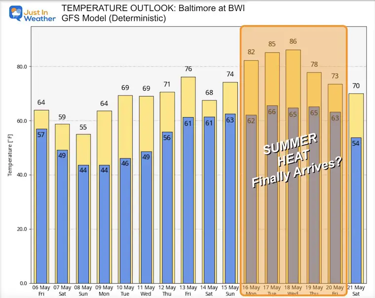
This is for the location of Baltimore at BWI
It does prove that the extended chilly pattern deeper into spring will inevitably POP the cork and unleash the return of heat.
I will have a more detailed look at our rain event in my Friday morning report.

Atlantic Tropical History: Maps of Origin Regions Every 10 Days


*Disclaimer due to frequent questions:
I am aware there are some spelling and grammar typos. I have made a few public statements over the years, but if you are new here you may have missed it:
I have dyslexia, and found out at my second year at Cornell. I didn’t stop me from getting my meteorology degree, and being first to get the AMS CBM in the Baltimore/Washington region.
I do miss my mistakes in my own proofreading. The autocorrect spell check on my computer sometimes does an injustice to make it worse.
All of the maps and information are accurate. The ‘wordy’ stuff can get sticky.
There is no editor that can check my work when I need it and have it ready to send out in a newsworthy timeline.
I accept this and perhaps proves what you read is really from me…
It’s part of my charm.