


May 2 One More Hot Day Then The Cool Down And Rain For The Weekend
Thursday May 2 Morning Report This is one of those days where we get a little surprise. The old air mass is holding strong and will allow one more hot…
April 27 2022
Wednesday Afternoon Update
The chilly winds today are the leading edge of this new arctic air mass moving in with the core of the cold air tonight.
The clouds will break locally, allowing or additional radiational cooling. This is why many areas north and west of Baltimore should drop below 32ºF and even the 20s by Thursday morning. If you live in the Freeze Warning area, it is highly recommended to cover your newly planted or sprouting seedlings with a tarp or garbage bag, plus bring your potted plants back into the house.
Much of the region will drop into the 30s. If the winds stay breezy, that will limit for formation of frost. But something to consider into Friday morning when we may repeat the cold temps again with light winds. That is when frost will probably be more widespread.
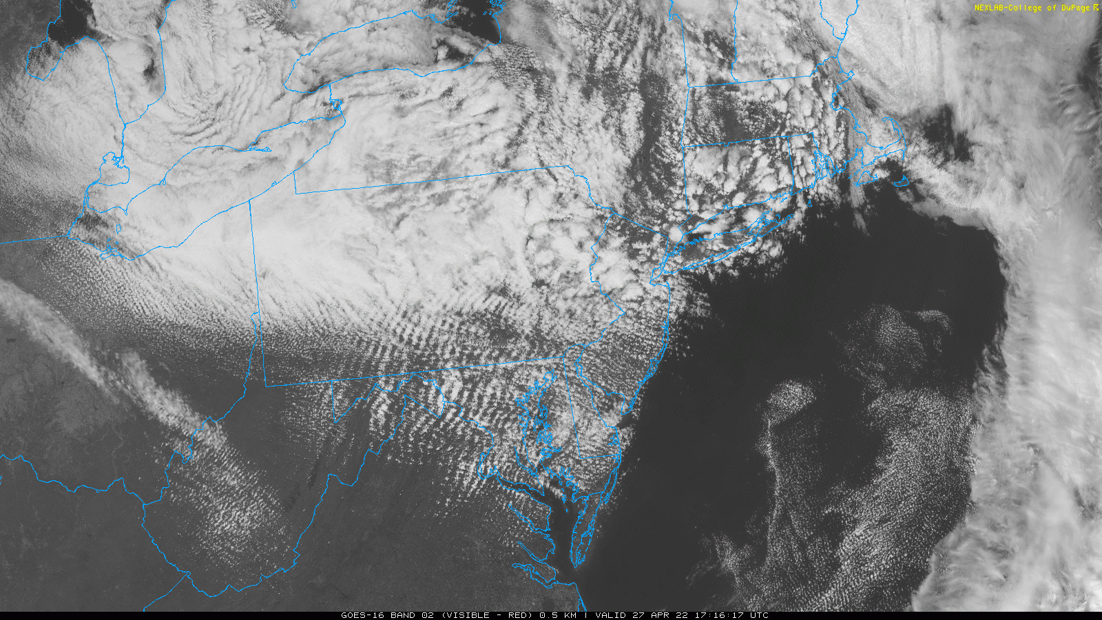
The cold front is passing through central Maryland this afternoon…

1 PM to 3:30 PM
The ripples are standing wave clouds. This is common when we get cold winds flowing over the mountains. It is also common for the sky to remain overcast farther north, and for the clouds locally to dissipate as the sun angle gets lower heading into nightfall.
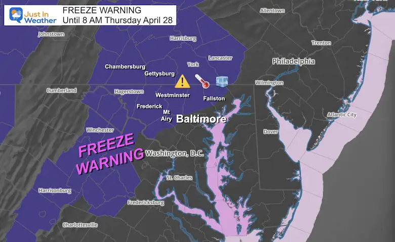
The freezing line may cut right through Baltimore.
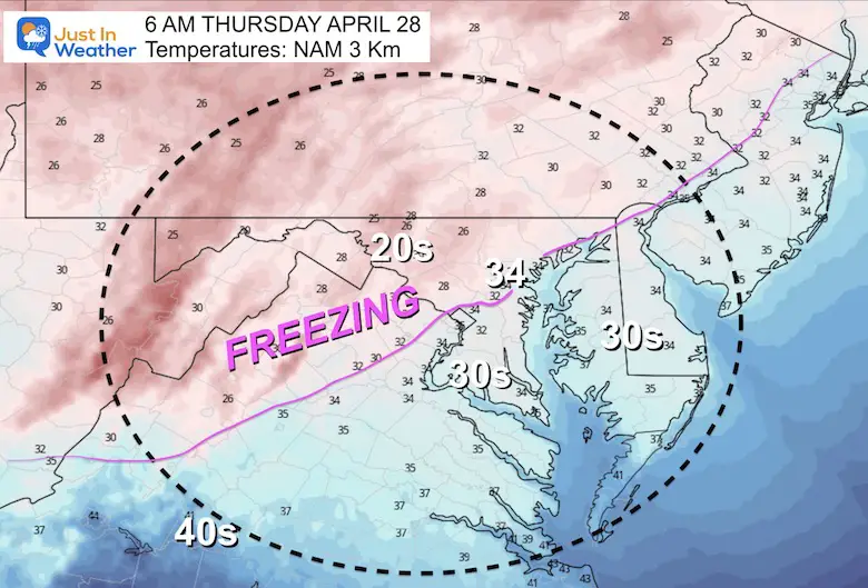
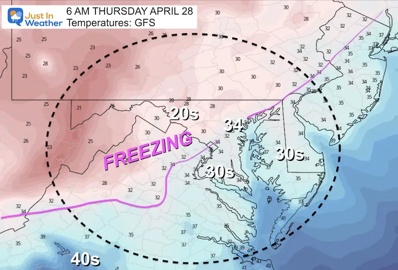
This shows a similar freezing line through Baltimore City and inland from the Bay around I-91. This alignment confirms the higher likelihood.
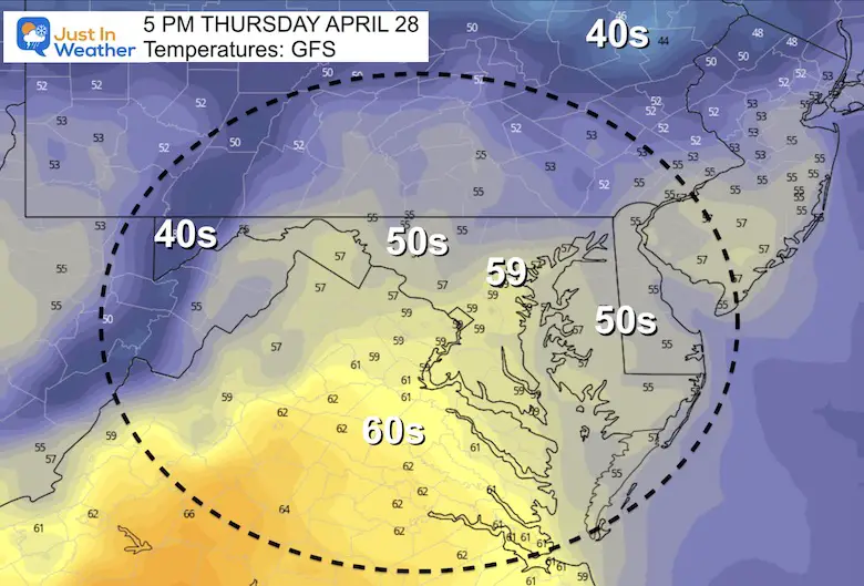
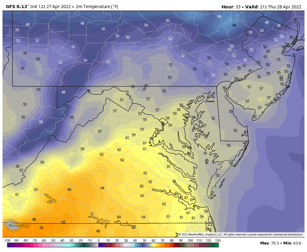
Remaining Chilly with most areas staying in the 50s across Central Maryland and across Delmarva.
This loop shows the drop in temps again near freezing just inland from the water.
With less wind, a more widespread FROST is possible through southern Maryland and across inland Delmarva.
We will modify a little over the weekend and back to the 80s early next week. This will come with increased thunderstorms as well.


Atlantic Tropical History: Maps of Origin Regions Every 10 Days


*Disclaimer due to frequent questions:
I am aware there are some spelling and grammar typos. I have made a few public statements over the years, but if you are new here you may have missed it:
I have dyslexia, and found out at my second year at Cornell. I didn’t stop me from getting my meteorology degree, and being first to get the AMS CBM in the Baltimore/Washington region.
I do miss my mistakes in my own proofreading. The autocorrect spell check on my computer sometimes does an injustice to make it worse.
All of the maps and information are accurate. The ‘wordy’ stuff can get sticky.
There is no editor that can check my work when I need it and have it ready to send out in a newsworthy timeline.
I accept this and perhaps proves what you read is really from me…
It’s part of my charm.