April 23 2022
Saturday Morning Report
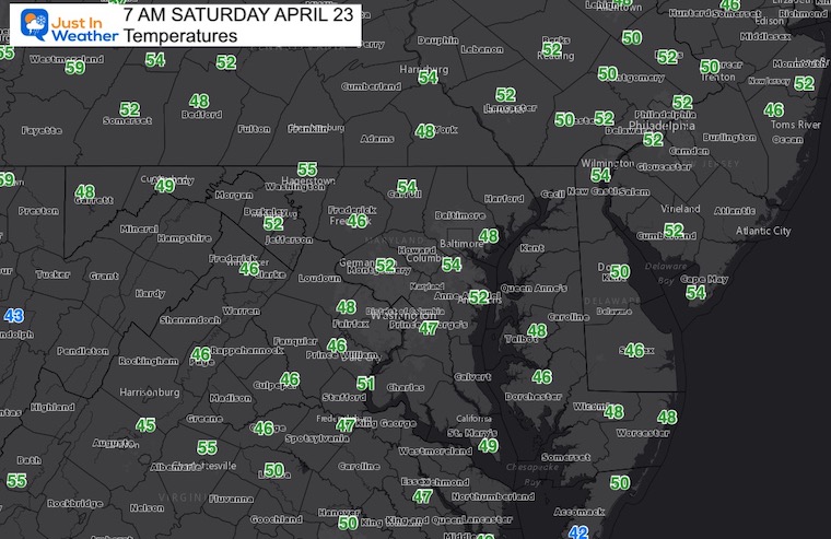
At first glance, the weather looks seasonal to start the weekend. However. The weather map tells the story that means a split across our region. The air mass in place is cool and the winds off of the water will keep eastern areas cooler.
Meanwhile, a very warm push of spring air is trying to move in from the west, and some of our area will get a summer preview this weekend. Basically a modest drive can span 20 to 30 degrees in the afternoons.
Morning Set Up
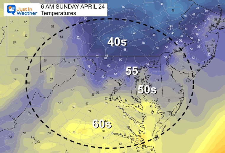
Temperatures
Mild Morning…
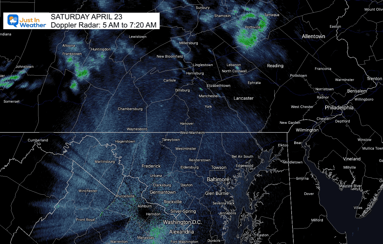
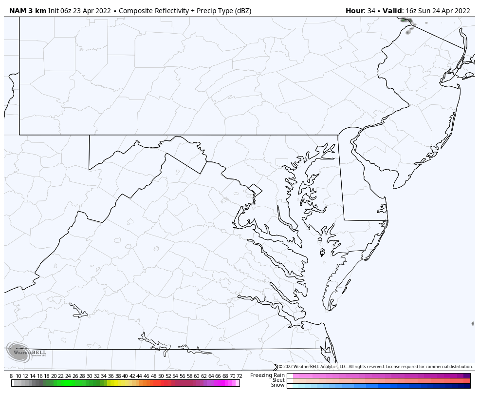
Doppler Radar
There have been some light showers to our north that have been falling apart. More clouds are passing through, and there may be some sprinkles across Southern PA and Northern MD, but nothing substantial.
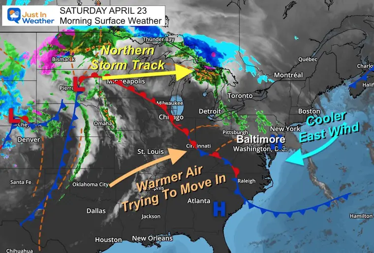
Surface Weather
This is not a true Back-Door Cold Front as I mentioned a few days ago, but it is a New England dominant chilly air mass.
The result:
Warmer West – Cooler East.. especially near the water.
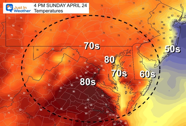
Afternoon Highs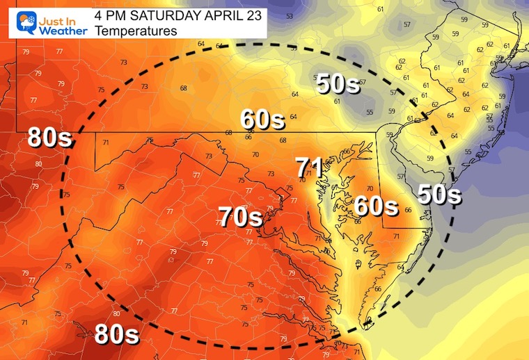
CLIMATE DATA
TODAY April 23rd
Normal Low in Baltimore: 45ºF
Record 31ºF in 1982
Normal High in Baltimore: 67ºF
Record 94ºF 1960
Sunday Weather
Morning Temperatures
Afternoon Temperatures
The warmer air should reach metro areas, but still expecting a sharp cool down near the water and across Delmarva.
Afternoon Showers-T’storms
This product has underperformed, so we should consider the potential for more showers into the evening.
Looking Ahead…
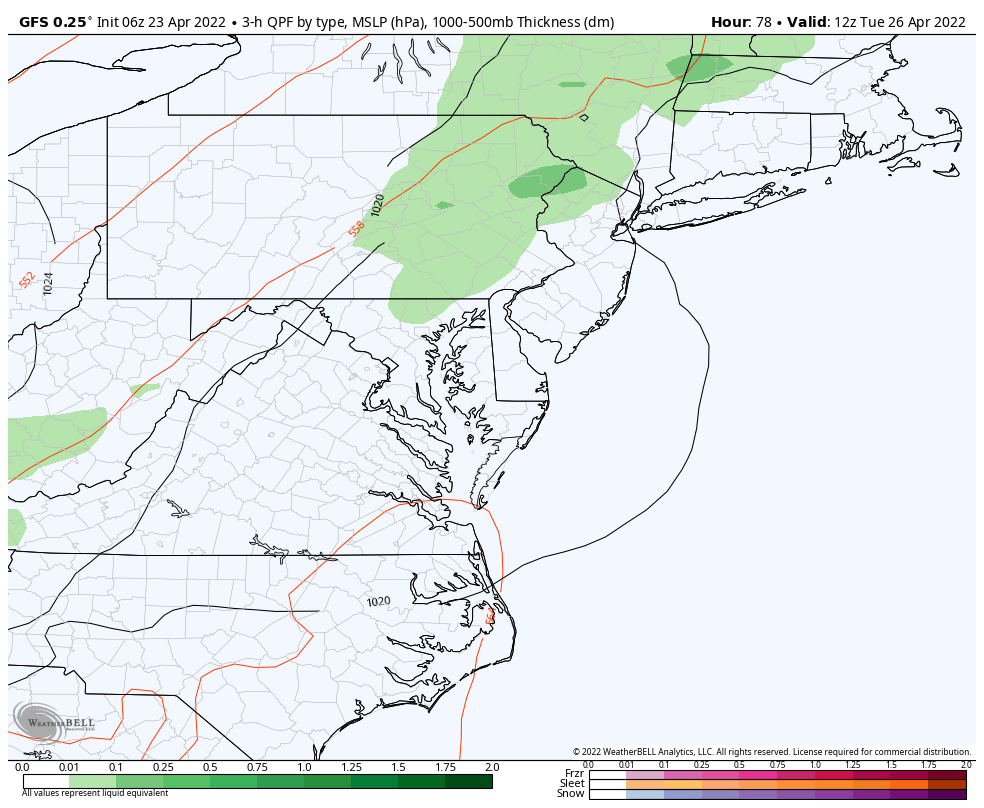
Rain Animation:
The main weather event looks like rain between late Tuesday into early Wednesday morning… This will be followed by another push of colder air.
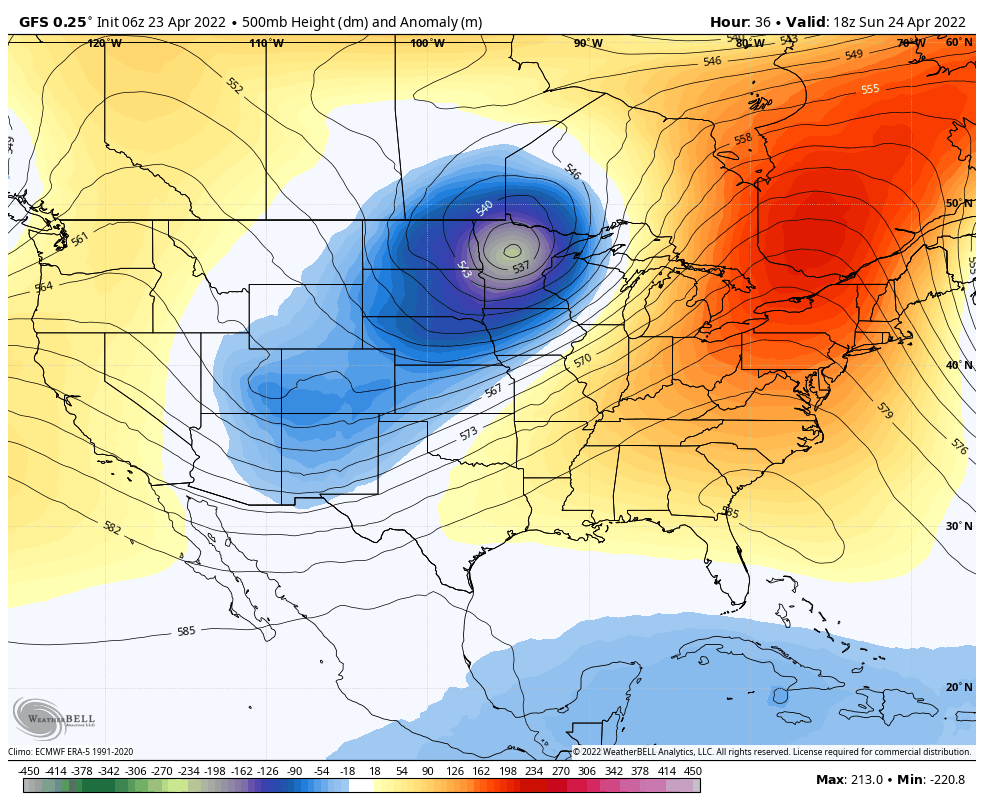
Jet Stream:
After Our warm Sunday, the two main factors will be:
Wed-Thu: Cut Off Low in New England
This will help bring us FROST Thursday morning.
Next Weekend: Another trough may kick off My on a chilly note.
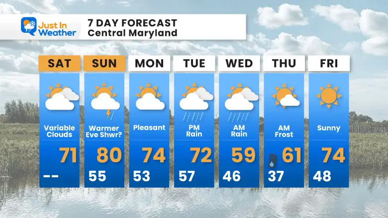
7 Day Forecast
The rain Tuesday into Wednesday will be followed by possible Frost Thursday morning.
Tropical Season Begins June 1
Atlantic Hurricane Forecast

Related Posts
Atlantic Tropical History: Maps of Origin Regions Every 10 Days


Please share your thoughts, best weather pics/video, or just keep in touch via social media
*Disclaimer due to frequent questions:
I am aware there are some spelling and grammar typos. I have made a few public statements over the years, but if you are new here you may have missed it:
I have dyslexia, and found out at my second year at Cornell. I didn’t stop me from getting my meteorology degree, and being first to get the AMS CBM in the Baltimore/Washington region.
I do miss my mistakes in my own proofreading. The autocorrect spell check on my computer sometimes does an injustice to make it worse.
All of the maps and information are accurate. The ‘wordy’ stuff can get sticky.
There is no editor that can check my work when I need it and have it ready to send out in a newsworthy timeline.
I accept this and perhaps proves what you read is really from me…
It’s part of my charm.


