


May 1 Weather Gradual Cooling Trend Will Bring Rain Into The Weekend
Wednesday, May 1 Morning Report One of the marks of May Day is an ancient European holiday celebrating the start of summer. It feels like we have had our taste…
Monday January 31- Morning Report
We will close out the month on a cold and quiet note. There will be a little warm up this week, but the trade off is that it will come with rain.
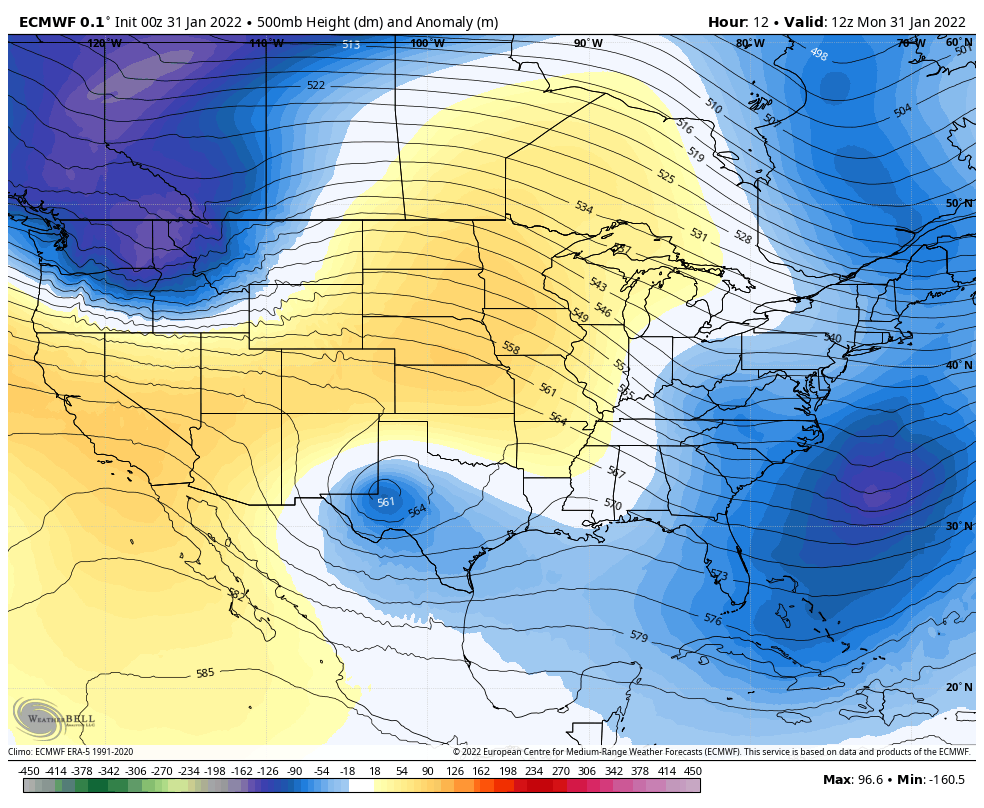
There has been a lot of chatter about that ending with and arctic front and transition back to snow. Once again, I think that long range outlook might have been initiated with more expectation that reality. More on that below.
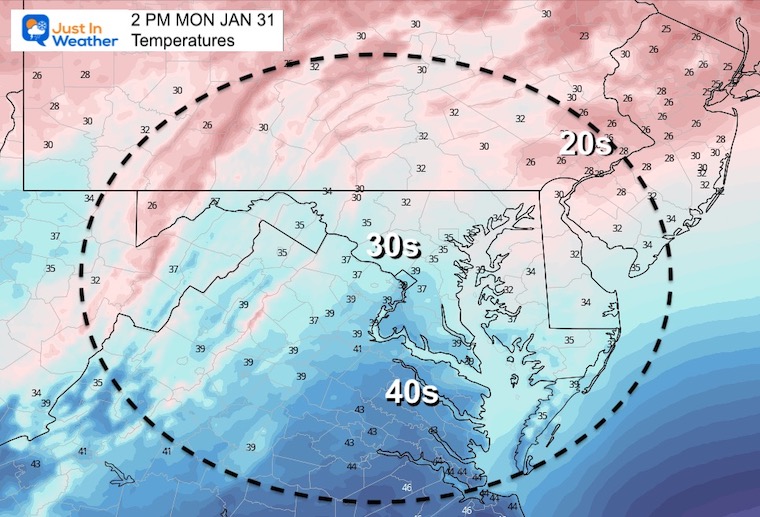
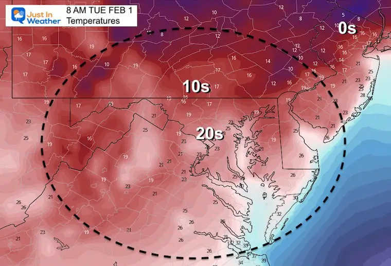
I’ve highlighted a pocket of teens this morning across lower Delaware and Maryland. With snowpack over 10 inches, temps are down into the teens. This matches southern Pennsylvania and spots in the mountains.
Overall the region is in the 20s but the winds are light so it is tolerable.
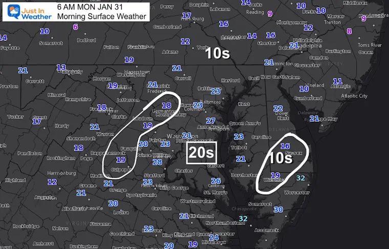
High Pressure is in control, however we will see plenty of clouds today.
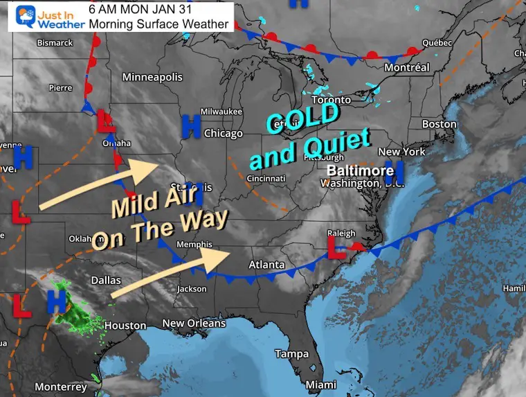
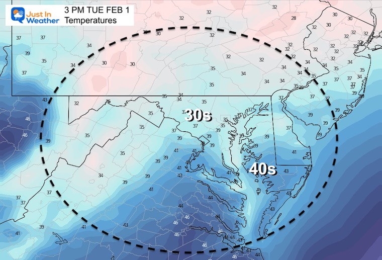
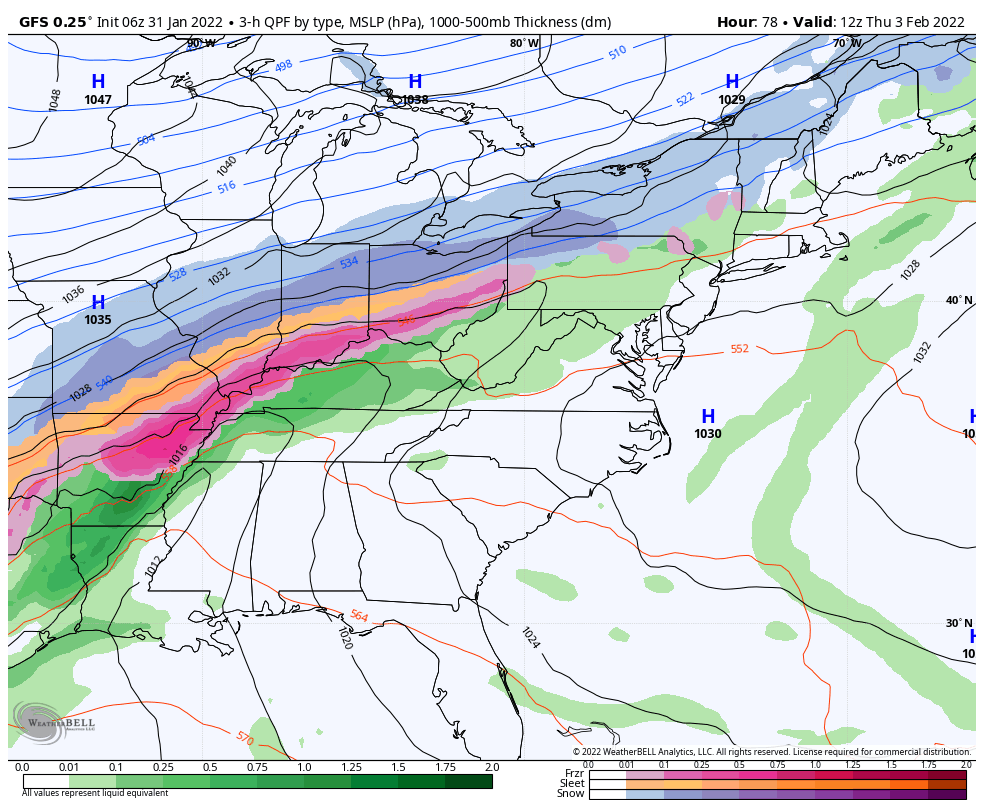
The pattern will be shifting this week, The next storm track will be well west, allowing a surge of mild temp for a couple of days.
TODAY January 31
Seasonal Snow: 13.3”;
+4.7″ ABOVE AVERAGE
Normal Low in Baltimore: 25ºF
Record 4ºF in 1966
Normal High in Baltimore: 42ºF
Record 69ºF 1947
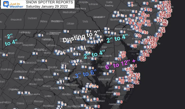
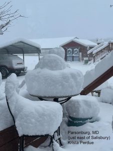
Did you see the storm recap and snow list?
Click here for maps and list.. Plus GRADE MY FORECAST
You can log a grade and see my score card here:
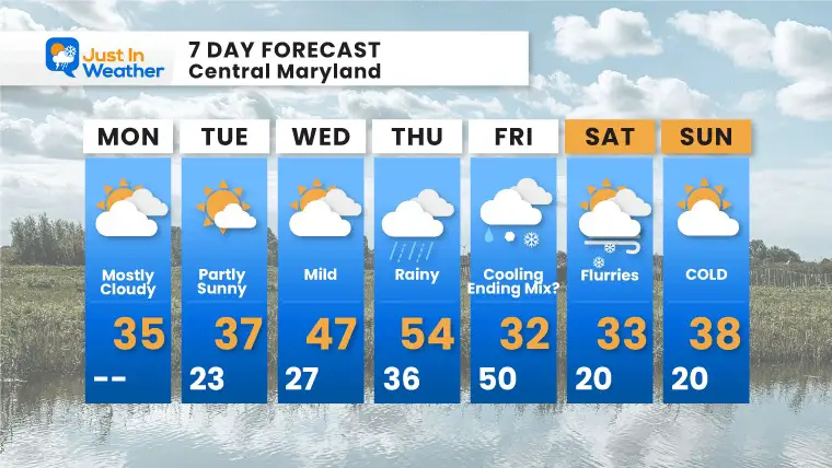
7 AM Monday to 7 AM Saturday
The trend aloft will be milder… This will allow temps to reach the 50s for us, as the next storm tracks to our west.
Colder air will follow that storm for us on Friday and Saturday.
7 AM Thursday to 7 AM Saturday
Based on Baltimore at BWI
Rain arrives Wednesday night into Thursday, with temps into the 50s. Arctic air is expected to follow the storm Friday. This may end with a windy mix. It is too early to speculate if this will be a travel impact…
*Disclaimer due to frequent questions:
I am aware there are some spelling and grammar typos. I have made a few public statements over the years, but if you are new here you may have missed it:
I have dyslexia, and found out at my second year at Cornell. I didn’t stop me from getting my meteorology degree, and being first to get the AMS CBM in the Baltimore/Washington region.
I do miss my mistakes in my own proofreading. The autocorrect spell check on my computer sometimes does an injustice to make it worse.
All of the maps and information are accurate. The ‘wordy’ stuff can get sticky.
There is no editor that can check my work when I need it and have it ready to send out in a newsworthy timeline.
I accept this and perhaps proves what you read is really from me…
It’s part of my charm.
#FITF