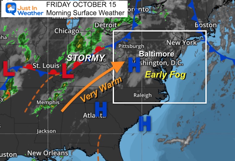
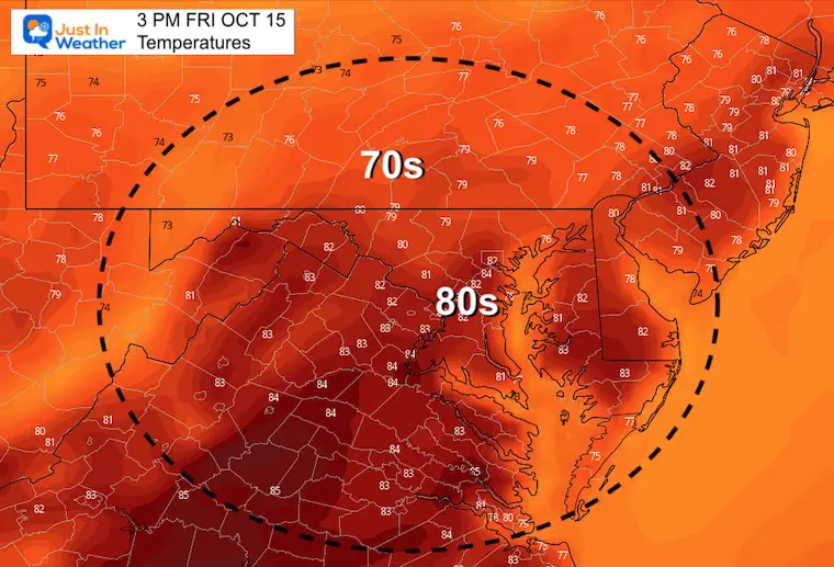
Are you enjoying this warm weather? On Thursday we finally broke the clouds and Baltimore hit 81ºF at BWI. Today, we might have some early fog and clouds, but sun this afternoon will boost temps a little higher.However, it may fall just short of the record 86ºF set in 1989 and other years.
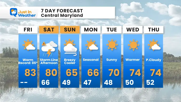
Plans outside on Saturday will need to contend with a strong cold front. This will provide a brief line of intense rain, possibly severe, then turning sharply cooler. Timeline simulation below
Morning Surface Weather
High Pressure in control one more day. Some patchy early fog, but the sun and warmer winds will take over into the afternoon.
The cold front to the west will reach us by early Saturday afternoon and introduce the change to much cooler weather.
Morning Temperatures
Current Conditions: See the tab on the right.
Change your location: See the Blue Bar at the top of this post.
The cold front will be brief, lasting less than 1 hour for most. But it will be intense, and possibly severe.
K-Index = 30+ is a good measure for thunderstorms. This is not a good indicator for severity. I will have an expanded look at this in my afternoon report.
Simulation Timeline —> slider
october-15-weather-rain-storm-saturday-pm-12
october-15-weather-rain-storm-saturday-pm-1
october-15-weather-rain-storm-saturday-pm-2
october-15-weather-rain-storm-saturday-pm-3
october-15-weather-rain-storm-saturday-pm-4
october-15-weather-rain-storm-saturday-pm-5
october-15-weather-rain-storm-saturday-pm-6
october-15-weather-rain-storm-saturday-pm-7
Temperature Transition
Noon Saturday to 11 AM Sunday
7 Day Forecast
Maryland Trek Gear
Maryland Trek 8 Says THANK YOU!
Running Total Raised $116,438
During 329 Miles From Wisp To Ocean City
To Honor Kids In Cancer Treatment and Support FREE Programs At Just In Power Kids
Please share your thoughts, best weather pics/video, or just keep in touch via social media
Please make sure you sign up (above or click here to sign up for email alerts…. ) for my newsletter. This way you will get an email to make sure you are notified of each report.