August 29 Hurricane Idalia Upgraded As Weak Cold Front Helps Steer It
August 29, 2023
Tuesday Update
Overnight Idalia was upgraded to a hurricane as expected, making it the 3rd hurricane and 9th named storm of the 2023 Atlantic hurricane season. Meanwhile, Hurricane Franklin has appeared to peak at Category 4. The focus will be on Idalia with expected rapid intensification today and becoming a major hurricane before making landfall in Florida tomorrow.
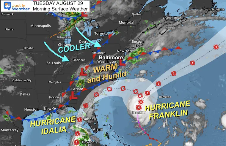
Morning Surface Weather
Locally a weak cold front is part of the equation that will help steer this through the Carolinas and then out into the Atlantic. More on our local weather below. But first, a look at the tropics.
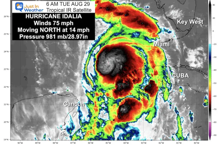
Hurricane Idalia
- LOCATION…23.1N 85.0W
- ABOUT 85 MI…135 KM N OF THE WESTERN TIP OF CUBA
- ABOUT 370 MI…600 KM SSW OF TAMPA FLORIDA
- MAXIMUM SUSTAINED WINDS…75 MPH…120 KM/H
- PRESENT MOVEMENT…N OR 360 DEGREES AT 14 MPH…22 KM/H
- MINIMUM CENTRAL PRESSURE…981 MB…28.97 INCHES
Map
WATCHES AND WARNINGS
A Storm Surge Warning is in effect for…
* Englewood northward to Indian Pass, including Tampa Bay
A Hurricane Warning is in effect for…
* Cuban province of Pinar del Rio
* Middle of Longboat Key northward to Indian Pass, including Tampa Bay
A Tropical Storm Warning is in effect for…
* Isle of Youth Cuba
* Dry Tortugas Florida
* Chokoloskee northward to the Middle of Longboat Key
* West of Indian Pass to Mexico Beach
* Sebastian Inlet, Florida to Altamaha Sound, Georgia
A Storm Surge Watch is in effect for…
* Chokoloskee northward to Englewood, including Charlotte Harbour
* Mouth of the St. Mary’s River to South Santee River South Carolina
A Hurricane Watch is in effect for…
* Englewood to the Middle of Longboat Key
A Tropical Storm Watch is in effect for…
* Lower Florida Keys west of the west end of the Seven Mile Bridge
* Altamaha Sound northward to South Santee River South Carolina
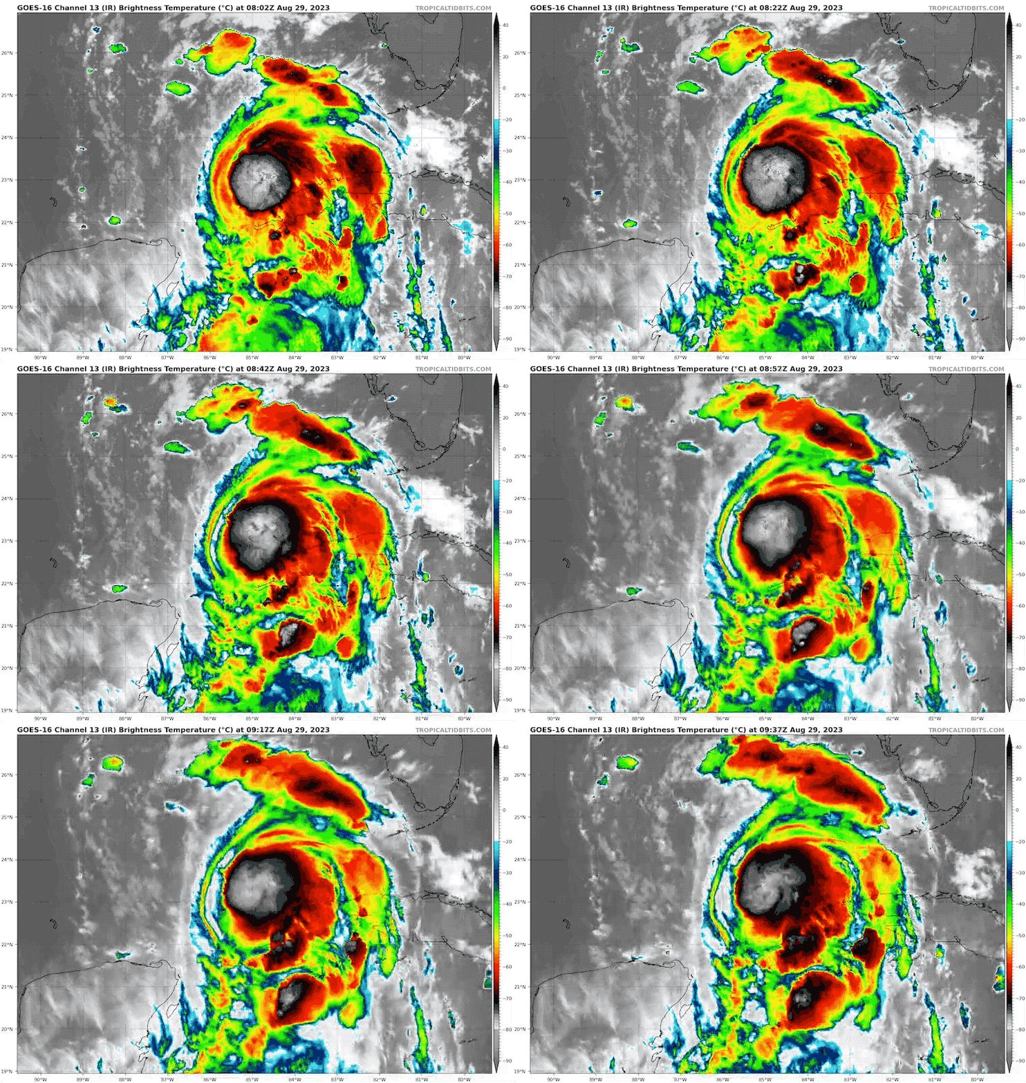
Hurricane Idalia Satellite Loop
Hurricane Force Winds reach 15 miles from the center
Tropical Storm Force Winds reach 160 miles from the center.
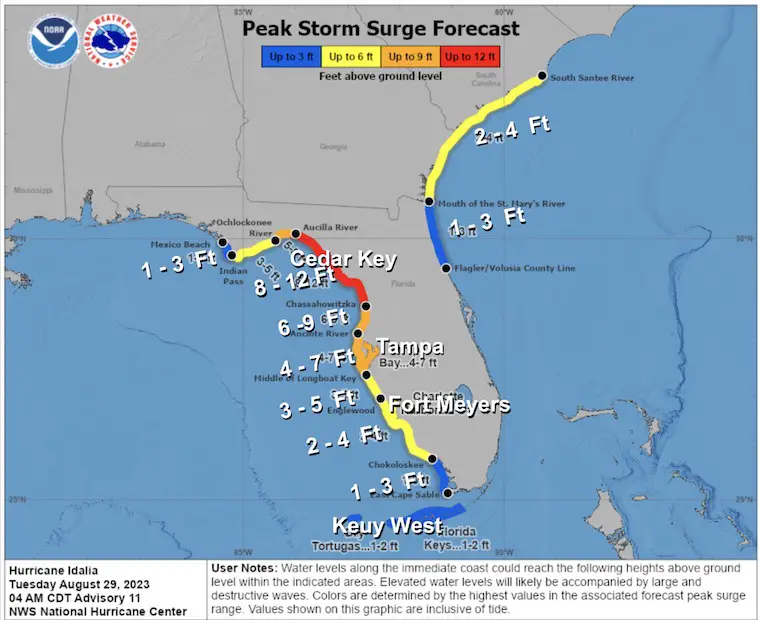
Storm Surge Forecast From The National Hurricane Center
The combination of a dangerous storm surge and the tide will cause normally dry areas near the coast to be flooded by rising waters moving inland from the shoreline. The water could reach the following heights above ground somewhere in the indicated areas if the peak surge occurs at the time of high tide.
- Aucilla River, FL to Chassahowitzka, FL…8-12 ft
- Chassahowitzka, FL to Anclote River, FL…6-9 ft
- Ochlockonee River, FL to Aucilla River, FL…5-8 ft
- Anclote River, FL to Middle of Longboat Key, FL…4-7 ft
- Tampa Bay…4-7 ft
- Middle of Longboat Key, FL to Englewood, FL…3-5 ft
- Englewood, FL to Chokoloskee, FL…2-4 ft
- Charlotte Harbor…2-4 ft
- Indian Pass, FL to Ochlockonee River, FL…3-5 ft
- Mouth of the St. Mary’s River to South Santee, SC…2-4 ft
- Chokoloskee, FL to East Cape Sable, FL…1-3 ft
- Flagler/Volusia County Line, FL to Mouth of St. Mary’s River…1-3ft
- Indian Pass to Mexico Beach…1 to 3 ft.
- Florida Keys…1-2 ft
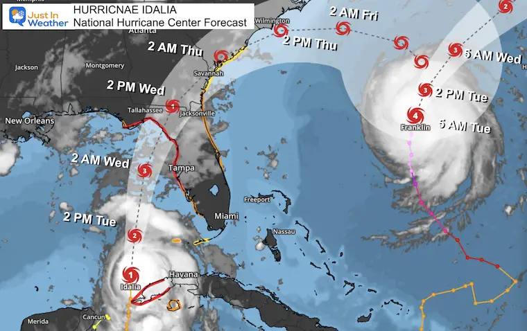
National Hurricane Center Forecast Track/Times
This is still expected to be a Category 3 storm with winds of 115 mph or higher and may make landfall near Cedar Key.
We can see Hurricane Franklin on the edge of the map. Please note that the end location for Idalia will be where Franklin ‘was’. It will be moving away and they will not merge.
Hurricane Franklin
- LOCATION…30.2N 70.8W
- ABOUT 385 MI…615 KM WSW OF BERMUDA
- MAXIMUM SUSTAINED WINDS…140 MPH…220 KM/H
- PRESENT MOVEMENT…NNE OR 15 DEGREES AT 9 MPH…15 KM/H
- MINIMUM CENTRAL PRESSURE…935 MB…27.61 INCHES
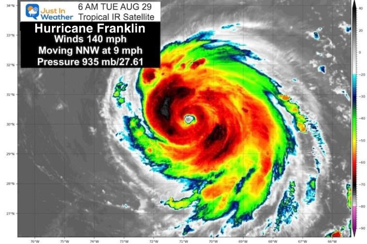
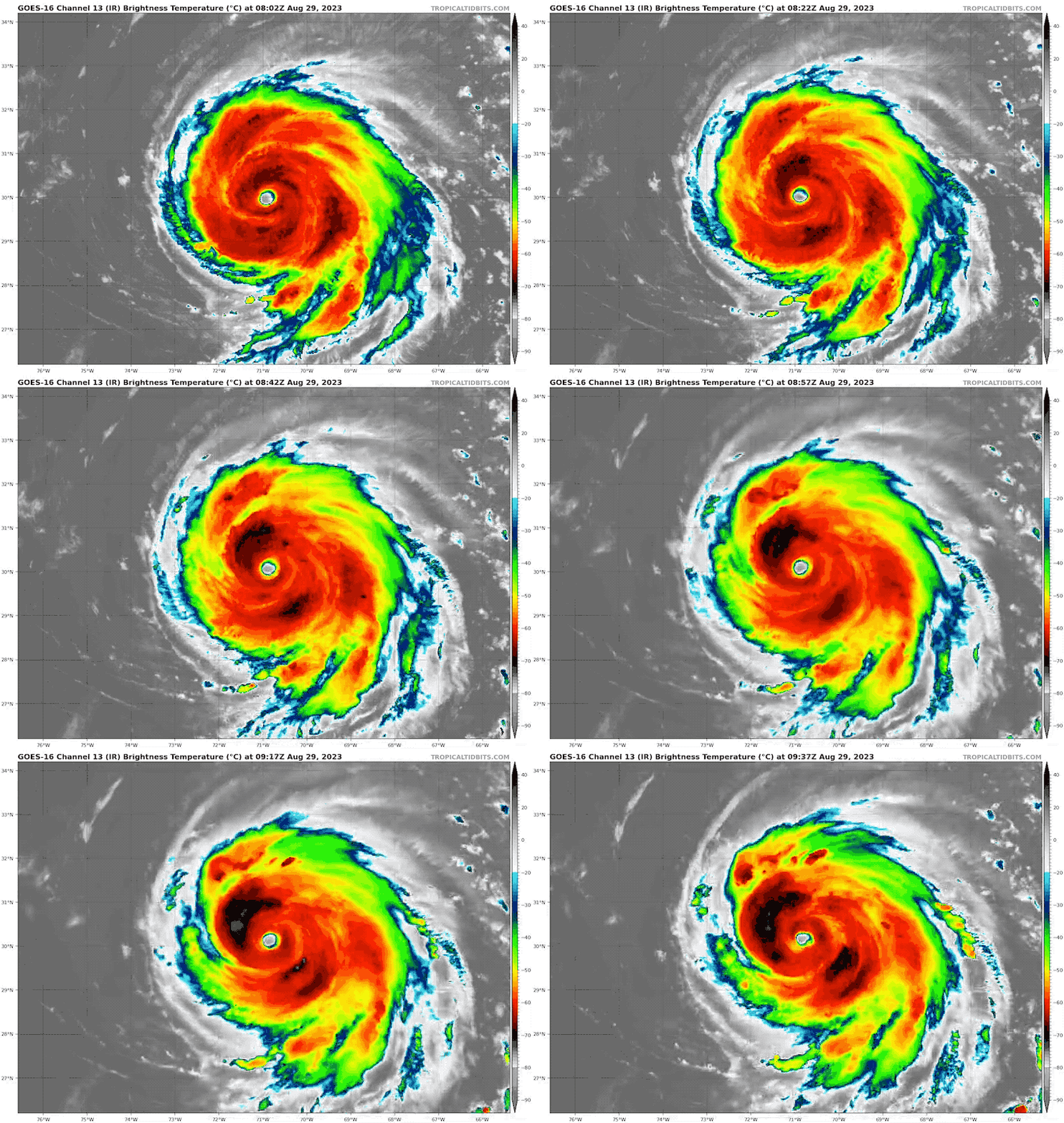
Hurricane Franklin Satellite Loop
- Tropical Storm Watch is in effect for Bermuda
- Hurricane Force Winds reach 35 miles from the center.
- Tropical Storm Force Winds reach 150 miles from the center.
LOCAL WEATHER
The cold front that will be crossing the region is not strong and will only bring us scattered showers. This is helping to steer the tropical systems away from the Mid Atlantic.
Closer Look Below The Climate Data
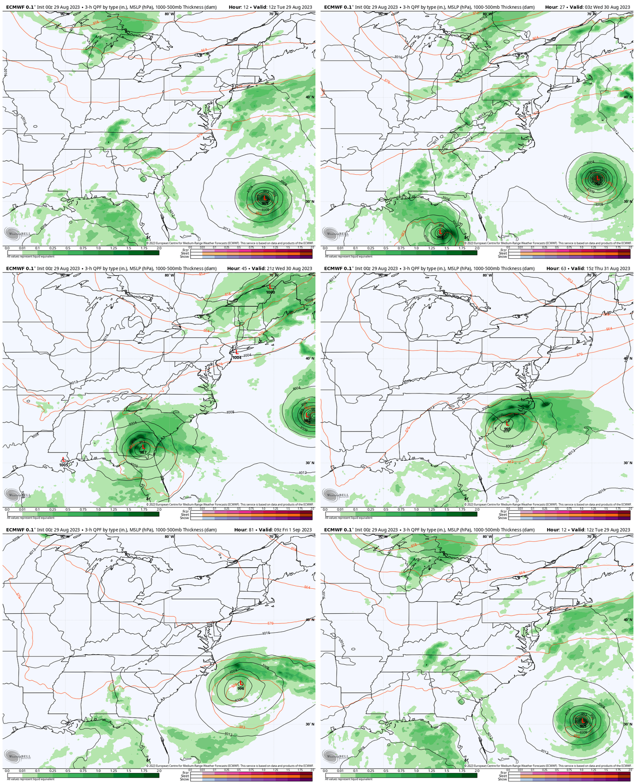
ECWMF Model: Tuesday Morning to Friday Morning
CLIMATE DATA: Baltimore
TODAY August 29
Sunrise at 6:32 AM
Sunset at 7:42 PM
Normal Low in Baltimore: 65F
Record 47ºF in 1986
Normal High in Baltimore: 85ºF
Record 100ºF 1953
Subscribe for eMail Alerts
Weather posts straight to your inbox
Sign up and be the first to know!
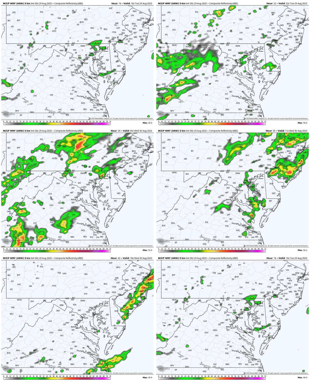
Radar Simulation: WRF Model
12 PM Tue to 4 PM Wed
Only scattered showers or thunderstorms. Nothing well organized.
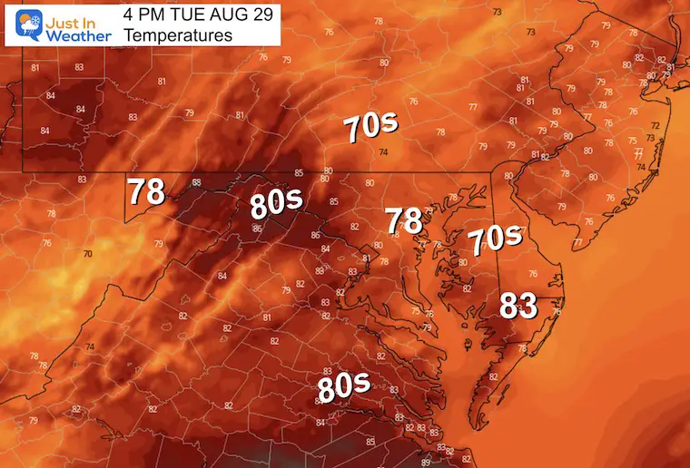
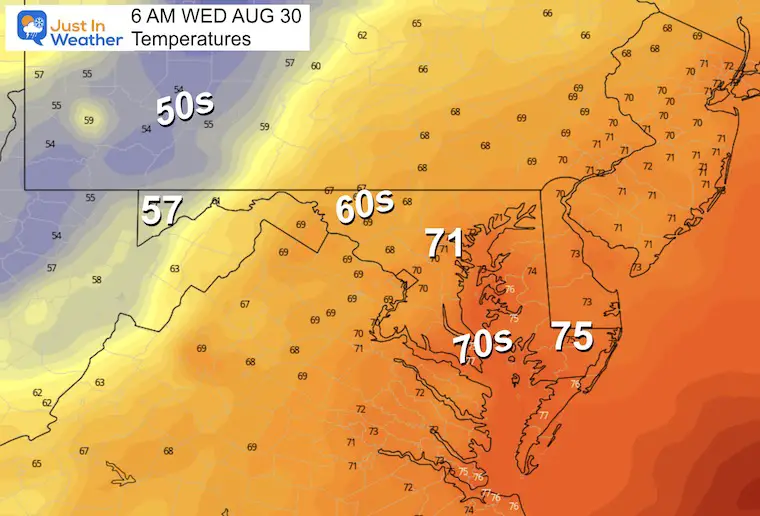
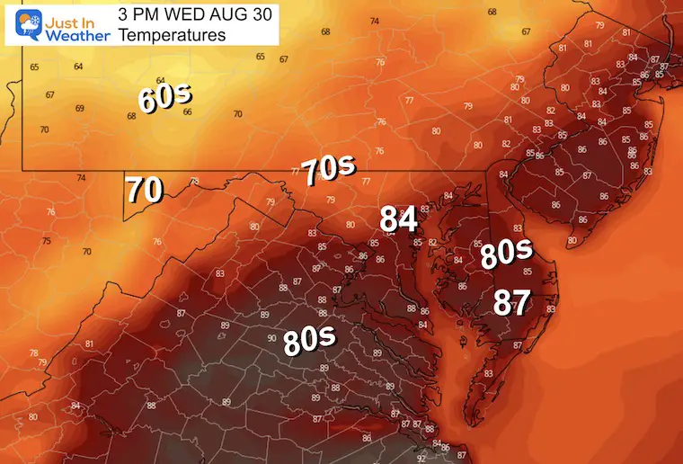
Temperature Forecast
Tuesday Afternoon
Wednesday Morning
Wednesday Afternoon
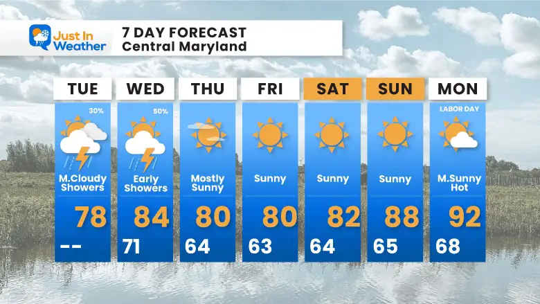
7 Day Forecast
After Hurricane Idalia moves off the coast, pleasant weather will follow and leave us with many sunny days. This is not good news for the growing drought, but will provide dry days through Labor Day Weekend. Temperatures will get back to the 90s by the end of the weekend.
