April 12, 2023
Wednesday Morning Update
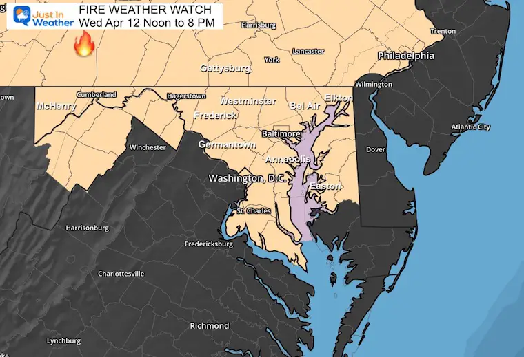
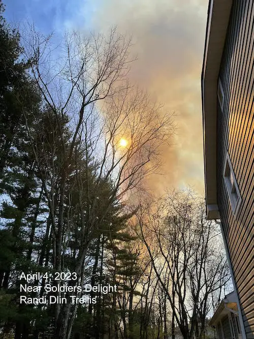
The warm and dry conditions has prompted a rare Fire Weather Watch across our region today. Just one week ago there was a wildfire in Baltimore County’s Soldiers Delight. Overnight, a wildfire in New Jersey burned 2,500 acres, and forced nearly 200 homes to be evacuated (see video below).
Needless to say, we should take this seriously as anything from a cigarette to backyard grill or fire pit can lead to uncontrolled flames.
Fire Weather Watch
Today Noon to 8 PM
Weather maps below.
Last Week In Maryland
This was the smoke at my friend Randi’s home near Soldiers Delight Park.
Overnight Fire In New Jersey
2,500 acres burned and it is only 10% contained this morning.
Up to 200 homes were under a mandatory evacuation, but that was lifted this morning.
WATCH: Winds kick up flames high into the air above tall trees level, spreading flames in New Jersey forest fire overnight. 170 homes evacuated so far. 2500 acres&counting burned. Air filled with embers&thick smoke in Ocean County south of Great Adventure. @FOX29philly pic.twitter.com/8LSer92O8G
— Steve Keeley (@KeeleyFox29) April 12, 2023
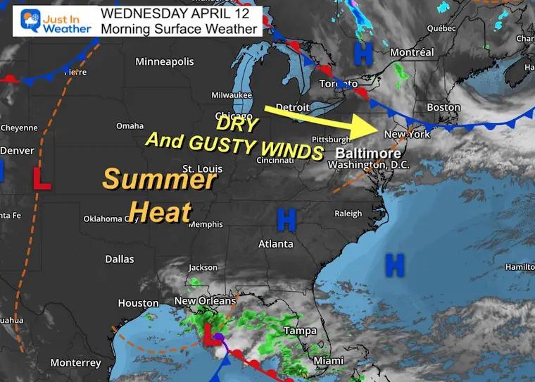
Morning Surface Weather
High Pressure dominates with dry weather and warming conditions. The wind will again increase during the afternoon to help with low humidity to further dry out the soil.
While we expect summer heat, we are not expected to get record highs today.
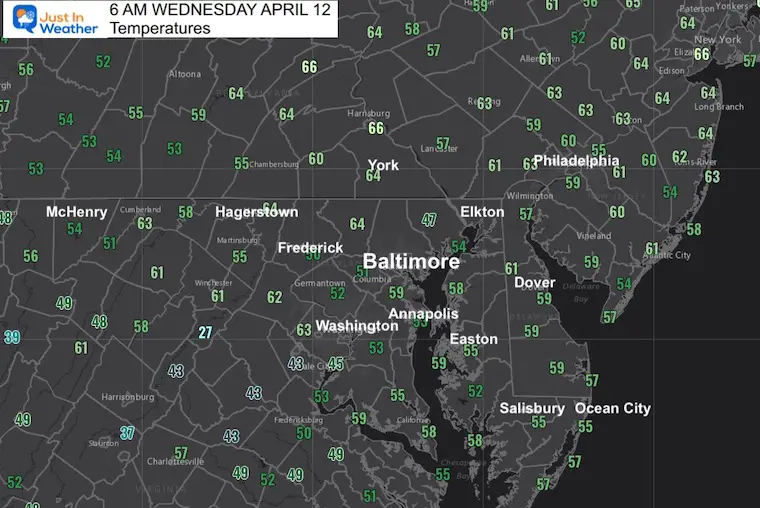
Morning Temperatures
A mild start already…
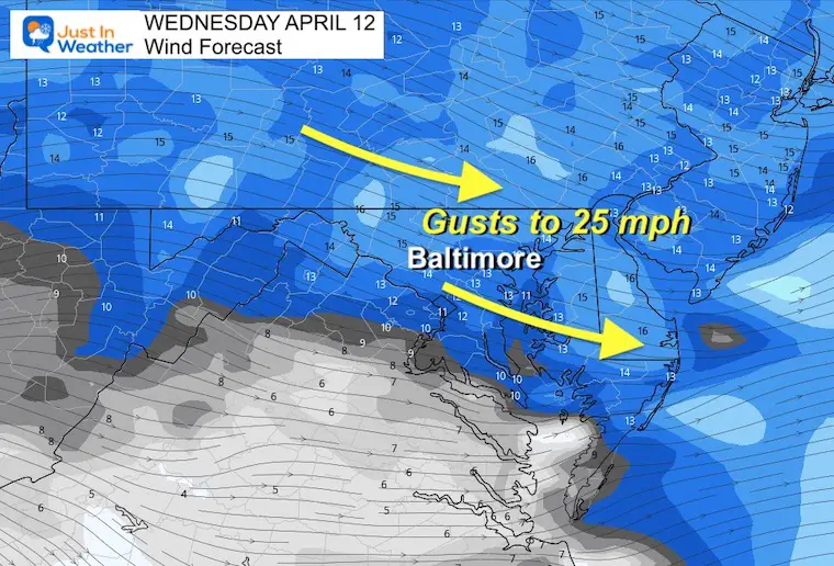
Afternoon Wind Forecast
The winds will pick up between 15 and 20 mph, with gusts up to 30 mph.
Given the higher temperatures AND lower humidity, this is part of the danger for wildfires to develop and rapidly spread.
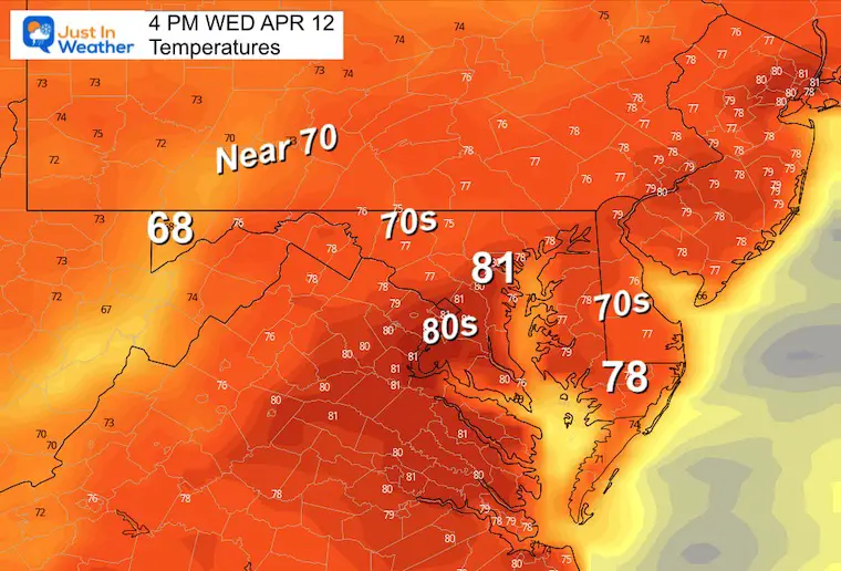
Afternoon Temperatures
Mid 70s to lower 80s.
Subscribe for eMail Alerts
Weather posts straight to your inbox
Sign up and be the first to know!
CLIMATE DATA
TODAY April 12
Normal Low in Baltimore: 42ºF
Record 27ºF in 1874
SNOW: 0.4” in 1959
Normal High in Baltimore: 65ºF
Record 88ºF in 1977
REPORTS:
Winter 2023 Recap: My BUSTED Snow Outlook
La Niña Has Ended. El Niño May Return By Fall
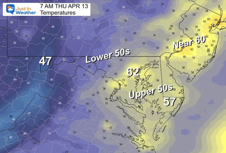
Thursday Morning Temperatures
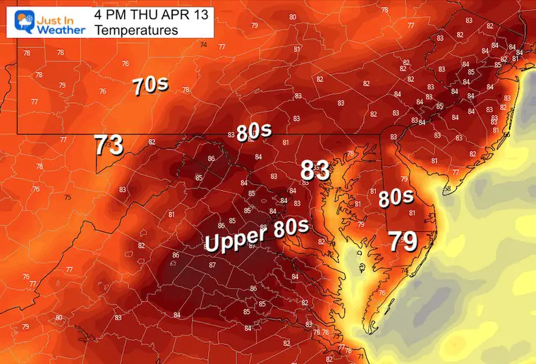
Thursday Afternoon Temperatures
More areas will reach the 80s.
Weekend Weather
A disturbance will bring scattered showers on Saturday. This will NOT be a washout. It will be tough to pin down specific locations and timing of the showers until we get closer. So for now, just keep it as part of your planning.
Sunday will be warm and more likely to hold off the storms until evening and overnight.
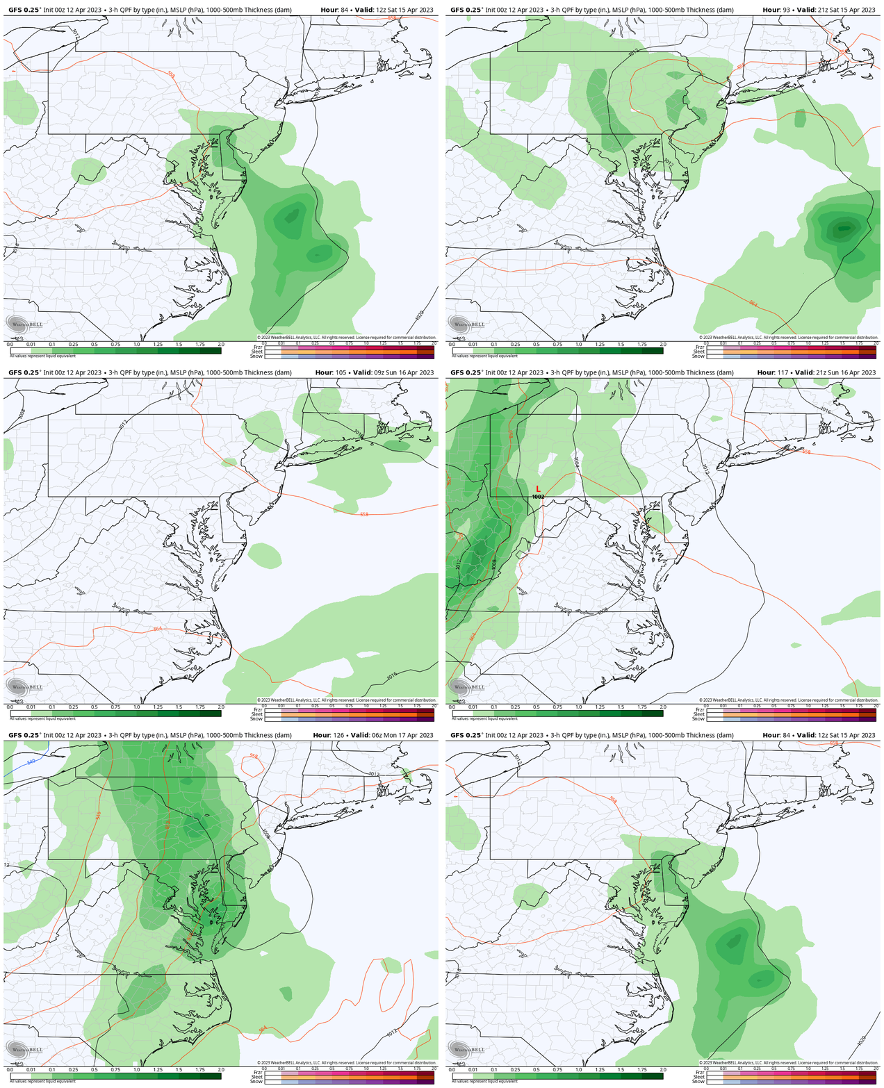
Snapshot Sunday Night
At this time it looks like a mostly dry day, with showers arriving from the mountains in the evening and at night.
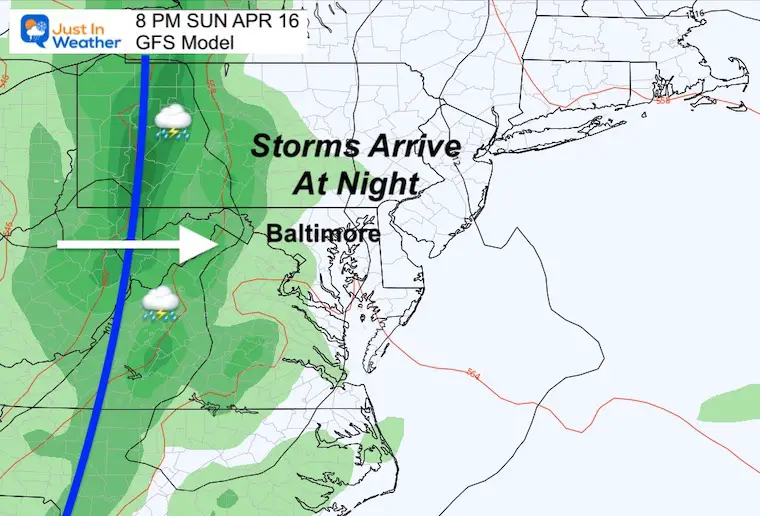
Jet Stream Animation: Wednesday Afternoon to Monday Afternoon
The pocket of warm air will finally get moved out and replaced by a cooler air mass by Monday… following the line of storms.
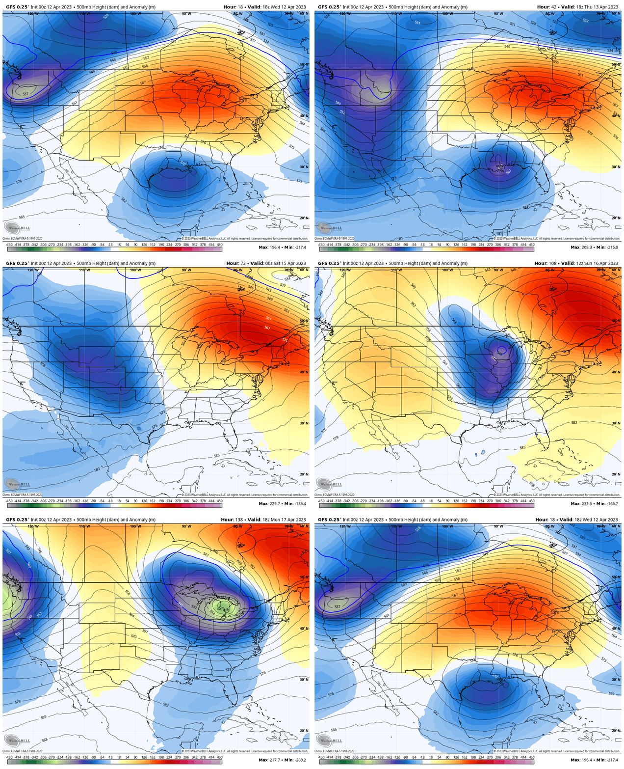
7 Day Forecast
Summer like heat will stay with us for a few days, so we may continue with the fire risk until the weekend.
Showers on Saturday will be scattered and not promised. But they could impact your location.
Storms on Sunday night are likely to arrive AFTER sunset and move out Monday morning, when cooler temps arrive.
STEM Assemblies/In School Fields Trips Are Back
Click to see more and ‘Book’ a visit to your school
Please share your thoughts, best weather pics/videos, or just keep in touch via social media
-
Facebook: Justin Berk, Meteorologist
-
Twitter
-
Instagram
RESTATING MY MESSAGE ABOUT DYSLEXIA
I am aware there are some spelling and grammar typos, and occasional other glitches. I take responsibility for my mistakes, and even the computer glitches I may miss.
I have made a few public statements over the years, but if you are new here you may have missed it:
I have dyslexia, and found out during my second year at Cornell University. It didn’t stop me from getting my meteorology degree, and being first to get the AMS CBM in the Baltimore/Washington region. One of my professors told me that I had made it that far without knowing, and to not let it be a crutch going forward. That was Mark Wysocki and he was absolutely correct!
I do miss my mistakes in my own proofreading. The autocorrect spell check on my computer sometimes does an injustice to make it worse. I also can make mistakes in forecasting. No one is perfect predicting the future.
All of the maps and information are accurate. The ‘wordy’ stuff can get sticky.
There has been no editor that can check my work when I needed it and have it ready to send out in a newsworthy timeline. Barbara Werner is a member of the web team that helps me maintain this site. She has taken it upon herself to edit typos, when she is able. That could be AFTER you read this.
I accept this and perhaps proves what you read is really from me…
It’s part of my charm.
#FITF


