February 26 Morning Fog Then Clearing Storms Ahead Still Have Hints Of Winter
February 26 2023
Sunday Morning
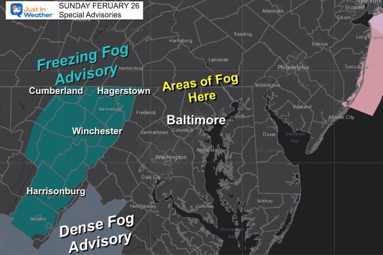
We got our snow yesterday, but officially only a Trace, so we did not add to our total even though there were areas with a coating. As expected, we have areas of fog this morning that has been combined with freezing temps in the mountains. A rare Freezing Fog Advisory is in effect until 10 AM for the mountains around Hagerstown, Cumberland, and down I-81 into southwest Virginia.
Freezing Fog Advisory
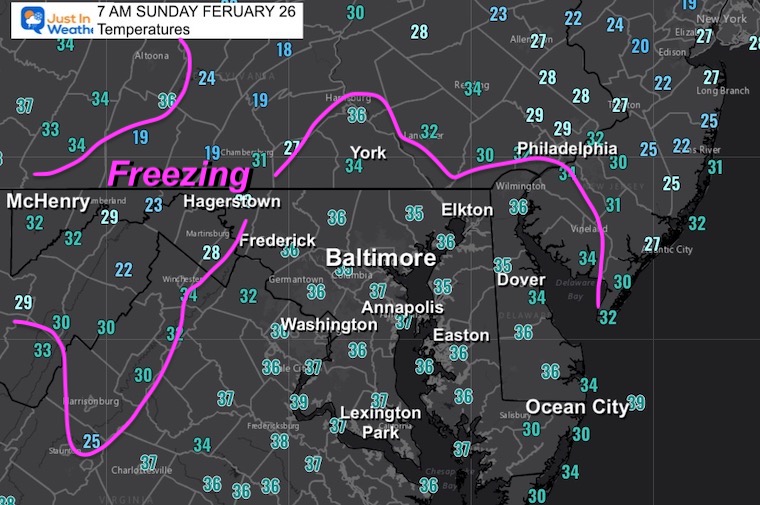
Morning Temperatures
National Weather
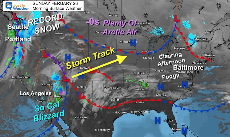
Quite the difference out west with snow in Los Angeles. The city received over 6 inches of rain, with a blizzard in the mountains, and record snow keeps falling around Seattle and Portland.
Los Angeles Snow
Saturday Snow On The Palm Trees
Los Angeles snow in SLO-MO. pic.twitter.com/F7EvJX21ze
— Glenn Farrington (@HaHaScribe) February 25, 2023
Southern Californian Snow Stickage
Dumping snow in the city of Los Angeles! Sunland/Tujunga area @NWSLosAngeles #cawx pic.twitter.com/eP2craQ8tG
— Jeremy Z (@jeremyziskind) February 25, 2023
Eventually this has to push east, right? Well, this first storm will allow the winter pattern into the Great Lakes. There is definitely an interesting week ahead for us and the Northeast US as the following tracks will be shifting.
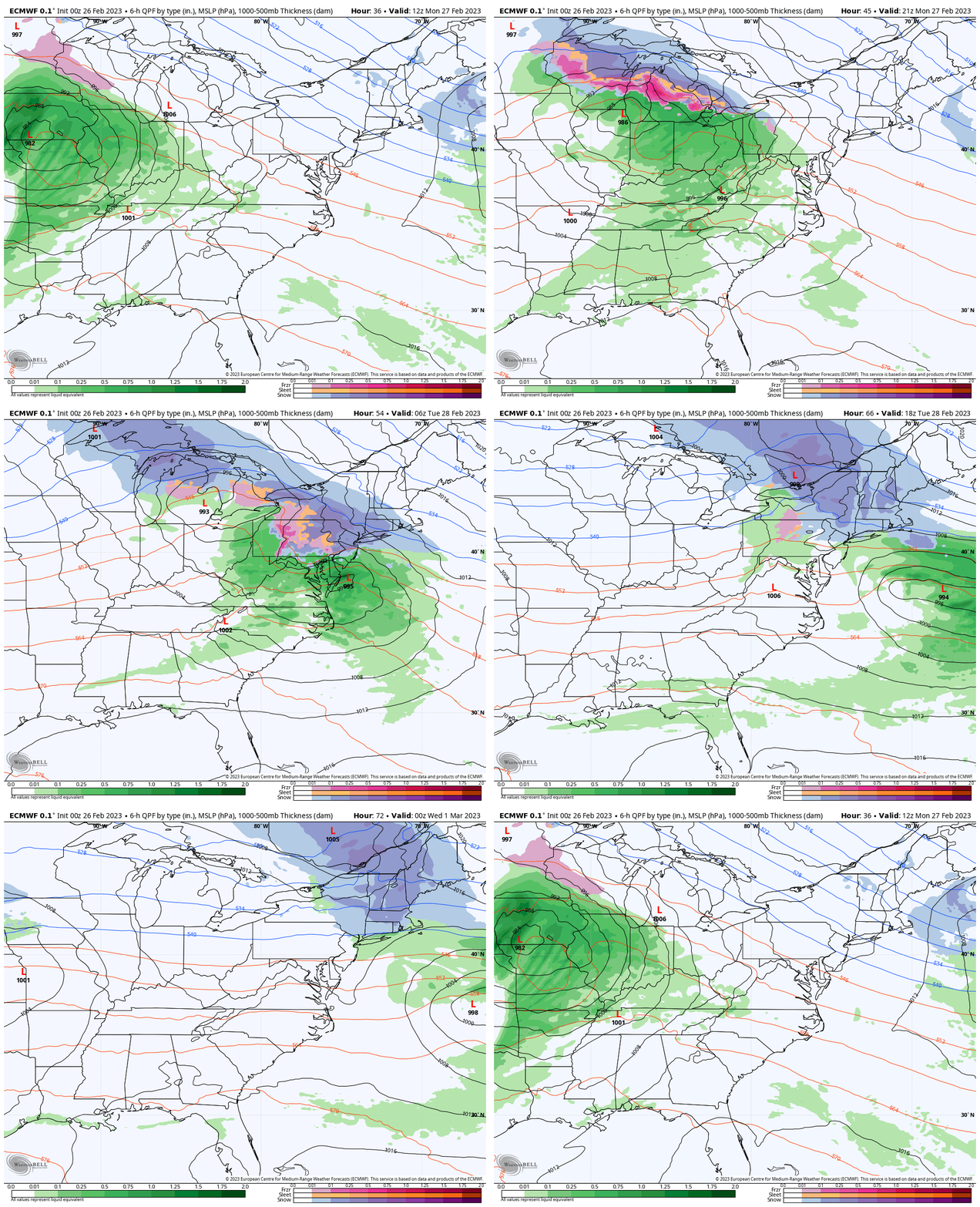
As we head into the month of March, it becomes more challenging to get a winter event to impact travel, but it is possible. (This would be a good time for your septic pumping) So any snow I show is with curiosity.
Temperatures
Afternoon:
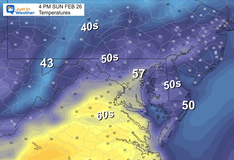
The morning fog and clouds will eventually clear and bring us another mild afternoon.
Subscribe for eMail Alerts
Weather posts straight to your inbox
Sign up and be the first to know!
CLIMATE DATA
TODAY February 26
Normal Low in Baltimore: 29ºF
Record 13ºF in 1990
SNOW: 3” in 1993
Normal High in Baltimore: 49ºF
Record 74ºF in 1932
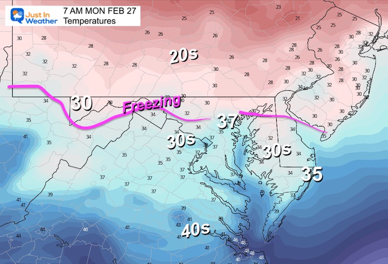
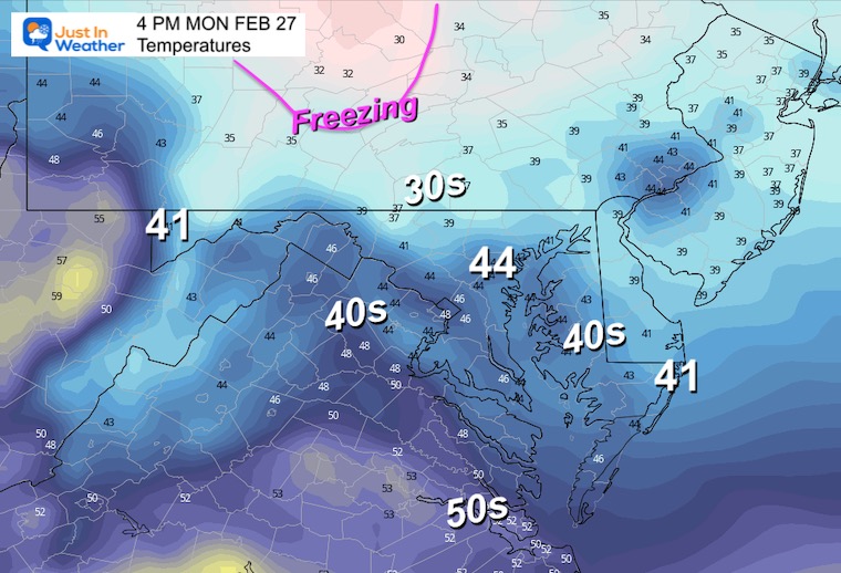
Monday Temperatures
Morning
Afternoon
Monday Weather
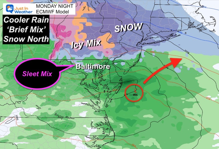
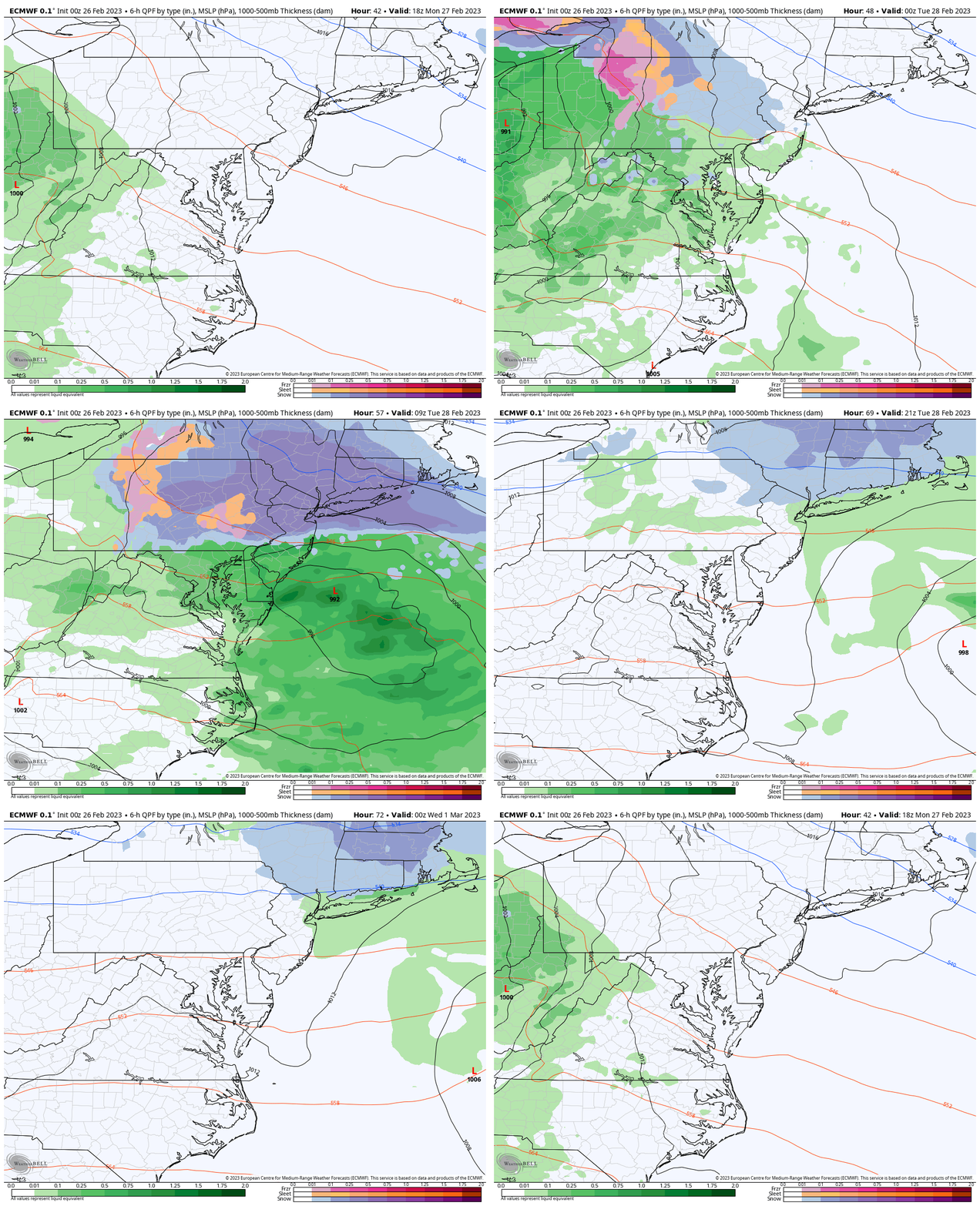
The next round of rain will be arriving during the afternoon and evening. The bulk of this event will be overnight.
Here the European Model is showing some pockets of mix or sleet, but mainly a rain event for us.
Snow will be a travel issue from central PA to metro New York and New England.
Snapshot: Monday Night
This will be a rain event for our region, but we could have some sleet or snow mixed in at night. The colder air will make it more challenging across Pennsylvania near the Turnpike (I-76) and northward through the Poconos and metro New York.
Storm Forecast Animation
Monday Afternoon to Tuesday Night
Next Storm: Thursday to Friday
After all the cold and snow in the western half of the nation, the atmosphere has support to eventually send some of that our way.
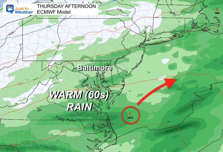
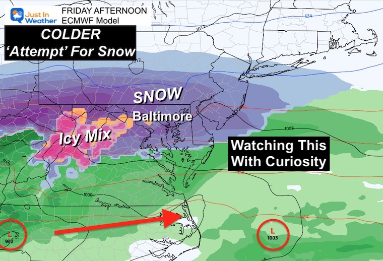
What we may see is another WARM RAIN event on Thursday with temps in the 60s, followed by a second wave of Low Pressure forming in the colder air on Friday.
Snapshots
Thursday
Rain with temperatures in the 60s.
Friday
Second Storm with colder air? This is something that has been showing up on the modeling, but I have been hesitant to show you anything beyond one week with snow.
Now that we are within the 7-day window, I will show with curiosity and trends. No long range promises.
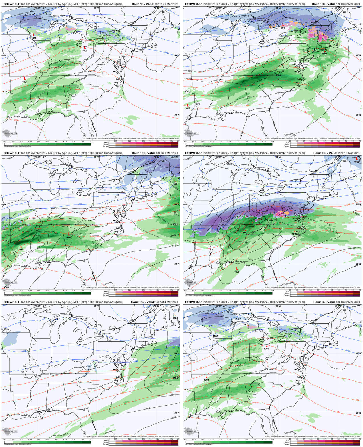
Storm Simulation: Wednesday 7 AM to Saturday 7 AM
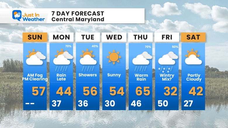
7 Day Forecast
An active weather week ahead, with more mild weather and rain. The end of week storm is worth watching, but with curiosity more than anything at this point.
Also See:
Winter History: Low Snow And Late Starts
See my research based on Baltimore data since 1883.
Subscribe for eMail Alerts
Weather posts straight to your inbox
Sign up and be the first to know!
STEM Assemblies/In School Fields Trips Are Back
Click to see more and ‘Book’ a visit to your school 
My Winter Outlook: Not A Typical La Niña!
I see many factors to support colder influence with multiple systems. Early and later in winter. Check it out. https://justinweather.com/2022/11/22/winter-outlook-2023-for-snow-not-typical-la-nina-plus-polar-vortex-disruption/
Also See The Winter Outlook Series:
Farmer’s Almanac Comparison
September Starts Meteorological Autumn: Weather Climate Stats For Maryland at Baltimore
Triple Dip La Niña Winter
https://justinweather.com/2022/09/09/winter-outlook-2023-la-nina-triple-dip-expectations/
CONNECTION TO WINTER?
If you want a snowy winter, this is what you might want to look for in the rest of the tropical season. https://justinweather.com/2022/08/31/record-august-for-no-named-tropical-storms-closer-look-at-snow-following/
Woolly Bear Caterpillars
https://justinweather.com/2022/10/25/winter-weather-outlook-from-the-wooly-bear-caterpillar/
Persimmon Seeds
Click to see Top 20 and MORE
Normals And Records: Maryland and Baltimore Climate History
Please share your thoughts, best weather pics/videos, or just keep in touch via social media
-
-
Facebook: Justin Berk, Meteorologist
-
Twitter: @JustinWeather
-
Instagram: justinweather
-


