February 25, 2023
Saturday Afternoon Update
Here we go! We’ve finally got some snow. For many in our region this is only the second time this month and even all winter! Just think, 48 hours ago it was close to 80ºF, now we may double our snowfall for the season. That is not saying much!
The little system passing through the Mid Atlantic today is in the process of developing. I have seen the skepticism this morning when the sun was shining. Even my wife was doubtful, but she has also been very public of her opposing views to mine on winter. We have the full spectrum covered here.
The good news is that we have snow falling to satisfy the winter lovers, but the warm surface temperatures will help to keep the pavement wet. Let’s take a look at the midday set up, then how this should evolve over the next few hours.
Noon Surface Weather
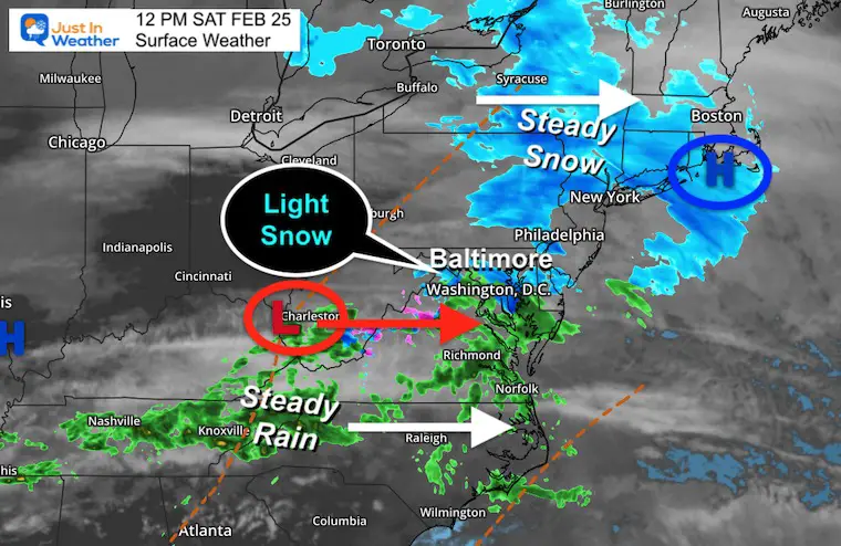
Low Pressure is located in West Virginia. This is forming as the result of converging upper level wind flow. To the North, there is a band of snow across Pennsylvania and New York. To the South there is a band of rain from Tennessee to Virginia.
In between is the new break out of snow now going across metro Washington, DC and central Maryland.
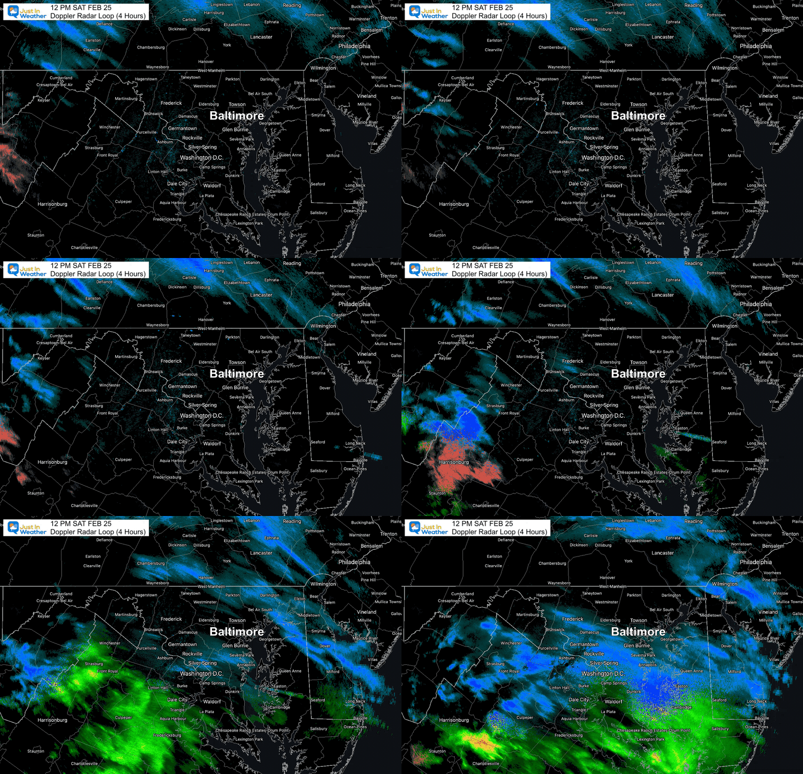
Radar Loop 8 AM to Noon
Notice the spread of snow (blue) across the region. This is in response to the upper level dynamics allowing Low Pressure to develop and expand.
There may be a mix of snow and sleet as this crosses Southern Maryland and Delmarva.
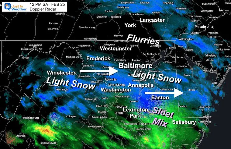
Doppler Radar At Noon
The steady light snow has reached as far north as Frederick, through metro Washington DC and even Annapolis. Steady snow is falling across Kent Island to Easton. Sleet has been reported in Cambridge and Crisfield.
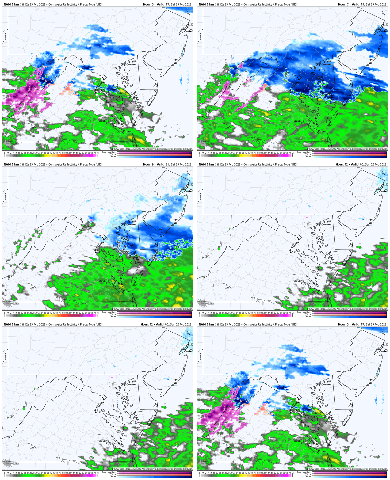
Radar Simulation Slider —> 12 PM to 6 PM
This first image is the forecast for noon that should match the Radar Image above. However, we can see there is more actual coverage of snow than the model predicted. This shows us that is has underplayed the event… But I had mentioned that in prior reports.
As this develops, the snow should peak mid afternoon, possibly including the PA line, but less will fall farther north. The bulk will be central Maryland… ending before evening.
Radar Simulation
Just putting the slider above in motion. The snow will peak mid afternoon, then end before sunset.
Now Potential
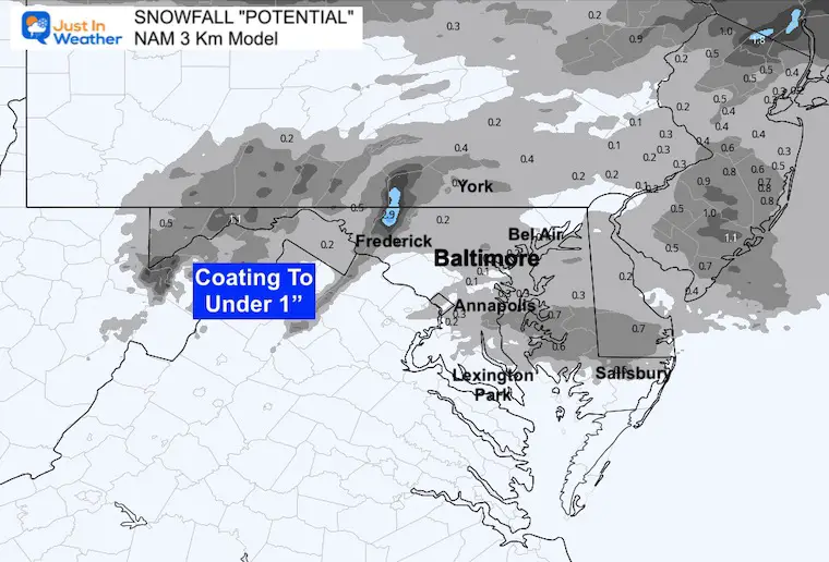
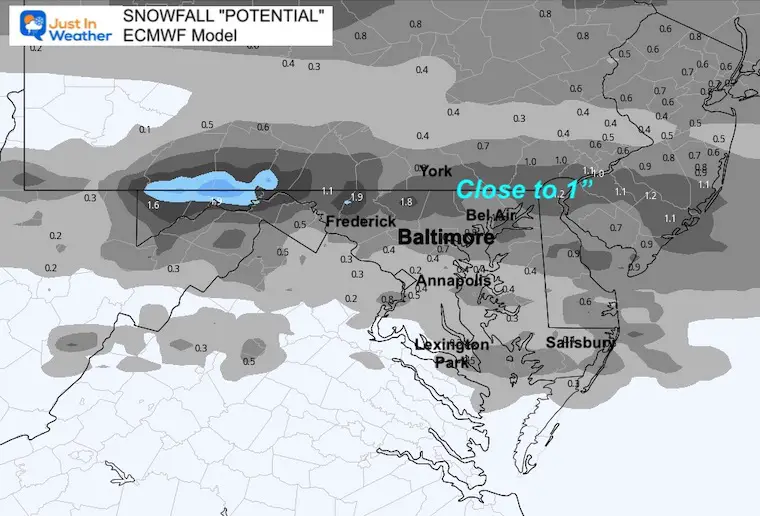
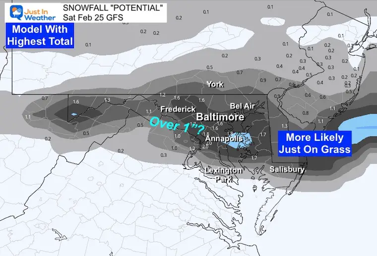
Due to the warm ground and temps just above freezing, any stickage would be limited to the grassy areas and car tops.
Most likely expectations will be between a coating to 1 inch.
Model forecast maps
NAM 3 Km
ECMWF
GFS
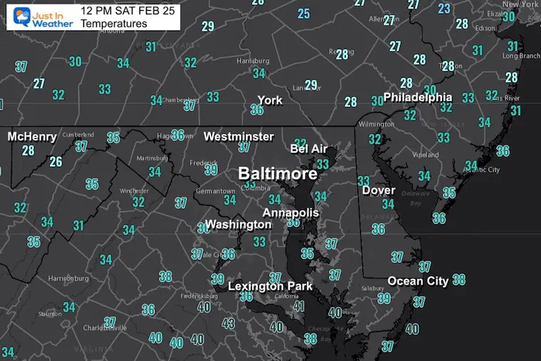
Temperatures At Noon
Where the snow falls, temps may drop a few degrees. However in the core of this event, temps should remain safely just above freezing.
Forecast Temperatures
Temperatures
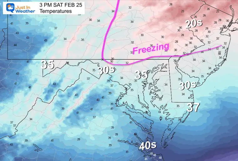
Afternoon:
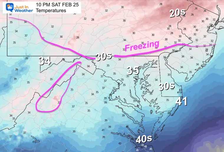
Temps will be close to freezing in the northern areas around the MD/PA Line. This may support more stickage.
Notice the mid 30s in central Maryland and Delmarva. That is why roads are likely to remain wet.
Tonight
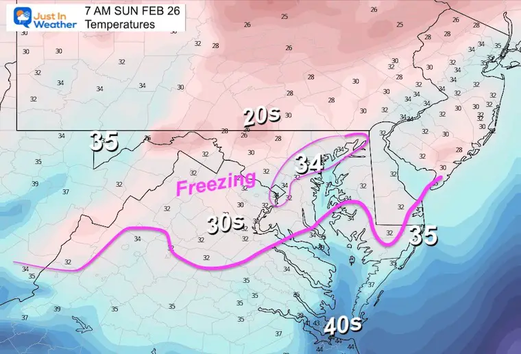
Not much cooling after the snow ends, so the concern for icing is minimal if you have plans to go out. This may be different in the morning.
Sunday Weather
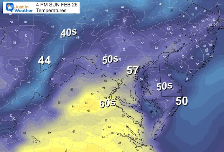
There may be some morning fog, then we will get into clearing and mild temps in the afternoon.
Temperatures
Morning
Afternoon
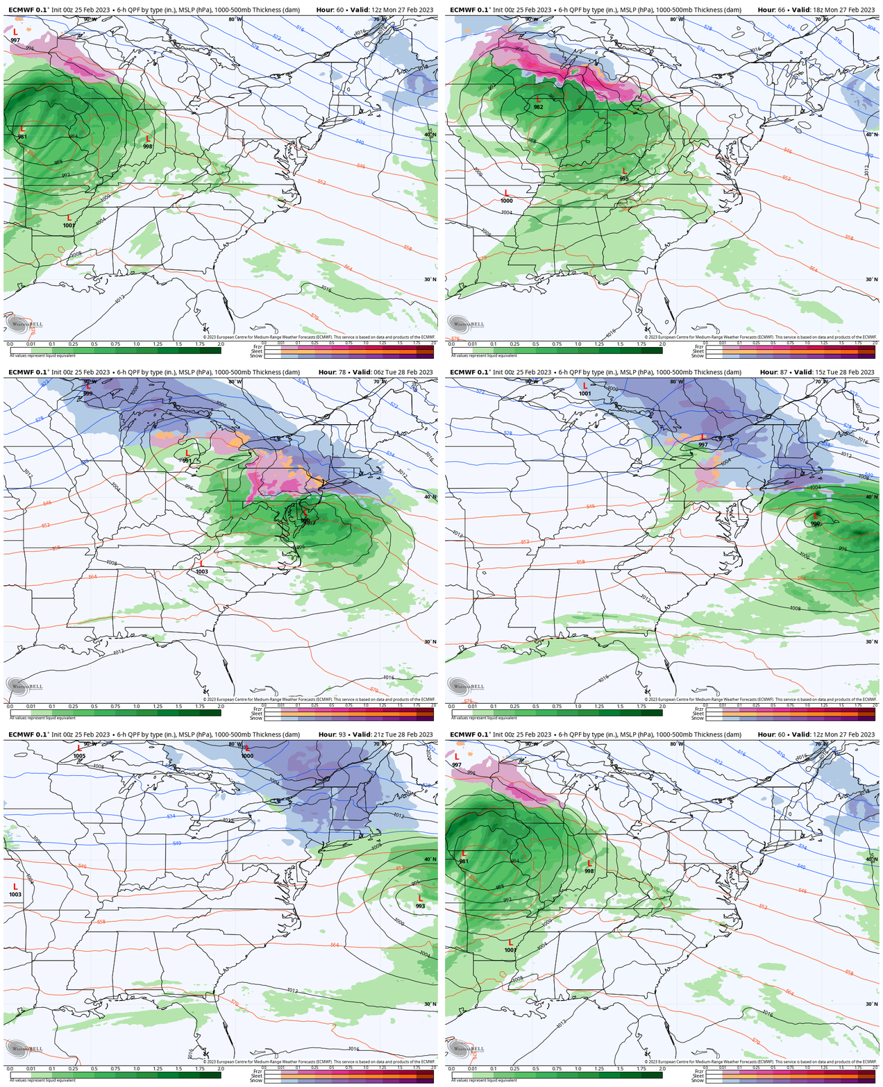
Monday: Next Storm
The system that is bringing Blizzard Conditions to Southern California will reach the Great Lakes and once again keep us on the warmer side. This will be another rain event for us. Some wintry mix at the start in central PA.
Radar Simulation:
Monday Morning To Tuesday Afternoon
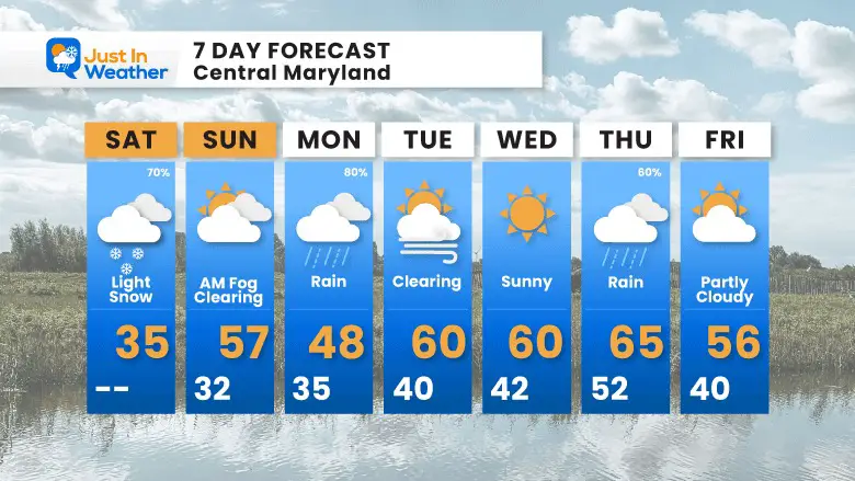
7 Day Forecast
After today’s winter blip, we turn the tables again.
The pattern repeats with a rain storm, then warm. There is a significant change on the way, but after this coming week.
Also See:
Winter History: Low Snow And Late Starts
See my research based on Baltimore data since 1883.
Subscribe for eMail Alerts
Weather posts straight to your inbox
Sign up and be the first to know!
STEM Assemblies/In School Fields Trips Are Back
Click to see more and ‘Book’ a visit to your school 
My Winter Outlook: Not A Typical La Niña!
I see many factors to support colder influence with multiple systems. Early and later in winter. Check it out. https://justinweather.com/2022/11/22/winter-outlook-2023-for-snow-not-typical-la-nina-plus-polar-vortex-disruption/
Also See The Winter Outlook Series:
Farmer’s Almanac Comparison
September Starts Meteorological Autumn: Weather Climate Stats For Maryland at Baltimore
Triple Dip La Niña Winter
https://justinweather.com/2022/09/09/winter-outlook-2023-la-nina-triple-dip-expectations/
CONNECTION TO WINTER?
If you want a snowy winter, this is what you might want to look for in the rest of the tropical season. https://justinweather.com/2022/08/31/record-august-for-no-named-tropical-storms-closer-look-at-snow-following/
Woolly Bear Caterpillars
https://justinweather.com/2022/10/25/winter-weather-outlook-from-the-wooly-bear-caterpillar/
Persimmon Seeds
Click to see Top 20 and MORE
Normals And Records: Maryland and Baltimore Climate History
Please share your thoughts, best weather pics/videos, or just keep in touch via social media
-
-
Facebook: Justin Berk, Meteorologist
-
Twitter: @JustinWeather
-
Instagram: justinweather
-


