November 2 Warming Trend Plus Details On Total Lunar Eclipse
November 2 2022
Wednesday Morning Update
We continue to get a bonus extended Fall season, almost feeling like late summer at times. This morning is starting off mild, and even with more clouds, the afternoon will be warmer than average. That is our trend with even warmer air through the weekend and early next week.
But there is more to talk about. If you missed my last report, I have it linked below: November Weather Almanac, Clocks Back, Rocket Launch, and Total Lunar Eclipse all in the next week!
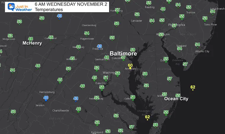
Morning Temperatures
- Sunrise at 7:35 AM
- Sunset at 6:04 PM
Losing 2 minutes and 14 seconds from yesterday
DAYLIGHT SAVING TIME ENDS THIS SUNDAY MORNING
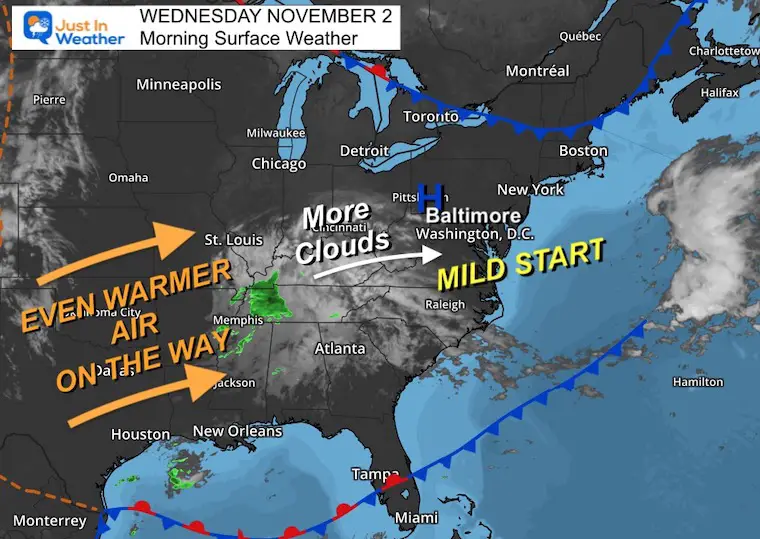
Morning Surface Weather
High Pressure is overhead, but a disturbance dropping rain in Tennessee will spread a few more clouds our way today. The rain is not expected to reach us.
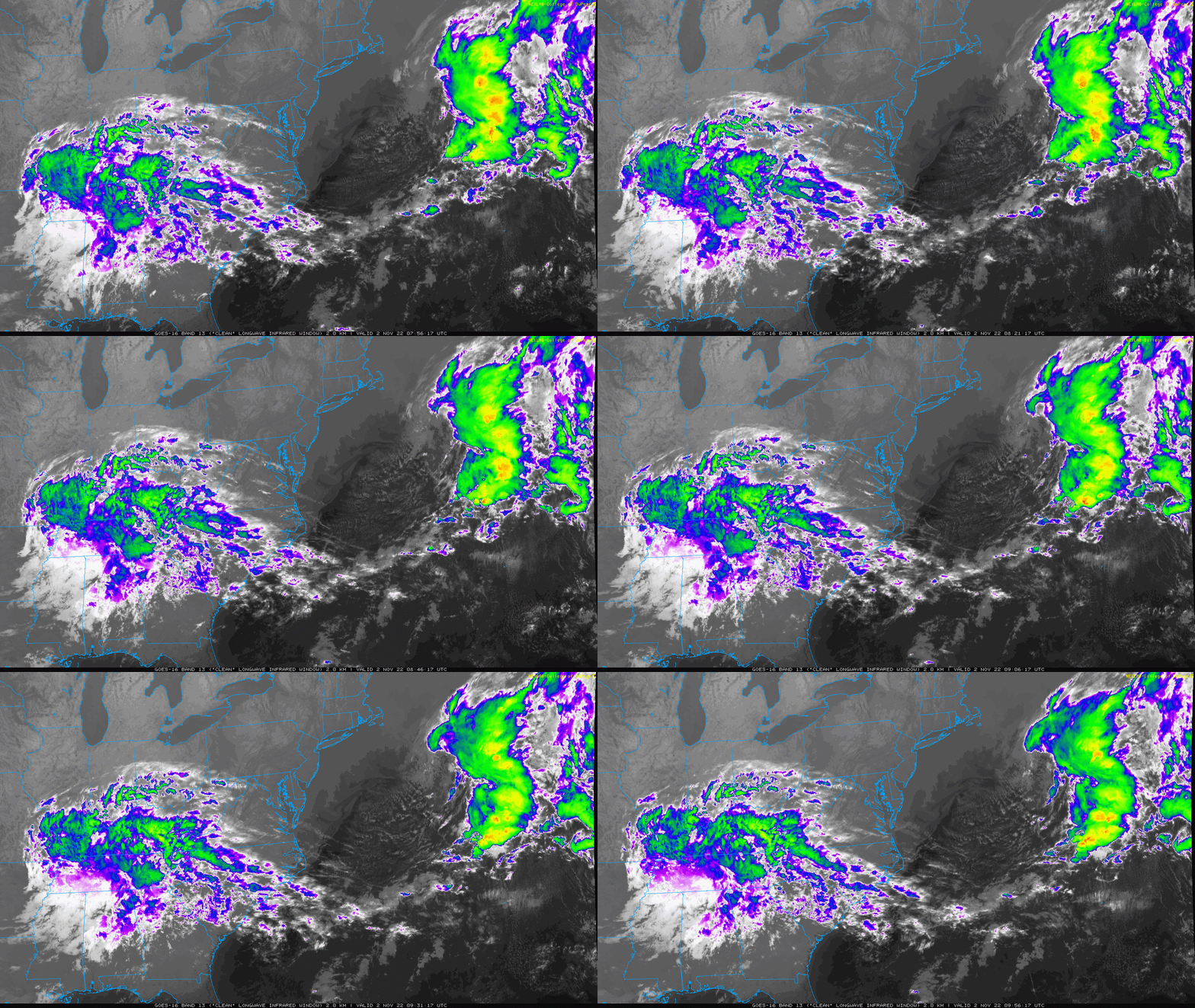
Satellite Loop: 4 AM to 6 AM
High cirrus clouds will mix with the sun this morning and may dim it out at times today.
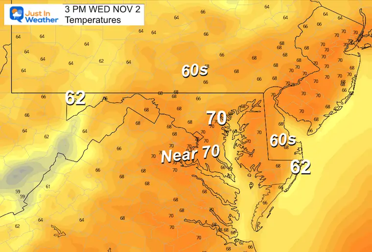
Afternoon Temperatures
Once again near 70ºF in urban areas and 60s most elsewhere.
NEW REPORT:
November Almanac, Rocket Launch, AND Total Lunar Eclipse Info
CLIMATE DATA
TODAY November 2
Normal Low in Baltimore: 40ºF
Record 29ºF in 1976
SNOW: Trace in 1954
Normal High in Baltimore: 62ºF
Record 84ºF 1950
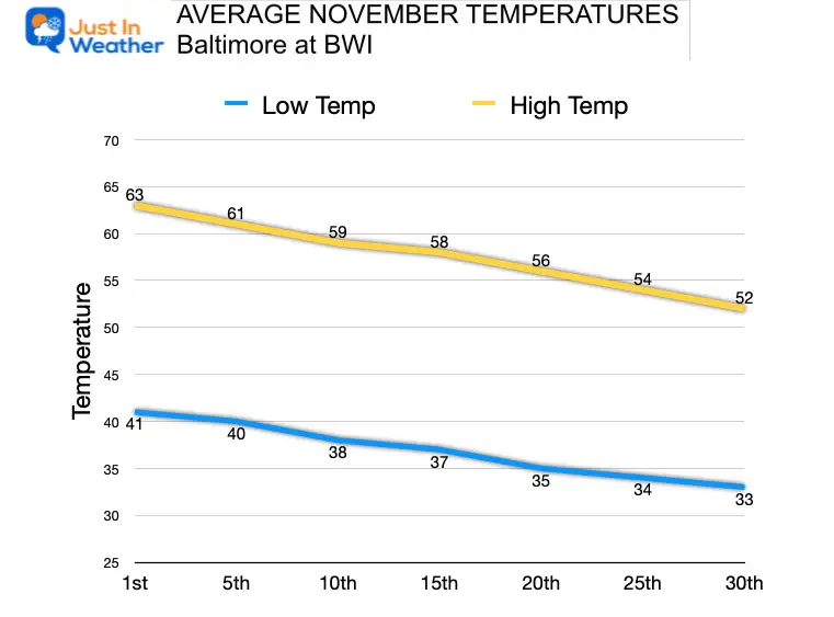
Average Temperatures Trending Cooler
We lose an average of 11 degrees over the next 4+ weeks.
Weather posts straight to your inbox
Sign up and be the first to know!
Thursday Temperatures
Morning
Still mild, with chilly 40s inland. Check out the beaches holding in the 60s.

Afternoon
Temps might be a little cooler for a day, then will warm back up heading to the weekend.

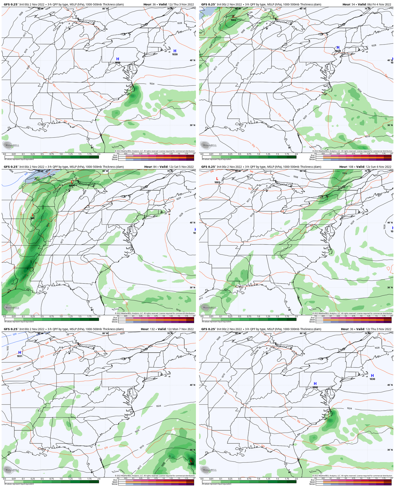
GFS Model: Storm Animation Thursday Through Monday
Very small chance of a brief shower on Sunday.
7 Day Forecast
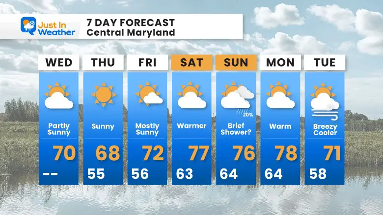
The weekend looks warm and very comfortable, bonus days by November standards. The beginning of a reality check shows up next week.
Looking Farther Ahead!
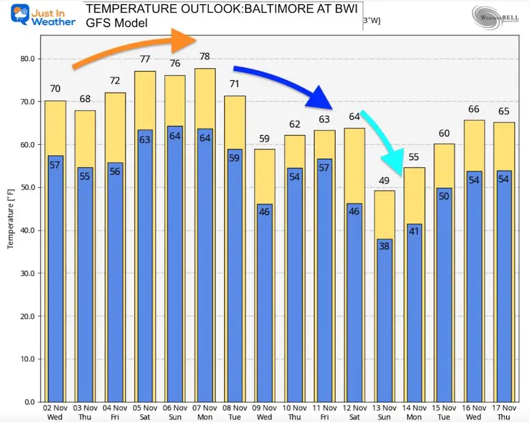
This is the GFS Model for Baltimore at BWI. Notice the peak of our ‘heat’ early next week, then the bottom should fall out. Mind that later in the month the script should flip to well below average temps.
STEM Assemblies/In School Fields Trips Are Back
Click to see more and ‘Book’ a visit to your school
Weather posts straight to your inbox
Sign up and be the first to know!
Winter Outlook Reports
Farmer’s Almanac Comparison
September Starts Meteorological Autumn: Weather Climate Stats For Maryland at Baltimore
Triple Dip La Niña Winter
CONNECTION TO WINTER?
If you want a snowy winter, this is what you might want to look for in the rest of the tropical season. (You might be seeing a lot of commercial snow removal people out this Winter).
Rainbow Ice Cave In Mt. Rainier A Very Rare Find: Photos And Video
Wooly Bear Caterpillars
https://justinweather.com/2022/10/25/winter-weather-outlook-from-the-wooly-bear-caterpillar/
Persimmon Seeds
Click to see Top 20 and MORE
Winter Weather Folklore Top 20 And More Outlook Signals From Nature For Cold And Snow
Normals And Records: Maryland and Baltimore Climate History
Faith in the Flakes Gear
SNOWSTIX – Available Now
Please share your thoughts, best weather pics/videos, or just keep in touch via social media
-
Facebook: Justin Berk, Meteorologist
-
Twitter: @JustinWeather
-
Instagram: justinweather


