Monday Afternoon May 16 2022
One band of rain moved through central Maryland this morning, even with thunder. There was an industry discussion about this possibly resulting in one of two things: If it was stronger it could have taken some of the energy from the air, limiting the impact of the afternoon storms. That was why there was a delay issuing any Watch for Central Maryland.
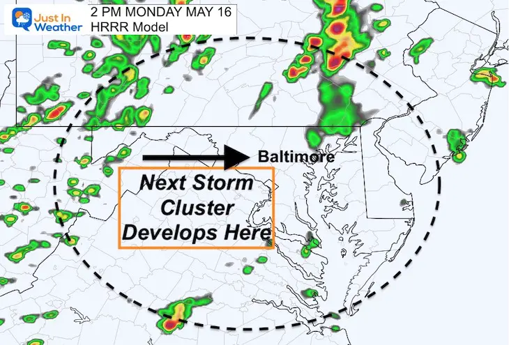
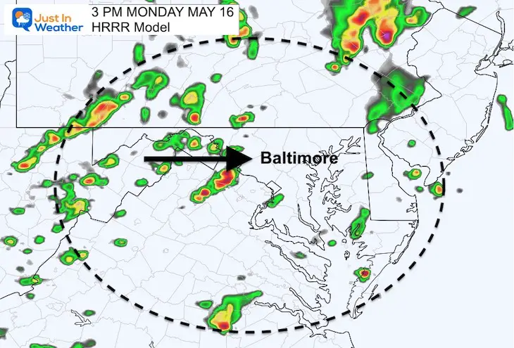
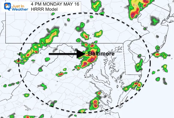
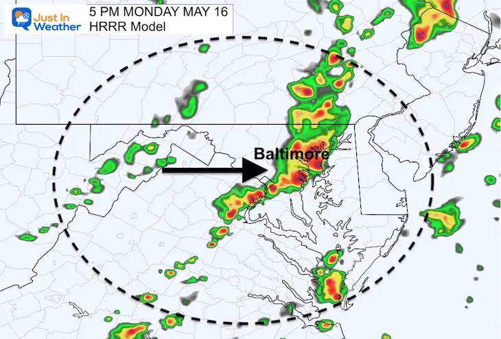
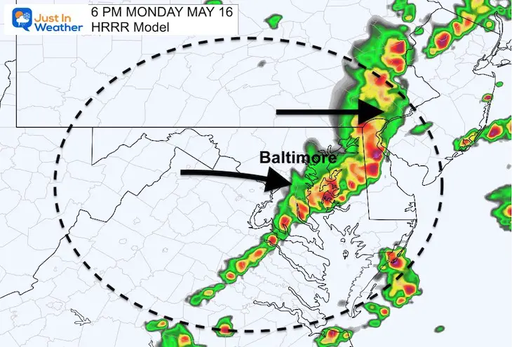
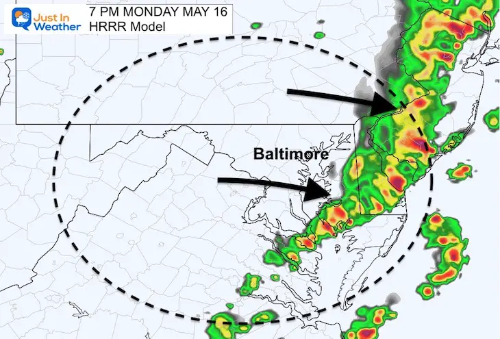
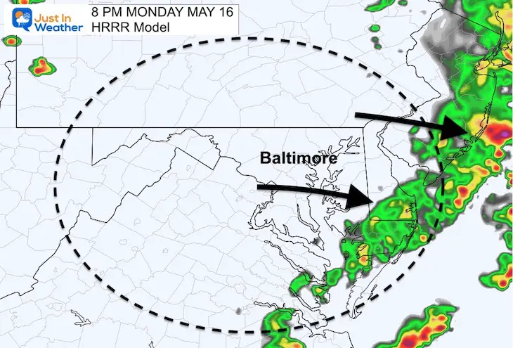
The sun will return and quick development is expected as shown in the simulations below. Our metro area timing is between 3 PM to 5 PM for any activity that may develop. However, the worst now appears to be expected farther east.
As of this post: There is NO Watch for central Maryland AND Southern PA shifted the Watch are EAST of Lancaster through metro Philadelphia.
Note: I was wrong in my earlier report about the expansion of the Watch into Maryland.. But we still may see storms turn severe.
School Discussion: Howard County Public School in Maryland closed school early, but nearby schools stayed in while cancelling afternoon activities. This was before any ‘Watch’ was issued. There is a lot of passion about if this was the correct call or not. This may open a discussion for future events considering safety (better in school or home), and impact on parents piking up or kids going home along. I shared my thoughts in my prior post, but would like to explore that with an open mind at a later time.
This post is simply about the weather today…
Storm Plotting:
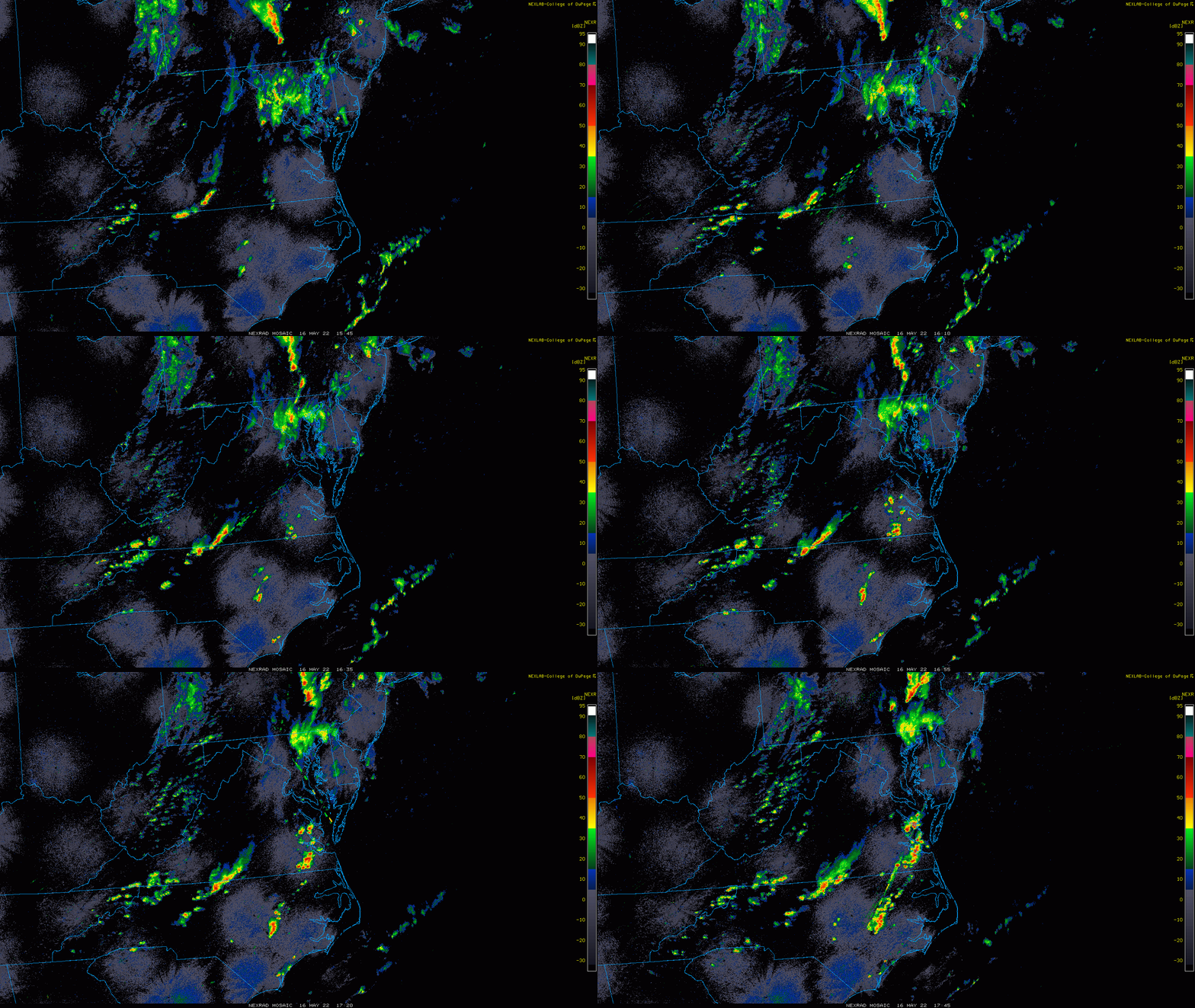
Radar Loop:
11:45 AM to 1:45 PM
That push of rain with some thunder in Central Maryland arrived at lunch time, and took some of the energy out of the air.
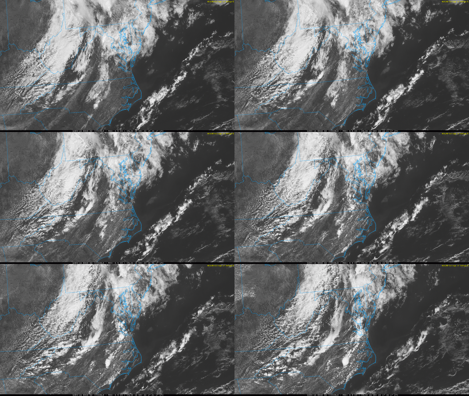
Satellite Loop:
11:45 AM to 1:45 PM
Here we can see the sun breaking out west of the cities, which should also return heating and some instability.
There will be more storms developing in the sunshine, but may take longer to fully develop – farther east.
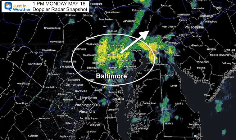
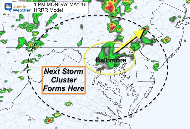
Snapshots at 1 PM
To see if the model I am using is performing well, I’ve compared this snapshot at 1 PM from the actual radar to the forecast. AS we can see, it’s pretty close… which means it may be handling the environment well going forward.
Doppler Radar at 1 PM
HRRR Model at 1 PM
Radar Simulation Animation
2 PM to 10 PM
This still looks impressive. It does NOT rule out some storms with severe parameters in Central Maryland between 3 PM and 5 PM, but the peak results may be east of the Metro Baltimore…
I would still pay attention on Delmarva to the coast through the evening.
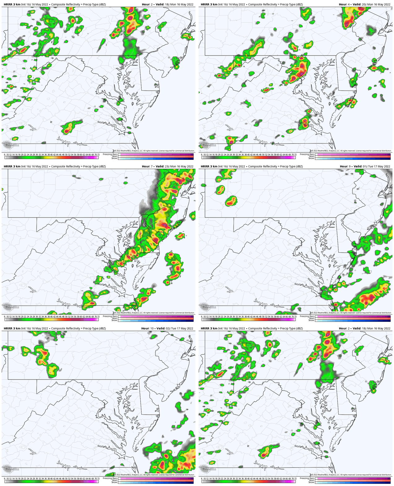
Slider —> 2 PM to 8 PM
UPDATED SEVERE THUNDERSTORM WATCH
Again, the morning rain changed the dynamics.
I was wrong about the expansion to Maryland, but we still see an expansion to the east into Metro Philadelphia
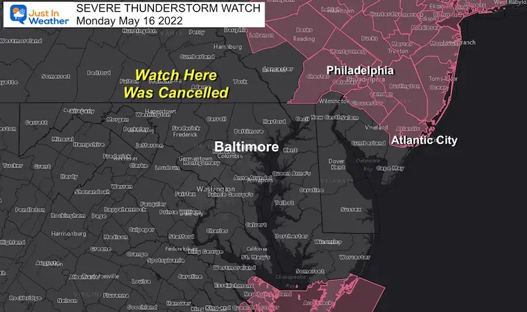
Know Watch Vs Warning
Should an Alert be issued for Severe Storms, Tornadoes, or Flooding, please remember this:
A WATCH means it ‘might’ happen. This is often issued first for a large area.
A WARNING means it is ‘HAPPENING NOW’! This is shirt term with a county and towns listed in the path.
Severe Storm Risk- From This Morning
The Enhanced Risk is Level 3 of 5, a rare status for us, so lease take this seriously.
Storms may contain damaging winds, large hail, and isolated tornados.
This is a Risk POTENTIAL, NOT A PROMISE…
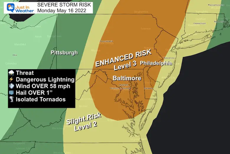
Severe Storm Risk: Potential For
Damaging Winds Over 58 mph
Hail OVER 1 inch diameter
Isolated Tornadoes are very possible, but not for everyone. These are hit and mostly miss, but all it takes is one!
Weather posts straight to your inbox
Sign up and be the first to know!
Tropical Season Begins June 1
Related Posts
NOAA Study: Reducing Air Pollution INCREASED Tropical Storms
Atlantic Tropical History: Maps of Origin Regions Every 10 Days
Please share your thoughts, best weather pics/video, or just keep in touch via social media
Facebook: Justin Berk, Meteorologist
Twitter: @JustinWeather
Instagram: justinweather
*Disclaimer due to frequent questions:
I am aware there are some spelling and grammar typos. I have made a few public statements over the years, but if you are new here you may have missed it:
I have dyslexia, and found out at my second year at Cornell. I didn’t stop me from getting my meteorology degree, and being first to get the AMS CBM in the Baltimore/Washington region.
I do miss my mistakes in my own proofreading. The autocorrect spell check on my computer sometimes does an injustice to make it worse.
All of the maps and information are accurate. The ‘wordy’ stuff can get sticky.
There is no editor that can check my work when I need it and have it ready to send out in a newsworthy timeline.
I accept this and perhaps proves what you read is really from me…
It’s part of my charm.


