


April 24 Weather: Some Showers Then Another Push Of Cold Air Followed By Summer Heat Sunday
Wednesday, April 24 Morning Report A milder start today with most areas in the 50s to near 60ºF along parts of the Bay. There is a push of colder air…
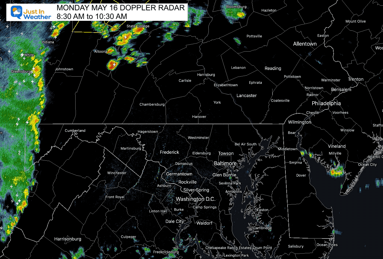
Monday May 16 2022 A line of rain with some embedded storms already developed this morning. There have been some warnings issued in the mountains, and this initial round is a mountain event. Much more activity is expected and I hope this information will help you plan ahead.
I included my personal opinion in response to a concern with schools. Ultimately that call is up to those in charge of each location. Showers have develop well ahead of the main energy across southern Maryland, and even some pop up cells as we can see on the morning radar loop below.
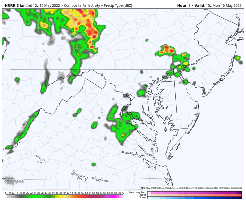
Below is a look at the updated information on storm energy and radar simulation through this evening.
*UPDATE* Showers and some storms popping earlier than shown on short range models. I mentioned this a few times… Please just pay attention and cautious with your surroundings and plans traveling.
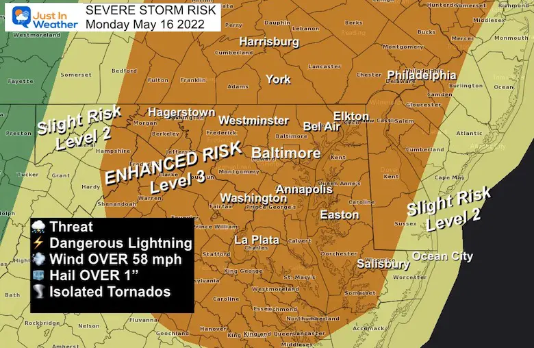
The Enhanced Risk is Level 3 of 5, a rare status for us, so lease take this seriously. Storms may contain damaging winds, large hail, and isolated tornados. See the local look and radar simulation timeline below.
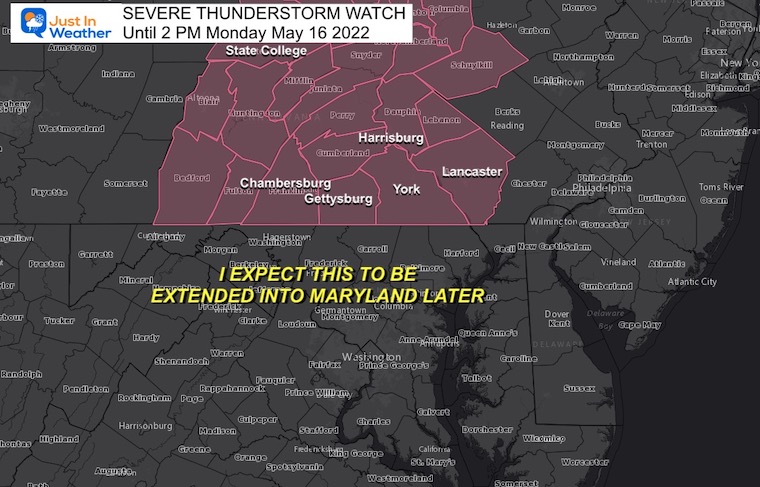
This is From the National Weather Service Office in State College PA. Maryland is under the Sterling VA Office and considering a later time frame for the event.
I EXPECT THIS TO BE EXPANDED INTO MARYLAND AND EXTENDED LATER
Should an Alert be issued for Severe Storms, Tornadoes, or Flooding, please remember this: A WATCH means it ‘might’ happen. This is often issued first for a large area. A WARNING means it is ‘HAPPENING NOW’! This is shirt term with a county and towns listed in the path.
Anything between 1000 to 2500 J/Kg (Joules per Kilogram) means moderate instability.
Over 2500 J/Kg is strong instability and more suggestive of supercells with large hail and isolated tornadoes.
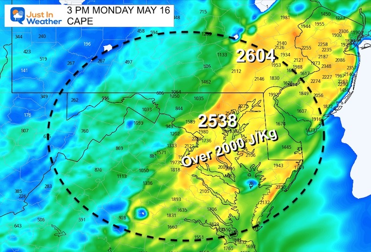
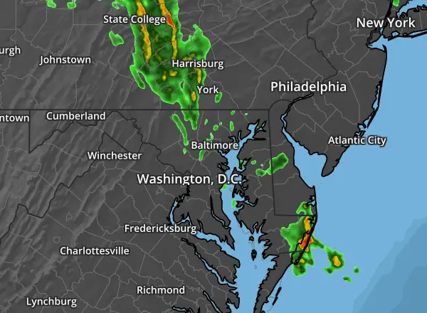
Plotting the progress of the storm energy through the region to the Eastern Shore by evening. It should fade when crossing Delmarva this evening between Salisbury and Ocean City.
I have been asked by a few about sending kids home early. I will NOT make the call for ay school, but personally I believe this: Kids are safest in a school building made of brick, concrete, and steel along with trained adult staff. If there was an option to stay there late, or go home early and possibly be alone, I would lean towards keeping them in place if that is the option.
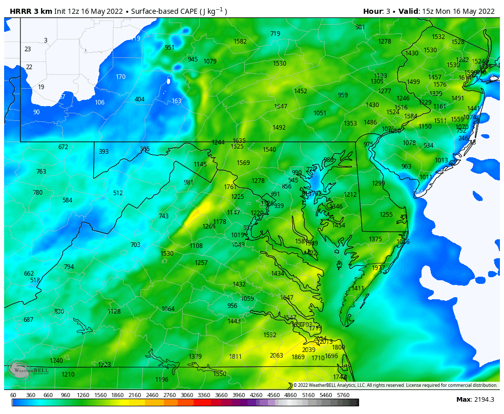
8:30 AM to 10:30 AM Note: The PA storms are on the outer edge of the Sterling, VA Doppler Radar range. .. They were much more intense than shown here…
The showers across VA and Southern Maryland over performed from short range model plots. Basically there are more storms- earlier than models have suggested.
11 AM to 7 PM (See the slider you control below) Reminder: This produce is good but NOT PERFECT! It missed some showers this morning, and may miss some coverage this afternoon. This is a guide, not gospel.
Again: More activity already than shown on this model projection. Be cautious for a very busy storm day.


My Next Update Will Include Any Expanded Watches

NOAA Study: Reducing Air Pollution INCREASED Tropical Storms

Atlantic Tropical History: Maps of Origin Regions Every 10 Days


*Disclaimer due to frequent questions:
I am aware there are some spelling and grammar typos. I have made a few public statements over the years, but if you are new here you may have missed it:
I have dyslexia, and found out at my second year at Cornell. I didn’t stop me from getting my meteorology degree, and being first to get the AMS CBM in the Baltimore/Washington region.
I do miss my mistakes in my own proofreading. The autocorrect spell check on my computer sometimes does an injustice to make it worse.
All of the maps and information are accurate. The ‘wordy’ stuff can get sticky.
There is no editor that can check my work when I need it and have it ready to send out in a newsworthy timeline.
I accept this and perhaps proves what you read is really from me…
It’s part of my charm.