Monday, June 17
Morning Report
After a spectacular weekend, the weather will remain sunny and dry. Now, we watch a classic summer High Pressure settling in to lock up along the Eastern US. This will be fondly called The Heat Dome all week as a heat wave will build each day. Temperatures will climb into the upper 90s and approach 100ºF this weekend, with heat index values rising even higher.
This will be dangerous for a few days with Heat Advisories likely later in the week and weekend. It will also eventually lead to strong thunderstorms later in the weekend.
Notable early dates for 100ºF in Baltimore
- June 20, 1931
- June 21, 2012
- June 22, 1988
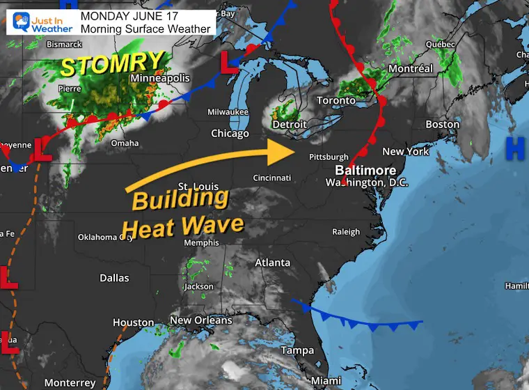
Morning Surface Weather
The warm front on the map is the signal of the shift in wind and building heat wave. This will be a gradual process for a few days, then the humidity will be overbearing later in the week.
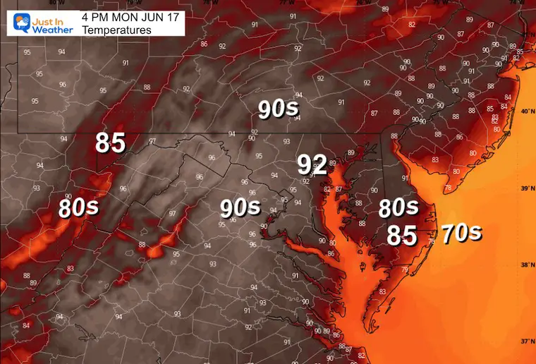
Afternoon Temperatures
Pleasant with low humidity and temperatures near or slightly below average.
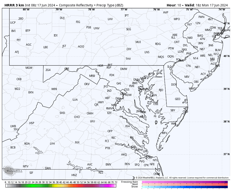
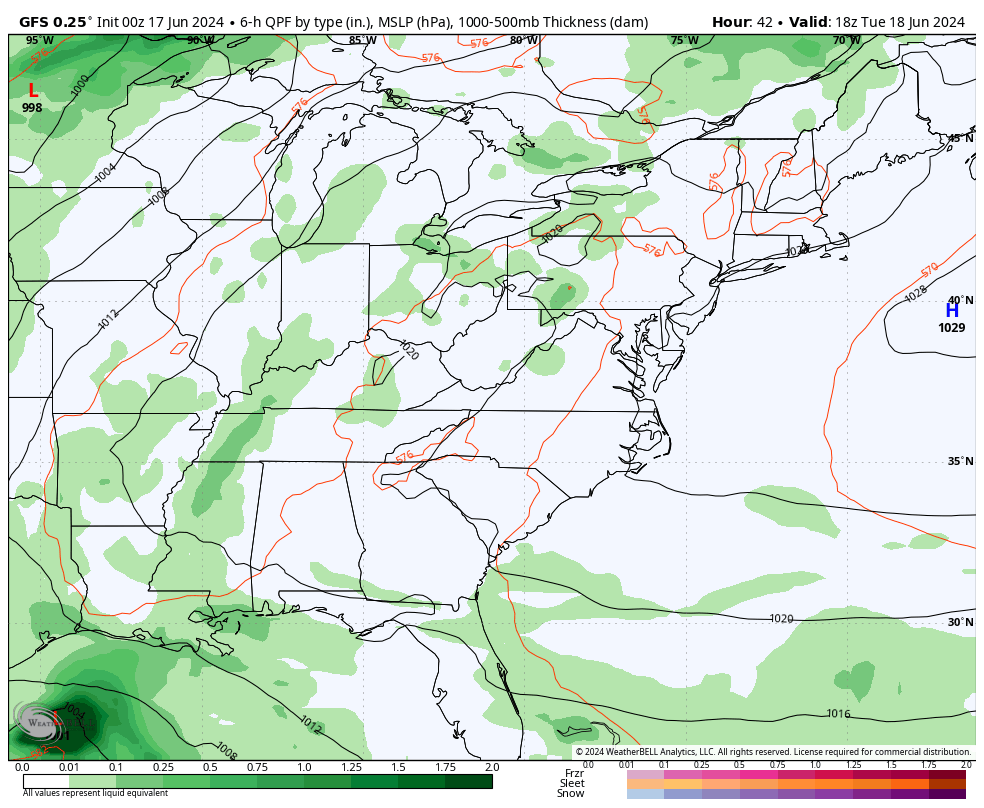
Radar Simulation: 2 PM to 10 PM
Some isolated thunderstorms may pop up over the mountains.
CLIMATE DATA: Baltimore
TODAY June 17
Sunrise at 5:40 AM
Sunset at 8:35 PM
Normal Low in Baltimore: 63ºF
Record 47ºF in 1964
Normal High in Baltimore: 85ºF
Record 96ºF 1939; 2022
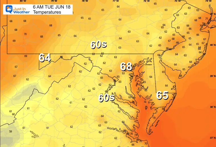
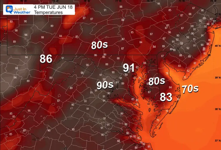
Tuesday
Starting to crank up the numbers into the 90s, at least for metro areas.
Morning Temperatures
Afternoon Temperatures
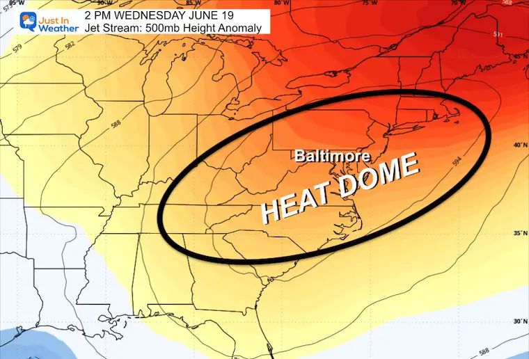
Looking Ahead: Jet Stream
Wednesday
The HEAT DOME is the large ridge of High Pressure that will lock in high temperatures across the Eastern US.
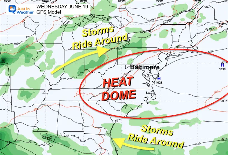
Wednesday Surface Weather
As High-Pressure parks off the East Coast and locks in that Heat Wave/Heat Dome, rain and storms will ride around the periphery. Eventually, this will break down, allowing storms later in the weekend.
Storm Forecast Animation: Tuesday to Sunday
Plotting the High Pressure may also help understand the impact of two possible tropical systems from Florida and the Southern Plains, then looping around into a Cold Front that reaches the East Coast next weekend.
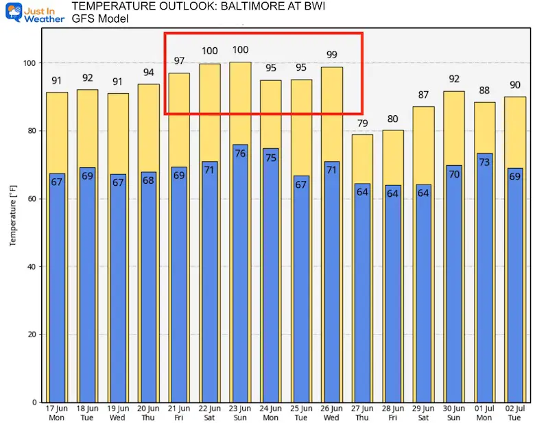
Model Temperature SUGGESTION
I am showing the GFS Model forecast for Baltimore at BWI simply to highlight the aggressive nature of the heat. I am holding back a little in my forecast below, but there is a suggestion of temps reaching over 100ºF next weekend.
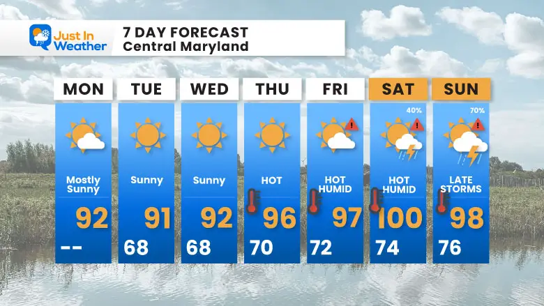
7 Day Forecast
The week will crank up all week, gradually increasing the humidity. This will become dangerous with heat index values over 100ºF later in the week, and actual temperatures may break 100ºF on the weekend.
If You Missed It: Click To See
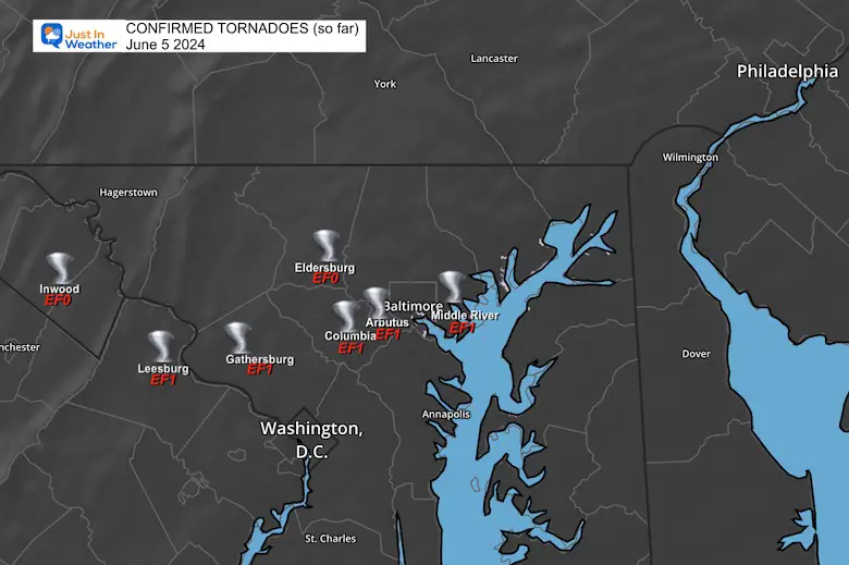
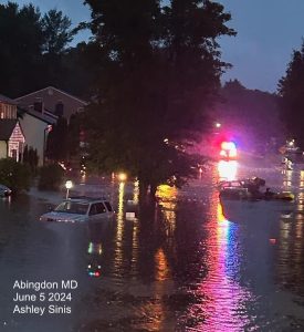
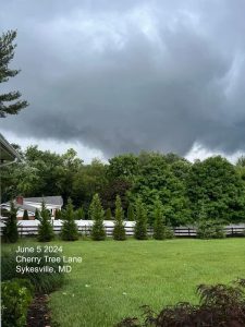
June 5 Storm Report (Preliminary) With Videos And Photos
Hurricane Season Outlook
Click to read: NOAA Releases Most Aggressive Outlook

Please share your thoughts and best weather pics/videos, or just keep in touch via social media
RESTATING MY MESSAGE ABOUT DYSLEXIA
I am aware there are some spelling and grammar typos and occasional other glitches. I take responsibility for my mistakes and even the computer glitches I may miss. I have made a few public statements over the years, but if you are new here, you may have missed it: I have dyslexia and found out during my second year at Cornell University. It didn’t stop me from getting my meteorology degree and being the first to get the AMS CBM in the Baltimore/Washington region.
One of my professors told me that I had made it that far without knowing and to not let it be a crutch going forward. That was Mark Wysocki, and he was absolutely correct! I do miss my mistakes in my own proofreading. The autocorrect spell check on my computer sometimes does an injustice to make it worse. I also can make mistakes in forecasting. No one is perfect at predicting the future. All of the maps and information are accurate. The ‘wordy’ stuff can get sticky.
There has been no editor who can check my work while writing and to have it ready to send out in a newsworthy timeline. Barbara Werner is a member of the web team that helps me maintain this site. She has taken it upon herself to edit typos when she is available. That could be AFTER you read this. I accept this and perhaps proves what you read is really from me… It’s part of my charm. #FITF


