


Tropical Storm Chantal Forecast Landfall Sunday And Impact Monday
Saturday July 5 Late Afternoon Update Tropical Storm Chantal officially was named earlier today and has be working towards and US landfall tomorrow. This is the third named storm of…
Thursday, June 6 2024
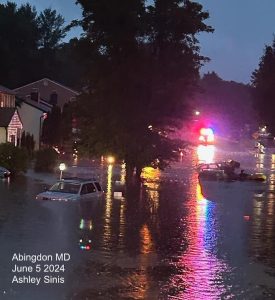
Often, the day after a severe storm outbreak, there is heightened anxiety. The numerous tornados in Maryland tracked and touched down in many locations, which is still being studied by National Weather Service Survey teams. A few reports may be ready later today, but it could take an extra day or two to get the final conclusion of track and intensity for all.
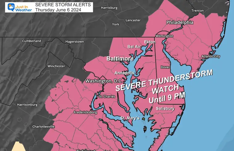
A Severe Thunderstorm Watch has been issued for parts of Maryland, Virginia, and Delaware. This means storms might turn severe. If they do, a WARNING will be issued to track them more specifically through towns with a timeline.
This means storms can potentially reach severe limits, but not all will. However, they can still be dangerous.
Severe Storms May Contain:
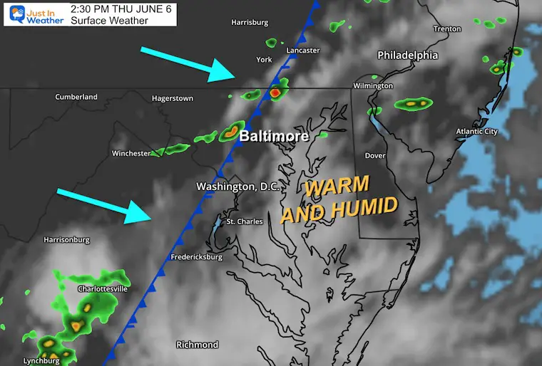
This afternoon, we have more storms firing up along a Cold Front. This boundary will lower the humidity for us in the days ahead. One storm already prompted a Tornado Warning in Frederick, and there may be more.
The atmosphere is primed to overachieve as it did yesterday, so we must be on attention.
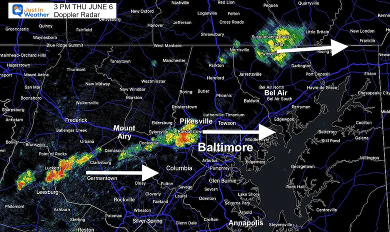
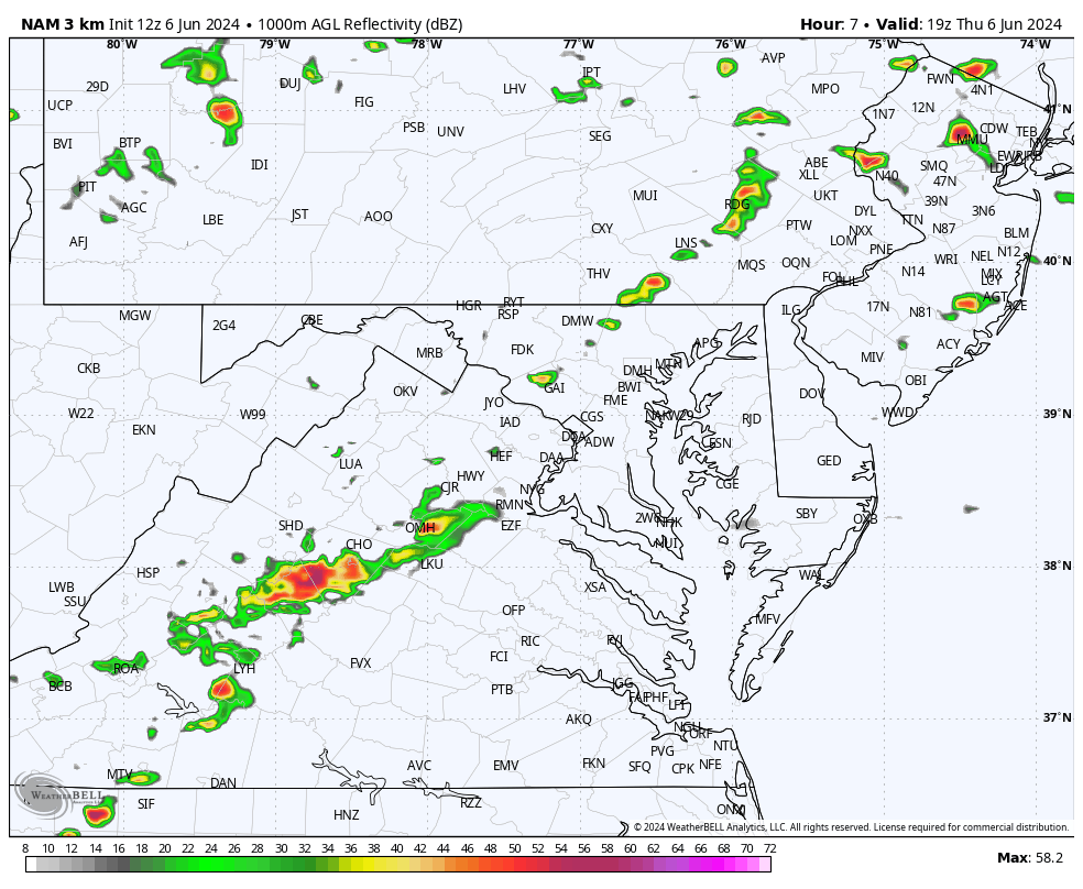
3 PM Doppler Radar
This is much more active west of Baltimore than the forecast for the same time frame below.
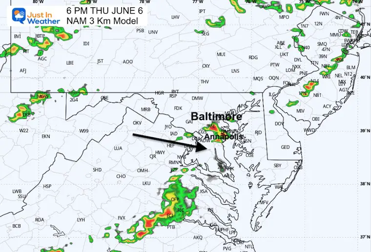
3 PM Forecast: NAM 3 Km
This model has performed well, but as we can see, it has been underestimating the storm activity. So, going forward, it is likely to be more active than shown here.
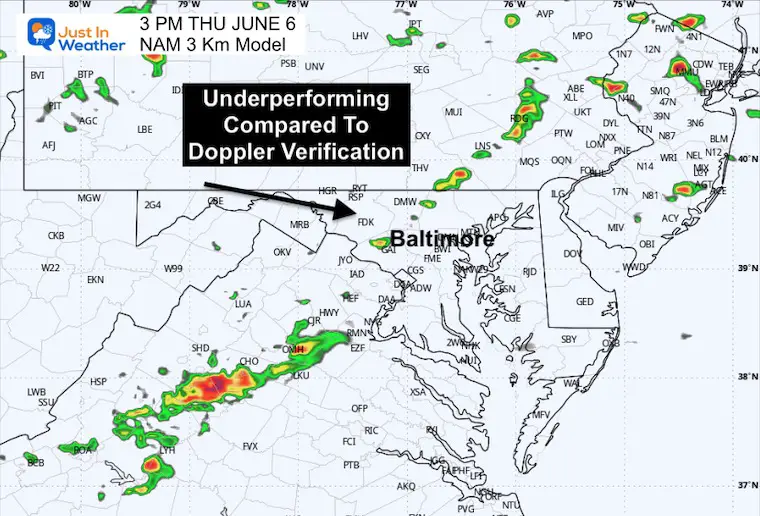
The storms may be more numerous and arrive earlier than shown here.
South of Baltimore?
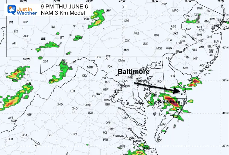
The storms may be more numerous and arrive earlier than shown here.
Eastern Shore near Salisbury?
I would allow the window of between 7:30 PM and 10 PM for this region to the beaches.
The storms may be more numerous and arrive earlier than shown here.
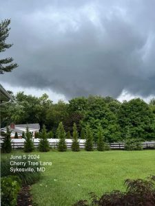
June 5 Storm Report (Preliminary) With Videos And Photos
I am aware there are some spelling and grammar typos and occasional other glitches. I take responsibility for my mistakes and even the computer glitches I may miss. I have made a few public statements over the years, but if you are new here, you may have missed it: I have dyslexia and found out during my second year at Cornell University. It didn’t stop me from getting my meteorology degree and being the first to get the AMS CBM in the Baltimore/Washington region.
One of my professors told me that I had made it that far without knowing and to not let it be a crutch going forward. That was Mark Wysocki, and he was absolutely correct! I do miss my mistakes in my own proofreading. The autocorrect spell check on my computer sometimes does an injustice to make it worse. I also can make mistakes in forecasting. No one is perfect at predicting the future. All of the maps and information are accurate. The ‘wordy’ stuff can get sticky.
There has been no editor who can check my work while writing and to have it ready to send out in a newsworthy timeline. Barbara Werner is a member of the web team that helps me maintain this site. She has taken it upon herself to edit typos when she is available. That could be AFTER you read this. I accept this and perhaps proves what you read is really from me… It’s part of my charm. #FITF